National Weather Service United States Department of Commerce

Severe Thunderstorms in the Central U.S.; Heavy to Excessive Rainfall in the Ohio Valley and Central Appalachians

Severe thunderstorms producing damaging winds, hail, and a few tornadoes are expected through Tuesday across parts of the central Plains and lower to mid Missouri Valley. Heavy to excessive rainfall could produce flooding across portions of the Ohio Valley into the Central Appalachians through Tuesday. Read More >

Summary | ForecastTravel Center | Monitoring & Reporting | Safety


SYNOPSIS:

The anticipated strong cold front is moving through Wyoming and will continue to push through, through the evening.  Areas of strong southwest winds will persist ahead of the cold front, eventually changing direction and coming out of the northwest.  High Wind Warnings are currently in effect (see below). The strongest winds are expected from southeast Fremont County across Natrona County, and eventually up into lower elevations of Johnson County, where wind gusts will occasionally exceed 60 mph. 

Moderate to heavy snow showers are pushing into western Wyoming along the cold front and will continue into tonight.  An isolated thunderstorm is still possible in southwest Wyoming.  Light snow accumulations, mostly under one inch are expected east of the Divide as well.  The snow will quickly taper off behind the cold front Monday morning, but a quick 3 to 6 inches of snow is possible in the western valleys with 6 to 12 inches in the mountains.  Severely reduced visibility and blowing and drifting snow with the heavier snow showers is also anticipated.  

Snow showers and strong west winds will also likely impact Interstate 80 tonight with limited visibility and slick road surfaces.   On Monday morning, Interstate 90 across northeast Wyoming will be impacted by areas of snow and blowing snow and strong northwest winds behind the cold front.  Most other areas across central Wyoming will likely see more wind and limited snowfall with the frontal passage tonight into Monday morning. Winds will be in the form of strong downslope, west to northwest from 25 to 35 mph with gusts up to 60 mph. 


Timing of the Cold Front and the Impacts
Click to enlarge Click to enlarge

Animation of Strong Cold Frontal Passage Across the area Sunday afternoon and Sunday night
Click Image To Enlarge

Storm Impact Index
Click Image To Enlarge

Top Menu


 Summary | ForecastTravel Center | Monitoring & Reporting | Safety
 

NWS Text Products and Forecasts

  Area Forecast Discussion
  Winter Weather Statement
  Special Weather Statement
  What's a "Watch?"
  Observed Snow Totals or High Wind
 High Wind Statement
 Weather Story

Quick View of Hazards and Forecast Snow Totals and Peak Wind Gusts:
Click to enlarge

Winter Weather Advisories and High Wind Warnings are in Effect
Click Image To Enlarge

Click to enlarge Click to enlarge

27-Hour Forecast Snowfall
2 pm Sunday until 5 PM Monday

Click Image To Enlarge

27-Hour Forecast Peak Wind Gusts
2 pm Sunday until 5 pm Monday
Click Image To Enlarge

Click to enlarge Click to enlarge

Storm Prediction Center's Day 1 Outlook
Light green indicates area where
general thunderstorms are possible
through Sunday evening
Click Image To Enlarge

Change in High Temperatures
from Sunday to Monday

Click Image To Enlarge

 
Snow and Wind Reports
Public Information Statement
National Weather Service Riverton WY
1120 PM MST Sun Mar 5 2017

Here are the Peak Wind Gusts in the past 36 hours ending at 11 PM
MST Sunday evening.  

Location                     Speed     Time/Date       Elevation (ft.)      

...Big Horn County...
30 E Greybull                56 MPH    0258 PM 03/05   8898                 
Greybull Airport             43 MPH    0335 PM 03/05   3935                 

...Fremont County...
7 SW Muddy Gap               74 MPH    0950 PM 03/05   7380                 
Lander Airport               70 MPH    0703 PM 03/05   5586                 
3 NNW Hudson                 58 MPH    0846 PM 03/05   5555                 
Crowheart                    55 MPH    1222 PM 03/05   6099                 
Red Canyon                   53 MPH    0125 PM 03/04   6768                 
2 W South Pass City          52 MPH    0736 PM 03/05   8185                 
8 W South Pass City          51 MPH    0850 PM 03/05   8120                 
Jeffrey City                 50 MPH    0915 PM 03/05   6374                 
Riverton Airport             47 MPH    0807 PM 03/05   5525                 
South Pass                   45 MPH    0115 PM 03/05   8556                 
Beaver Rim                   45 MPH    0241 PM 03/05   6784                 
10 W Fort Washakie           43 MPH    0201 PM 03/05   9235                 

...Hot Springs County...
Boysen Peak                  63 MPH    0355 PM 03/05   7300                 
10 S Meeteetse               46 MPH    0542 PM 03/05   7127                 
Thermopolis                  45 MPH    0930 PM 03/05   4426                 

...Johnson County...
18 NW Buffalo                65 MPH    0847 AM 03/04   8604                 
12 N Kaycee                  52 MPH    1046 AM 03/04   5287                 
7 SW Barnum                  50 MPH    0346 PM 03/05   6440                 
Buffalo Airport              48 MPH    0358 PM 03/05   4970                 
25 ESE Buffalo               48 MPH    0410 PM 03/05   4657                 
2 NW Mayoworth               43 MPH    1143 AM 03/04   5404                 
7 NE Buffalo                 41 MPH    0318 PM 03/05   4370                 
20 SW Echeta                 40 MPH    0245 PM 03/05   4068                 

...Lincoln County...
Mt Coffin                    72 MPH    0100 PM 03/05   10870                
13 W Kemmerer                51 MPH    1005 PM 03/05   6718                 
3 NW Etna                    49 MPH    0135 PM 03/05   5692                 
Cokeville                    48 MPH    0323 PM 03/05   6191                 
Afton Airport                46 MPH    0155 PM 03/05   6220                 
Deadman Mtn                  42 MPH    1200 AM 03/05   10350                

...Natrona County...
Casper Airport               64 MPH    1030 PM 03/05   5320                 
8 S Casper                   60 MPH    0952 PM 03/05   7740                 
Casper Outer Drive           60 MPH    0526 AM 03/04   5463                 
3 WSW Mills                  54 MPH    0939 PM 03/05   5197                 
2 SE Hiland                  53 MPH    0245 PM 03/05   6134                 
Natrona                      53 MPH    1015 PM 03/05   5589                 
20 N Casper                  49 MPH    0300 PM 03/05   5677                 
7 W Alcova                   48 MPH    1010 PM 03/05   6342                 

...Park County...
5 WNW Clark                  92 MPH    1109 AM 03/04   4659                 
Chief Joseph Hwy             69 MPH    0630 AM 03/04   8136                 
8 N Meeteetse                58 MPH    0906 AM 03/04   5926                 
8 S Clark                    56 MPH    0200 PM 03/04   4710                 
1 W Clark                    55 MPH    0604 PM 03/04   4270                 
10 WNW Cody                  54 MPH    1240 PM 03/04   8401                 
Hoyt Peak                    53 MPH    0230 PM 03/04   9800                 
2 WSW Cody                   44 MPH    0356 PM 03/04   5167                 
3 E Pahaska                  43 MPH    1257 PM 03/05   7500                 
20 SW Cody                   41 MPH    1234 PM 03/04   5843                 

...Sweetwater County...
I 80 - Mile Marker 184       62 MPH    1006 PM 03/05   7112                 
Rock Springs Airport         60 MPH    0743 PM 03/05   6760                 
15 SE Rock Springs           58 MPH    0744 PM 03/05   7550                 
5 E Rock Springs             49 MPH    0750 PM 03/05   6369                 
I 80 - Mile Marker 142       47 MPH    0815 PM 03/05   7162                 
I 80 - Mile Marker 157       47 MPH    0825 PM 03/05   6965                 
1 NNE Green River            43 MPH    0837 PM 03/05   6315                 
7 WSW Rock Springs           43 MPH    0845 PM 03/05   6238                 
Mckinnon                     40 MPH    1030 PM 03/05   7086                 
7 WNW Green River            40 MPH    0802 PM 03/05   6387                 
6 WSW Rock Springs           40 MPH    0825 PM 03/05   6212                 
Farson                       40 MPH    0715 PM 03/05   6594                 

...Teton County...
Summit - Jackson Resort      59 MPH    1215 PM 03/05   10318                
5 ENE Alta - Freds Mtn       52 MPH    0900 PM 03/04   9840                 
Snow King                    43 MPH    0115 PM 03/05   7810                 
7 E Moran Jct                40 MPH    0152 PM 03/05   7251                 

...Washakie County...
15 SSW Big Trails            53 MPH    0140 PM 03/05   6554                 
12 ENE Ten Sleep             52 MPH    0314 PM 03/05   8202                 
10 SSE Worland               44 MPH    0517 PM 03/05   4520                 
Worland Airport              44 MPH    0258 PM 03/05   4245                 

Observations are collected from a variety of sources with varying
equipment and exposures. Not all data listed are considered official.


Summary | ForecastTravel Center | Monitoring & Reporting | Safety

Current Radar & Web Cams - Click Thumbnails To Enlarge
Northern Rockies Radar
Riverton Radar
Pocatello
Billings
Salt Lake
Cheyenne


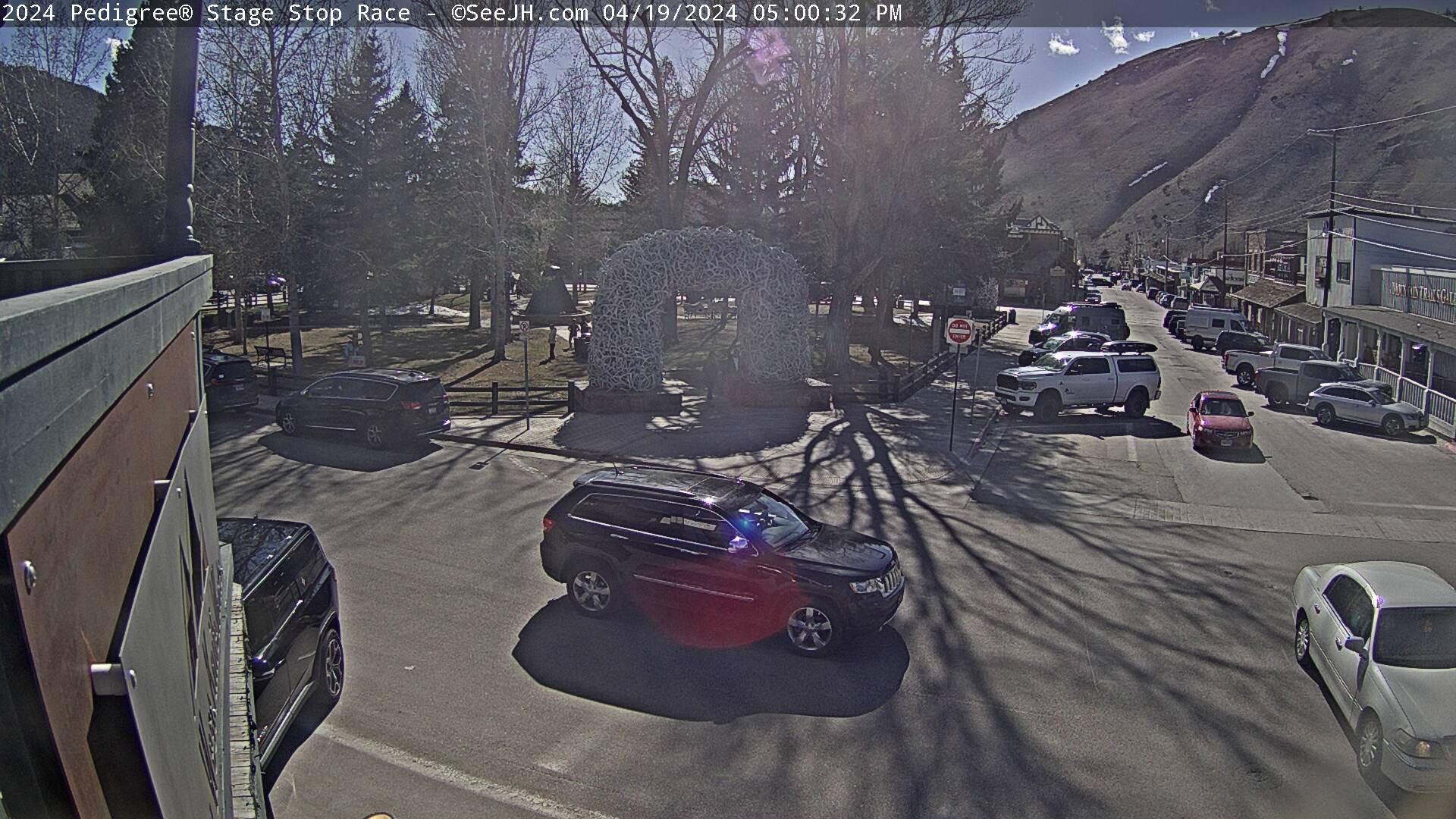
Downtown Jackson
Teton Pass Hwy 22
Togwotee Pass U.S. Hwy 287
South Pass Hwy 28
I-80 Rock Springs
Granite Pass U.S. Hwy 14
Powder River Pass U.S. Hwy 16
Casper - Wyoming Blvd
WYDOT Image
I-90  Piney Creek (North of  Buffalo)
I-90/ / I-25 Interchange at Buffalo
Cody
Hwy 789 Blue Hill (11 miles SE of Lovell)


                                                                       Click Here to See All Webcams                                                  

If you plan to travel, we recommend checking road conditions along your route and staying on top of road closures here. If you are on Twitter, follow the hashtag: #WyoRoad (or look below) for the latest weather affecting roads and road conditions in and around Wyoming. 
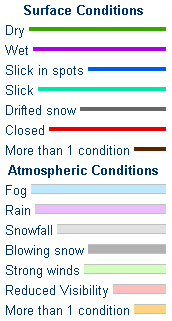
WYDOT Road Condition Legend
 

Get the play-by-play on this storm and contribute your own snow reports to #wywx

Follow Us on Twitter @NWSRiverton

On the road?

Tweet road conditions to #WyoRoad!


 Summary | ForecastTravel Center | Monitoring & Reporting | Safety

PLEASE SEND US YOUR SNOW REPORTS (CLICK HERE)

Monitor our Weather Summary Page for current Warnings, Watches, and Advisories. What's the difference?
Current            Weather Story Check the latest Weather Story graphic for an overview of the area forecast.
NWS Riverton Radar Check out what's on the radar.
Riverton | Pocatello | Cheyenne | Billings | Salt Lake City | Rapid City | Mosaic
Submit storm reports/images and keep up to date with us on Facebook!
Submit storm reports/images and keep up to date with us on Twitter!
Other reporting methods include submitting an online report, email (nws.riverton@noaa.gov), or by phone at 1-800-211-1448.
Check the latest Public Information Statement for the latest storm reports.
WyDoT's Webpage Monitor current road conditions by visiting the Wyoming Dept. of Transportation (WYDOT) or by calling 5-1-1.
Get current road conditions, web camera images, road alerts, and much more on your mobile device by downloading the Wyoming 511 Mobile App.


Top Menu

 Summary | ForecastTravel Center | Monitoring & Reporting | Safety
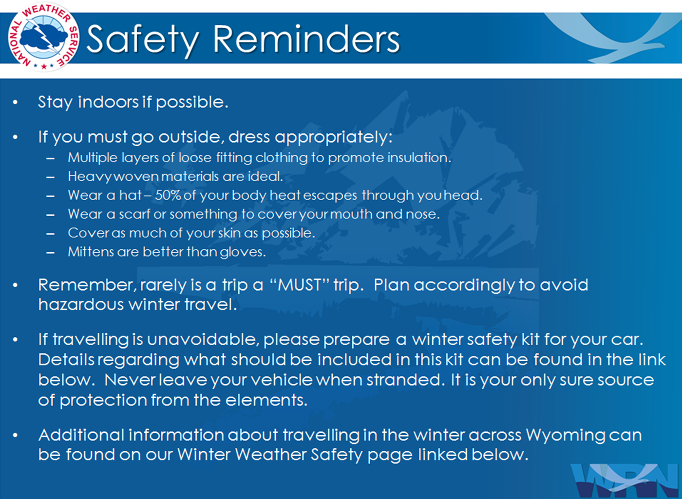
 

Winter Safety Kit      |      Winter Weather Safety


Learn more about the National Weather Service's efforts to build a Weather-Ready Nation!


 Top Menu