Summary | Forecast | Observed Snowfall | Travel Center | Monitoring & Reporting | Safety
SYNOPSIS: A snow storm will continue to impact western Wyoming today into this evening. Some light snow is expected to develop east of the Divide later Christmas Day, and last through the evening hours. Those planning travel into or out of Wyoming should be prepared for winter weather conditions. Before venturing out check the latest forecast and road conditions (wyoroad.info).
The winter storm summary from December 20th and 21st can be found here.
The winter storm summary from the December 22nd and 23rd winter storm.
Impacts:
|
|
|
|
|
|
|
|
|
 |
.png "Click to enlarge") |
|
Forecast Snowfall Today and Tonight |
Latest Hazard map (as of 3 AM 12/25) Click Image To Enlarge |
 |
 |
|
Observed Lows on Sunday Morning |
Observed Highs on Christmas Eve |
.png "Click to enlarge") |
.png "Click to enlarge") |
|
Christmas Morning Low Temperatures |
Christmas Day's High Temperatures |
|
Snow Totals and Wind Reports will be posted and updated here once the storm occurs (Snowfall Amounts from the December 22nd and 23rd winter storm) |
|
140
NOUS45 KRIW 041703
PNSRIW
WYZ001>020-022>030-050451-

Public Information Statement
National Weather Service Riverton WY
1051 AM MDT Sat Apr 4 2026

...SNOWFALL REPORTS...

A winter weather system brought some much need snow to many higher
elevations of Wyoming, the western Wyoming Valleys, and portions of
Johnson and Natrona Counties. Snow began late Thursday, April 1st
and continued through Friday, April 3rd. The highest snow totals
occurred across the Teton Mountains.

Location                     Amount     Elevation (ft.)

...Wyoming...

...Big Horn County...
19 N Shell                   13.0 in    9384
17 E Shell                   12.0 in    9577
14 NE Shell                  10.0 in    9343
1 WNW Shell                  4.0 in     4167

...Fremont County...
10 NNW South Pass City       8.0 in     9659
6 WSW Dubois                 8.0 in     9411
7 NNW South Pass City        7.0 in     8936
23 NW Dubois                 7.0 in     9347
14 SW Fort Washakie          6.0 in     10065

...Johnson County...
27 WNW Buffalo               15.0 in    8539
18 WNW Buffalo               15.0 in    9857
14 WNW Mayoworth             5.0 in     8052
16 W Buffalo                 4.0 in     8682
1 NNE Buffalo                3.8 in     4617

...Lincoln County...
3 SE Turnerville             20.0 in    8237
6 ENE Smoot                  19.0 in    8398
15 ESE Smoot                 17.0 in    9037
15 NNE Cokeville             10.0 in    8355
21 NE Cokeville              10.0 in    9322
16 ENE Turnerville           10.0 in    8783
8 S Smoot                    9.0 in     7593
4 NNE Thayne                 7.3 in     6248
5 SSE Smoot                  7.0 in     6980
15 ENE Cokeville             6.0 in     7903
10 ESE Smoot                 6.0 in     9378
1 SE Thayne                  5.7 in     6071
4 NE Thayne                  5.3 in     6199
16 ENE Turnerville           5.0 in     9022
Fossil Butte National Monume 5.0 in     6782
Afton                        3.5 in     6255
3 N Etna                     3.0 in     5927

...Natrona County...
22 SE Casper                 12.0 in    8402
20 N Arminto                 9.0 in     8585
7 S Casper                   7.0 in     8070
2 SSW Casper                 2.5 in     5419

...Park County...
8 W East Entrance            8.0 in     8411
16 N Pahaska                 6.0 in     9326
1 SW Canyon                  5.0 in     7865
13 WSW Sunlight Basin        3.0 in     9378
14 N Sunlight Basin          3.0 in     9357
20 SW Pitchfork              3.0 in     9789

...Sublette County...
17 ESE Turnerville           14.0 in    8764
14 E Bondurant               12.0 in    8206
11 E Big Sandy               10.0 in    9062
12 ESE Bondurant             8.0 in     7960
20 E Bondurant               8.0 in     7741
16 SW Dubois                 8.0 in     9716
21 W Big Piney               7.0 in     8062
12 N Cora                    7.0 in     8413
11 NNE Pinedale              7.0 in     9010
17 WNW South Pass City       6.0 in     8883
14 N Cora                    4.0 in
20 E Bondurant               3.5 in     7683

...Teton County...
3 NW Teton Village           25.0 in    9663
6 ENE Alta                   20.0 in    9260
4 WNW Teton Village          20.0 in    9628
2 NW Wilson                  19.0 in    8017
3 NW Teton Village           19.0 in    8220
23 ESE Moran Junction        12.0 in    9612
8 W South Entrance           12.0 in    7352
5 N South Entrance           12.0 in    7875
22 E South Entrance          11.0 in    9332
3 SSW Wilson                 11.0 in    6996
2 SSW Grant Village          10.0 in    7968
5 ENE Alta                   10.0 in    8792
6 NNW Moose                  8.0 in     9561
10 N Bondurant               7.0 in     6912
2 SSW Teton Village          6.5 in     6217
South Entrance               6.0 in     7004
19 NE Bondurant              5.0 in     8770
16 E Moran Junction          5.0 in     9188
5 W Wilson                   5.0 in     8047
8 NNE Moran Junction         4.0 in     7671
1 N Lake                     3.6 in     7895
2 NW Teton Village           3.5 in     6596
Moose                        3.5 in     6458

...Washakie County...
2 ENE Ten Sleep              8.5 in
12 SE Big Trails             8.0 in     7621
5 N Ten Sleep                7.5 in     4753
18 ENE Ten Sleep             5.0 in     9449

Observations are collected from a variety of sources with varying
equipment and exposures. We thank all volunteer weather observers
for their dedication. Not all data listed are considered official.

$$
|
Summary | Forecast | Observed Snow and Wind | Travel Center | Monitoring & Reporting | Safety
|
|
|
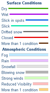
| Road Conditions and Web Cameras | |||
 |
|||
|
|
|
|
|
 |
 |
 |
 |
|
|
|
|
|
 |
|
 |
 |
|
|
|
|
|
 |
 |
 |
 |
|
|
|
|
|
 |
 |
 |
If you plan to travel, we recommend checking road conditions along your route and staying on top of road closures here. If you are on Twitter, follow the hashtag: #WyoRoad (or look below) for the latest weather affecting roads and road conditions in and around Wyoming.
| Tweets by @NWSRiverton | #WyoRoad Tweets |
|
Get the play-by-play on this storm and contribute your own snow reports to #wywx |
On the road? Tweet road conditions to #WyoRoad!
|

Summary | Forecast | Observed Snow and Wind | Travel Center | Monitoring & Reporting | Safety
PLEASE SEND US YOUR SNOW REPORTS (CLICK HERE)
 |
Monitor our Weather Summary Page for current Warnings, Watches, and Advisories. What's the difference? |
 |
Check the latest Weather Story graphic for an overview of the area forecast. |
 |
Check out what's on the radar. Riverton | Pocatello | Cheyenne | Billings | Salt Lake City | Rapid City | Mosaic |
| Submit storm reports/images and keep up to date with us on Facebook! | |
 |
Submit storm reports/images and keep up to date with us on Twitter! |
 |
Other reporting methods include email (nws.riverton@noaa.gov), or by phone at 1-800-211-1448. |
 |
Check the latest Public Information Statement for the latest storm reports. |
| Monitor current road conditions by visiting the Wyoming Dept. of Transportation (WYDOT) or by calling 5-1-1. | |
| Get current road conditions, web camera images, road alerts, and much more on your mobile device by downloading the Wyoming 511 Mobile App. |
Summary | Forecast | Observed Snow and Wind | Travel Center | Monitoring & Reporting | Safety

Winter Safety Kit | Winter Weather Safety
 |
Learn more about the National Weather Service's efforts to build a Weather-Ready Nation! |


