
Several rounds of severe thunderstorms are ongoing and expected from the central and southern High Plains to the Southeast U.S. through Sunday. Large hail, damaging winds, and a few tornadoes will be possible. Thunderstorms may also bring areas of excessive rainfall which could bring flooding to parts of the aforementioned areas through Sunday. Read More >
Summary | Forecast | Travel Center | Monitoring & Reporting | Safety
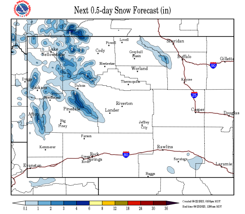
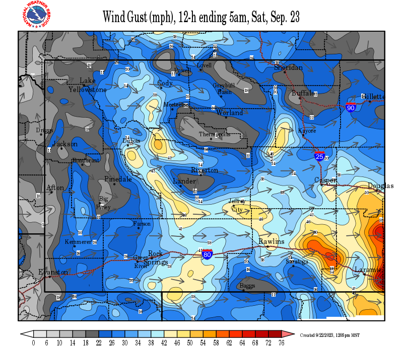
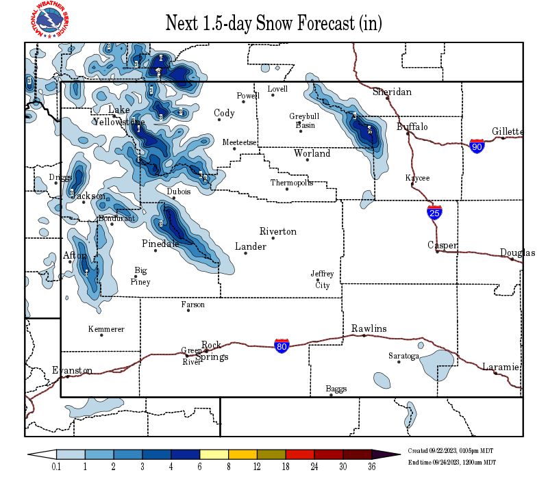
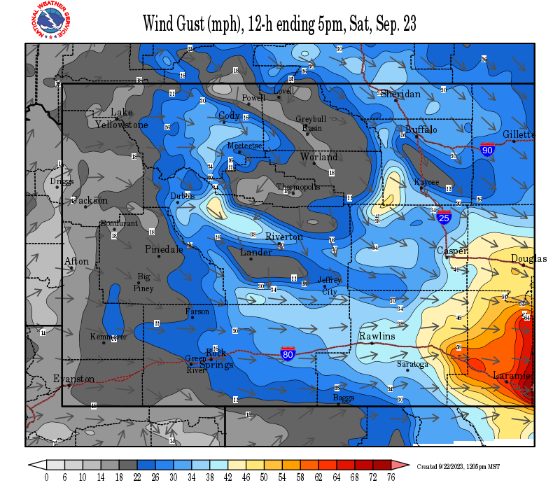
SYNOPSIS: It has been snowing in western Wyoming as a winter storm is moving into the area. This winter storm will bring moderate to heavy amounts of snow, along with windy conditions, into Western Wyoming through Saturday evening. Temperatures will warm as this system moves across the state. Then a cold front passes through on Saturday. A High wind warning has been issued for Natrona and southern Fremont counties from midnight Friday through 6 pm Saturday evening for the wind corridor from near South Pass to Casper. Wind speeds of 35 to 45 mph with gusts to 60 mph are possible. Areas of blowing and drifting snow are likely to occur once the wind picks up late Friday night. The Cody Foothills will also see strong winds beginning early Saturday morning with gusts of 35 to 45 mph.
IMPACTS:
 |
|
Click Image To Enlarge
|
| County | Station Name | Snowfall |
|---|---|---|
| Fremont | Burroughs Creek Snotel | 5 |
| Fremont | Little Warm Snotel | 3 |
| Fremont | Castle Creek Snotel | 3 |
| Fremont | Cold Springs Snotel | 3 |
| Fremont | Hobbs Park Snotel | 2 |
| Fremont | South Pass Snotel | 1 |
| Fremont | Deer Park Snotel | 1 |
| Fremont | Brooks Lake | 1 |
| Fremont | Atlantic City | 0.8 |
| Lincoln | Alpine | 12 |
| Lincoln | Alpine | 10 |
| Lincoln | Blind Bull Summit Snotel | 8 |
| Lincoln | Kelley Ranger Station Snotel | 6 |
| Lincoln | Willow Creek Snotel | 6 |
| Lincoln | Spring Creek Divide Snotel | 6 |
| Lincoln | Indian Creek Snotel | 6 |
| Lincoln | Hams Fork Snotel | 6 |
| Lincoln | Commissary Ridge | 6 |
| Lincoln | Box Y Ranch | 6 |
| Lincoln | Star Valley Ranch | 5 |
| Lincoln | Star Valley Ranch | 4.1 |
| Lincoln | Cottonwood Creek Snotel | 4 |
| Lincoln | Blind Bull Summit | 4 |
| Lincoln | 2 SE Thayne | 3.7 |
| Lincoln | Afton | 3.6 |
| Lincoln | 3 SE Bedford | 3 |
| Lincoln | Salt River Summit Snotel | 3 |
| Lincoln | Fossil Butte | 2.5 |
| Lincoln | 5 SSE Smoot | 2 |
| Park | Younts Peak Snotel | 5 |
| Park | Evening Star Snotel | 5 |
| Park | Pahaska | 3 |
| Park | Blackwater Snotel | 3 |
| Park | Kirwin Snotel | 2 |
| Park | 1 ENE Wapiti | 1.5 |
| Park | 2 WSW Cody | 1 |
| Park | Timber Creek Snotel | 1 |
| Park | Beartooth Lake Snotel | 1 |
| Park | 26 SW Cody | 0.5 |
| Sublette | Daniel Fish Hatchery | 7 |
| Sublette | Triple Peak Snotel | 7 |
| Sublette | Kendall Ranger Station Snotel | 7 |
| Sublette | Elkhart Park G.S. Snotel | 6 |
| Sublette | Loomis Park Snotel | 6 |
| Sublette | 14 NW Pinedale | 5 |
| Sublette | Big Sandy Opening Snotel | 5 |
| Sublette | Larsen Creek Snotel | 5 |
| Sublette | Snider Basin Snotel | 5 |
| Sublette | New Fork Lake Snotel | 5 |
| Sublette | Pinedale | 4.5 |
| Sublette | Pocket Creek Snotel | 4 |
| Sublette | East Rim Divide Snotel | 4 |
| Sublette | Gunsite Pass Snotel | 4 |
| Sublette | Boulder Rearing Station | 4 |
| Sublette | Bondurant | 0.6 |
| Sweetwater | Green River | 1 |
| Sweetwater | 4 NNW Rock Springs | 1 |
| Sweetwater | 7 SE Rock Springs | 1 |
| Sweetwater | Green River | 0.9 |
| Sweetwater | Green River | 0.8 |
| Sweetwater | Rock Springs | 0.8 |
| Sweetwater | Rock Springs | 0.6 |
| Sweetwater | 5 N Farson | 0.5 |
| Teton | Granite Creek Snotel | 6 |
| Teton | Phillips Bench Snotel | 6 |
| Teton | Jackson Hole - Rendezvous Bowl | 5 |
| Teton | 2 SW Wilson | 5 |
| Teton | Grand Targhee Snotel | 5 |
| Teton | Moose | 4.6 |
| Teton | Jackson Dam | 4.2 |
| Teton | Snake River Stn Snotel | 4 |
| Teton | Grassy Lake Snotel | 4 |
| Teton | Togwotee Pass Snotel | 4 |
| Teton | Jackson Hole - Raymer | 4 |
| Teton | 5 NW Jackson | 3.6 |
| Teton | Jackson Hole - Mid Mountain | 3.5 |
| Teton | Base Camp Snotel | 3 |
| Teton | Gros Ventre Summit Snotel | 3 |
| Teton | Grand Targhee - Chief Joseph | 3 |
| Teton | 2 NE Teton Village | 2.8 |
| Teton | 12 NE Jackson | 2.5 |
| Teton | Snow King | 2 |
| Teton | Jackson Hole - Base | 2 |
| Teton | Togwotee Mountain Lodge | 2 |
| Teton | Jackson | 2 |
| Yellowstone | Lewis Lake Divide Snotel | 6 |
| Yellowstone | Parker Peak Snotel | 5 |
| Yellowstone | Thumb Divide Snotel | 3 |
| Yellowstone | Two Ocean Plateau Snotel | 3 |
| Yellowstone | Old Faithful Ranger Station | 2.5 |
| Yellowstone | Lamar Ranger Station | 2 |
| Yellowstone | Tower Falls Ranger Station | 2 |
| Yellowstone | Sylvan Lake Snotel | 2 |
| Yellowstone | Sylvan Road Snotel | 2 |
| Yellowstone | Canyon Snotel | 1 |
|
|
|
|
|
|
|
|
High Wind Statement |
|
 |
 |
|
Click Image To Enlarge |
Click Image To Enlarge |
Snow and Wind Forecasts - Update Every 3 Hours
 |
 |
|
12 Hour Snow Accumulation Forecast |
12 Hour Peak Wind Gusts |
 |
 |
|
24 Hour Snow Accumulation Forecast |
12-24 Hour Peak Wind Gusts |
 |
 |
|
36 Hour Snow Accumulation Forecast |
24-36 Hour Peak Wind Gusts |
Summary | Forecast | Travel Center | Monitoring & Reporting | Safety
|
|
|
|
|
|
|
|
 |
 |
 |
 |
|
|
|
|
|
 |
 |
 |
 |
|
|
|
|
|
|
|
 |
 |
 |
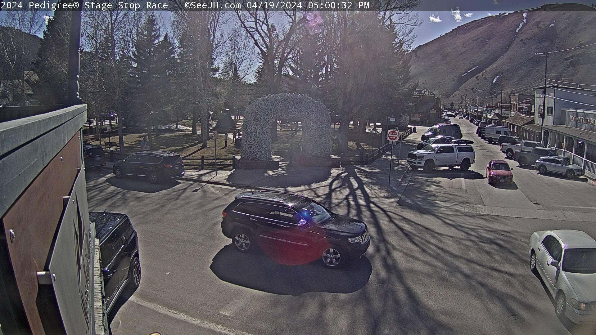
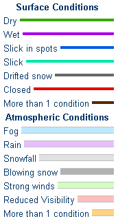
If you plan to travel, we recommend checking road conditions along your route and staying on top of road closures here. If you are on Twitter, follow the hashtag: #WyoRoad (or look below) for the latest weather affecting roads and road conditions in and around Wyoming.
 |
| Tweets by @NWSRiverton | #WyoRoad Tweets |
|
Get the play-by-play on this storm and contribute your own snow reports to #wywx |
On the road? Tweet road conditions to #WyoRoad!
|

Summary | Forecast | Travel Center | Monitoring & Reporting | Safety
PLEASE SEND US YOUR SNOW REPORTS (CLICK HERE)
 |
Monitor our Weather Summary Page for current Warnings, Watches, and Advisories. What's the difference? |
 |
Check the latest Weather Story graphic for an overview of the area forecast. |
 |
Check out what's on the radar. Riverton | Pocatello | Cheyenne | Billings | Salt Lake City | Rapid City | Mosaic |
 |
Submit storm reports/images and keep up to date with us on Facebook! |
 |
Submit storm reports/images and keep up to date with us on Twitter! |
 |
Other reporting methods include submitting an online report, email (nws.riverton@noaa.gov), or by phone at 1-800-211-1448. |
 |
Check the latest Public Information Statement for the latest storm reports. |
 |
Monitor current road conditions by visiting the Wyoming Dept. of Transportation (WYDOT) or by calling 5-1-1. |
 |
Get current road conditions, web camera images, road alerts, and much more on your mobile device by downloading the Wyoming 511 Mobile App. |
Summary | Forecast | Travel Center | Monitoring & Reporting | Safety
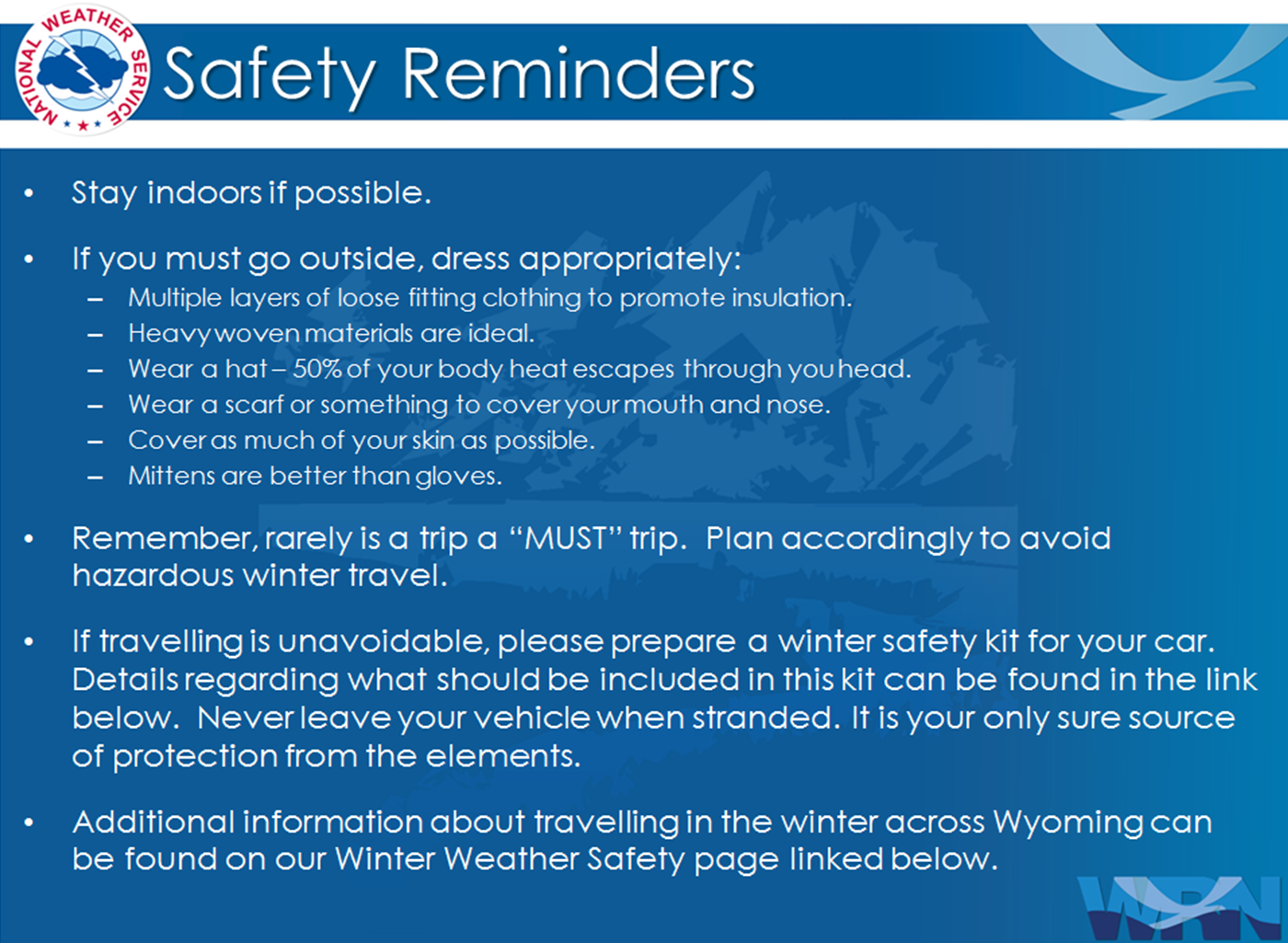
Winter Safety Kit | Winter Weather Safety
 |
Learn more about the National Weather Service's efforts to build a Weather-Ready Nation! |