
Scattered severe storms are expected in the Midwest this afternoon/tonight, with another threat possible in the central/southern Plains. Late-season snow is expected over parts of the central Rockies including the Denver Metro into Wednesday. Severe thunderstorms are expected Tuesday and Wednesday across Texas and the mid-South, with threats of damaging winds, large hail, tornadoes, and flooding. Read More >

|
||||||||||||||||||
|
Funnel Cloud: A funnel-shaped cloud, extended outward or downward from a thunderstorm, that corresponds to a rotating column of air. If the rotation is violent and reaches the ground, the funnel cloud is associated with a tornado. Tornado: A violently rotating column of air, in contact with the ground, that extends from the base of a thunderstorm to the ground. This is often visible as a funnel cloud with swirling dust or debris near the surface. Severe Thunderstorm: A thunderstorm that produces hail one inch or larger in diameter (quarter size) and/or a wind gust to 58 mph or higher. Microburst: A convective downdraft with an affected outflow area of less than 2½ miles wide and peak winds lasting less than 5 minutes. Microbursts may induce dangerous horizontal/vertical wind shears, which can adversely affect aircraft performance and cause property damage. Straight-line Winds: Generally, any wind that is not associated with rotation, used mainly to differentiate them from tornadic winds. Flash Flood: A sudden inundation of water in low-lying areas, usually brought on by heavy rain, dam break, rapid snowmelt or ice jams. Watch: The potential exists for severe weather to occur within the next 8 hours but the exact location and timing is not known. Action can be taken to protect property such as putting your vehicle in the garage, putting away patio furniture, etc. Warning: Severe weather either is occurring or will be shortly. Immediate action should be taken to protect yourself by going to the lowest portion of a sturdy building, or into a closet, hallway or room without windows.
Severe Weather Climatology Wyoming experiences a full range of weather related hazards. The following graphics show the number of public reported severe weather related events across Wyoming. This data is from 1950 through 2014. The severe weather season in Wyoming runs roughly from mid-April through September with the majority of the severe weather occuring between 2 p.m. and 7 p.m. 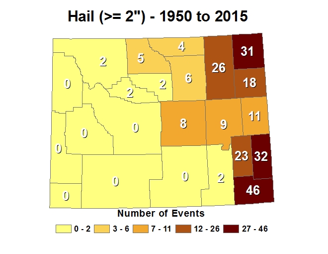 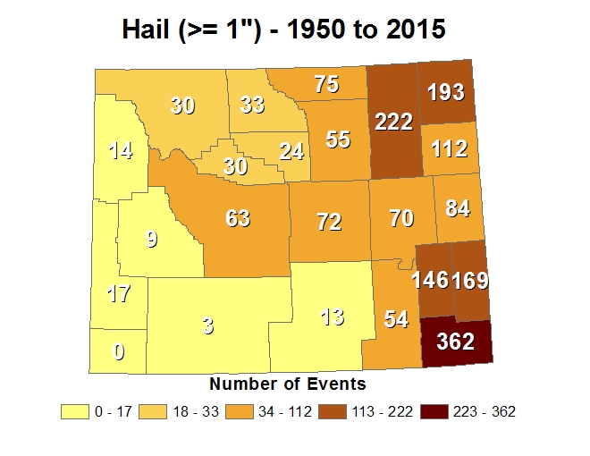 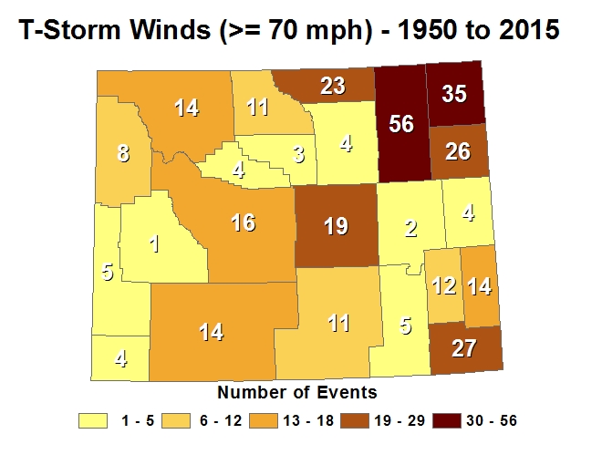 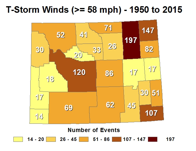 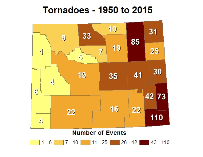 |