Summary | Forecast | Travel Center | Monitoring & Reporting | Safety
SYNOPSIS: Light to moderate new snow accumulations are expected for central and western Wyoming through the night, with heavier new snow accumulations expected for southern and eastern Wyoming. Check below for the latest forecast details, and the latest snow totals as of Monday evening.
| County | Station Name | Snowfall |
|---|---|---|
| Fremont | Bruce's Campground | 10 |
| Fremont | South Pass Snotel | 5 |
| Fremont | Deer Park Snotel | 4 |
| Fremont | St. Lawrence Alt Snotel | 4 |
| Fremont | Hobbs Park Snotel | 4 |
| Fremont | Lander | 3 |
| Fremont | Cold Springs Snotel | 3 |
| Fremont | Townsend Creek Snotel | 3 |
| Fremont | Lander Airport | 2.8 |
| Fremont | Atlantic City | 2 |
| Fremont | Jeffrey City | 2 |
| Fremont | Little Warm Snotel | 2 |
| Fremont | Riverton | 1.4 |
| Fremont | Riverton Airport | 1.2 |
| Hot Springs | Thermopolis | 0.5 |
| Johnson | Little Goose Snotel | 2 |
| Johnson | Buffalo | 1 |
| Johnson | Kaycee | 1 |
| Lincoln | Fossil Butte | 0.7 |
| Natrona | Casper Mountain | 10-14 |
| Natrona | Reno Hill Snotel | 9 |
| Natrona | Bessemer Bend | 6 |
| Natrona | Casper Airport | 5 |
| Natrona | Casper | 5-10 |
| Natrona | Grave Spring Snotel | 3 |
| Park | 3 NE Sunshine | 0.5 |
| Sublette | Pocket Creek Snotel | 1 |
| Sweetwater | Wamsutter | 6 |
| Sweetwater | 3 NW Green River | 2.5 |
| Sweetwater | Buckboard Marina | 2 |
| Sweetwater | 7 SE Rock Springs | 2 |
| Sweetwater | Green River | 1 |
| Sweetwater | Rock Springs | 0.5-1 |
| Teton | Moose | 1.5 |
| Teton | 3 SSW Wilson | 0.5 |
| Washakie | Middle Powder Snotel | 2 |
| Yellowstone | Lamar Ranger Station | 0.2 |
|
|
|
|
|
|
|
|
High Wind Statement |
|
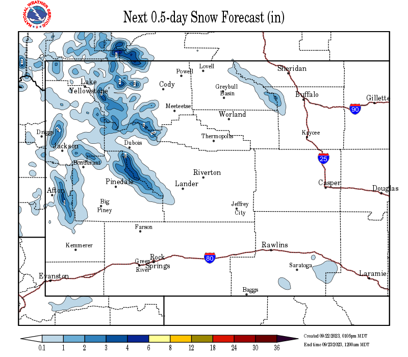
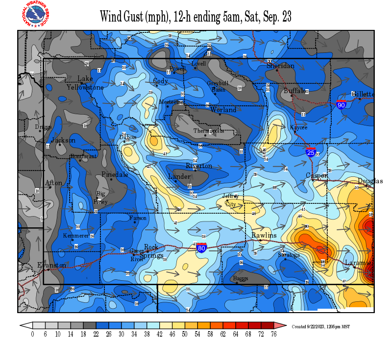
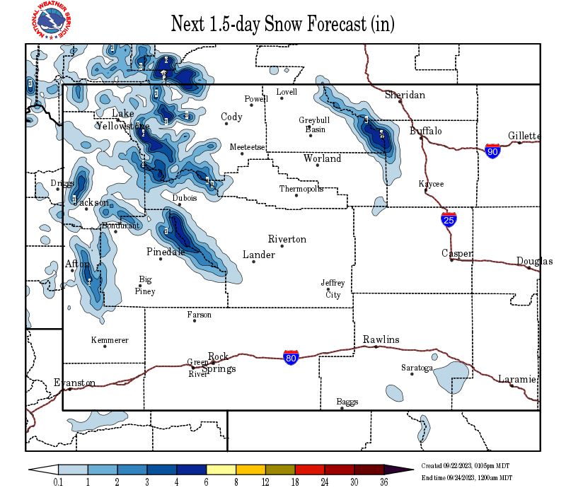
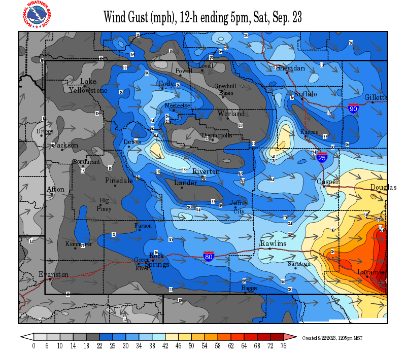
Snow and Wind Forecasts - Update Every 3 Hours
 |
 |
|
12 Hour Snow Accumulation Forecast |
12 Hour Peak Wind Gusts |
 |
 |
|
24 Hour Snow Accumulation Forecast |
12-24 Hour Peak Wind Gusts |
 |
 |
|
36 Hour Snow Accumulation Forecast |
24-36 Hour Peak Wind Gusts |
Summary | Forecast | Travel Center | Monitoring & Reporting | Safety
|
|
|
|
|
|
|
|
|
 |
 |
 |
 |
|
|
|
|
|
 |
 |
 |
 |
|
|
|
|
|
|
|
 |
 |
 |
Click Here to See All Webcams (New Window)
If you plan to travel, we recommend checking road conditions along your route and staying on top of road closures here. If you are on Twitter, follow the hashtag: #WyoRoad (or look below) for the latest weather affecting roads and road conditions in and around Wyoming.
| Tweets by @NWSRiverton | #WyoRoad Tweets |
|
Get the play-by-play on this storm and contribute your own snow reports to #wywx |
On the road? Tweet road conditions to #WyoRoad! |
 |
 |
|
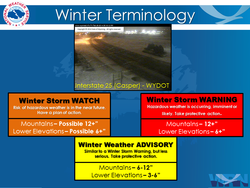
Winter Terminology |
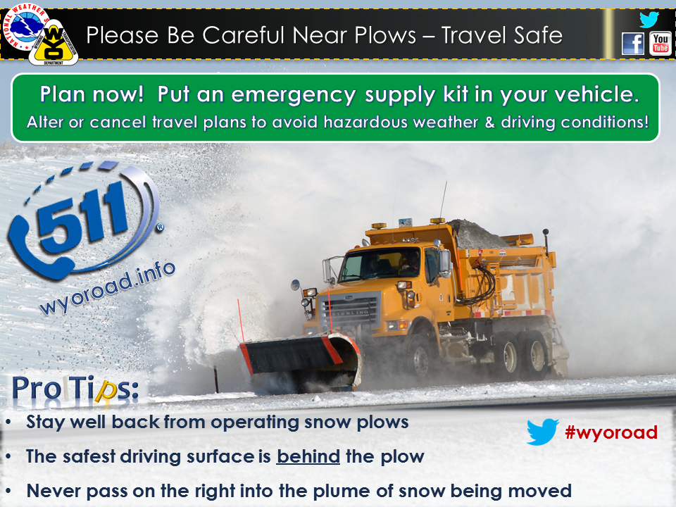
Snow Plow Safety |
 |
 |
|
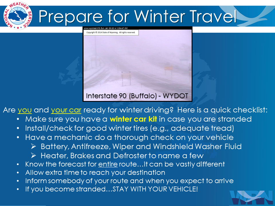
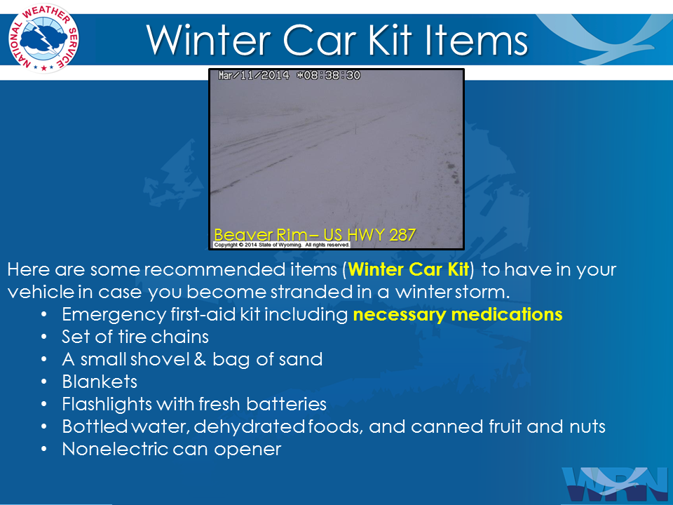
Prepare You and Your Car Before Traveling |
Always Have A Winter Survival Kit In Your Car |
 |
 |
|
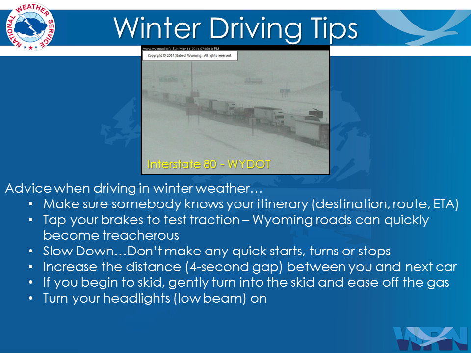
Remember Proper Winter Driving Tips |
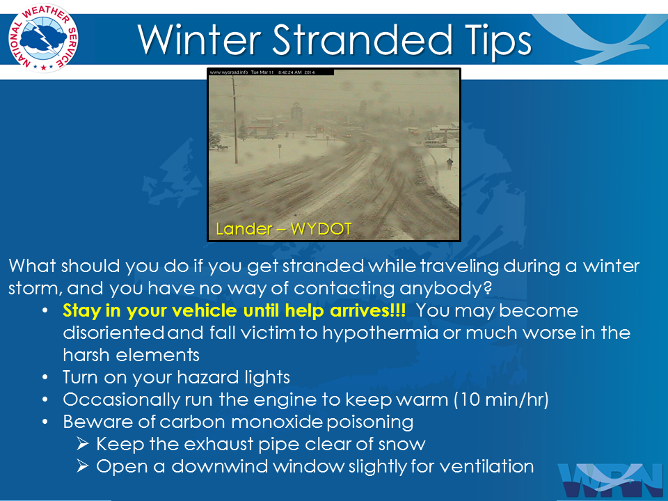
Stay In Your Vehicle If Stranded |

Summary | Forecast | Travel Center | Monitoring & Reporting | Safety
PLEASE SEND US YOUR SNOW REPORTS (CLICK HERE)
 |
Monitor our Severe Weather Summary Page for current Warnings, Watches, and Advisories. What's the difference? |
 |
Check the latest Weather Story graphic for an overview of the area forecast. |
 |
Check out what's on the radar. Riverton | Pocatello | Cheyenne | Billings | Salt Lake City | Rapid City | Mosaic |
 |
Submit storm reports/images and keep up to date with us on Facebook! |
 |
Submit storm reports/images and keep up to date with us on Twitter! |
 |
Other reporting methods include submitting an online report, email (cr.wxriw@noaa.gov), or by phone at 1-800-211-1448. |
 |
Check the latest Public Information Statement for the latest storm reports. |
 |
Monitor current road conditions by visiting the Wyoming Dept. of Transportation (WYDOT) or by calling 5-1-1. |
Summary | Forecast | Travel Center | Monitoring & Reporting | Safety
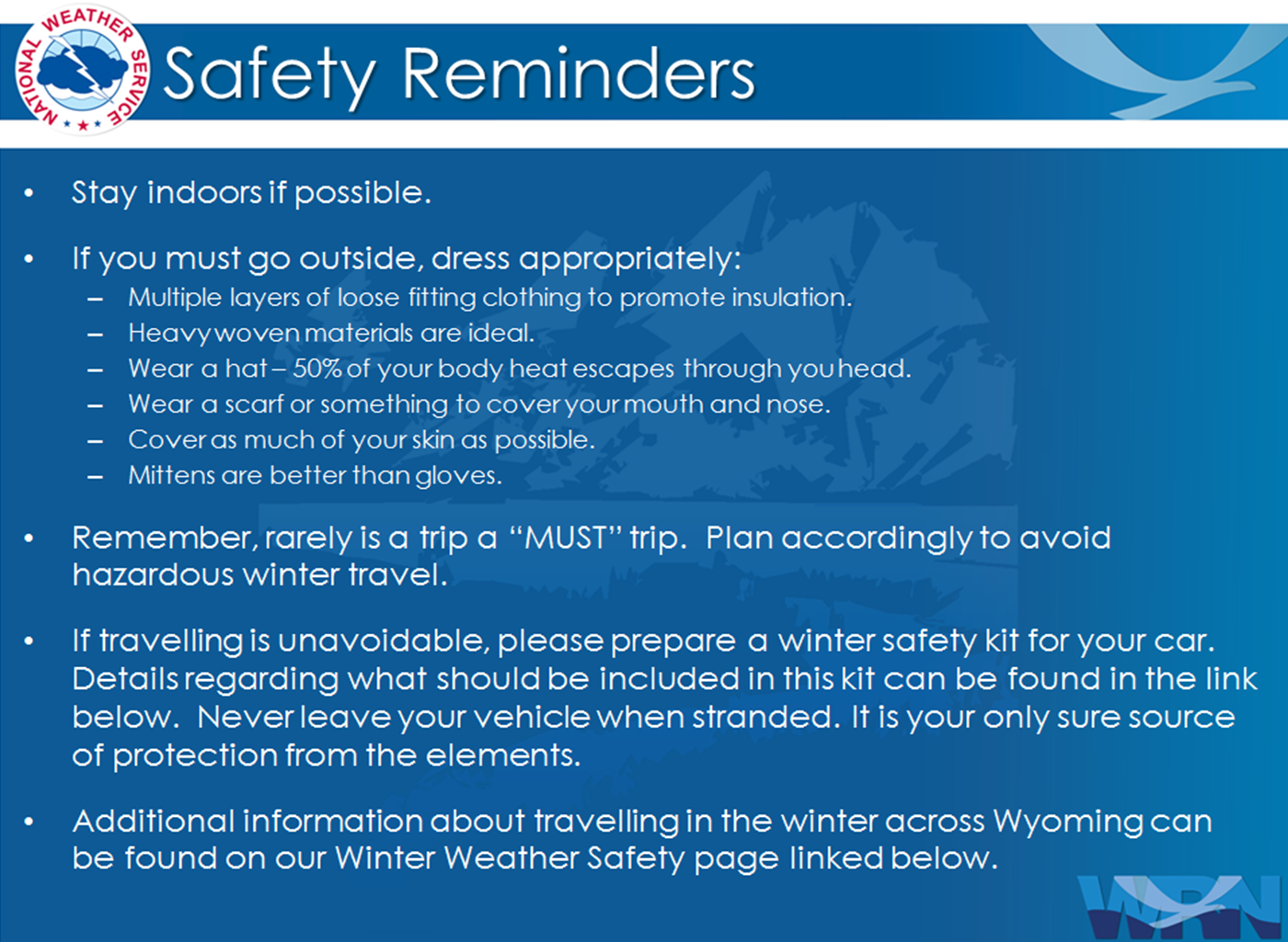
Winter Safety Kit | Winter Weather Safety
 |
Learn more about the National Weather Service's efforts to build a Weather-Ready Nation! |