


Winter Briefing
| Summer | Winter | Fire | Text |
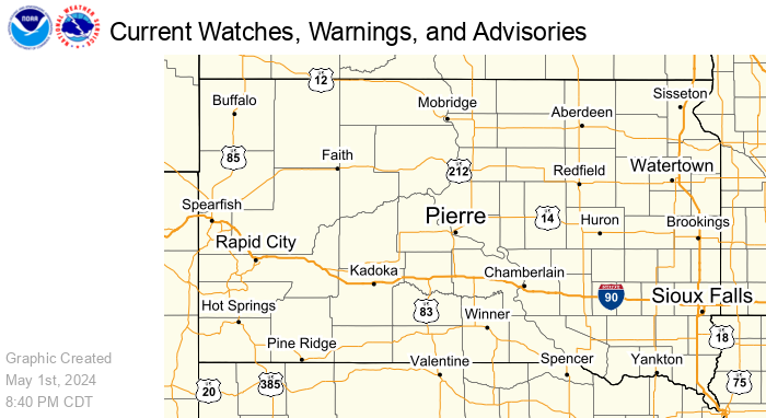
To view hazards legend: Stop the loop, step to the end, and use the alerts drop-down. View full radar page here.
Click here for a static hazards map.
Local Storm Reports
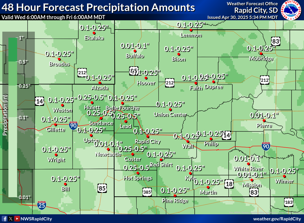
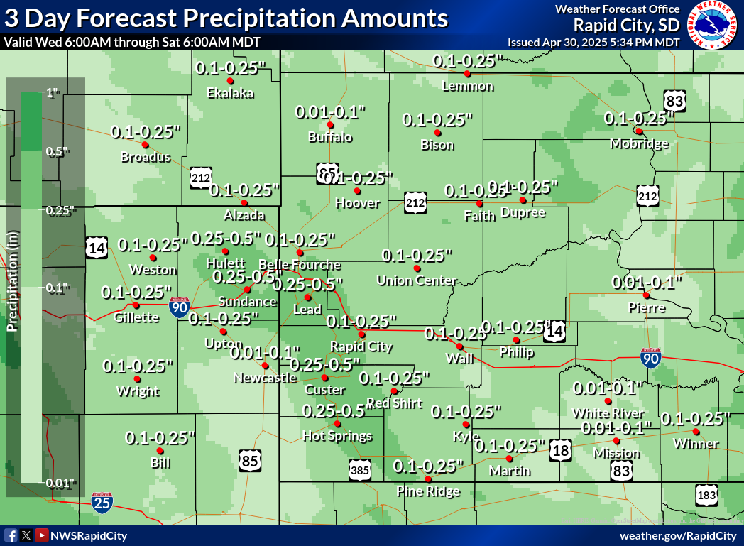
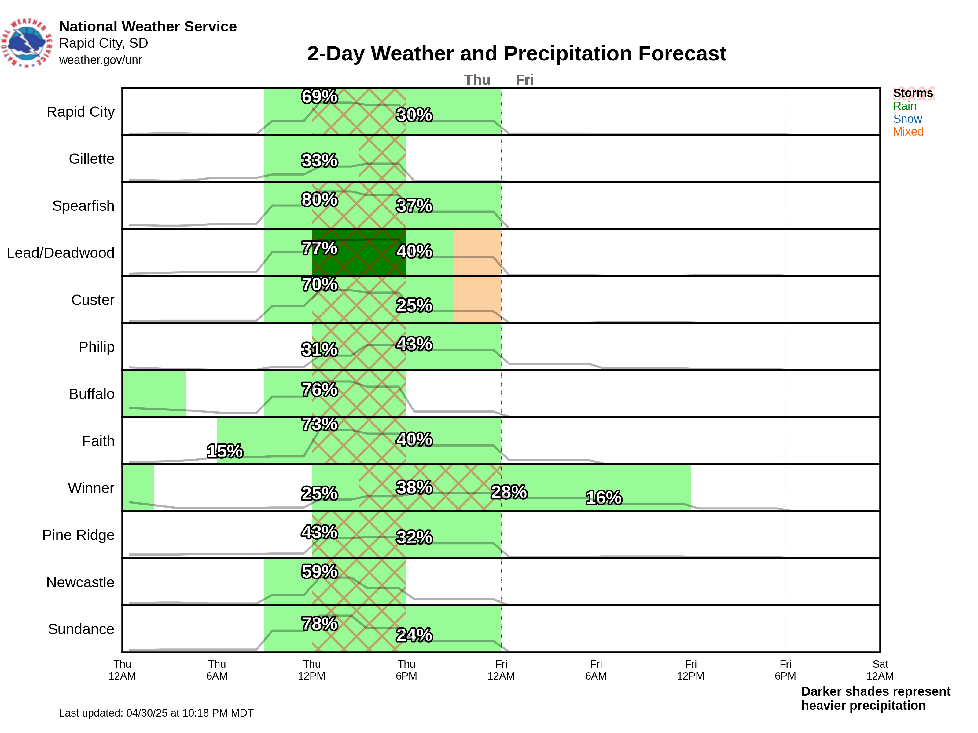
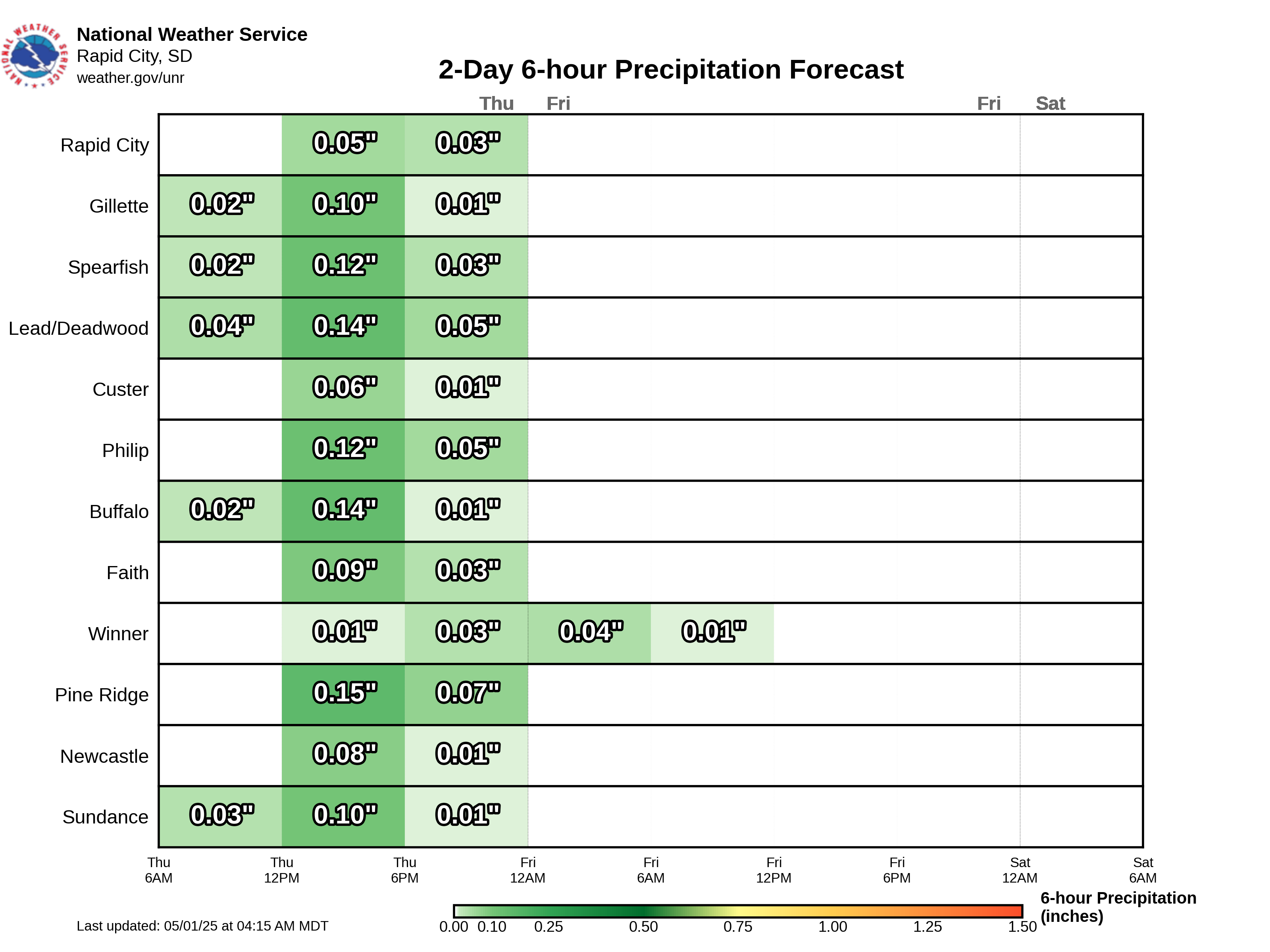
Precipitation Forecast
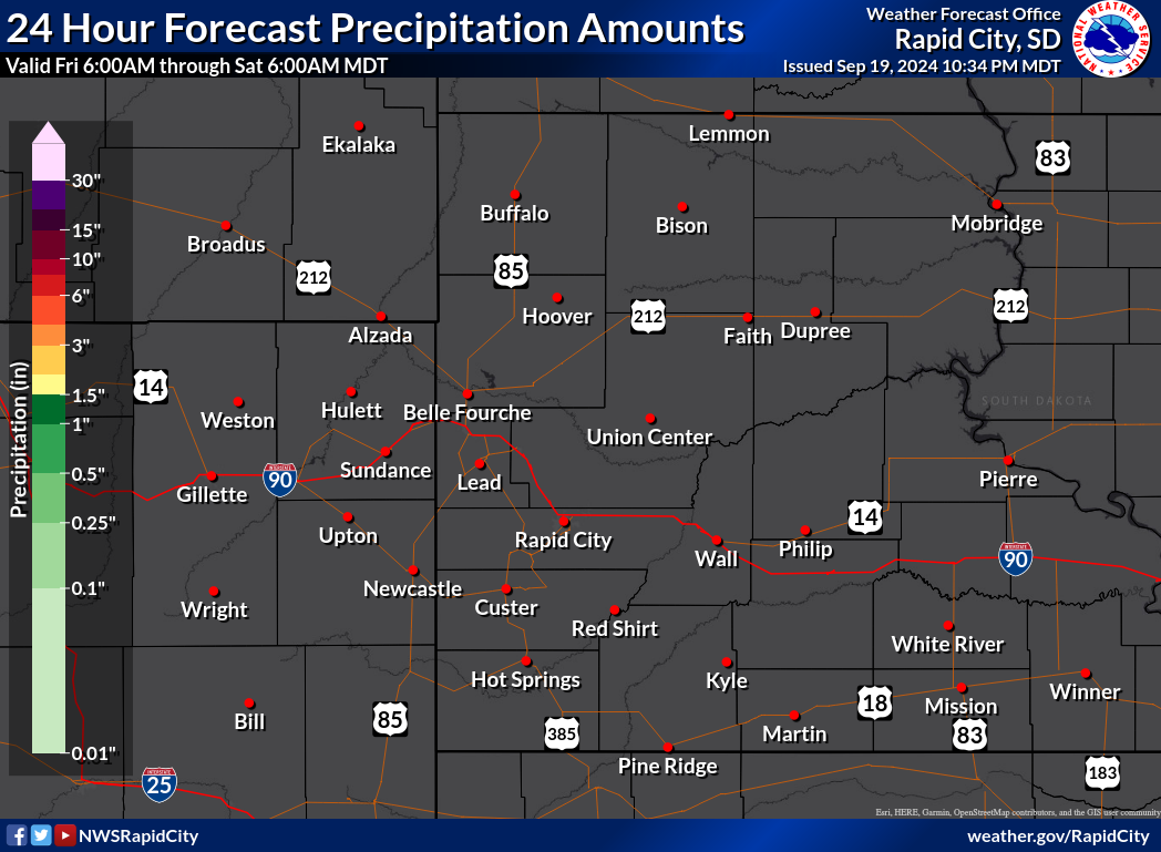
Liquid Precipitation
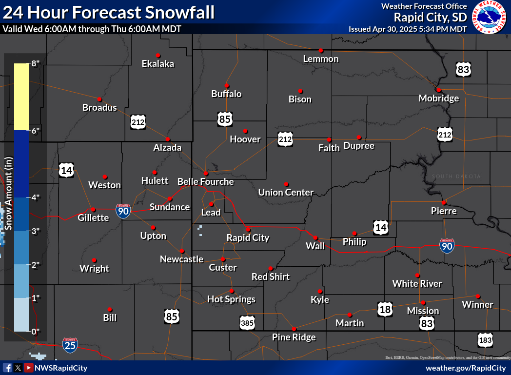
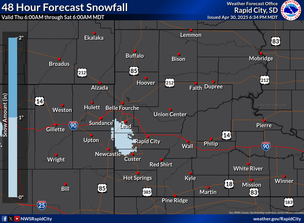
Snowfall
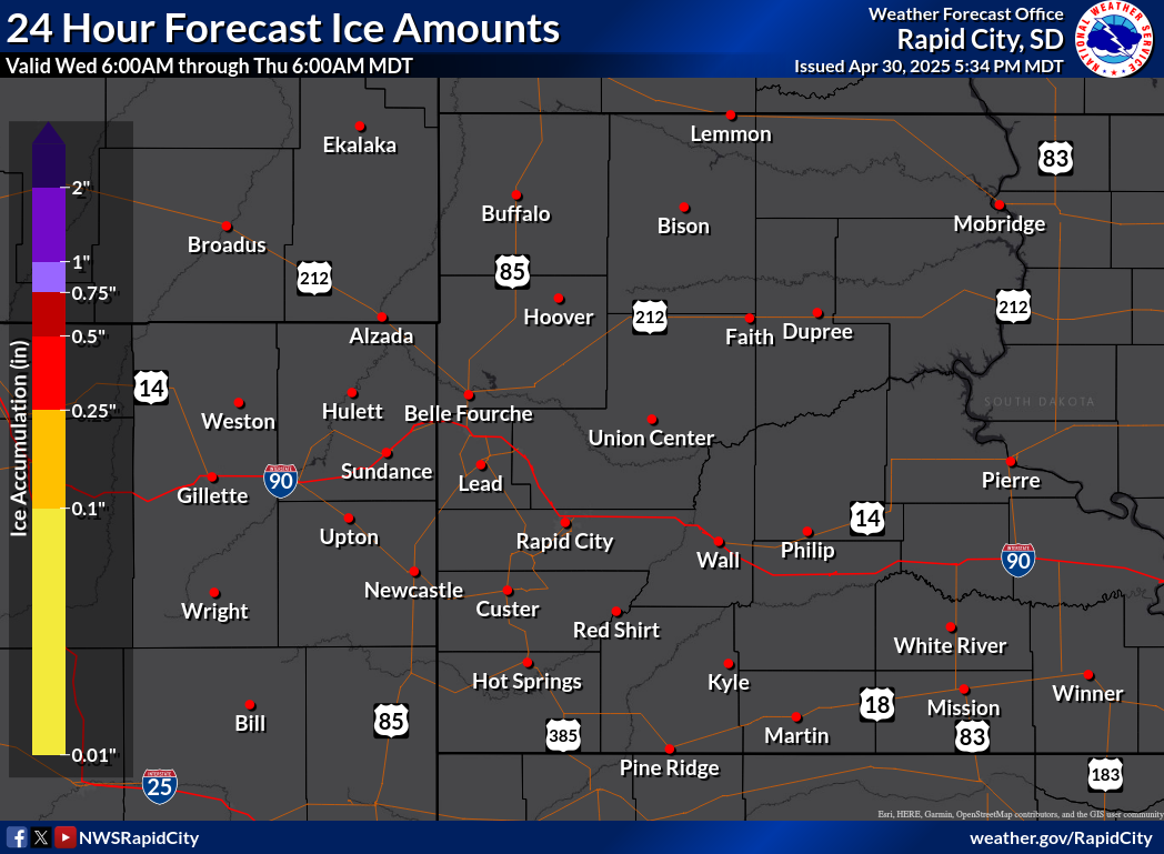
Ice

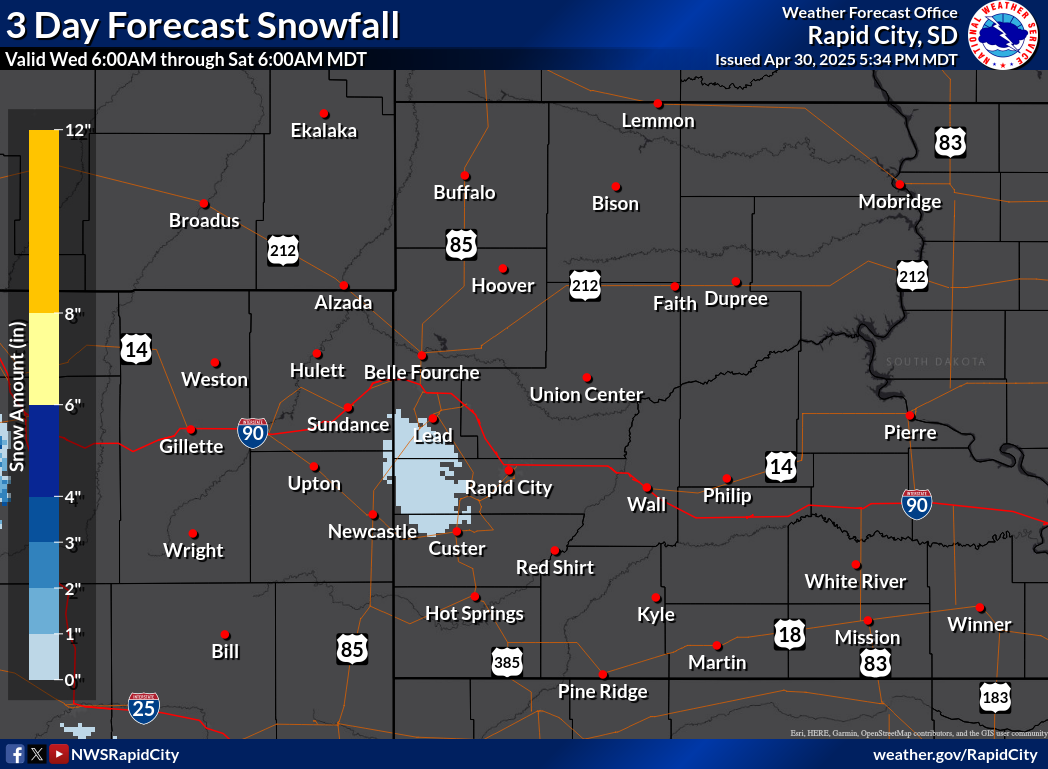

Range of 3-Day Snowfall Possibilities
Probability of Snow Amounts

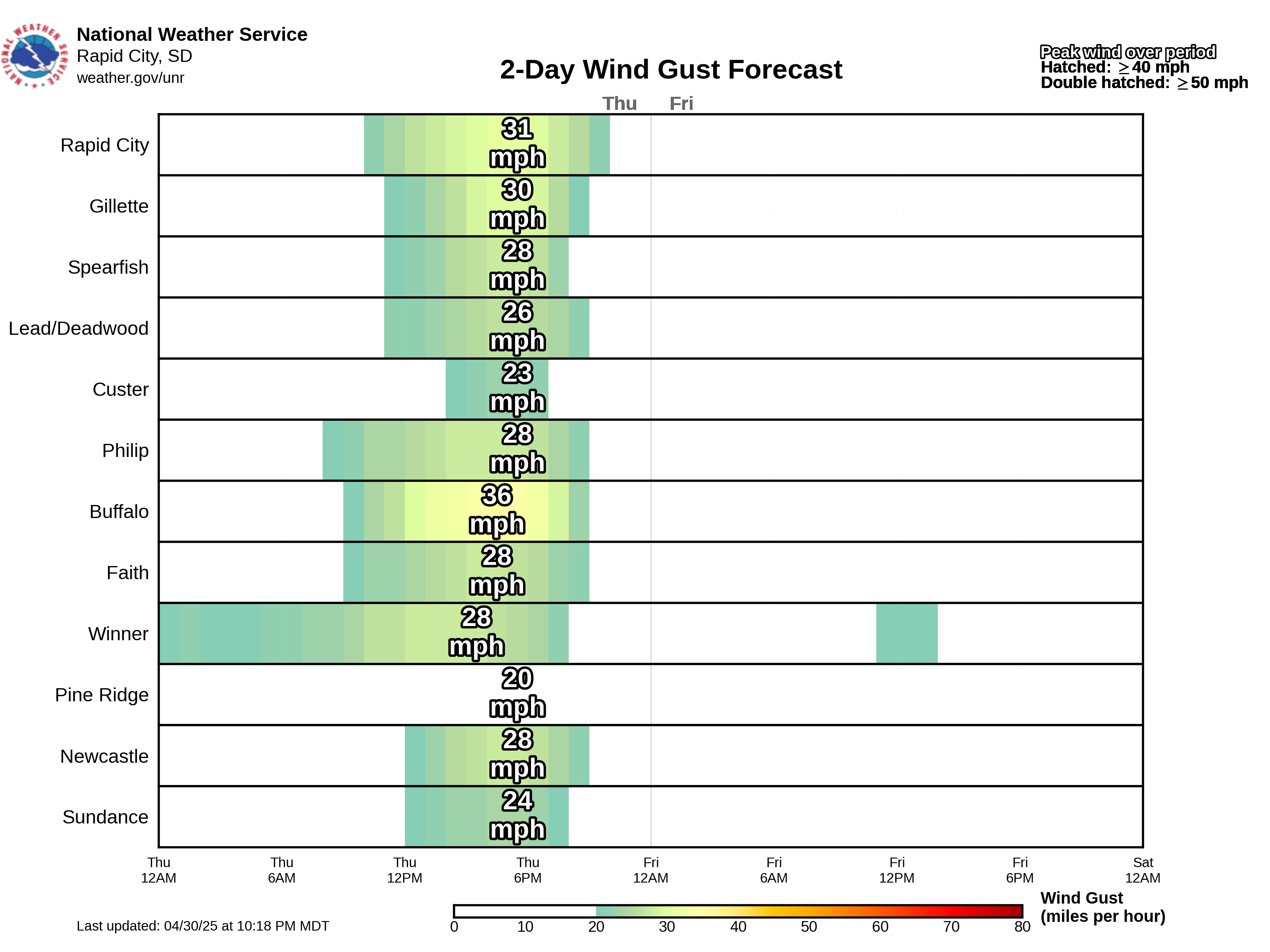
Additional Weather Elements
(mouse over day or period to see map below)
| Max Temperature | Day 1 | Day 2 | Day 3 | Day 4 | Day 5 | |||||
| Min Temperature | Day 1 | Day 2 | Day 3 | Day 4 | Day 5 | |||||
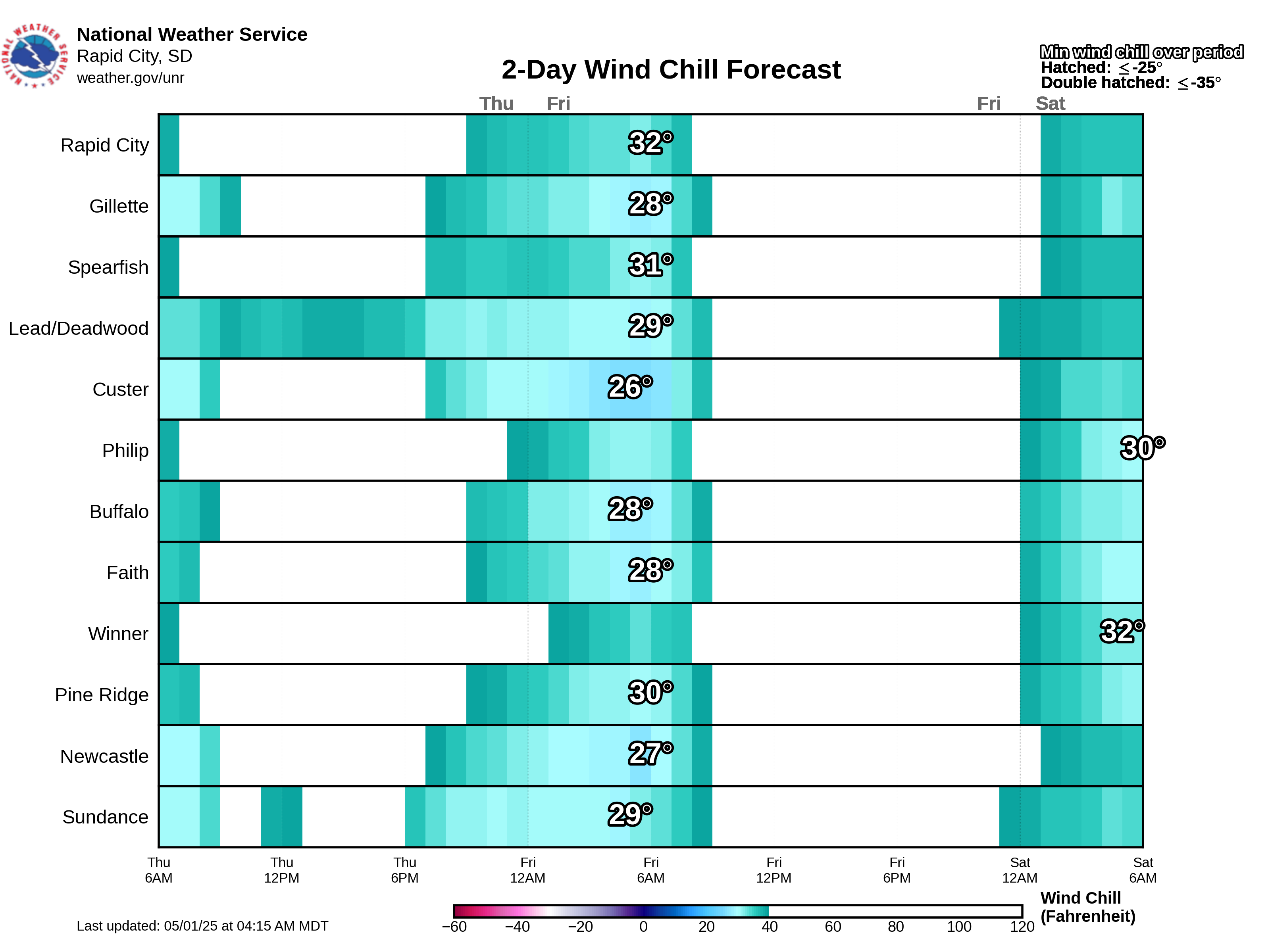
| Wind Chill | Period 1 | Period 2 | Period 3 | Period 4 | Period 5 | Period 6 | Period 7 | Period 8 | Period 9 | |
| Max Wind Gust | Period 1 | Period 2 | Period 3 | Period 4 | Period 5 | Period 6 | Period 7 | Period 8 | Period 9 | |
| Chance of Precip | Period 1 | Period 2 | Period 3 | Period 4 | Period 5 | Period 6 | Period 7 | Period 8 | Period 9 | |
| BH Snow Depth | Period 1 | Period 2 | Period 3 | Period 4 | Period 5 | Period 6 | Period 7 | |||
 |
||||||||||
Detailed Point Forecast
(click map to change the location of the forecast listed below the map)
Climate Outlooks
8-14 Day Temp Outlook

8-14 Day Precip Outlook
