HOME
FORECAST
Local
Graphical
Aviation
Marine
Rivers and Lakes
Hurricanes
Severe Weather
Fire Weather
Sun/Moon
Long Range Forecasts
Climate Prediction
Space Weather
PAST WEATHER
Past Weather
Heating/Cooling Days
Monthly Temperatures
Records
Astronomical Data
SAFETY
Tsunamis
Floods
Beach Hazards
Wildfire
Cold
Tornadoes
Air Quality
Fog
Heat
Hurricanes
Lightning
Safe Boating
Rip Currents
Thunderstorms
Space Weather
Sun (Ultraviolet Radiation)
Safety Campaigns
Wind
Drought
Winter Weather
INFORMATION
Wireless Emergency Alerts
Brochures
Weather-Ready Nation
Cooperative Observers
Daily Briefing
Damage/Fatality/Injury Statistics
Forecast Models
GIS Data Portal
NOAA Weather Radio
Publications
SKYWARN Storm Spotters
StormReady
TsunamiReady
Service Change Notices
EDUCATION
Be A Force of Nature
NWS Education Home
NEWS
NWS News
Events
Pubs/Brochures/Booklets
NWS Media Contacts
SEARCH
Search For
NWS
All NOAA
ABOUT
About NWS
Organization
Strategic Plan
Commitment to Diversity
For NWS Employees
International
National Centers
Careers
Contact Us
Glossary
Social Media
Local forecast by
"City, St" or ZIP code
Sorry, the location you searched for was not found. Please try another search.
Multiple locations were found. Please select one of the following:
Location Help
News Headlines
CMS Migration From NIDS To IDP Scheduled To Occur On Or About June 4, 2024
Click Here For The Spring 2024 SkyWarn Schedule!
Local Day In Weather History
Customize Your
Weather.gov
Enter Your City, ST or ZIP Code
Remember Me
LOADING...
Cleveland, OH
Weather Forecast Office
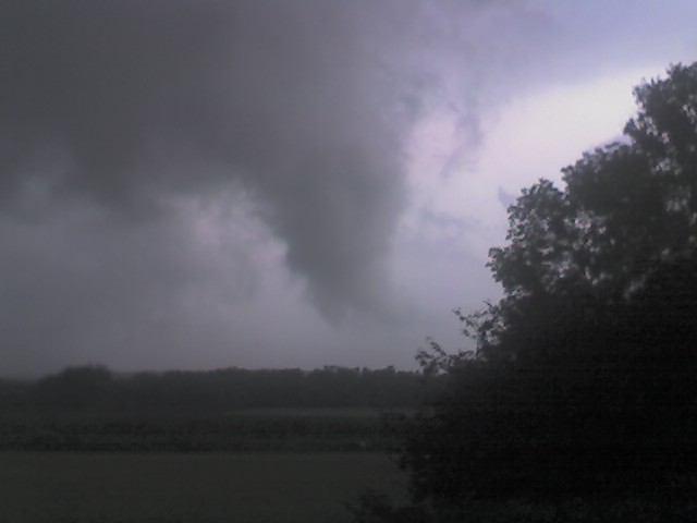
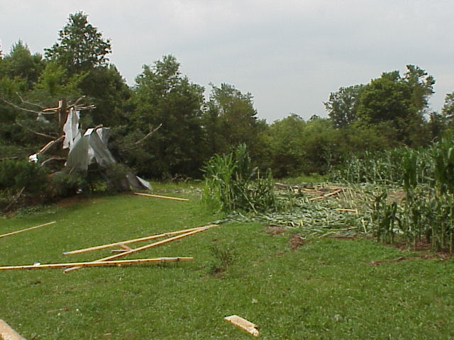
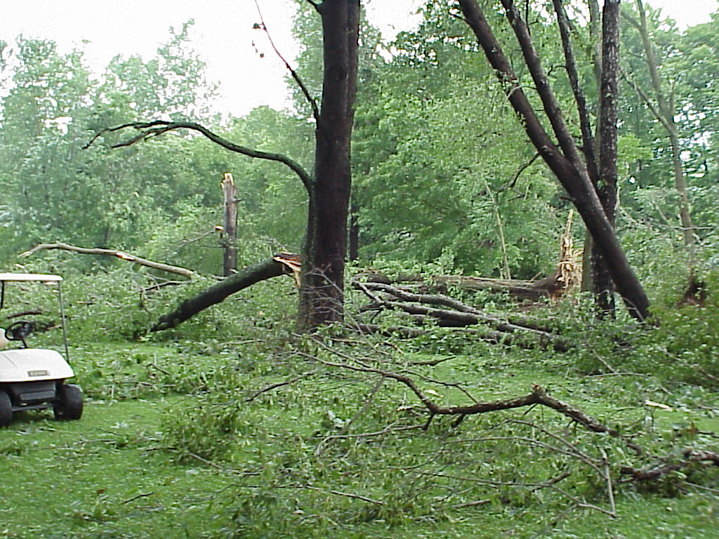
July 10, 2006 Richland, Ashland F1 Tornado Pictures
Weather.gov
>
Cleveland, OH
> July 10, 2006 Richland, Ashland F1 Tornado Pictures
Current Hazards
River Flooding
Briefing Page
Winter
Space
Local Outlook
Drought
Thunderstorms
Hurricanes
Local Criteria
Graphical Hazardous Weather Outlook
Current Conditions
Observations (List)
Rainfall
Air Quality
Satellite
Observations (Map)
Marine Obs (Map)
Local Storm Reports
Public Information Statements
Radar
Local KCLE Standard Radar (low bandwidth)
Local KCLE Enhanced Radar
Regional Standard Radar (low bandwidth)
National Standard Radar (low bandwidth)
Other Area Radars
Forecasts
Forecasters' Discussion
Hourly View
Map View
Aviation
Tropical
Activity Planner
Marine
Winter
Beach
Fire Weather
Request Spot Forecast
Near Term and Extended Forecasts
Rivers and Lakes
*New* National Water Prediction Service (NWPS)
*New* NWPS - Local View
River Observations (Map)
River Forecasts (Map)
Current & Past Streamflow
Ensemble River Guidance
River Forecast Centers
Climate and Past Weather
Past Observed Weather
24 Hour Summary
CoCoRaHS
Past Rainfall
Snowfall Records
Drought Outlook
Historical Records
Climate Prediction
Nat'l Climate Data Center (NCDC)
Local Climate Information One-Stop-Shop
Local Programs
SKYWARN
Local Weather Event Summaries
Local Day In Weather History
StormReady
WRN Ambassadors
Weather Radio
Seguridad Meteorológica (Weather Safety)
Submit a Storm Report
July 10, 2006
Richland, Ashland County F1 Tornado
Click on the images below to enlarge.
Radar
Current Weather
Rivers & Lakes
Satellite
Forecast Maps
Hour by Hour Forecast
Tropical Weather
Graphical Hazards
Text Bulletins
Skywarn
Marine Forecasts
Forecaster's Discussion
NOAA Weather Radio
Climate
Submit Storm Report
Beach Forecast
Fire Weather
Drought
Follow us on Twitter
Follow us on Facebook
Follow us on YouTube
CLE RSS Feed