
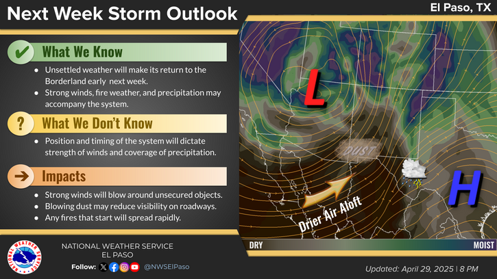
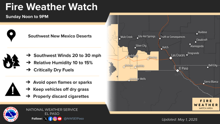
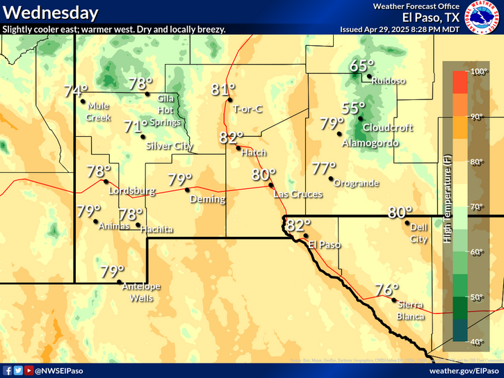
Scattered severe thunderstorms are possible Saturday afternoon into early evening across parts of the southern High Plains. Damaging winds, large hail, isolated tornadoes, and heavy to excessive rainfall are possible. Along the Atlantic Coast, widespread minor to isolated moderate coastal flooding at high tides is forecast through the weekend. Read More >
Last Map Update: Fri, Sep 20, 2024 at 8:08:42 pm MDT
 Briefing |
 Forecast Discussion |
 Weather Hazards Outlook |
 Hourly Forecast |
 Gridded Forecast |
 Weather Calculator |
|
|
 Satellite |
|
 Past Weather |
 Drought |
 Hydrology |
 Wx Radio |
 Skywarn |
 Fire Weather |
Volunteer |
 Aviation |
 Social Media |


 Radar
Radar Weather Map
 Satellite