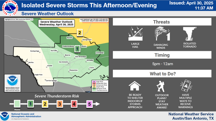
A stalled frontal boundary over the Hill Country and Central Texas could bring the focus for isolated to scattered showers and thunderstorms today into this evening. Southwestern counties will remain mostly dry however. Expect highs in upper 80s to mid 90s.
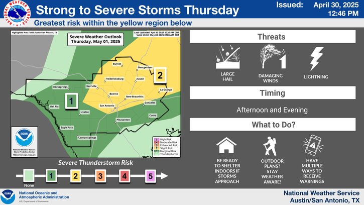
Isolated showers and storms will be possible again for daytime Wednesday, but a new frontal surge will shift the rain chances south of the area late in the day. Drier and slightly cooler air will arrive to bring pleasant and near normal September temperatures Wednesday night through Thursday night. Warmer than normal daytime temperatures return Friday into the weekend.


 Austin/San Antonio Radar
 Weather Map
 Satellite Imagery
 Del Rio Radar
 Digital Forecast Map
 Tropical Outlook
 Drought Status
 Air Quality
 Fire Weather Forecasts
 Observed Rainfall
 Observed Temperatures
 Daily Climate Graphs