
Active weather for the center of the nation today. Severe thunderstorms and flash flooding concerns over portions of the Central and Southern Plains into the Mississippi Valley today into tonight. Meanwhile, cool and snowy in parts of the Northwest and Great Basin with above average and potentially record breaking temperatures for the Ohio Valley and Mid-Atlantic. Read More >
| Click on the icons below to access individual briefing pages |
|
|
|
***Click Here for Experimental Probabilistic Snowfall Products***
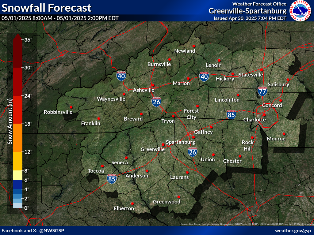
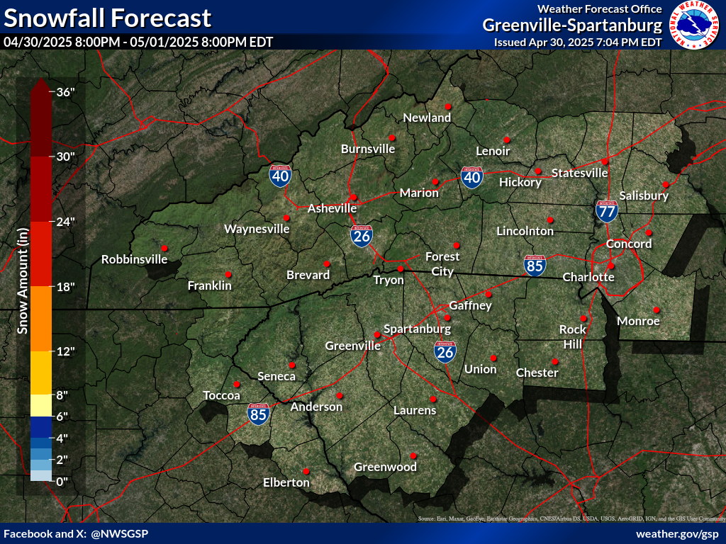
Snowfall Accumulation Forecast (click on thumbnails to display below)
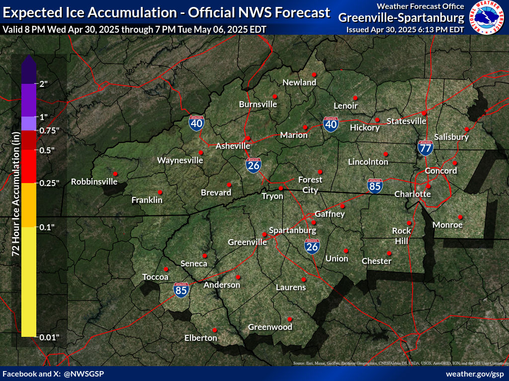
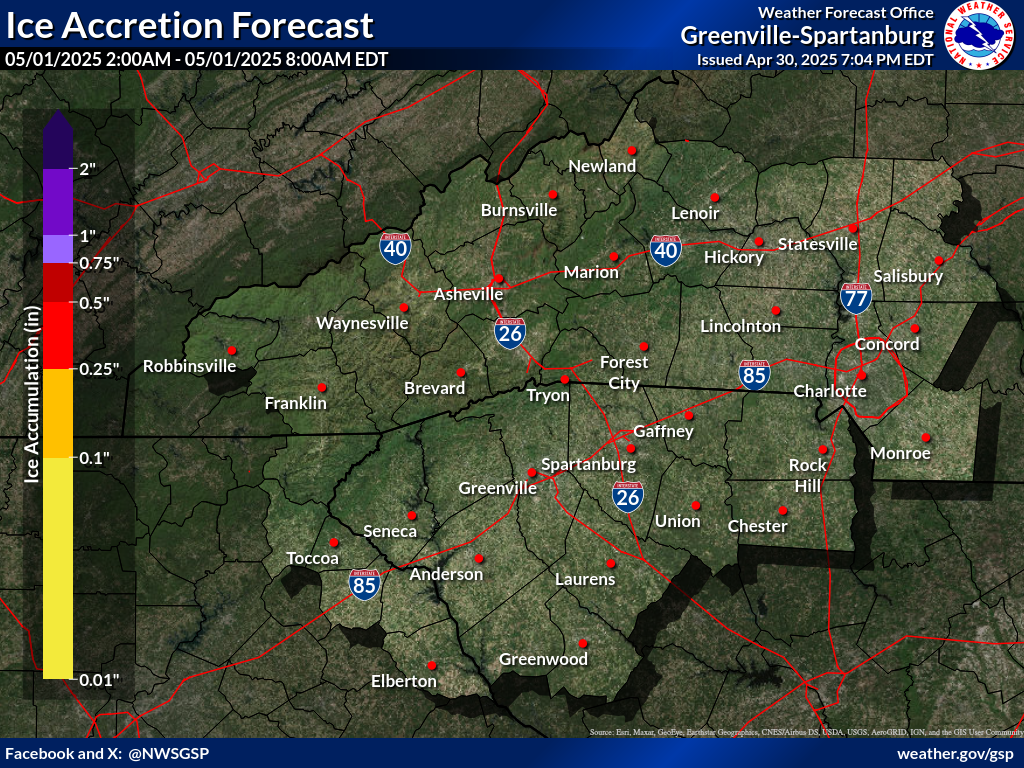
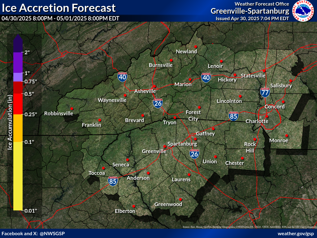
Ice Accumulation Forecast (click on thumbnails to display below)
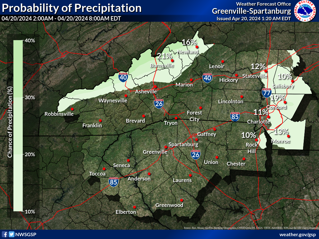
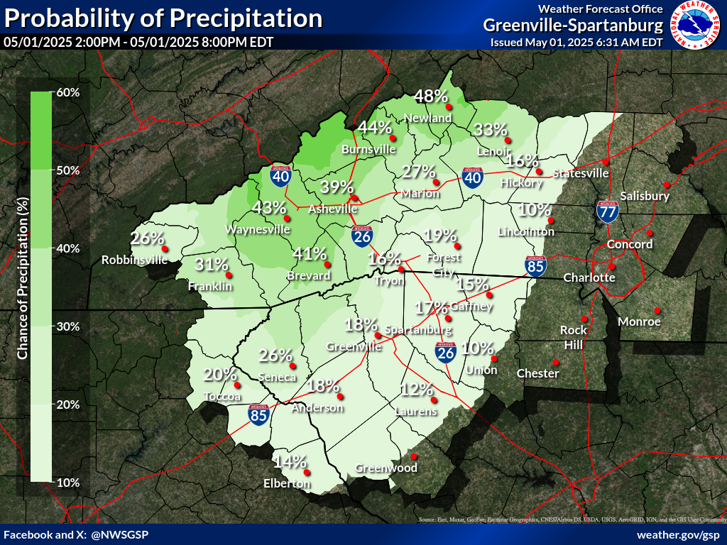
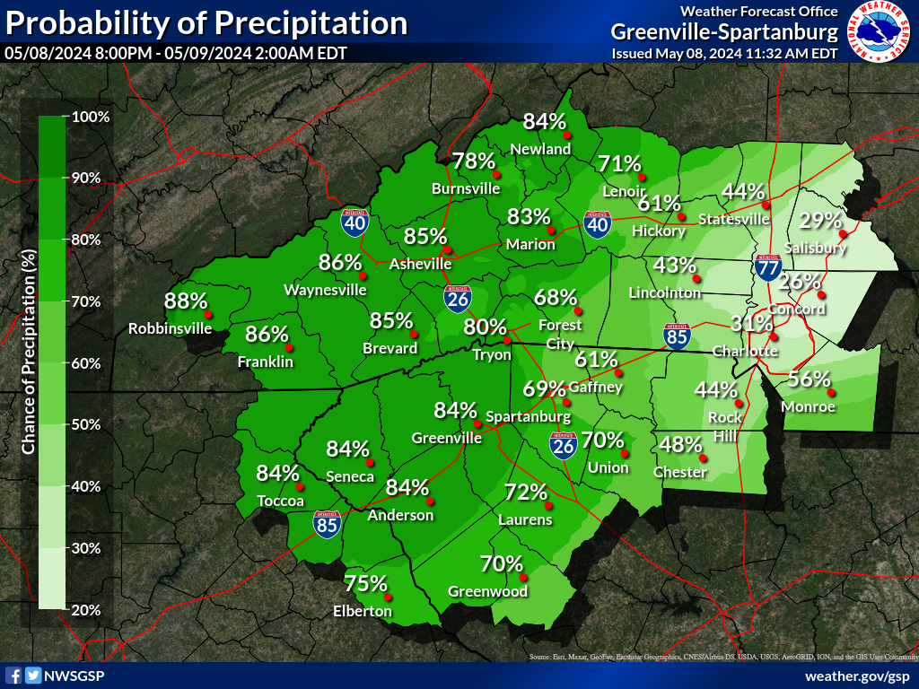
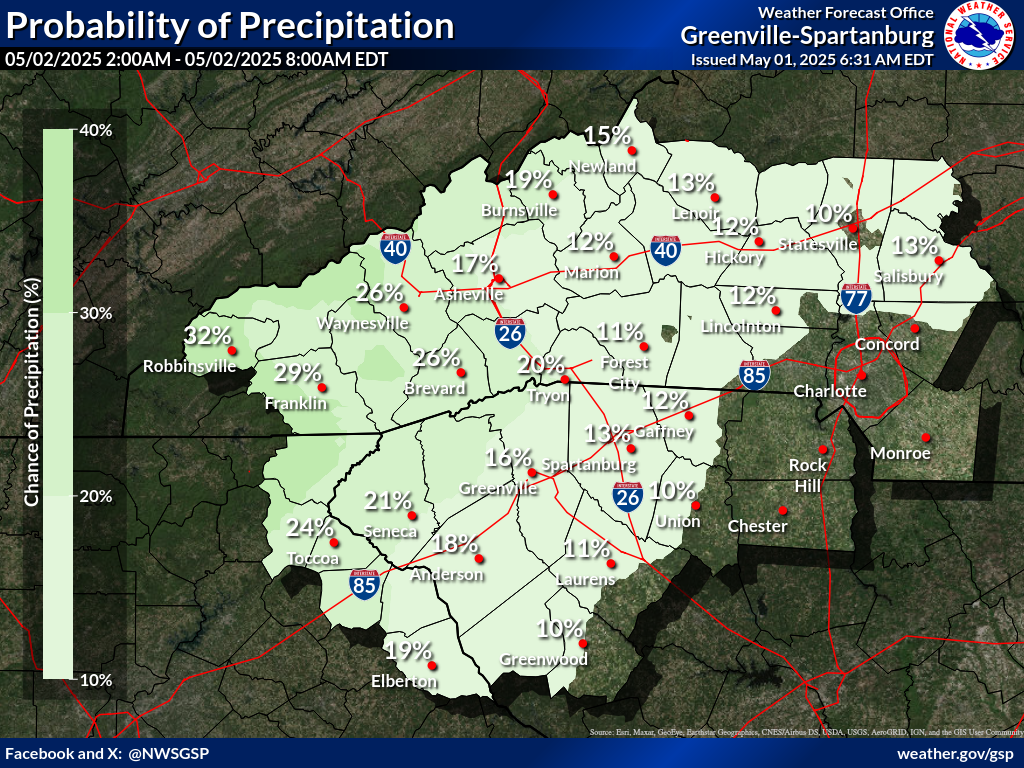
Probability of Precipitation (PoP) (click on thumbnails to display below)
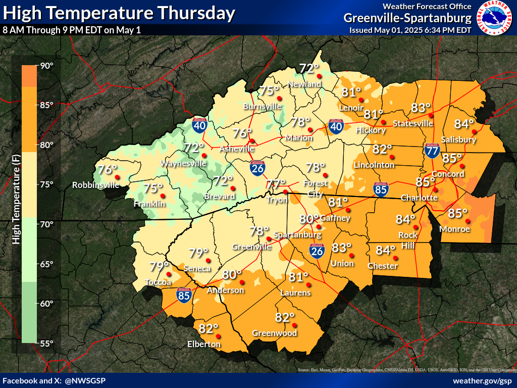
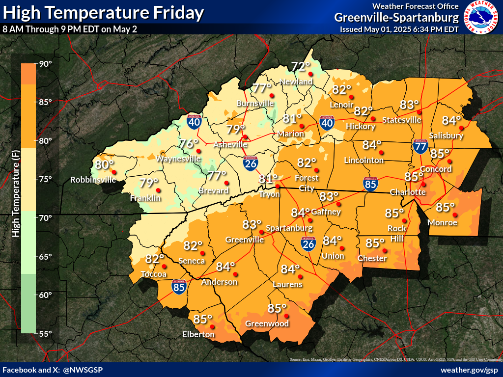
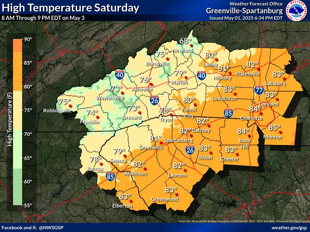
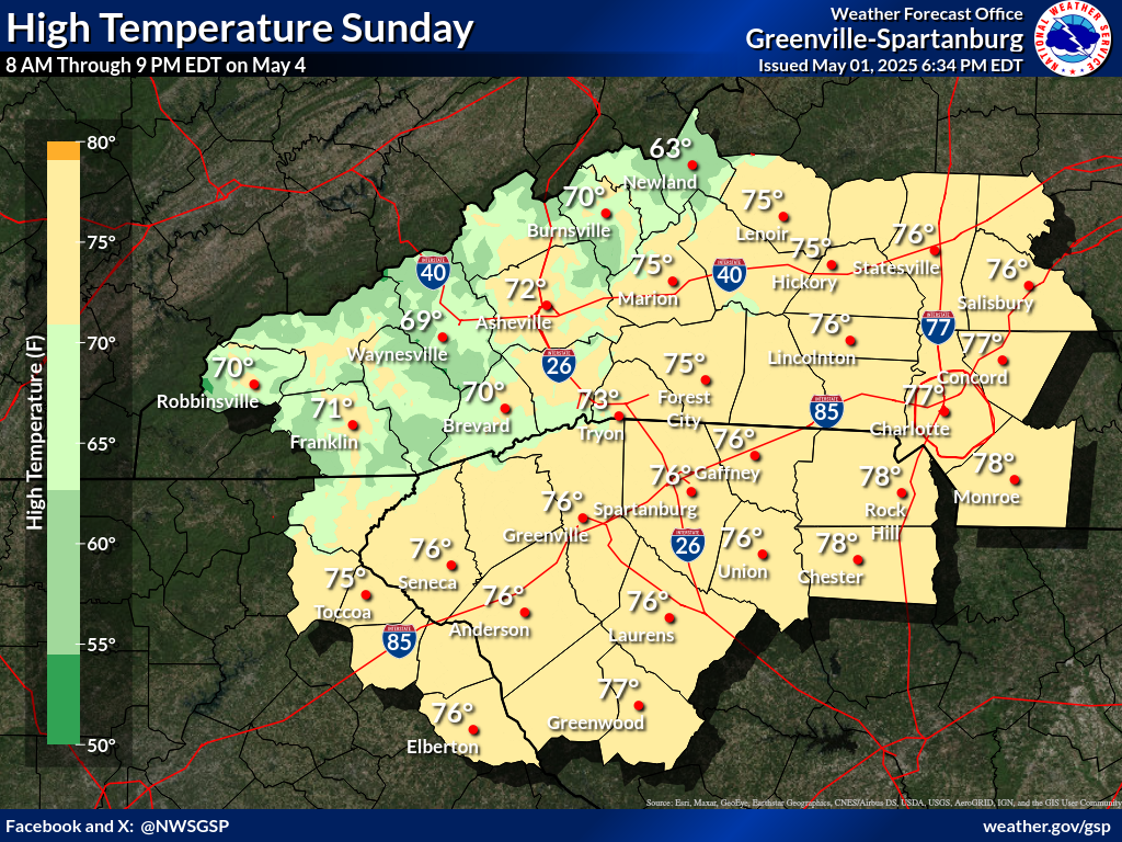
Days 1-4 Max Temperatures(click on thumbnails to display below)
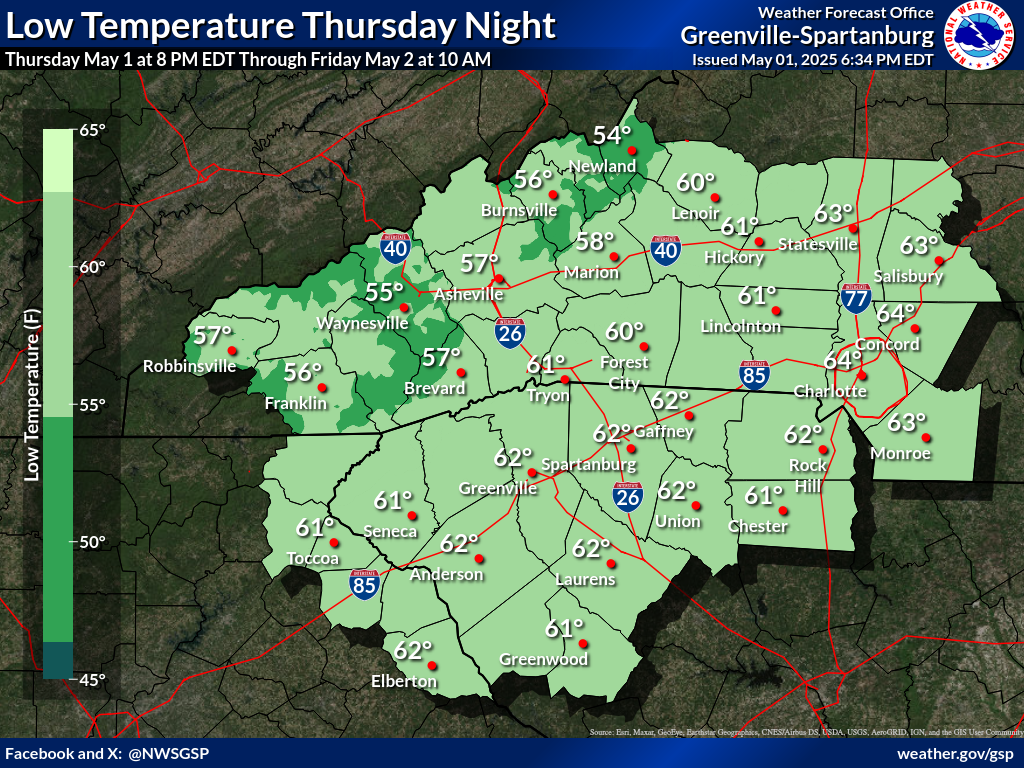
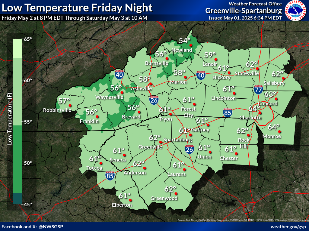
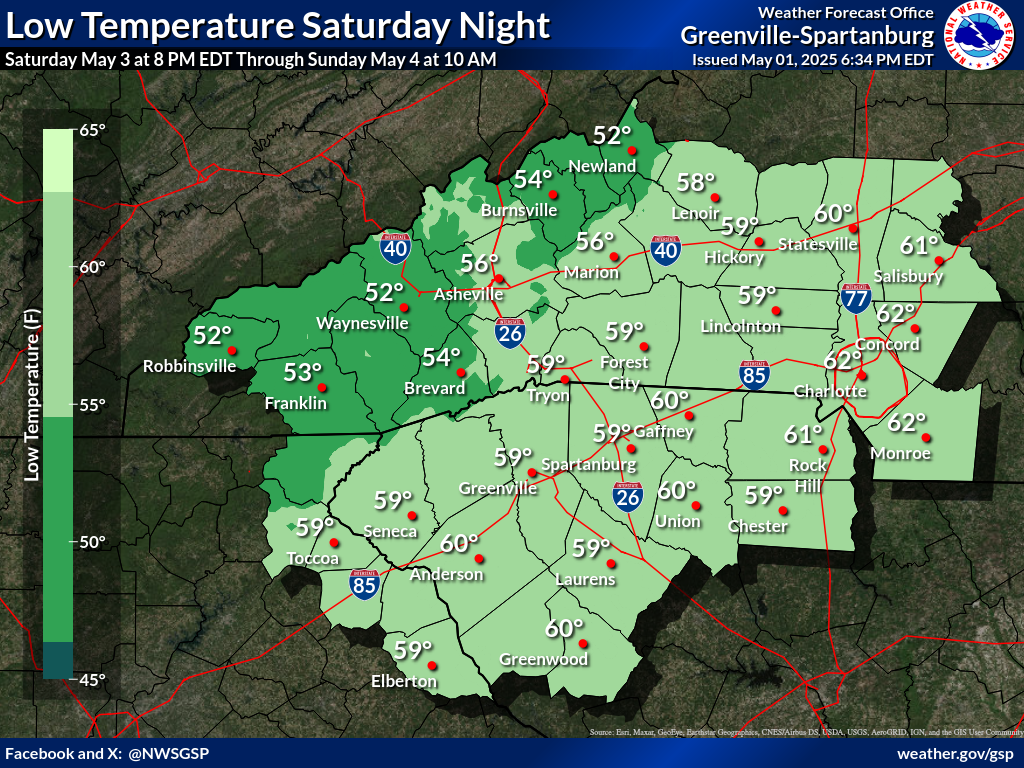
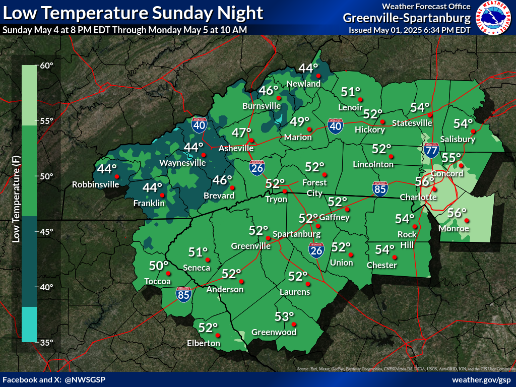
Nights 1-4 Min Temperatures(click on thumbnails to display below)
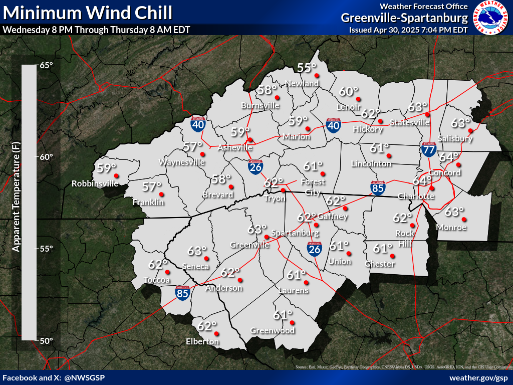
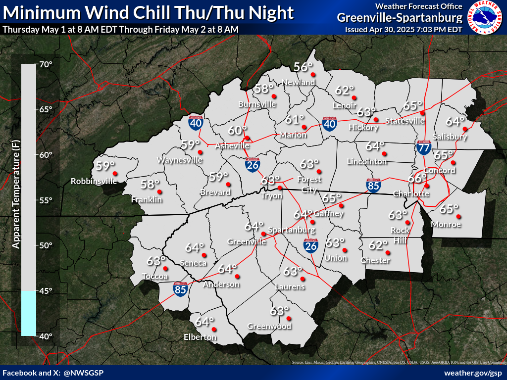
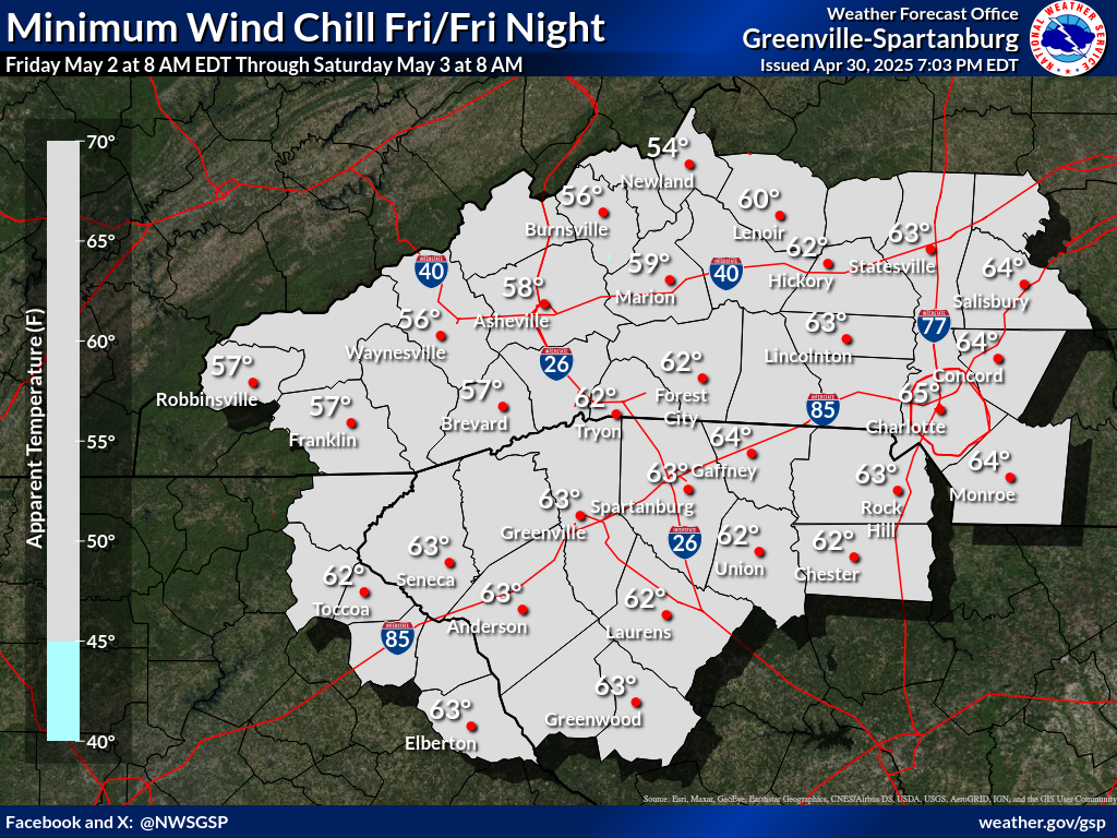
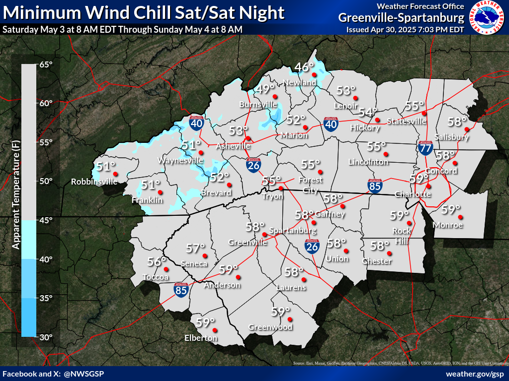
Days 1-4 Min Wind Chill(click on thumbnails to display below)
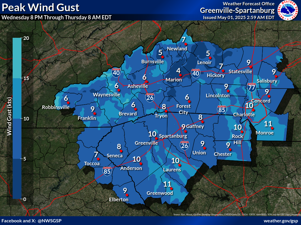
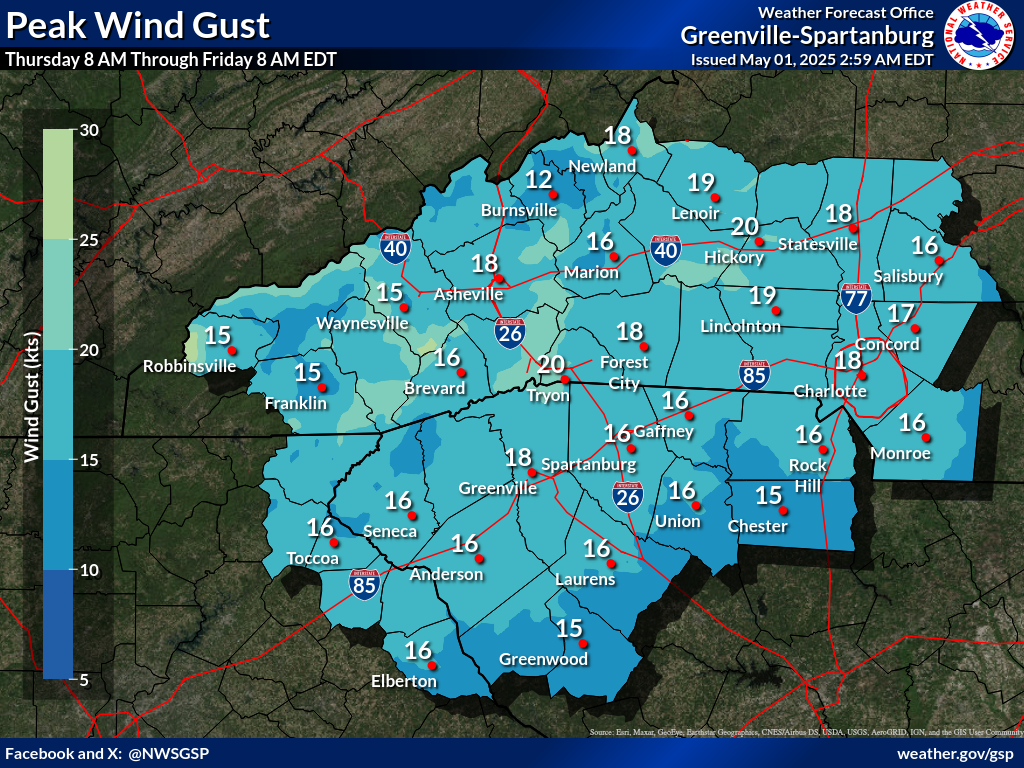
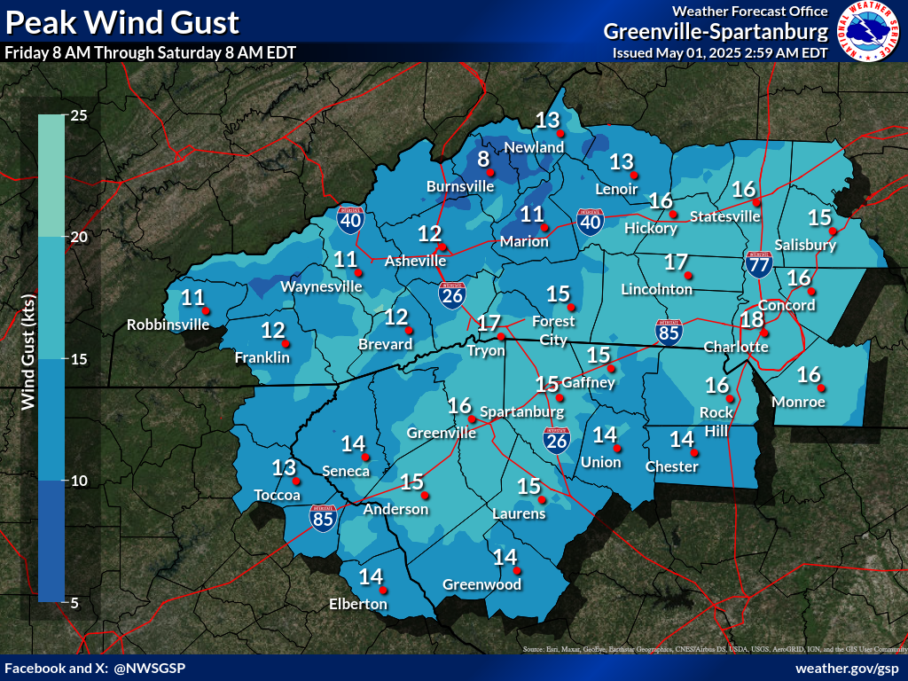
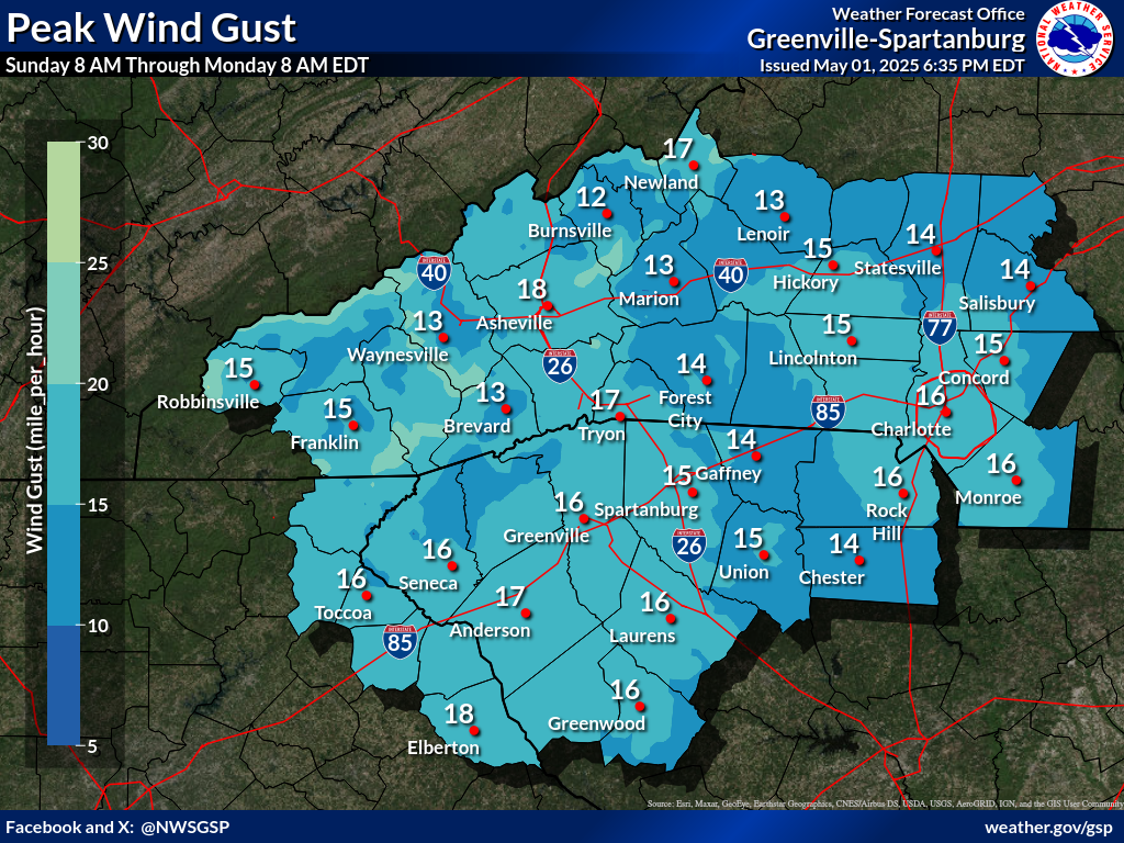
Days 1-4 Max Wind Gusts(click on thumbnails to display below)
Radar Loops: Local Radar (KGSP) | Charlotte Radar | Southeast Radar Loop NWS GSP Products: Winter Weather Warning / Watches / Advisrories (WSW) - WSW Map Criteria Explanation Non- Precipitation Warnings / Watches / Advisories (NPW) -- NPW Map Criteria Explanation Hazardous Weather Outlook | Special Weather Statement | Local Storm Reports |


 Tropical Weather
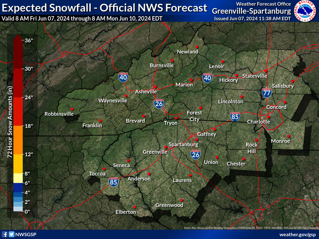


 Current Conditions Map
 Follow us on YouTube