
Heat will build over the Intermountain West and the Southwest the next couple of days. Lightning from dry thunderstorms can create new fire starts and combined with gusty winds may cause a fire to rapidly grow in Oregon and northern California. Flash flooding will be possible in New Mexico and west Texas today, as well as parts of the southern and central Plains due to slow moving thunderstorms. Read More >
| Hazard Type | Watch/Warning Name Criteria |
Advisory Name Criteria |
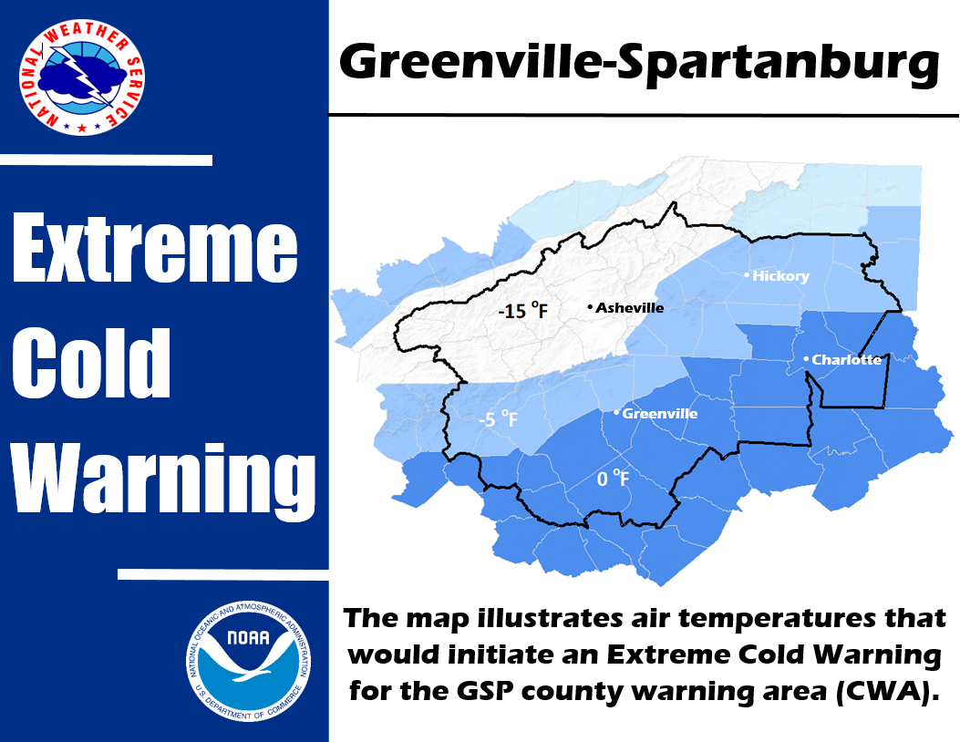
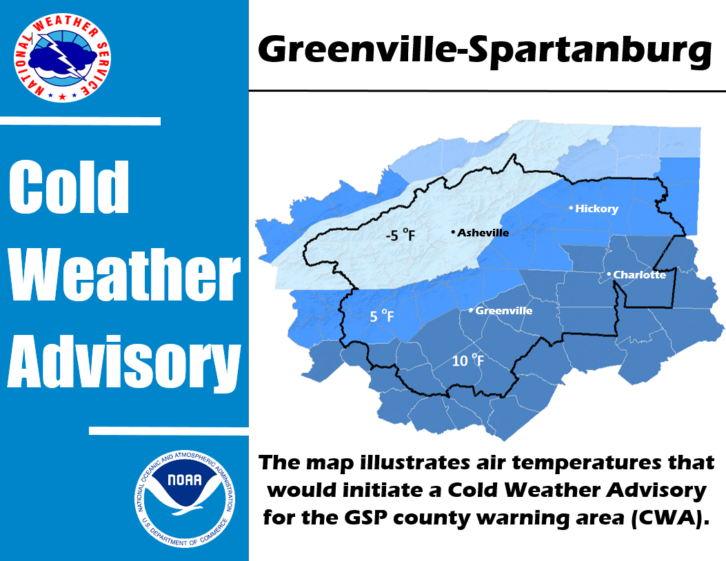
| Cold Weather | ||
| Heat | Excessive Heat Watch/Warning Heat Index 110 or greater |
Heat Advisory Heat Index 105 or greater but less than 110 |
| Wind (Non-Thunderstorm) | High Wind Watch/Warning Sustained winds higher than 40 mph and/or frequent gusts greater than 57 mph |
Wind Advisory |
| Frost Freeze | Freeze Watch/Warning Low temperature of 32 degrees or less during the |
Frost Advisory Scattered to widespread frost is forecast during the Growing Season* |
| Fog | N/A | Dense Fog Advisory Fog causing widespread visibility of 1/4 mile or less |


 Current Conditions Map
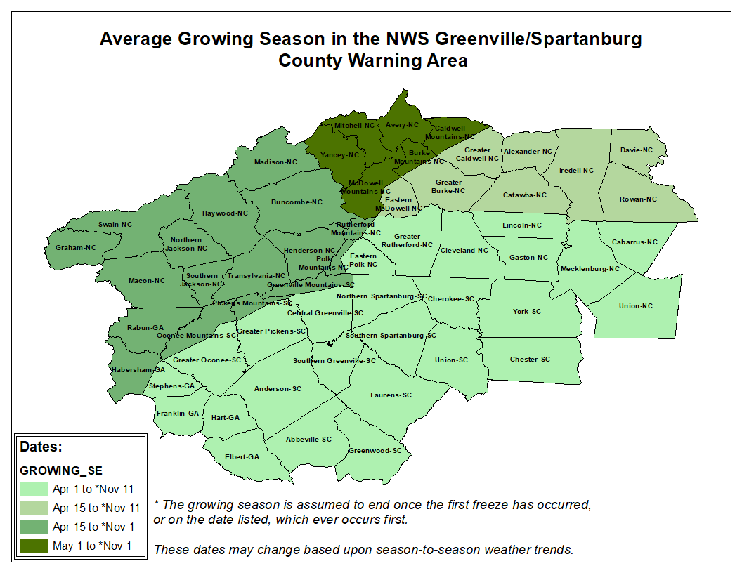