Event Summary
A potent storm system developed across the Intermountain West before tracking east across the Lower Mississippi Valley region February 21st. As this system tracked east, the upper trough became negatively tilted. A rather cold and dry airmass was entrenched across the region through the 20th, with dewpoints in the teens and twenties. In fact, as atmospheric lift began to approach the area and some light showers moved across portions of the Delta, light sleet even occurred with this precipitation. There was not enough sleet to cause travel problems but demonstrated how cold the atmosphere was prior to the incoming low pressure system.
By the morning of the 21st, the warm front was still located along the Mississippi Gulf Coast. Dewpoints were still in the upper 30s as of late morning across Central Mississippi. Some showers and isolated thunderstorms moved through the area producing small hail. The warm front slowly moved north and by mid to late afternoon, dewpoints had finally increased to the mid and upper 50s across the I-20 corridor and were in the mid 60s further south. This helped to fuel additional showers and thunderstorms as the main upper level storm system tracked northeast. As the moisture increased across the region, the combination of strong wind shear and unstable airmass south of the warm front became more conducive to supercell and tornado development. Strong storms were moving through the southwestern portions of the region later that afternoon.
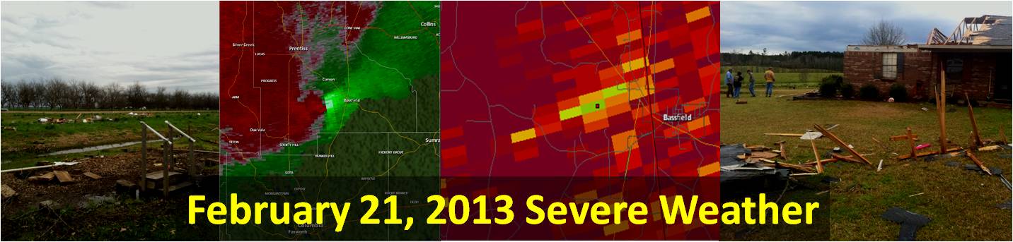
Around 5 pm storms began to exhibit rotation on radar and a tornado developed in Concordia Parish just south of Clayton. This tornado produced some damage to some homes and trailers in the area. As the low pressure gradually tracked northeast and the warm front lifted further, the environment became more favorable for tornadoes in southern Mississippi. One storm had continuous rotation as it moved from north-central Louisiana into south-central Mississippi. This storm crossed into southeast Lawrence to northwest Marion counties around 10 pm and continued to track northeast. Rotation began to intensify and a strong tornado developed around 1030 pm a few miles southwest of Bassfield. This tornado caused minor to moderate damage to some homes and buildings, snapped some power poles and caused extensive tree damage. The debris was picked up on the Brandon, MS (KDGX) radar due to the new dual-polarization upgrade. Another weak tornado developed around 11 pm a few miles southwest of Collins snapping some trees and causing some damage to a mobile home and chicken house. Scattered storms continued to affect the Pine Belt into the early morning hours on the 22nd, before finally moving out of the area.
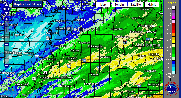
In addition to severe weather, flash flooding became an issue in central Mississippi. From the morning of the 21st through the early morning of the 22nd, the heaviest rainfall occurred over parts of central Mississippi, where 3 to 4 inches of rain fell and flash flooding was reported in the area.
Tornado Track Map
Click on map above to see entire event tracks and damage point notation.
Individual track maps also available on individual tornado pages.
Survey Information - Click on the location in the table for additional maps and details
| Location | Start/ End Time |
Event Type | Fatalities/ Injuries |
Path Length | Path Width |
| Concordia Parish 3 S Clayton to 3.5 SE Clayton |
5:12 pm - 5:15 pm |
EF-1 Tornado 90 mph |
none | 2.5 miles | 75 yards |
| Jefferson Davis County 7.2 SSW Bassfield to 2 W Bassfield |
10:31 pm - 10:41 pm |
EF-2 Tornado 120 mph |
none | 6.3 miles | 400 yards |
| Covington County 5 SW Collins to 4.2 SSW Collins |
11:00 pm - 11:01 pm |
EF-0 Tornado 80 mph |
none | 1 mile | 75 yards |
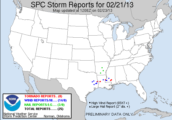
Local Storm Reports
Click on the map below for additional details.
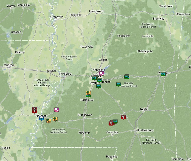

National Storm Reports
Rainfall Totals
(3 day storm total: February 21-23, 2013)