Louisville, KY
Weather Forecast Office
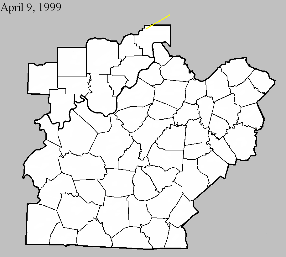
April 9, 1999
Counties: Jefferson IN (to Jennings and Ripley)
F-scale: F3
Deaths: 0
Injuries: 2
Path width:
Path length: 18 miles
Time: 1:56am EDT
Notes: Touched down at DuPont where it removed the roof from a home and threw a woman 2,000 feet resulting in serious injuries. Several homes and barns in far northern Jefferson County were damaged. The tornado intensified as it moved into Jennings and Ripley Counties.
Noted discrepancies: SPC lists a path width of 250 yards...NCDC says 400 yards...Storm Data has up to 450 yards.
Current Hazards
Hazardous Weather Outlook
Storm Prediction Center
Submit a Storm Report
Advisory/Warning Criteria
Radar
Fort Knox
Evansville
Fort Campbell
Nashville
Jackson
Wilmington
Latest Forecasts
El Nino and La Nina
Climate Prediction
Central U.S. Weather Stories
1-Stop Winter Forecast
Aviation
Spot Request
Air Quality
Fire Weather
Recreation Forecasts
1-Stop Drought
Event Ready
1-Stop Severe Forecast
Past Weather
Climate Graphs
1-Stop Climate
CoCoRaHS
Local Climate Pages
Tornado History
Past Derby/Oaks/Thunder Weather
Football Weather
Local Information
About the NWS
Forecast Discussion
Items of Interest
Spotter Training
Regional Weather Map
Decision Support Page
Text Products
Science and Technology
Outreach
LMK Warning Area
About Our Office
Station History
Hazardous Weather Outlook
Local Climate Page
Tornado Machine Plans
Weather Enterprise Resources
US Dept of Commerce
National Oceanic and Atmospheric Administration
National Weather Service
Louisville, KY
6201 Theiler Lane
Louisville, KY 40229-1476
502-969-8842
Comments? Questions? Please Contact Us.


 Weather Story
 Weather Map
 Local Radar