|
More Precipitation for the South Plains March 15th to 16th |
 |
|
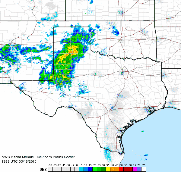
| Radar animation from about 9 am to 10 am on March 15, 2010. The precipitation at this time was still rain, with a few embedded thunderstorms. | |
|
|
|
An upper-level storm system centered over New Mexico moved slowly to the southeast into far west Texas on March 15th, while at the same time a cold front passed through the region. The result was a favorable pattern for widespread precipitation across the area - mainly on the Caprock in closer proximity to the storm system. A band of rain showers and embedded thunderstorms set up across central and southern portions of the South Plains early in the morning, and continued much of the day. The thunderstorm activity diminished by early afternoon, while gradually falling temperatures allowed the rain to mix with and in some instances, change over to snow. The snow was heavy enough to accumulate about one to two inches across much of Lubbock, Lynn, Hale, Floyd and Crosby counties. Fortunately, for the most part area roads remained free of snow. A lightning strike also caused a house fire in south Lubbock.
Late Monday night, the rain and snow began to taper off as the upper-level storm system moved across southwest Texas into south central Texas. Light showers did continue across southern and western locations through early Tuesday morning the 16th.
This storm added to the abundant precipitation much of the area has received so far this year. Through March 17th, Preston Smith International Airport at Lubbock has reported 5.98 inches of rain; nearly quadruple our long-term average of 1.55 inches. Only two January through March periods in the Lubbock record have been wetter, 6.64 inches back in 1911 and 7.42 inches in 2007.
To view the report of this storm from the West Texas Mesonet Group at Texas Tech University please click HERE.

Graphic displaying the total 2-day precipitation totals, in inches, from March 15-16, 2010. The data are courtesy of the West Texas Mesonet and the National Weather Service. Click on the image for a larger view.


 Follow us on YouTube