|
Chilly Rain for Early 2013 |
|
|
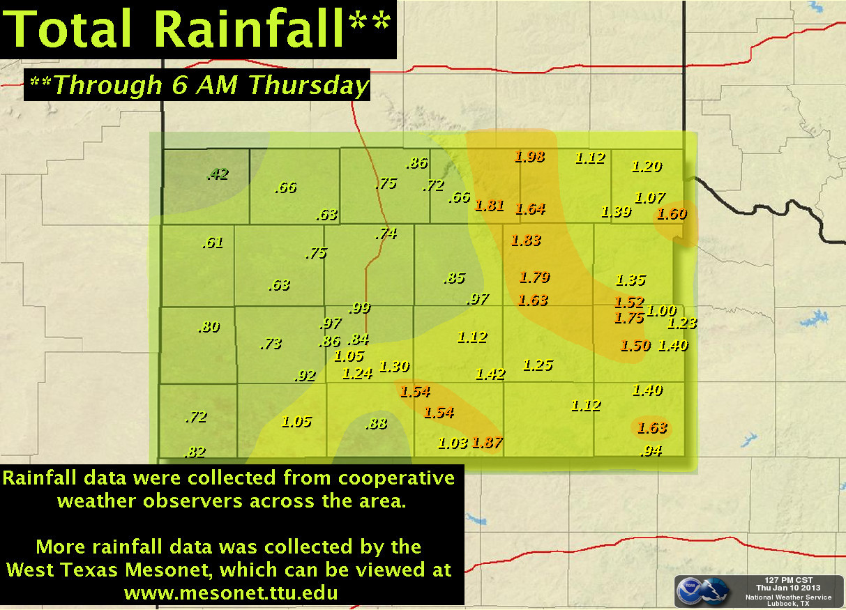
| Rainfall totals (in inches) collected by the NWS Cooperative Weather Observers between Wednesday morning and Thursday morning (9-10 January 2013). Click on the map for a larger view. |
| The first significant weather event of 2013 turned out to be widespread welcome rainfall of about a half inch to almost two inches across the whole South Plains area. Stations along and just east of the Caprock Escarpment recorded the most rainfall, including 1.98 inches six miles southwest of Brice, and 1.97 inches one mile northwest of Lake Alan Henry. This storm brought the highest 24-hour precipitation for many stations since the autumn of 2011, and in some cases even longer. 0.89 inches was recorded at Lubbock, of which 0.84 inches fell on Wednesday the 9th, which was a record for the date. The rain was produced by a strong upper-level storm system that took a somewhat unusual track, from northern Mexico northeastward across central Texas. This track allowed the storm system to wrap rich moisture from the Gulf of Mexico around its counter-clockwise circulation into West Texas. In addition, this flow also brought warmer air from the south, which kept temperatures from dropping below freezing. If temperatures had been just a few degrees colder, we might have had a major snowstorm on our hands! |
|
|
| Water vapor satellite image captured at 10:15 am on 9 January 2013. Click on the image for a bigger view. |
| The above satellite image shows a well-developed storm system (upper-level low with a counter-clockwise circulation) centered just south of the Big Bend of Texas during the morning hours on Wednesday, January 9th. The position and circulation of the upper-level low, combined with its slow storm motion, allowed plenty of Gulf of Mexico moisture to be pulled north and westward across West Texas, resulting in the widespread rain. |
|
|
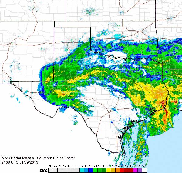
| Radar animation valid from 3:09 to 4:18 pm on 9 January 2013. A similar radar animation valid from 12:18 to 1:28 pm on the 9th can be FOUND HERE. |
| The above radar loop shows widespread light to moderate rain spreading northwestward across the South Plains, Rolling Plains, and southern Texas Panhandle during the afternoon on the 9th. The rain continued well into the evening hours (as seen below) before gradually shifting north into the Panhandles early on the 10th. The rainfall ensures that most of the area will finish with precipitation totals for the month of January near or above normal. |
|
|
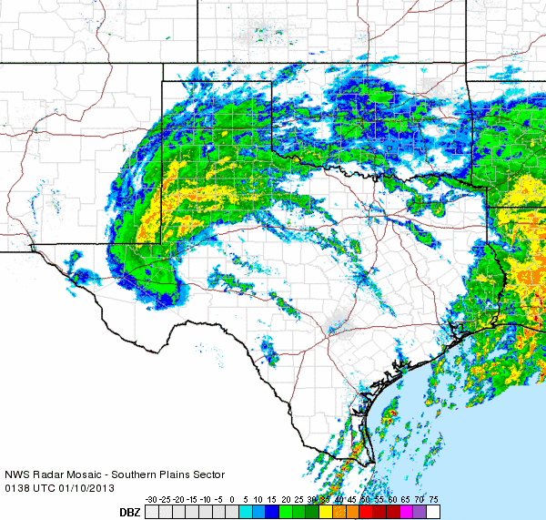
| Radar animation valid from 7:38 to 8:48 pm on 9 January 2013. A similar radar animation valid from 11:18 pm on the 9th to 12:28 am on the 10th can be FOUND HERE. |


