|
Unsettled Stretch of Weather |
|
 |
|
| Storm moving into northeast Lubbock during the evening of Saturday, 3 June 2017. | |
| Late May and early June of 2017 were on the unsettled side, though not necessarily what you might expect right in the middle of the typical severe weather season for West Texas. A slow moving upper level trough combined with gradually increasing moisture to bring several rounds of showers and thunderstorms to the South Plains area. Instability levels weren't particularly high, but the winds through the depth of the atmosphere were especially weak for this time of year. This kept storms from organizing and becoming very strong. In fact, no reports of severe hail or severe wind gusts were noted over the Lubbock County Warning Area (CWA), though several reports of small hail and wind gusts of 45 to 55 mph did occur. | |
 |
|
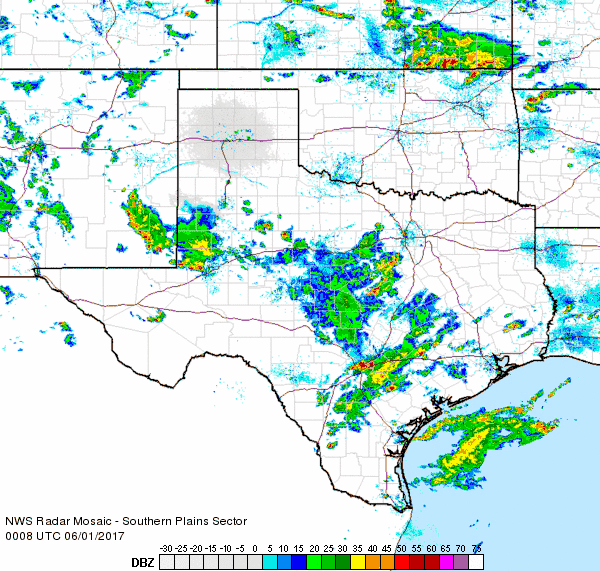
| Regional radar animation valid from 5:08 to 6:18 pm on 2 June 2017. Additional radar animations can be found at: 7:08 to 8:18 pm on 31 May 2017 and 7:08 to 8:18 pm on 1 June 2017. | |
| The action started relatively slowly and was confined primarily to the southern and southwestern South Plains on Tuesday and Wednesday (May 30th and 31st), where moisture levels were a little higher. The showers and storms spread over more of the area by June 1st, though the coverage was still fairly limited. This changed on June 2nd when more widespread thunderstorm activity developed over northwest Texas and edged slowly eastward. Although overall thunderstorm strength was tame, the slow-moving storms did produce very heavy downpours at time. | |
 |
|
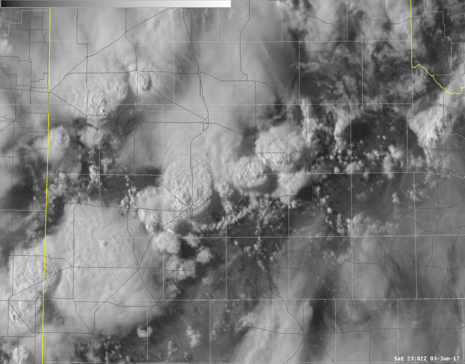
| Visible satellite image captured at 6:02 pm on 3 June 2017. This GOES-16 data is preliminary and non-operational. | |
| One anchored area of thunderstorm activity setup over the far eastern Rolling Plains into western North Texas during Friday morning (2 June). The most intense rains were focused in and near Throckmorton where the West Texas Mesonet recorded 8.43 inches on the day, most of which fell during the morning hours. | |
 |
|
| Regional radar animation valid from 5:38 to 6:48 pm on 3 June 2017. | |
| The next day brought more scattered to widespread showers and thunderstorms. These storms also produced locally heavy rains, but they moved southward just quick enough to prevent excessive amounts at any given location. One small storm tracked southward across roughly the eastern half of Lubbock during the early evening, dropping about a half of inch of rain in 10 minutes. | |
 |
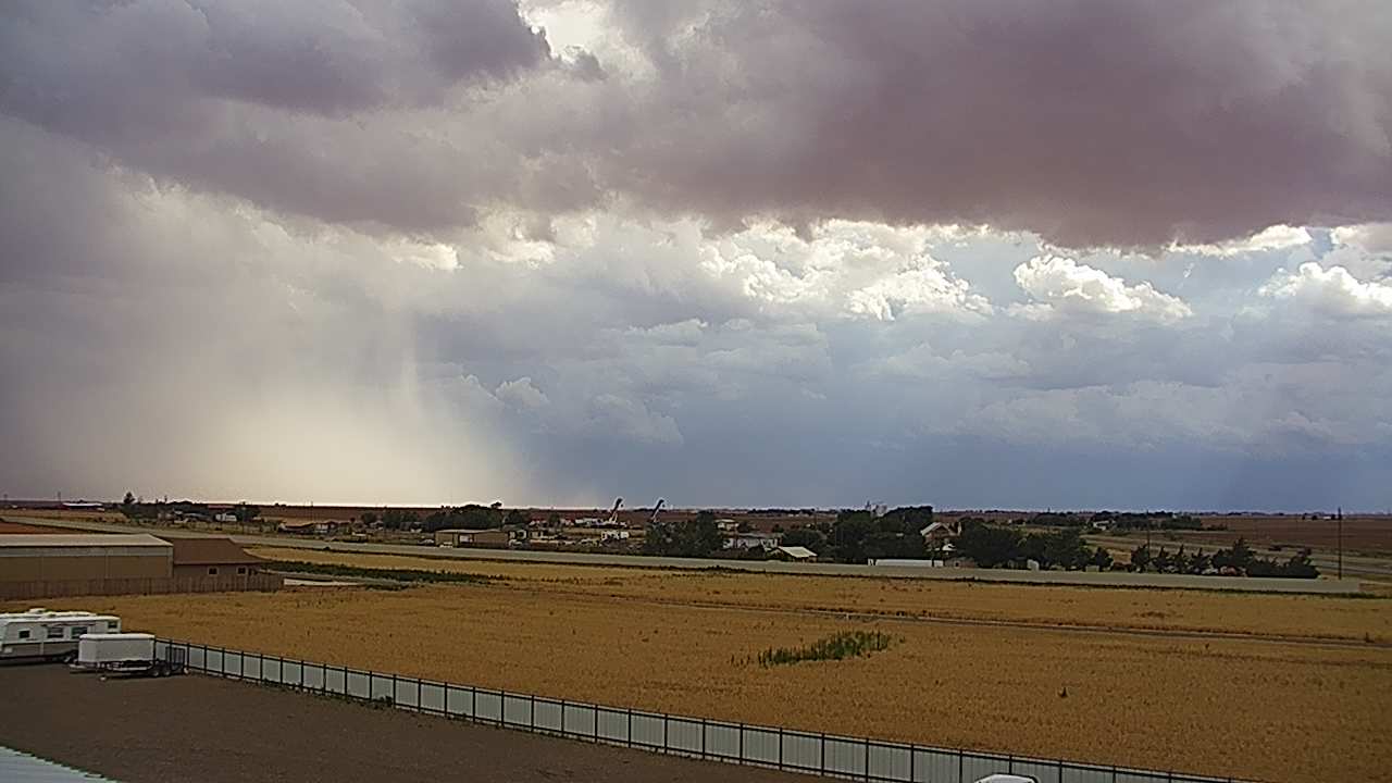 |
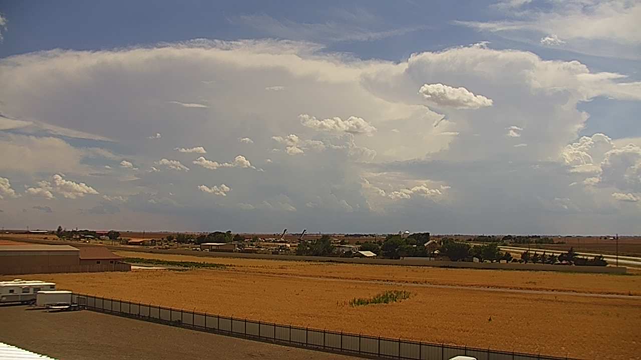
| Two views from near Wolfforth during the late afternoon and early evening of June 3rd. The left image was captured at 4:40 pm and the right image was taken at 5:44 pm. | |
| Thunderstorm coverage was more limited the following day, but where storms did occur they also dumped heavy rainfall. The most intense storm of the day dropped a quick one to two inches of rain in and near Aspermont Sunday evening. | |
 |
|
| Regional radar animation valid from 6:38 to 7:48 pm on 4 June 2017. An additional radar animations can be found at: 3:58 to 5:08 pm on 4 June 2017. | |
| The storms and rain did bring some pretty sights, including the rainbow below. A few reports of funnels and possible weak and brief landspout tornadoes were also received both Saturday and Sunday. No reports of any damage were received. | |
 |
|
| Rainbow revealed to the Wolfforth webcam Sunday evening (4 June 2017). | |
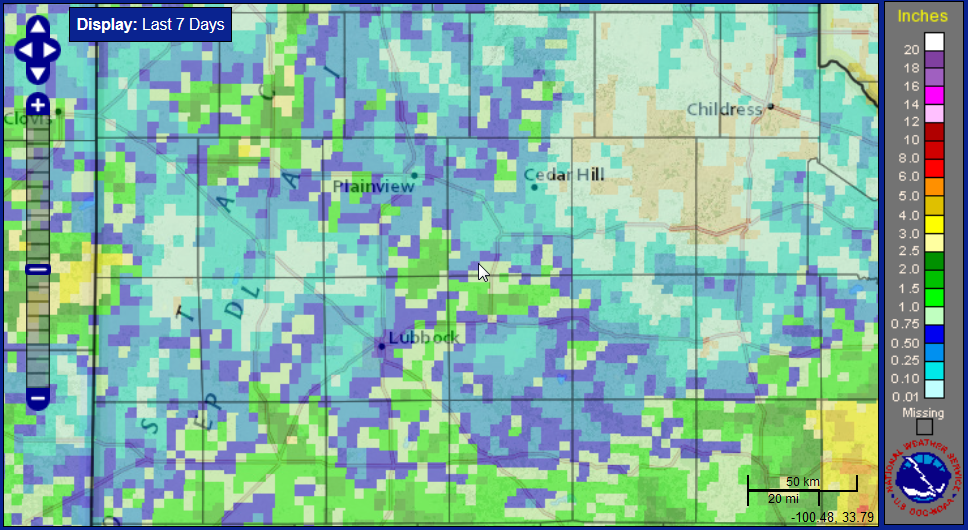
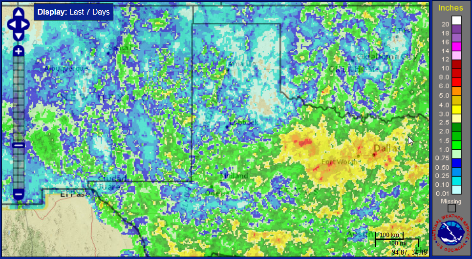
| Given the spotty nature of the showers and thunderstorms, not everyone received much rain. In fact some spots across the southeast Texas Panhandle into the northern Rolling Plains missed out on the rain altogether. However, there were also winner, spots that record 1 to 2+ inches over the course of the unsettled stretch. | |
 |
|
| Seven day radar-estimated and bias-corrected rain totals. Click on the image for a larger view. For a regional view CLICK HERE. | |
| Officially the Lubbock Airport only recorded 0.07 inches over the late May and early June stretch, while the Childress Airport fared even worse, with 0.03 inches. | |
 |
|
| West Texas Mesonet 5 day rain totals ending at 9 pm on 5 June 2017. | |

