|
Rounds of thunderstorms Labor Day Weekend |
|
 |
|
|
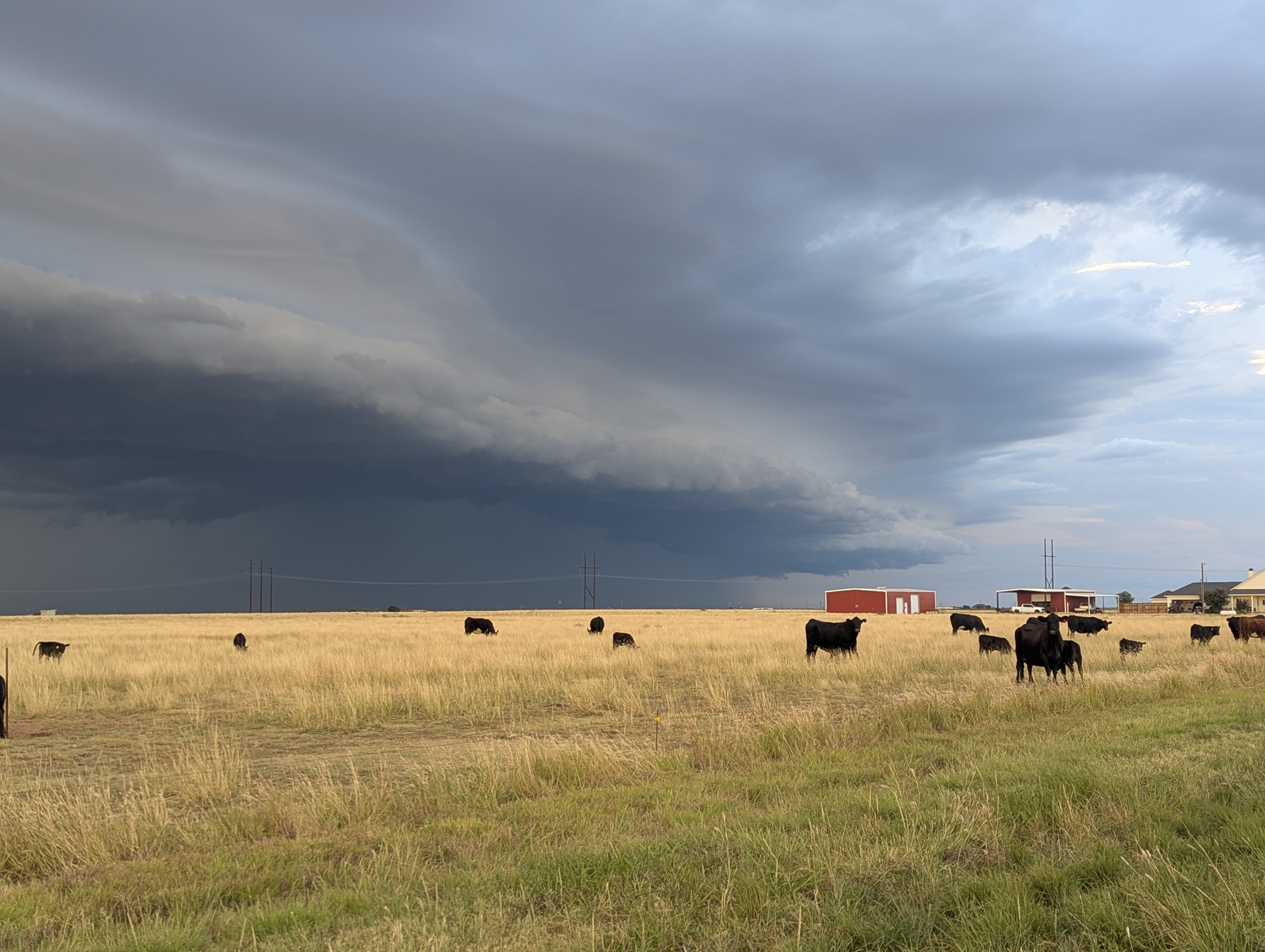
Shelf cloud on the leading edge of a thunderstorm moving southward into Lubbock County Saturday evening (30 August 2025). The picture was captured north of Shallowater near the intersection of FM 179 and FM 1729. |
|
|
Following a hot Thursday (28 August), with highs in the upper 90s and lower triple digits over the central and southern South Plains, and 100 to 106 degrees common over the southeast Texas Panhandle and Rolling Plains, a welcome cold front moved through late in the day. The front help trigger scattered thunderstorms over Rolling Plains while bringing cooler air to the entire area on breezy northeasterly winds. |
|
 |
|
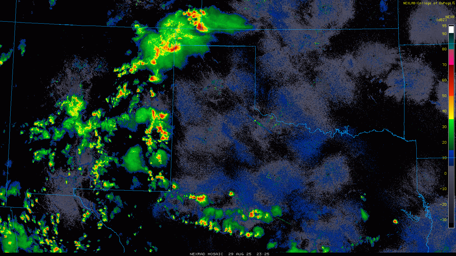
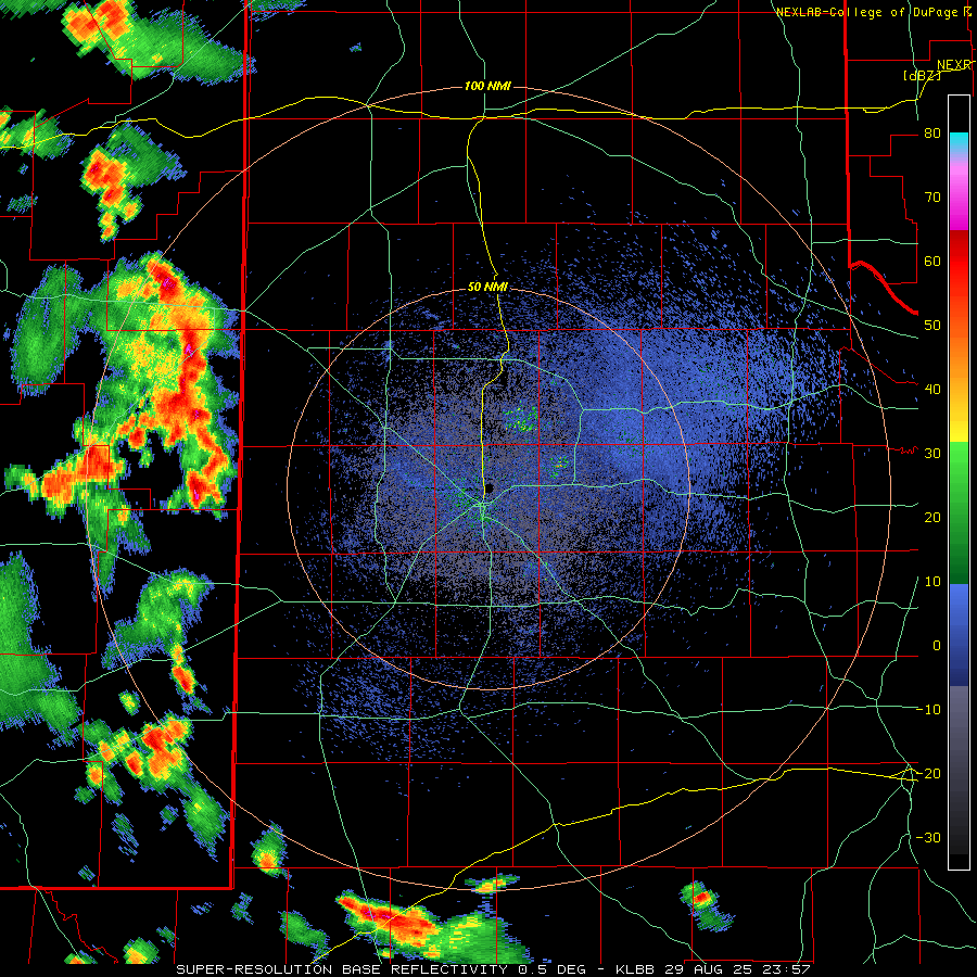
| Regional radar animation valid from 6:25 pm on Friday to 9:45 am on Saturday (29-30 August 2025). A LBB WSR-88D radar animation, valid from 6:57 pm on Friday to 9:51 am on Saturday, can be FOUND HERE. An infrared satellite loop over this same period can be VIEWED HERE | |
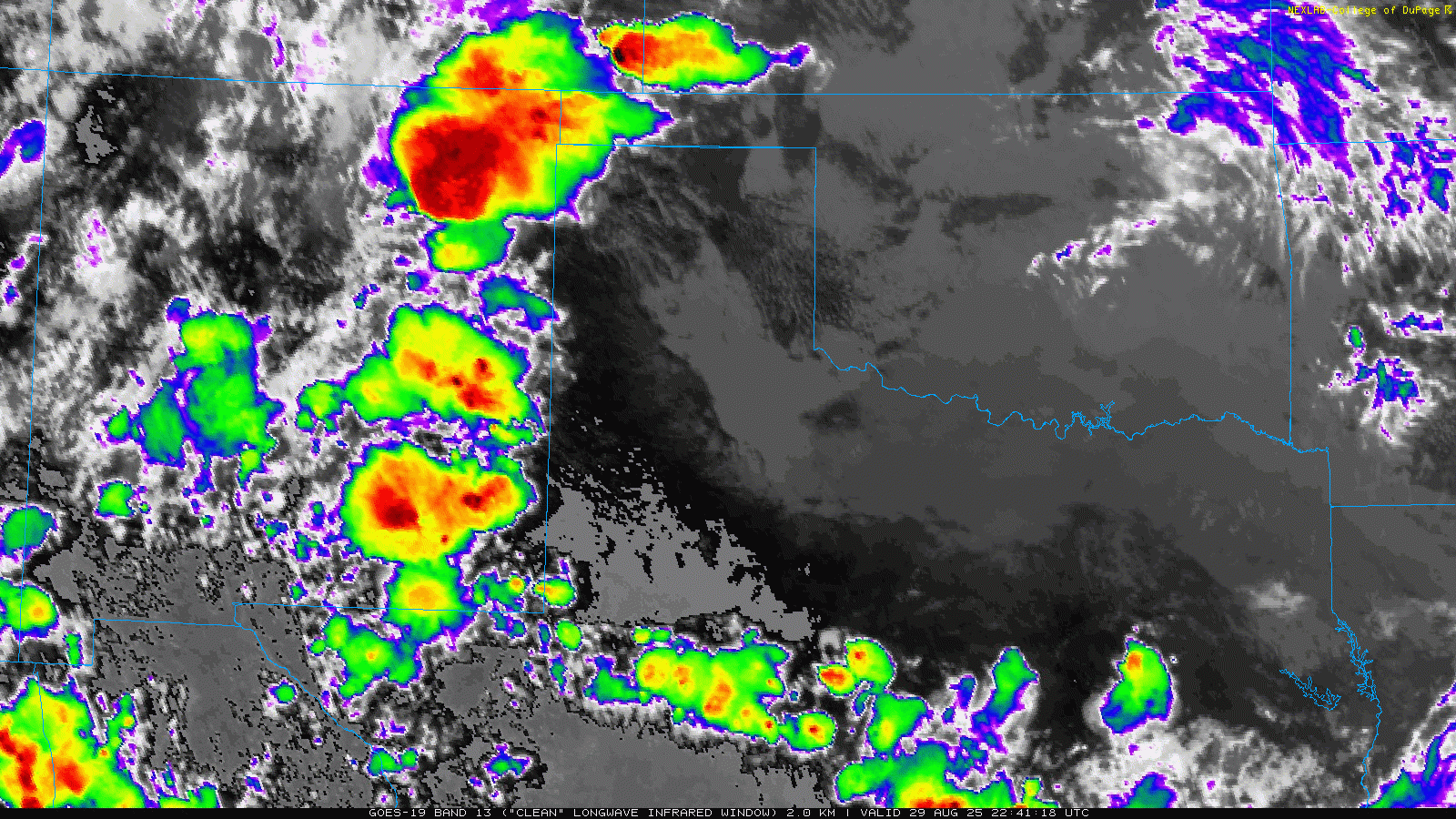
| Temperatures dropped down into the 60s and lower 70s behind the front Friday morning (29 August), but the cooler temperatures came in tandem with increased moisture levels. Plenty of cloud cover helped keep temperatures cooler on Friday, only warming into the 70s and lower 80s over much of the southern Texas Panhandle and Rolling Plains. However, where the clouds thinned earlier in the day, the temperatures rebounded into the upper 80s and lower 90s across the central and western South Plains. The heat and moisture, combined with a disturbance emerging from the southern Rockies, caused thunderstorms to blossom over the higher terrain of eastern New Mexico Friday afternoon. | |
 |
|
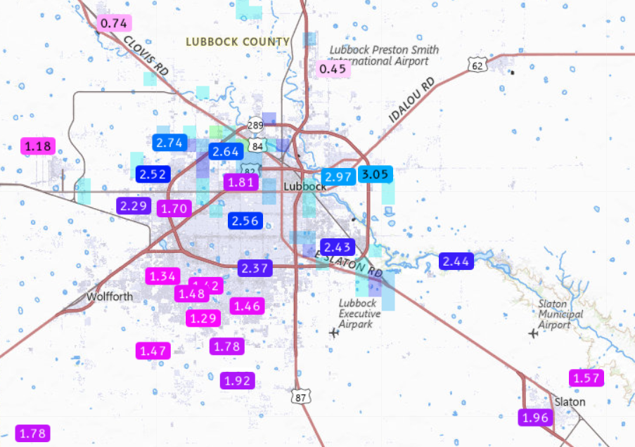
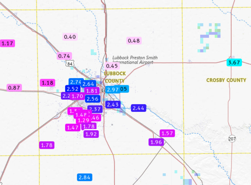
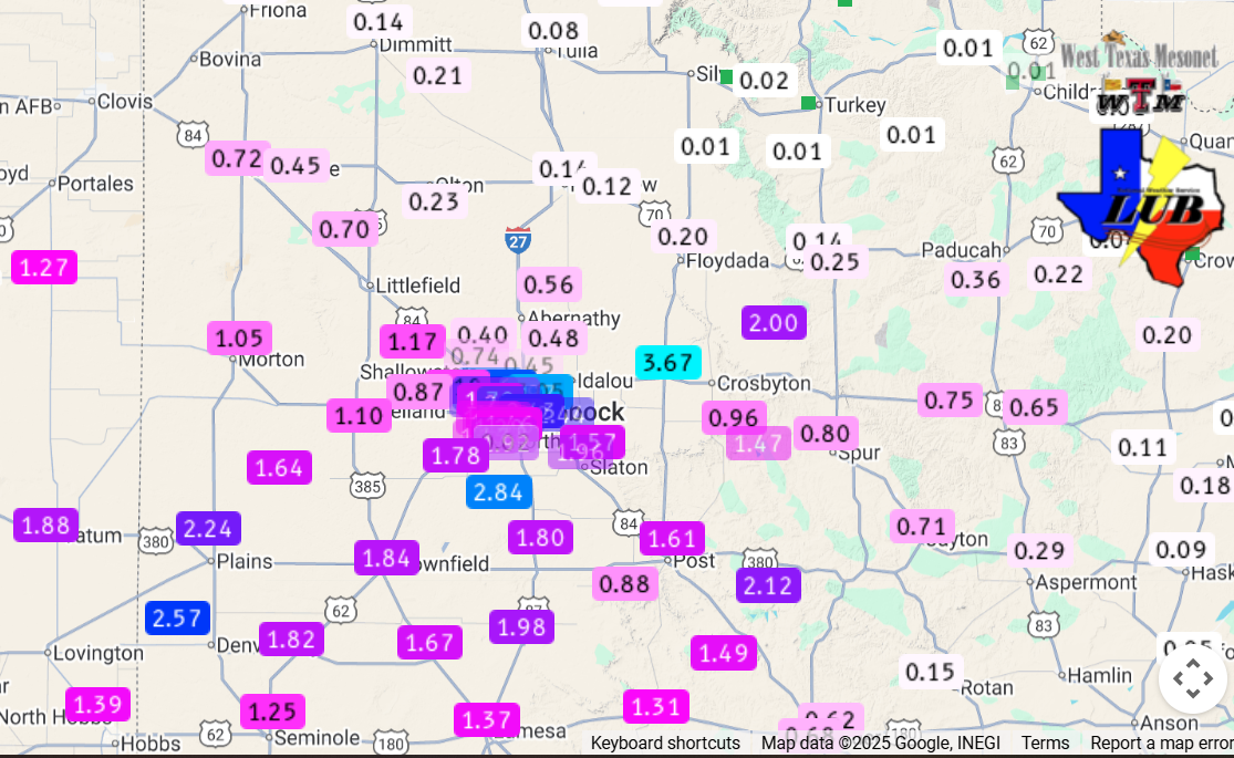
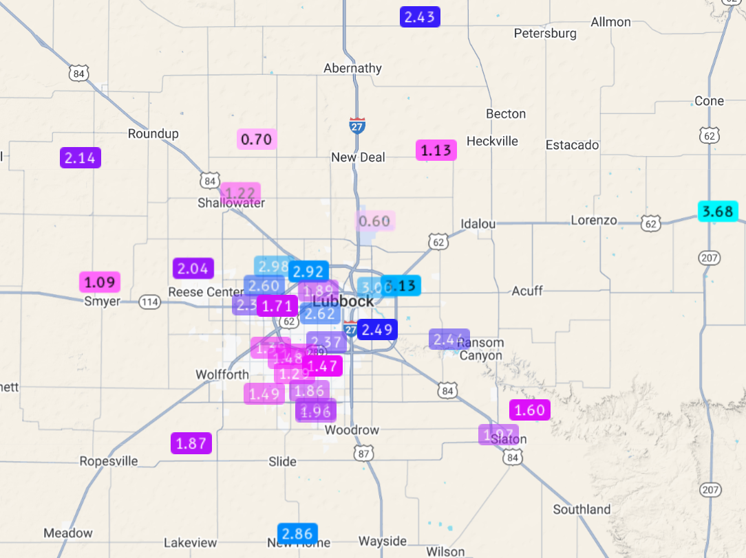
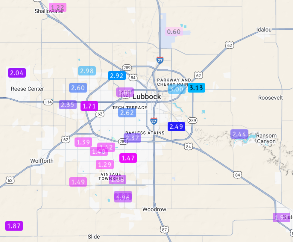
| 24 hour rainfall from around Lubbock, ending at 9:55 am on Saturday (30 August 2025). The data are courtesy of the National Weather Service (NWS) and West Texas Mesonet (WTM). A broader view of the Lubbock area can be FOUND HERE, with a South Plains perspective HERE. | |
|
A broken line of thunderstorms moved eastward, crossing into the southwest Texas Panhandle and western South Plains Friday evening. The initial activity began to fade as progressed into the central South Plains, but addition storms redeveloped as outflows interacted with each other and the warm and moist air in place. Some of the most intense storms formed in and around Lubbock and eastward into central Crosby County, where they produced torrential rainfall and vigorous lightning and thunder. |
|
 |
|
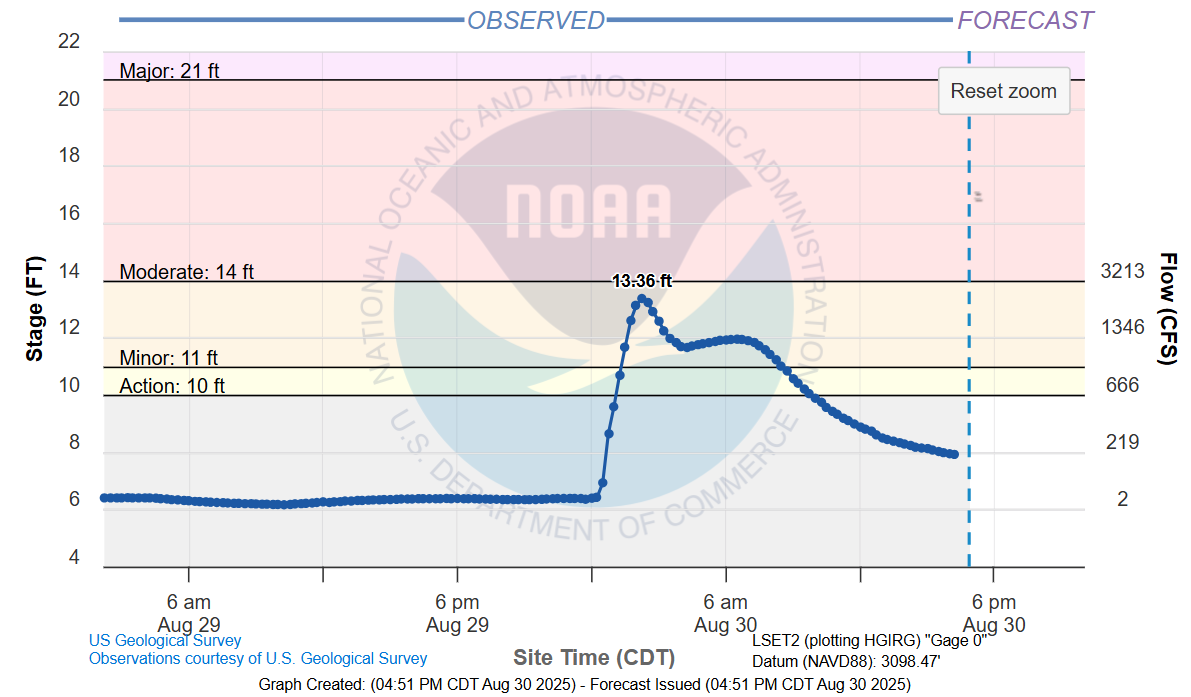
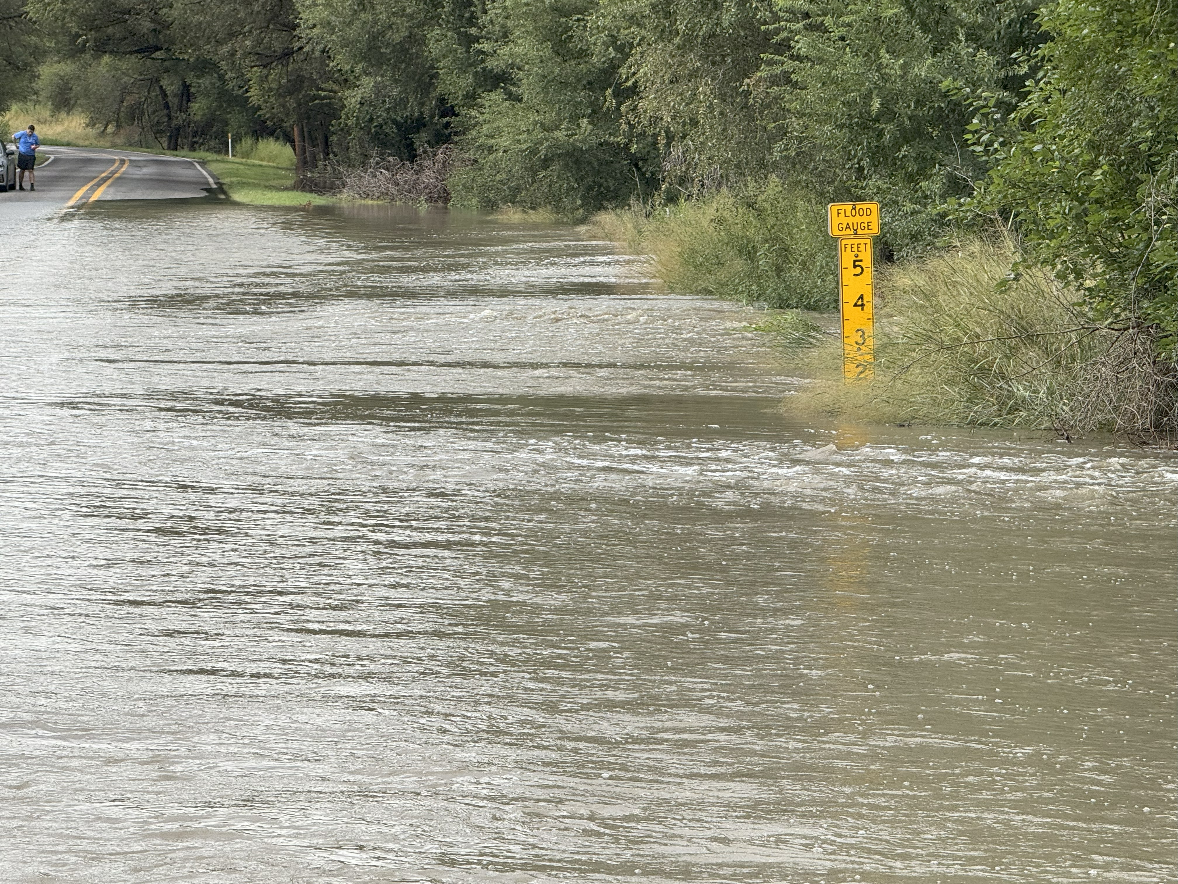
| Plot of the Brazos River on the southeast side of Lubbock in late August 2025. | |
|
The Lubbock area received a quick 1 to 3+ inches, with the heaviest rain targeting the north and east side of town. Runoff from the rain caused the Brazos River on the southeast side Lubbock to jump about 7 feet very early Saturday morning. This water made its way downstream, flooding FM 835 immediately upstream of Buffalo Springs Lake, as well as causing problems for those camping near the lake. |
|
 |
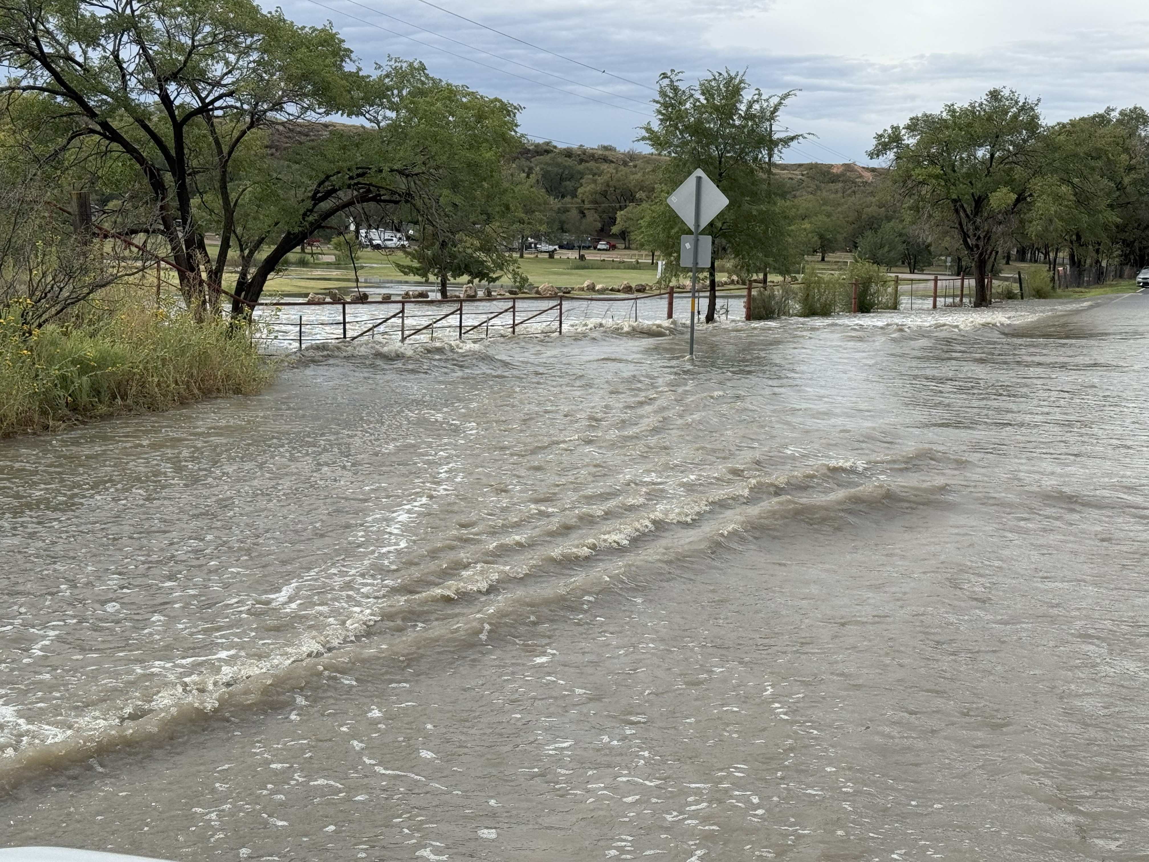 |
| Flooding across FM 835 immediately upstream of Buffalo Springs Lake on Saturday morning (30 August 2025). The pictures are courtesy of John Lipe. | |
| The thunderstorm activity grew upscale into a complex that traversed much of the South Plains and central and southern Rolling Plains late Friday night, with rain continuing through early Saturday morning (30 August), well behind the initial line of storms. | |
 |
|
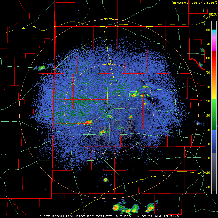
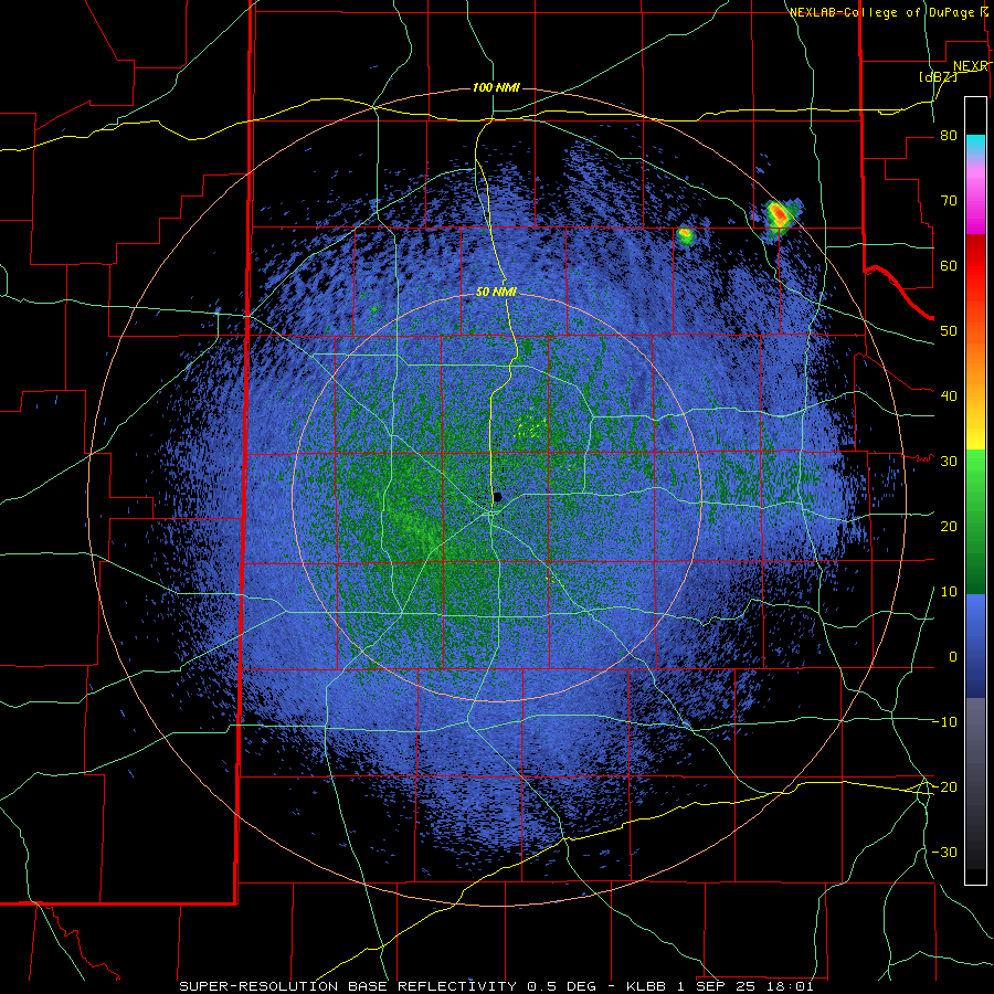
| LBB WSR-88D radar animation valid from 4:01 pm to 9:31 pm on Saturday (30 August 2025). | |
| After a brief lull late morning and early afternoon on Saturday, strong heating and lingering moisture led to the redevelopment of widely scattered storms by late afternoon over the central and southern South Plains. Pockets of heavy rain accompanied these small cells, which faded by early evening. However, a few intense storms formed farther north, over the northern South Plains, as the afternoon round was diminishing. This activity produced heavy rain as well as severe-caliber wind gusts, as high as 65 mph at the West Texas Mesonet site 6 miles east of New Deal, as they advanced southward toward Lubbock and Levelland. The approach of the thunderstorms prompted a delay in the TTU football game. Ultimately, this batch of storms met the same fate as its predecessor, fading over the central and southern South Plains by late evening, but not before putting on a show (as seen below). | |
 |
|
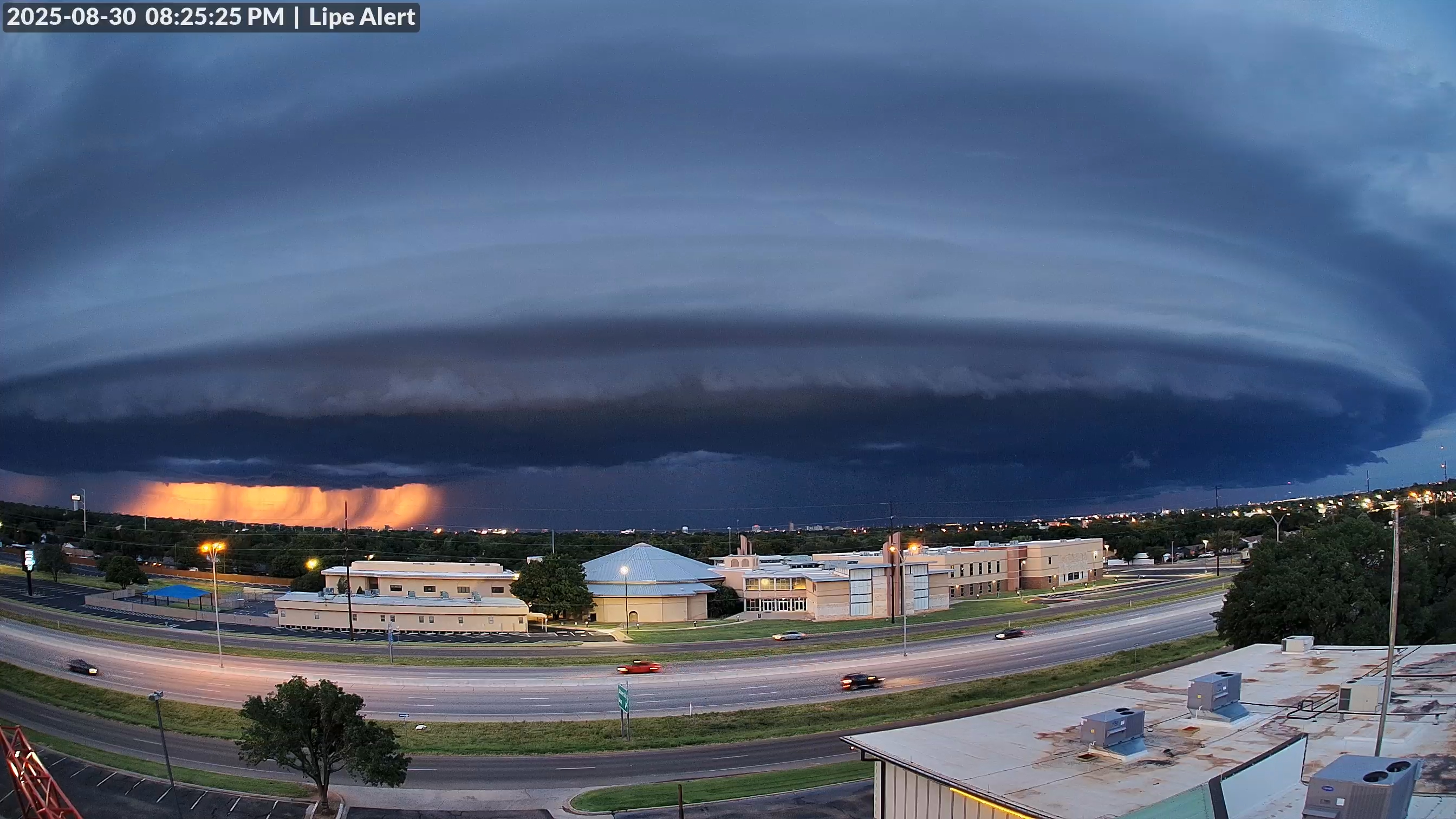
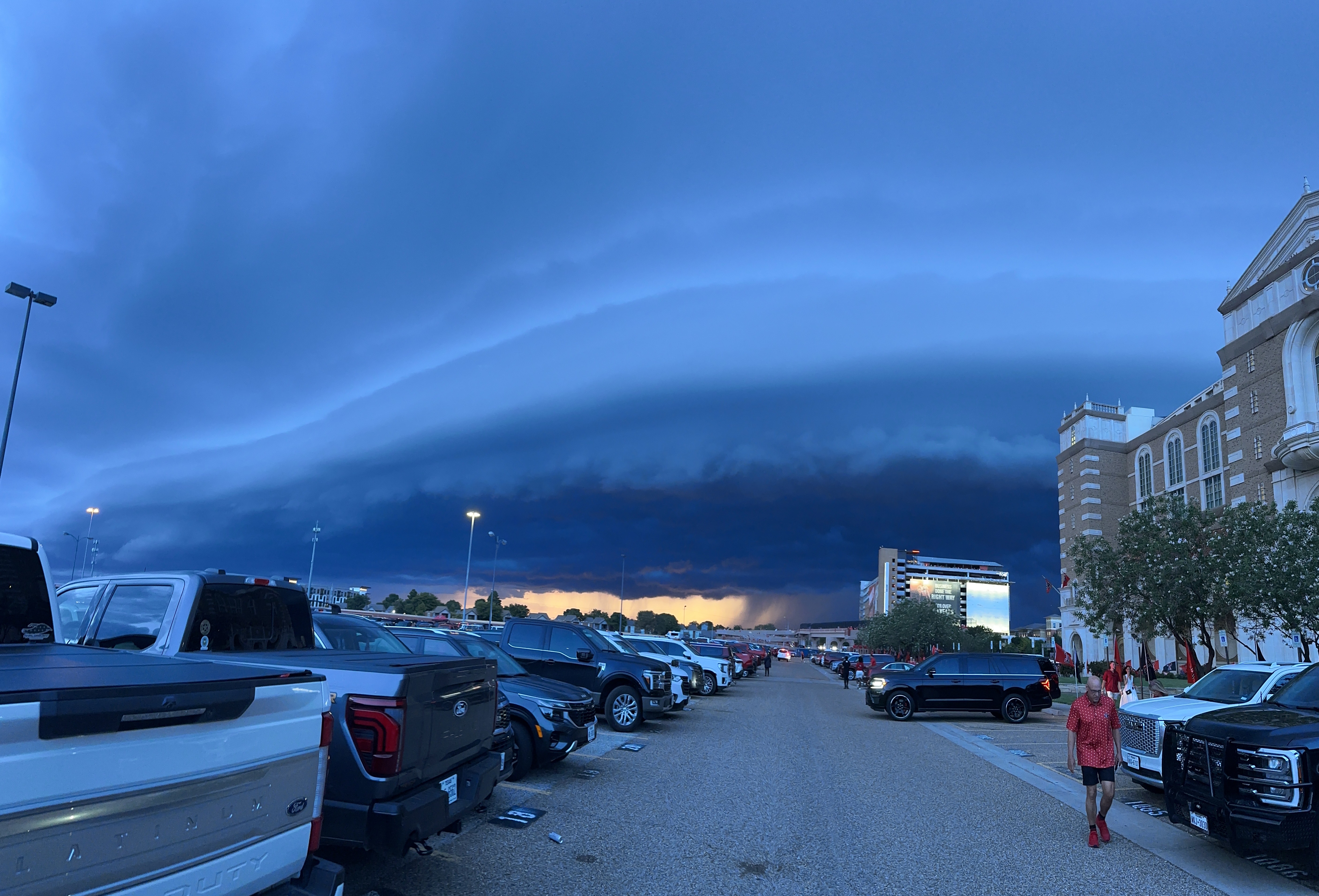
| Shelf cloud on the leading edge of a thunderstorm moving southward over Lubbock Saturday evening (30 August 2025). A view from next to Jones Stadium, courtesy of Bruce Haynie, can be VIEWED HERE. | |
|
Not to be outdone, yet another few clusters of showers and thunderstorms moved into parts of the western South Plains, southwest Texas Panhandle, as well as the southeast Texas Panhandle and northern Rolling Plains early Sunday morning (31 August). This overnight activity lingered into Sunday morning off the Caprock, though coverage was not as widespread as the previous morning. |
|
 |
|
| LBB WSR-88D radar animation valid from 2:17 am to 9:31 am on Sunday (31 August 2025). An additional radar animation, valid from 1:01 pm to 5:29 pm on Monday (1 September 2025) can be FOUND HERE. | |
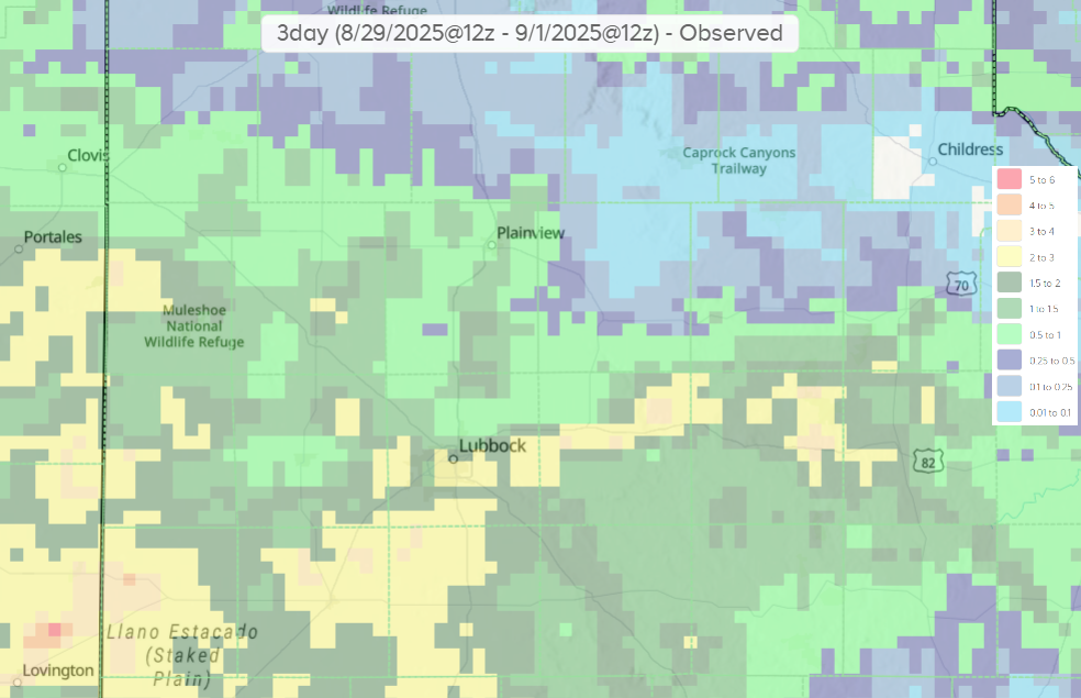
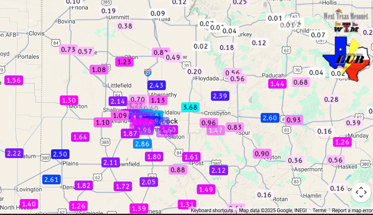
| Nearly everyone saw some rain over the holiday weekend, aside from a few pockets over the far southeast Texas Panhandle. The heaviest rain targeted the western and central South Plains into the central Rolling Plains, where totals in excess of 1 to 2 inch were common. Officially, Lubbock measured 0.53 inches at the airport over the Labor Day Weekend, well less than what much of the city farther to the south saw. Regardless, the rain boosted the annual running total to 13.53 inches, about 3 inches above normal through the end of August. | |
 |
|
| 3-hour radar-estimated and biased-corrected precipitation ending at 7 am on Monday (1 September 2025). The rainfall over this same period, as measured by the West Texas Mesonet and NWS, can be VIEWED HERE. A close up of the Lubbock area can be found HERE and HERE. | |
| A list of the preliminary storm reports collected on August 30th can be found below. | |
Preliminary Local Storm Report...Summary
National Weather Service Lubbock TX
1047 PM CDT Sat Aug 30 2025

..TIME...   ...EVENT...      ...CITY LOCATION...     ...LAT.LON...
..DATE...   ....MAG....      ..COUNTY LOCATION..ST.. ...SOURCE....
            ..REMARKS..

0422 PM     Flood            3 W Ransom Canyon       33.53N 101.73W
08/30/2025                   Lubbock            TX   County Official

            Two feet of water reported to still be over
            FM-835 upstream of Buffalo Springs Lake this
            afternoon.

0751 PM     Tstm Wnd Gst     6 ENE Abernathy         33.88N 101.76W
08/30/2025  M61 MPH          Hale               TX   Mesonet

            Peak gust. Additional gusts of 58 to 60 mph
            measured until 7:53 PM.

0818 PM     Tstm Wnd Gst     6 E New Deal            33.73N 101.74W
08/30/2025  M65 MPH          Lubbock            TX   Mesonet

            Peak gust. Also gusted to 60 mph at 8:17 PM.

0821 PM     Tstm Wnd Gst     Lubbock Int. Airport    33.67N 101.82W
08/30/2025  M67 MPH          Lubbock            TX   ASOS

            Corrects location of previous tstm wnd gst
            report from Lubbock Int Airport. ASOS
            station KLBB Lubbock International Airport.

0822 PM     Tstm Wnd Dmg     3 SW New Deal           33.69N 101.87W
08/30/2025                   Lubbock            TX   Emergency Mngr

            Power outages reported at FM 1294 and
            University Ave due to thunderstorm winds.

0833 PM     Tstm Wnd Gst     4 E Lubbock             33.59N 101.78W
08/30/2025  M65 MPH          Lubbock            TX   Mesonet

            Peak gust.

