Winter Makes a Brief Visit to West Texas
22 December 2017 |
|
|
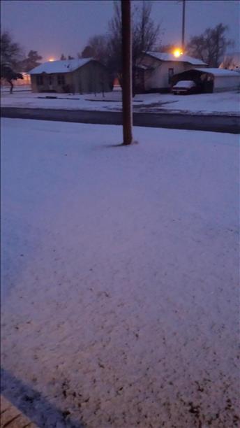
| A dusting of snow observed in Post Friday evening, December 22, 2017. The picture is courtesy of KCBD and Belinda Byrd. |
| |
| A taste of winter visited portions of West Texas on the first official full day of winter, Friday, December 22nd. After a warm week leading toward the Christmas Holiday Weekend, a strong cold front moved through the South Plains Thursday evening (21 December). Cold and relatively dry air settled into the region Friday behind the front, with temperatures only climbing into the 30s. At the same time, a potent upper level storm system approached via New Mexico during the afternoon hours. Lift from this system caused clouds and precipitation to blossom over the South Plains region, though for most spots the amounts were very light as the dry air largely won out. |
| |
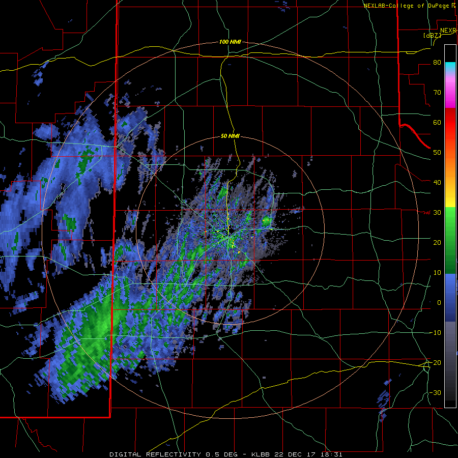
|
|
| Lubbock radar animation valid from 12:31 pm to 8:14 pm on Friday, 22 December 2017. |
|
| |
| Early on many spots also saw sleet, thanks to a warm layer of air centered around 4,000 feet above ground level. However, the elevated warm layer quickly cooled, allowing the sleet to change over to snow before coming to an end. Trace amounts of sleet and snow were common on the Caprock Friday afternoon. Over portions of the southeast Texas Panhandle into the northern and central Rolling Plains, where the snow persisted well into the evening, the snow managed to accumulate, covering the ground with anywhere from a dusting to over 2 inches. |
| |
 |
 |
| Snow that piled up in and around Matador on Friday evening, December 22, 2017. The pictures are courtesy of KCBD. The left picture was taken by Brian Marshall. |
| |
| Matador was one of the bigger winners, recording about 2 inches of snow. Locations around and northwest of Childress also reported snow totals as high as 2.5 inches. The below map shows the general distribution of the snowfall during the afternoon and evening of December 22nd. |
| |
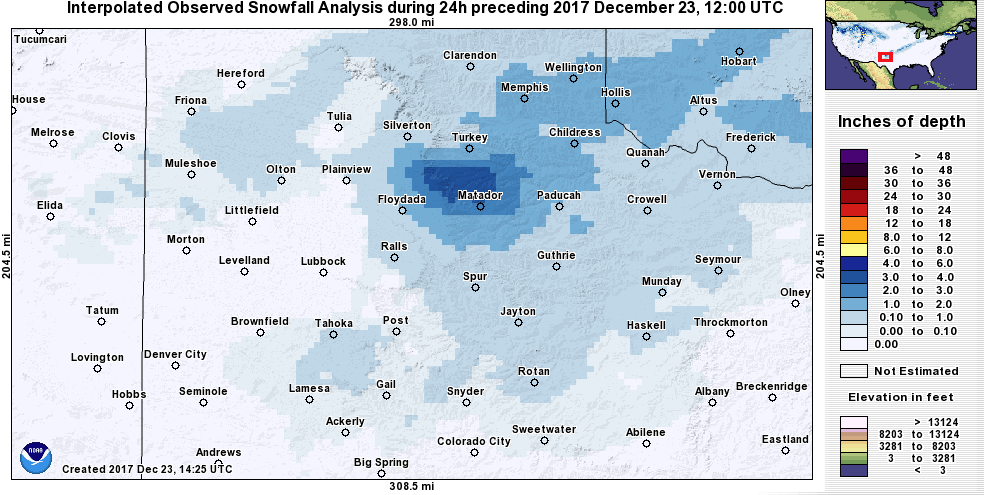 |
| Interpolated 24 hour snowfall analysis ending at 6 am on Saturday, 23 December 2017. The analysis is from the National Operational Hydrologic Remote Sensing Center. A plot of actual reported snowfall totals can be VIEWED HERE. |
| |
| The sleet and snow brought welcome moisture to the region, though amounts were limited. The below map from the West Texas Mesonet shows that the wintry precipitation melted down to a few hundredths to just over a tenth of an inch of liquid. |
| |
 |
| West Texas Mesonet observed 24-hour melted precipitation ending at noon on Saturday, 23 December 2017. |
| |
| When skies cleared and the sun came up Saturday morning, satellite imagery (below) showed a swath of snow stretching from near McAdoo and Matador east and northeastward into southwest Oklahoma. The snow quickly melted during the morning under full sunshine. |
| |
|
|
| GOES-16 Daytime True(ish) Color imagery taken at 9:12 am on Saturday, 23 December 2017. The white from near McAdoo and Matador into southwest Oklahoma is snow on the ground. The white streaks further north across the central Texas Panhandle are high cirrus clouds. |
| |
| The below maps contrast the warm temperatures experienced before the cold front on Thursday (21 December) with the much colder temperatures the following day. |
| |
 |
| West Texas Mesonet observed high temperatures on Thursday, 21 December 2017. |
| |
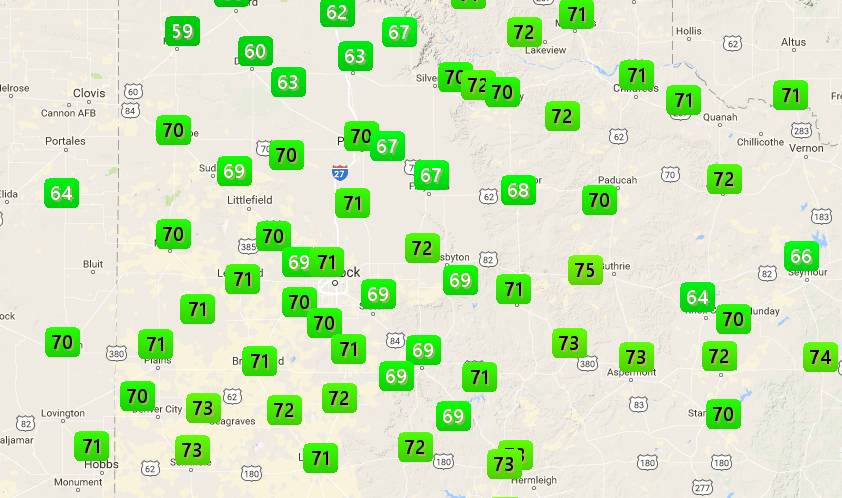
| Most locations saw high temperatures drop about 35 degrees behind the cold front, plummeting from near 70 degrees Thursday afternoon to the 30s Friday afternoon. A chilly night followed with many spots dipping into the teens, but highs recovered in the 50s and 60s for most Saturday. |
| |
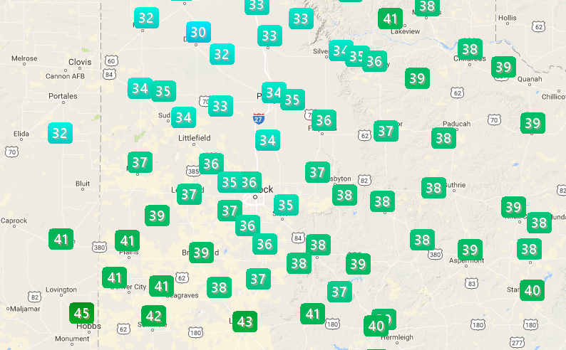 |
| West Texas Mesonet observed high temperatures on Friday, 22 December 2017. Lows observed the morning of the 22nd can be FOUND HERE. |
| |
| Below are temperature and snowfall reports collected by the National Weather Service in Lubbock for December 22nd. |


