National Weather Service United States Department of Commerce

Heavy Rain Continues in Florida; Cold Front Brings Thunderstorms and Showers to Central US

Scattered areas of heavy rain continue to produce isolated flash flooding across the Florida peninsula. Anomalous moisture will combine with a cold front and will bring heavy rain and scattered flash flooding across the Mid-South, Ohio and Tennessee Valleys today and Tuesday. Above average temperatures will continue to be found ahead of the cold front from the Midwest to the Northeast. Read More >


International Satellite Communications System

The World Area Forecast System (WAFS)
and the
The Regional Main Telecommunication Network (RMTN-IV)

ICAO LOGOWMO LOGO

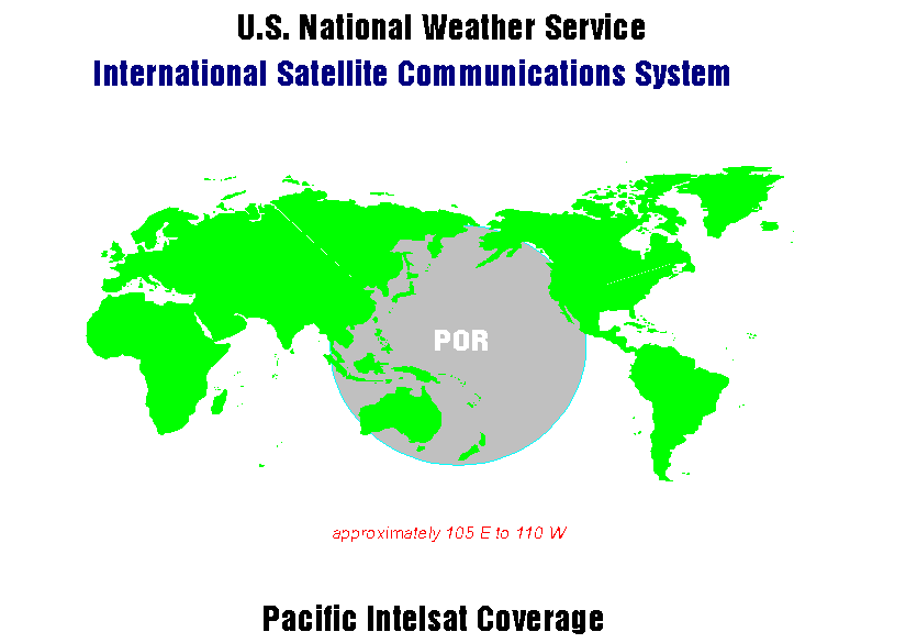
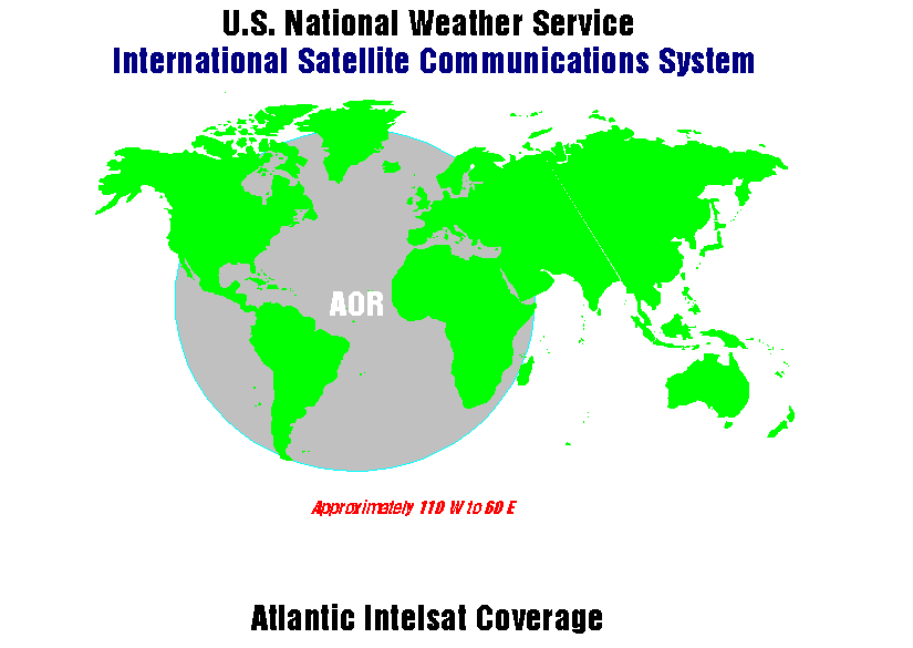
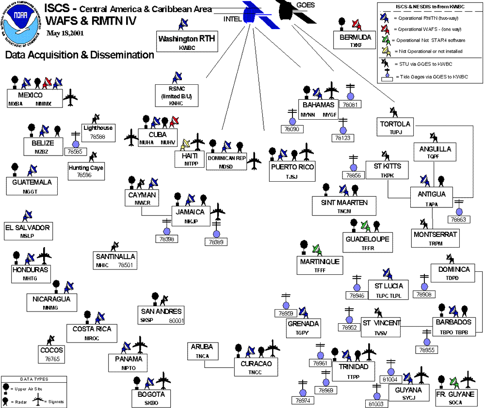
The ISCS has two parts. The two systems are for meteorological data delivery. They use the same satellites and communication protocols. The first service is the World Area Forecast System (WAFS) in support of the International Civil Aviation Organization (ICAO) program for aviation data distribution. The second service is a Global Telecommunication System (GTS) satellite data exchange system for WMO Region IV (North America) data exchange.

The ISCS Program Manager provides additional details and a modernization project that will use new telecommunication technology.

  1. The purpose of the WAFS broadcast is to make globally available the centrally produced aviation model forecast products of a World Area Forecast Center (WAFC) in standard gridded form (WMO GRIB code) as well as other supporting data for flight operations to as many aviation users as possible.
    1. The United States supports this requirement (as a servicing WAFC) with a delivery system called the ISCS/WAFS. The global coverage is approximately from 105 E° eastward to 65 E° , covering the Pacific Ocean , Atlantic Ocean , North America, and South America. The remainder of the world coverage is supported by the WAFC located in the United Kingdom through their satellite broadcast system called SADIS. SADIS covers the European, Asian, African continents and the Indian Ocean.
    2. These are point-to-multi-point delivery system which is an additive component to the Aeronautical Fixed Telecommunication Network (AFTN). This system does not, therefore, replace the data acquisition/distribution functions of the ICAO/AFTN.
  2. The purpose of the GTS broadcast dissemination and data acquisition system (a two-way system), called the ISCS/RMTN-IV (see graphic depiction of area of two-way coverage), replaces the two WMO Region IV GTS regional communication networks of the Antilles Meteorological (ANMET) and Central America Meteorological (CEMET) circuitry
    1. This communications system increases the success of data delivery and receipt within that part of a WMO Region where past ground communications was difficult to maintain.
    2. This system supports WMO GTS needs for the exchange of all data types among WMO Member countries.