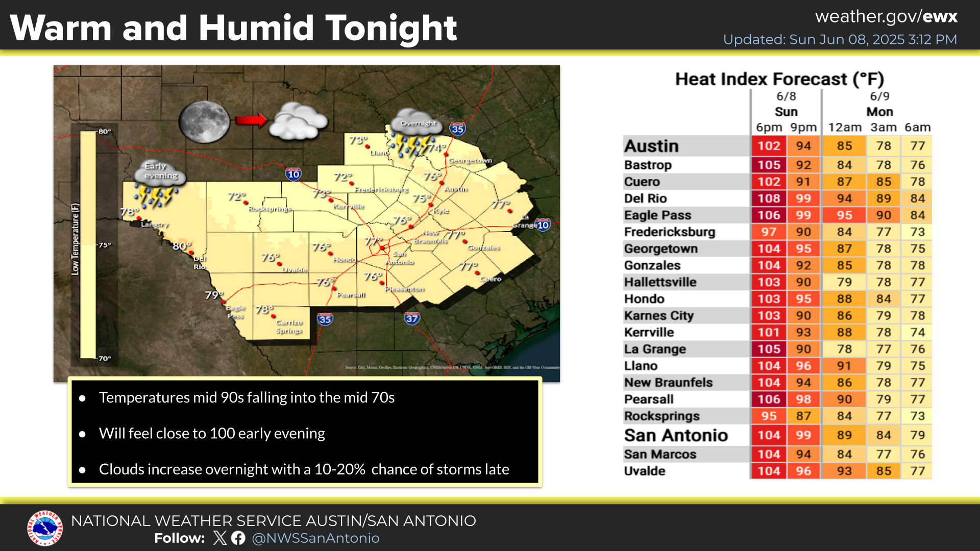
Expect a warm and humid night across South-Central Texas with overnight low temperatures settling into the low to mid 70s. Cloud cover will steadily increase across the region overnight and persist into early Monday morning. Dry weather is expected for the entire area.
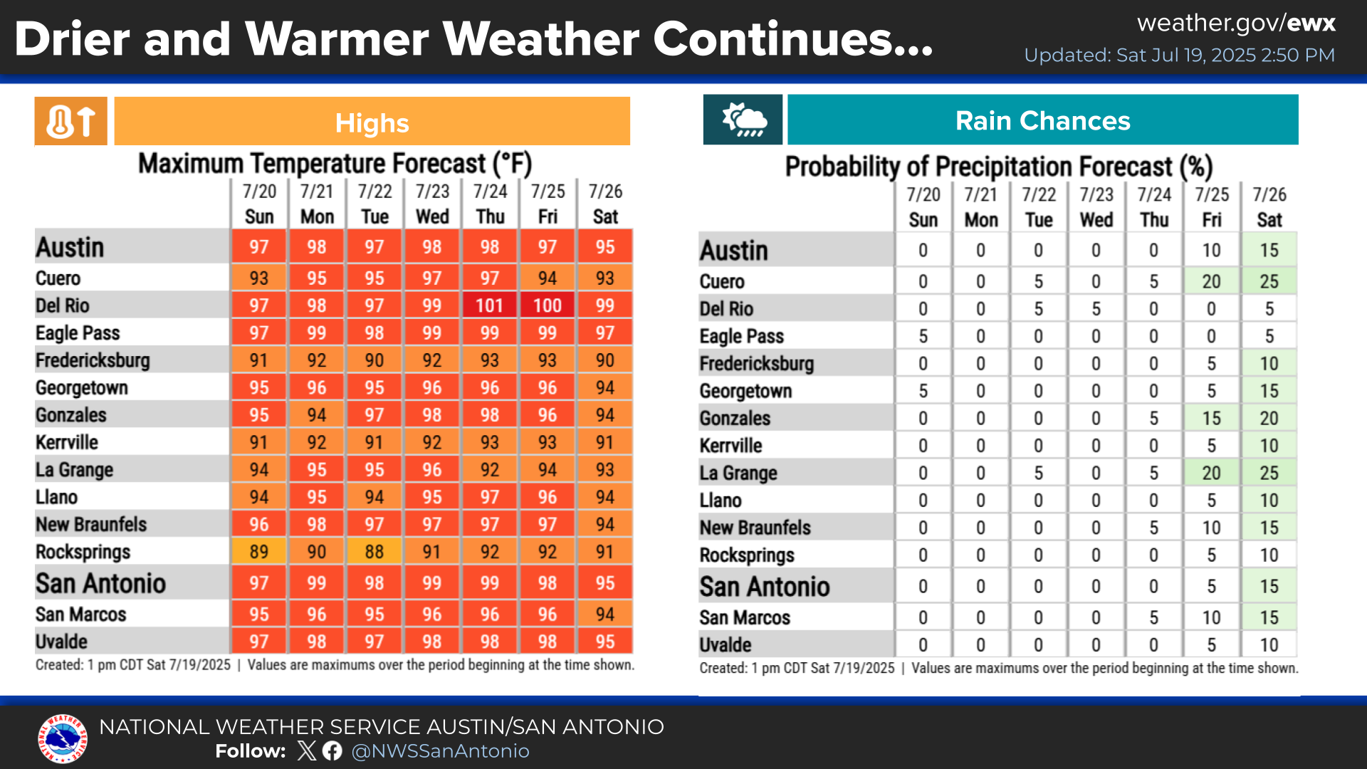
Typical summer heat and dry weather is locked in for the upcoming week. Highs generally in the mid to upper 90s and even 100 degrees for some locations.


 Austin/San Antonio Radar
 Weather Map
 Satellite Imagery
 Del Rio Radar
 Digital Forecast Map
 Tropical Outlook
 Drought Status
 Air Quality
 Fire Weather Forecasts
 Observed Rainfall
 Observed Temperatures
 Daily Climate Graphs