
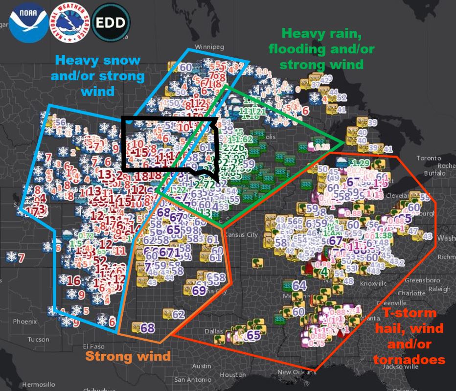
Record setting heat is expected over the next several days from the Intermountain West through the northern Plains. Furthermore, fire weather concerns increase with dry and breezy conditions. Meanwhile, heavy rainfall and severe thunderstorm threats for the Ohio/Tennessee Valleys, central Appalachians and Southeast today. The threat shifts to central Gulf Coast and across central Texas this week. Read More >
Overview
|
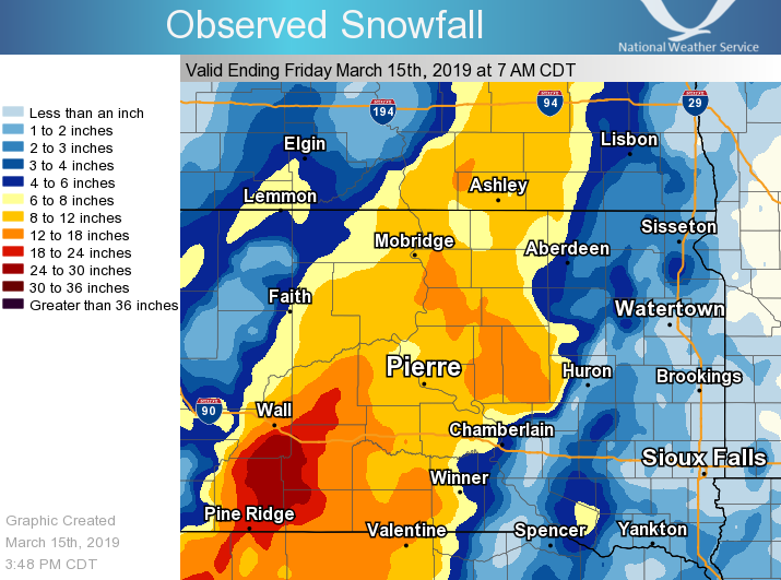
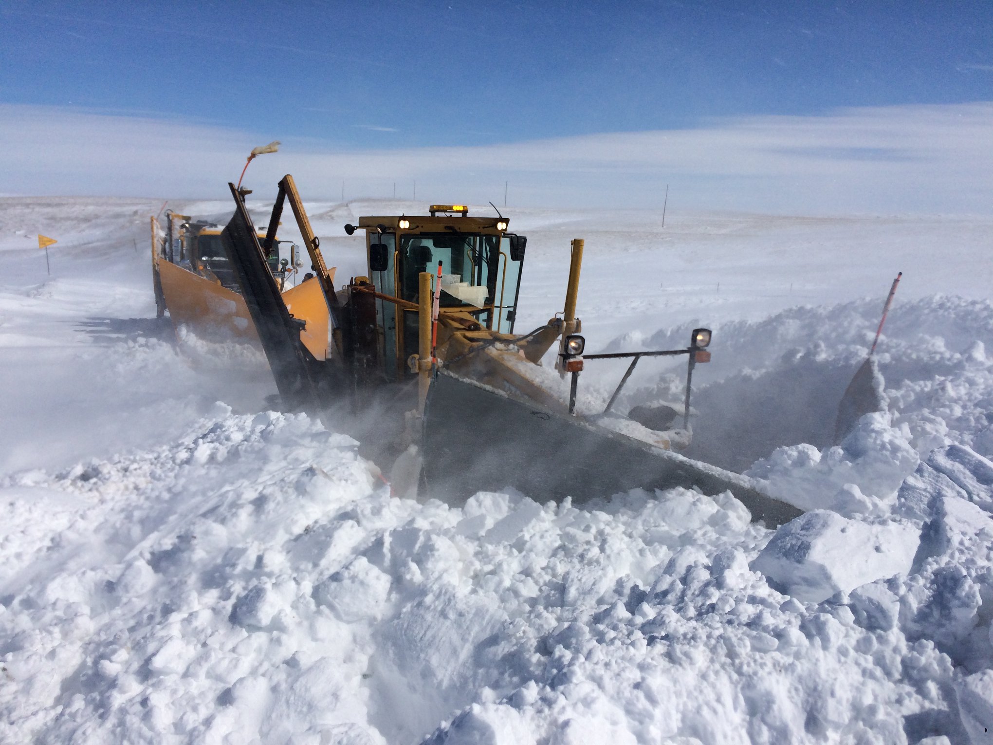
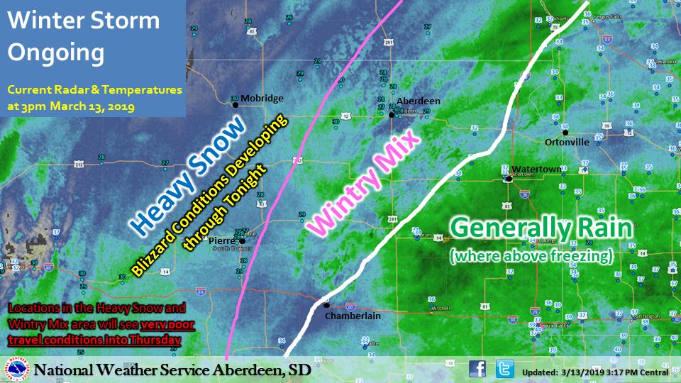
A low pressure system of rare intensity tracked across the Great Plains on Wednesday, March 13th and Thursday, March 14th 2019. Significant weather hazards began across South Dakota during the morning of the 13th as a broad arc of heavy precipitation moved from south to north. A rain/snow line was in place through much of the day, generally along the western side of the James Valley. Heavy rain of generally 1 to 2" as well as freezing rain (namely in and around Summit, which suffered tree damage) affected those to the east of this line, and heavy snow of generally 6 to 12" fell to the west of it. Strong and widespread north wind gusts of 45 to 70 mph developed during the evening of the 13th and lasted through much of the day on the 14th. Temperatures cooled during this time, and widespread blizzard conditions were observed across our forecast area. Severe snow drifts of up to 12 feet or higher were left in the storm's wake by the 15th across portions of central South Dakota. Impacts included minor flooding, countless vehicles in ditches, widespread road closures for extended periods (including portions of I-90), as well as power outages. This event capped off an incredibly snowy February and start to March, further setting the stage for potential springtime flooding. Event review pages from other offices can be found here: NWS Pueblo, CO, NWS Denver/Boulder, CO, NWS Rapid City, SD, NWS Grand Forks, ND, NWS Omaha/Valley, NE, and the Nebraska Department of Natural Resources. |
.gif) WPC Surface Analysis from 7am on March 13th to 4pm on March 14th |
 |
 |
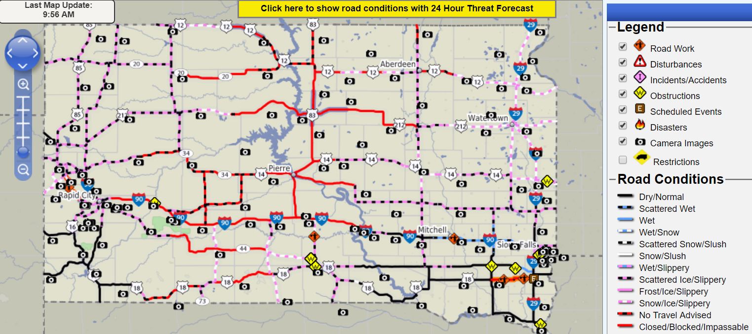 |
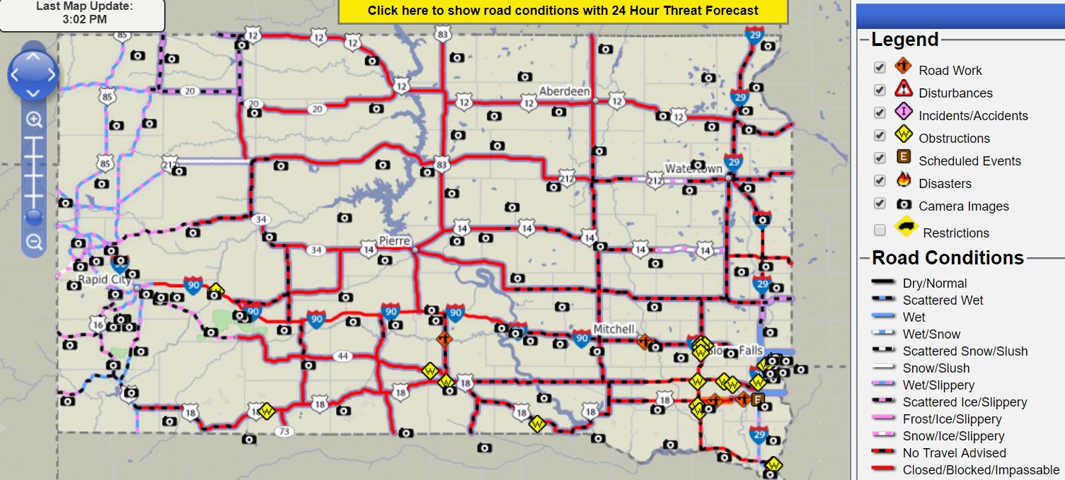
| This powerful storm system produced widespread hazardous weather across the country | SD DOT Road Conditions at 3 PM CDT on Thursday, March 14th, highlighting a large area of road closures. | SD DOT Road Conditions at 10 AM CDT on Friday, March 15th, highlighting the many roads that remained shut down. |
Snow, Rain, Wind
 |
 |
 |
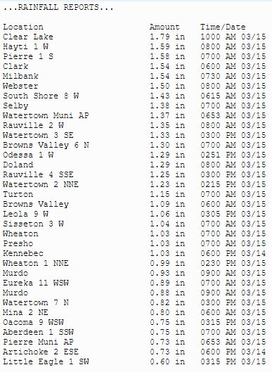 |
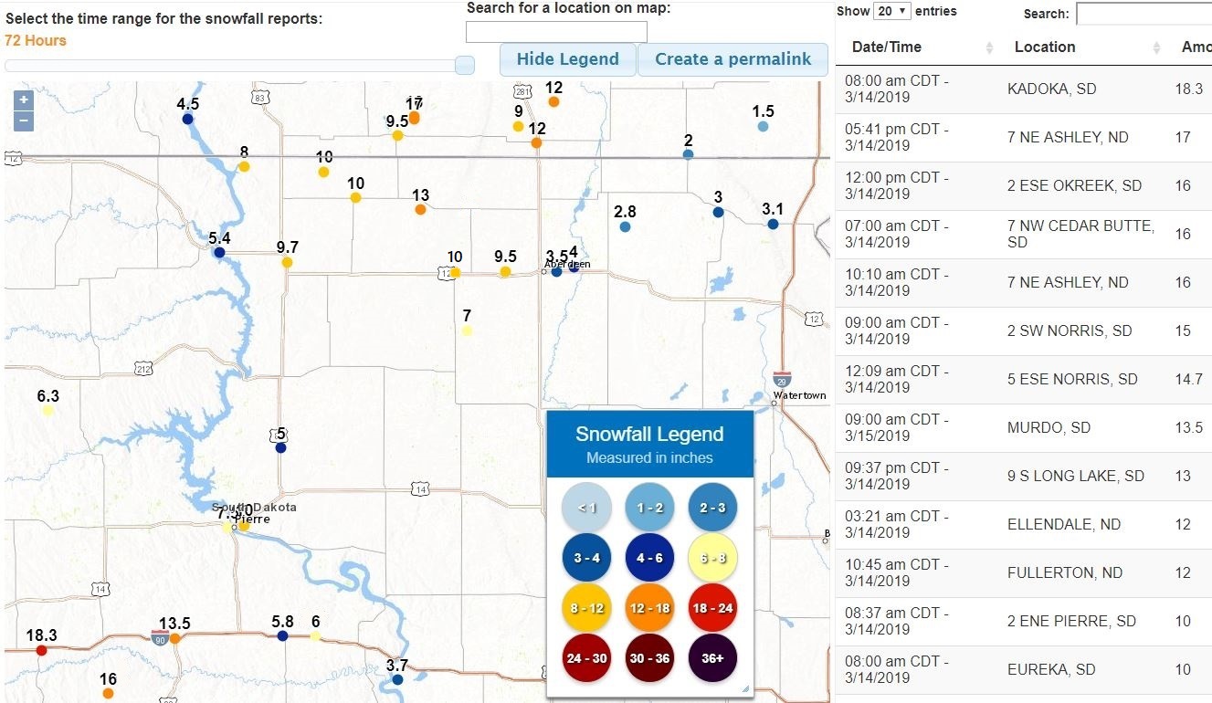
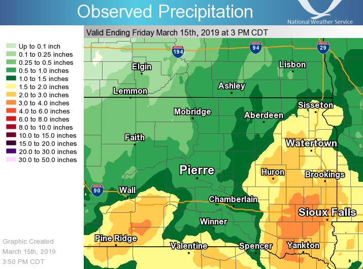
| Estimated storm total snowfall | Some storm total snowfall reports | Estimated storm total precipitation/liquid equivalent | Some precipitation/liquid equivalent reports |
 |
 |
 |
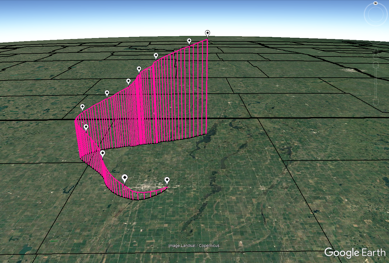 |
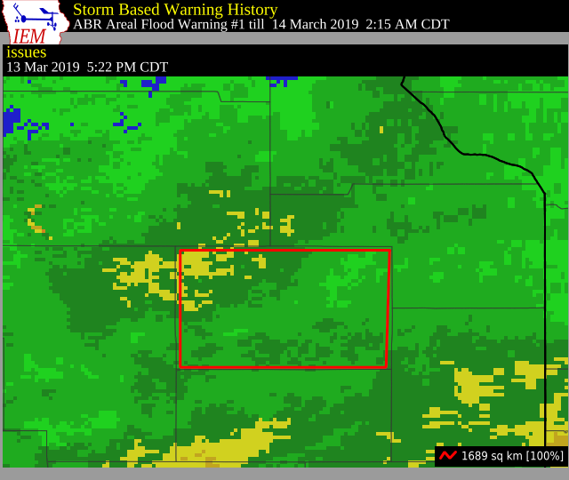
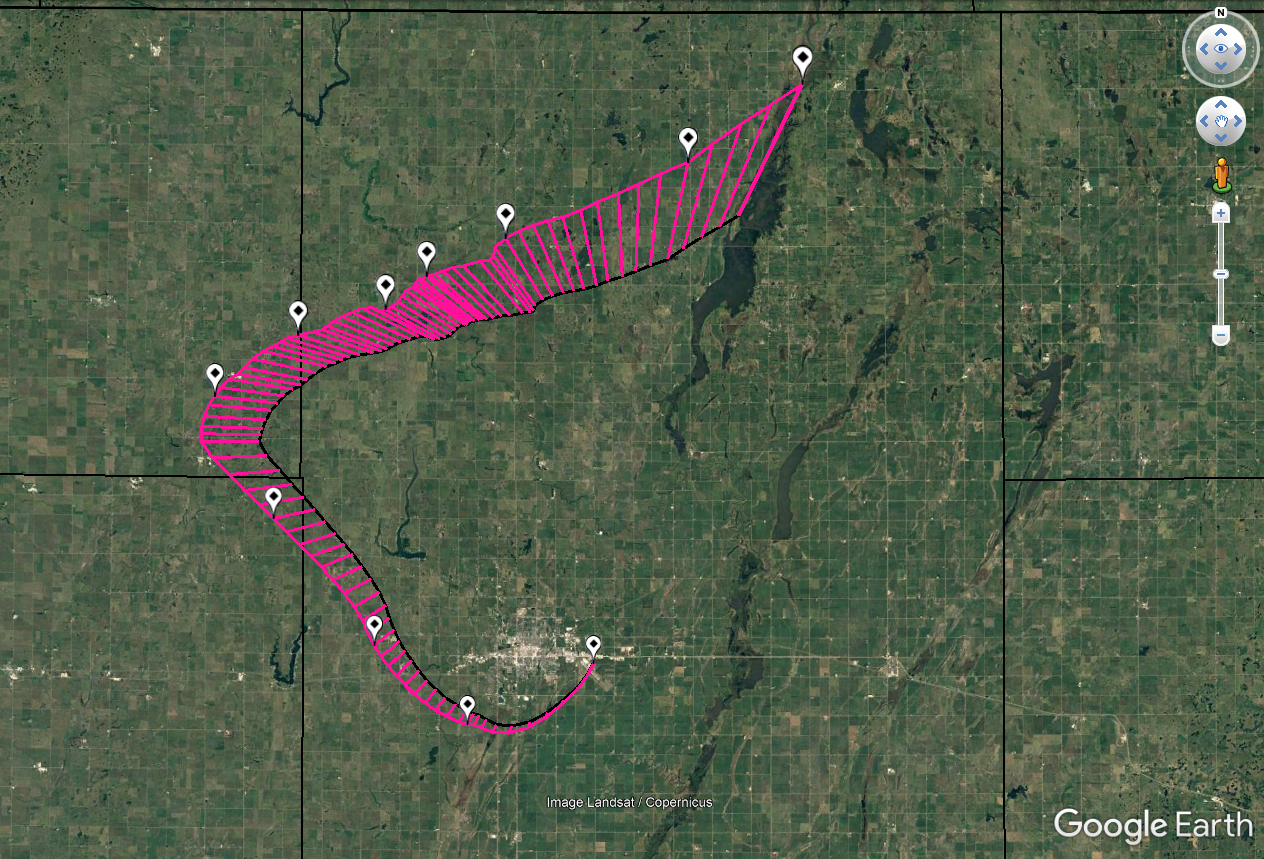
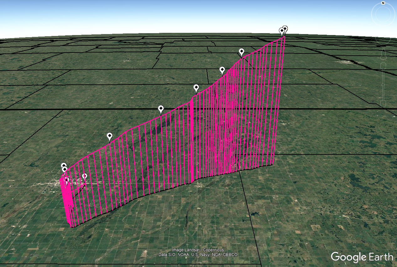
| An Areal Flood Warning was issued for Codington County at 522pm CDT March 13th due to heavy rain and melting snow | Some peak wind gust reports | Weather balloon flight path, launched from NWS Aberdeen at 5pm on Wednesday March 13th, 2019 | Weather balloon flight path, launched from NWS Aberdeen at 5pm on Wednesday March 13th, 2019 |
 |
 |
||
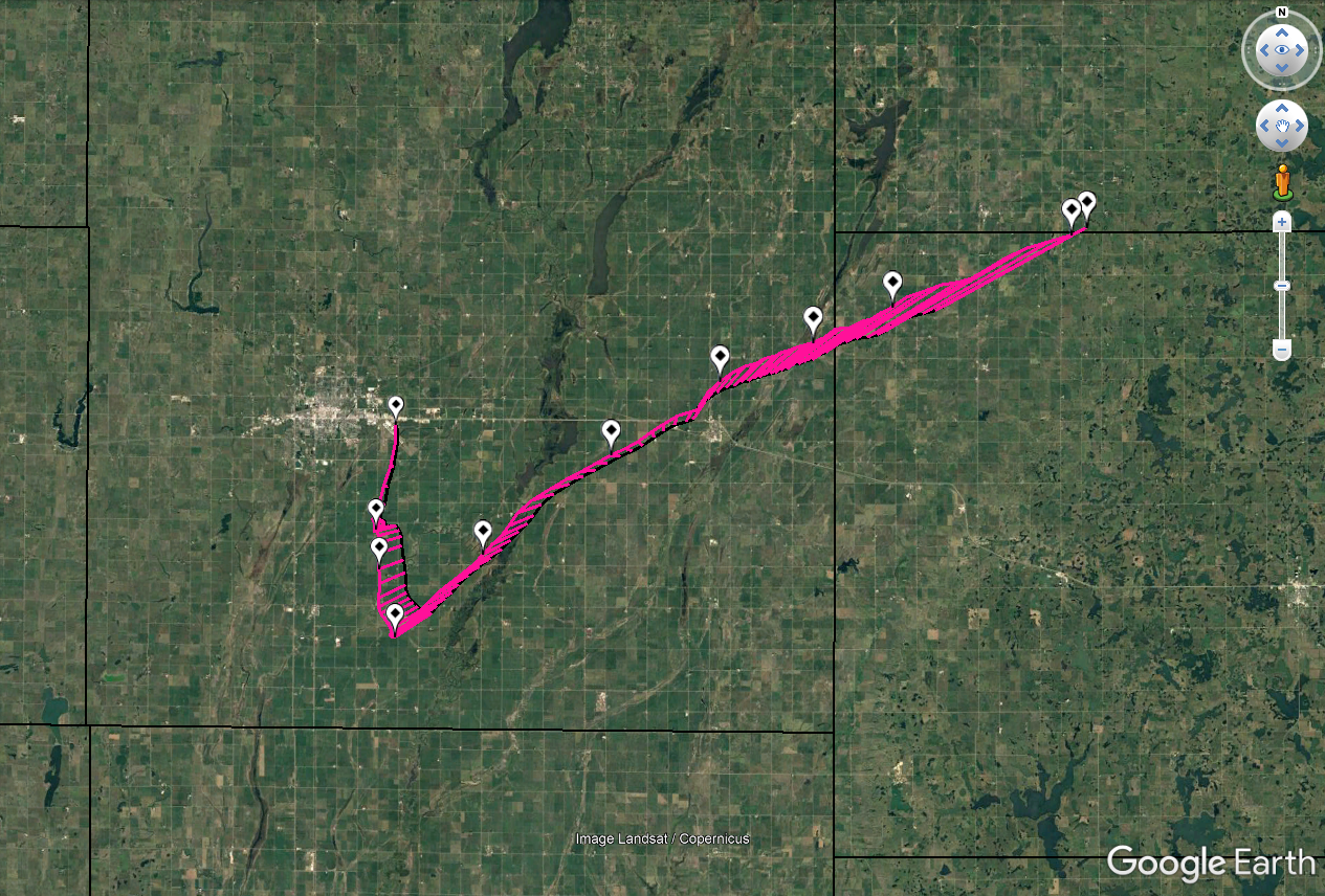
| Weather balloon flight path, launched from NWS Aberdeen at 5am on Thursday March 14th, 2019 | Weather balloon flight path, launched from NWS Aberdeen at 5am on Thursday March 14th, 2019 |
Photos, Video
 |
 |
 |
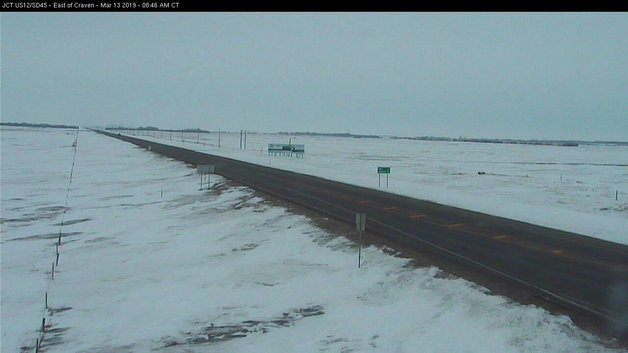 |
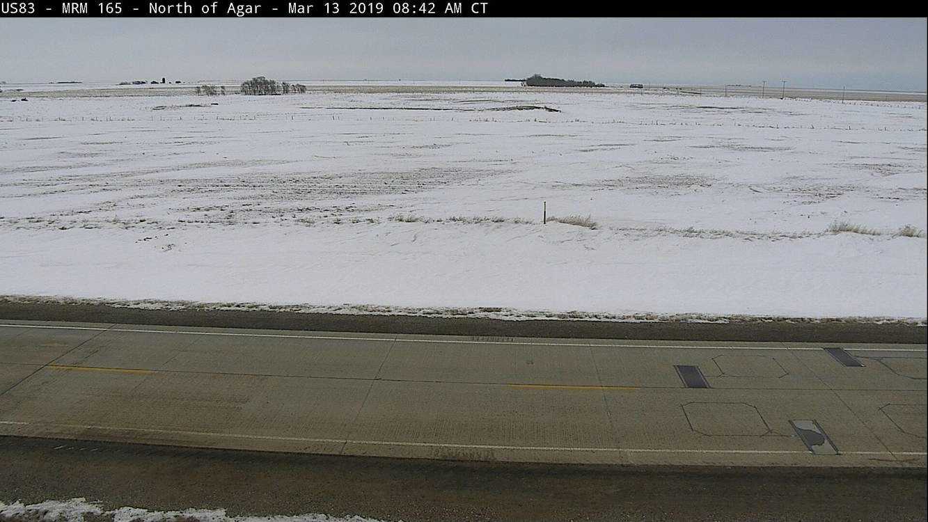
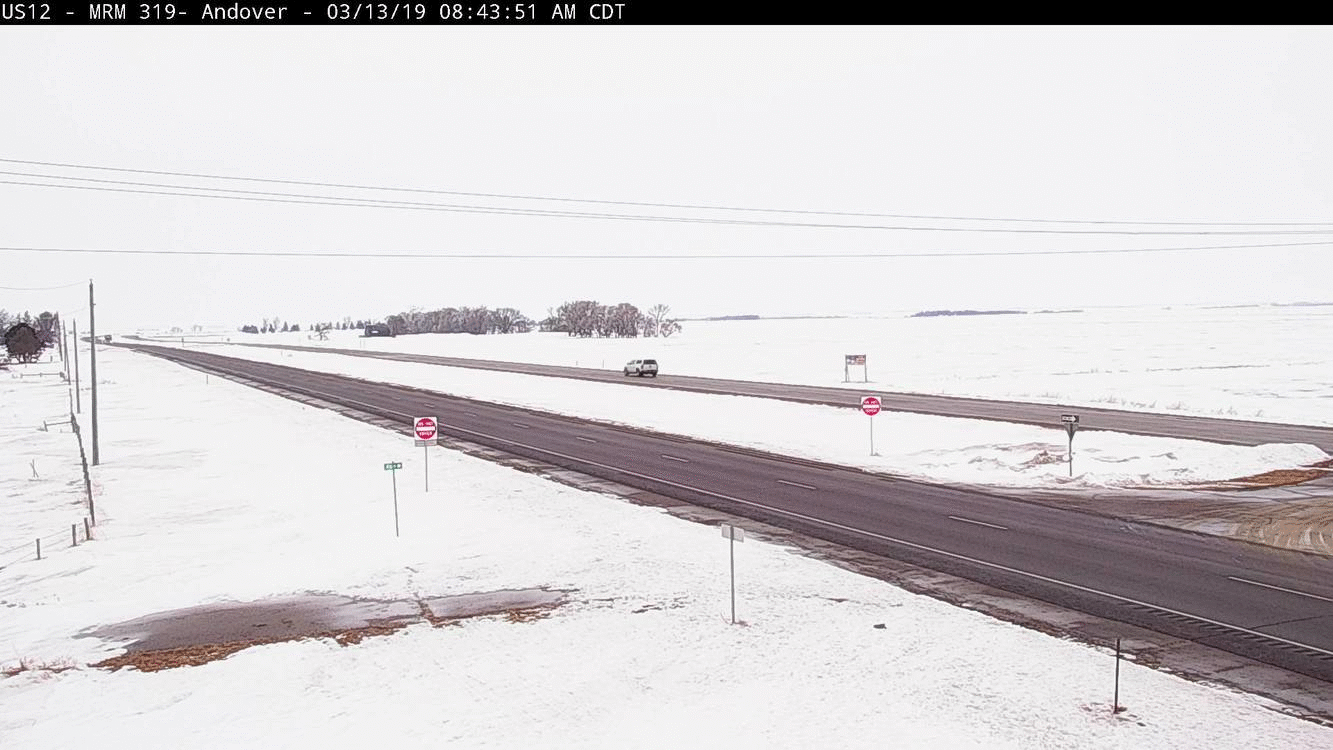
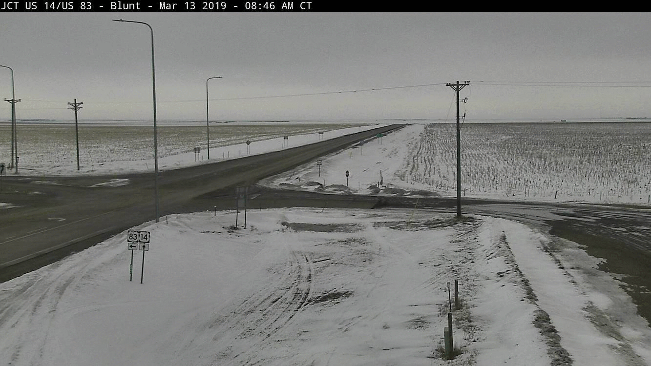
| SD DOT Cam from 3 miles north of Agar, at 9am Mar 13, 4pm Mar 13, 12pm Mar 14, and then 6pm Mar 14 | SD DOT Cam from Andover, at 9am Mar 13, 4pm Mar 13, 12pm Mar 14, and then 6pm Mar 14 | SD DOT Cam from 4 miles west of Blunt, at 9am Mar 13, 4pm Mar 13, 12pm Mar 14, and then 6pm Mar 14 | SD DOT Cam from Craven Corner, at 9am Mar 13, 4pm Mar 13, 12pm Mar 14, and then 6pm Mar 14 |
 |
 |
 |
 |
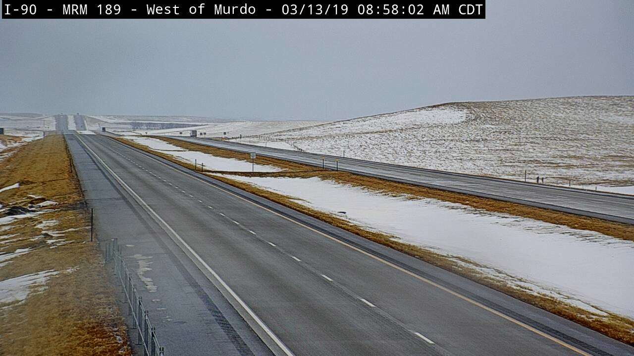
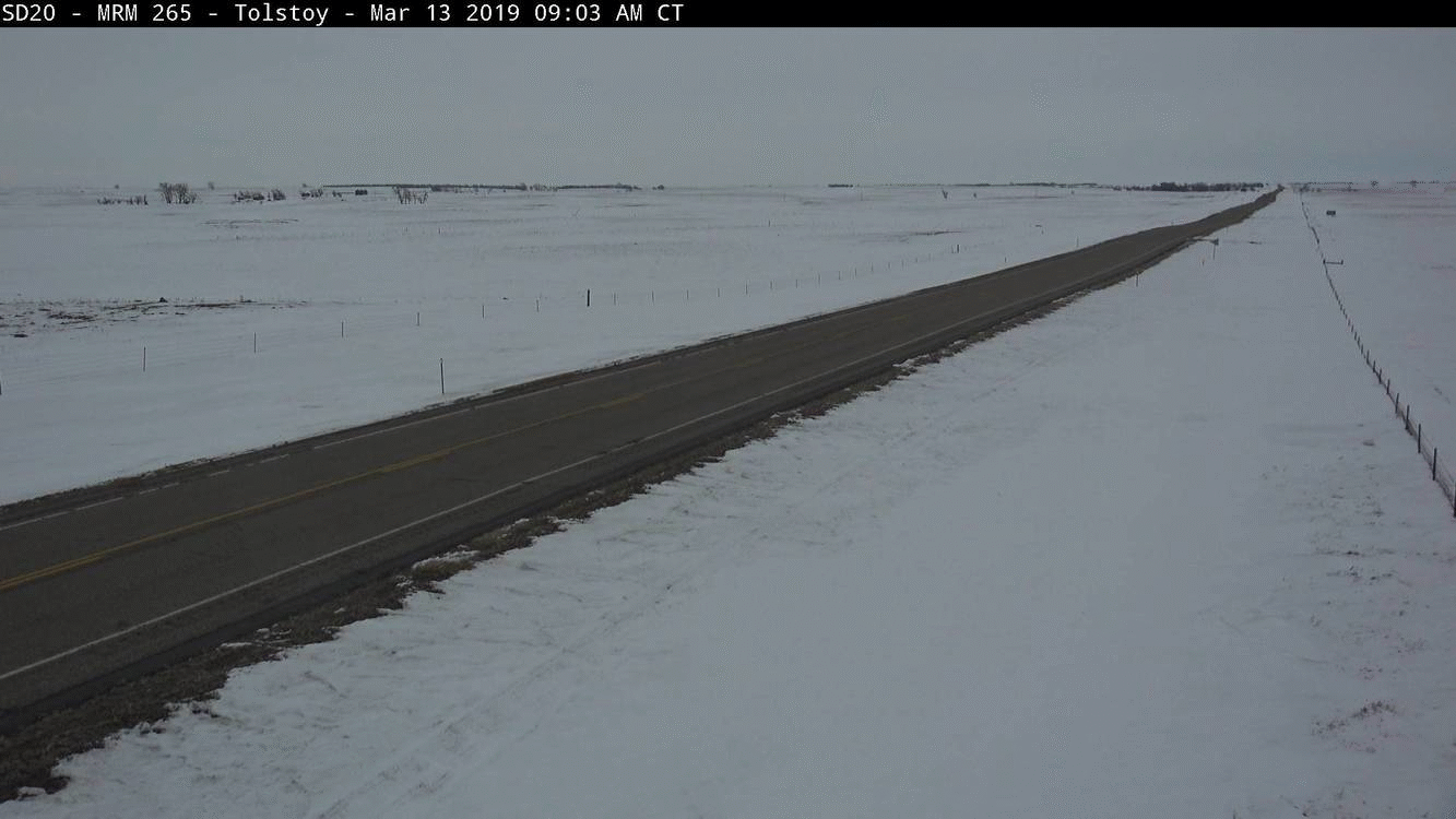
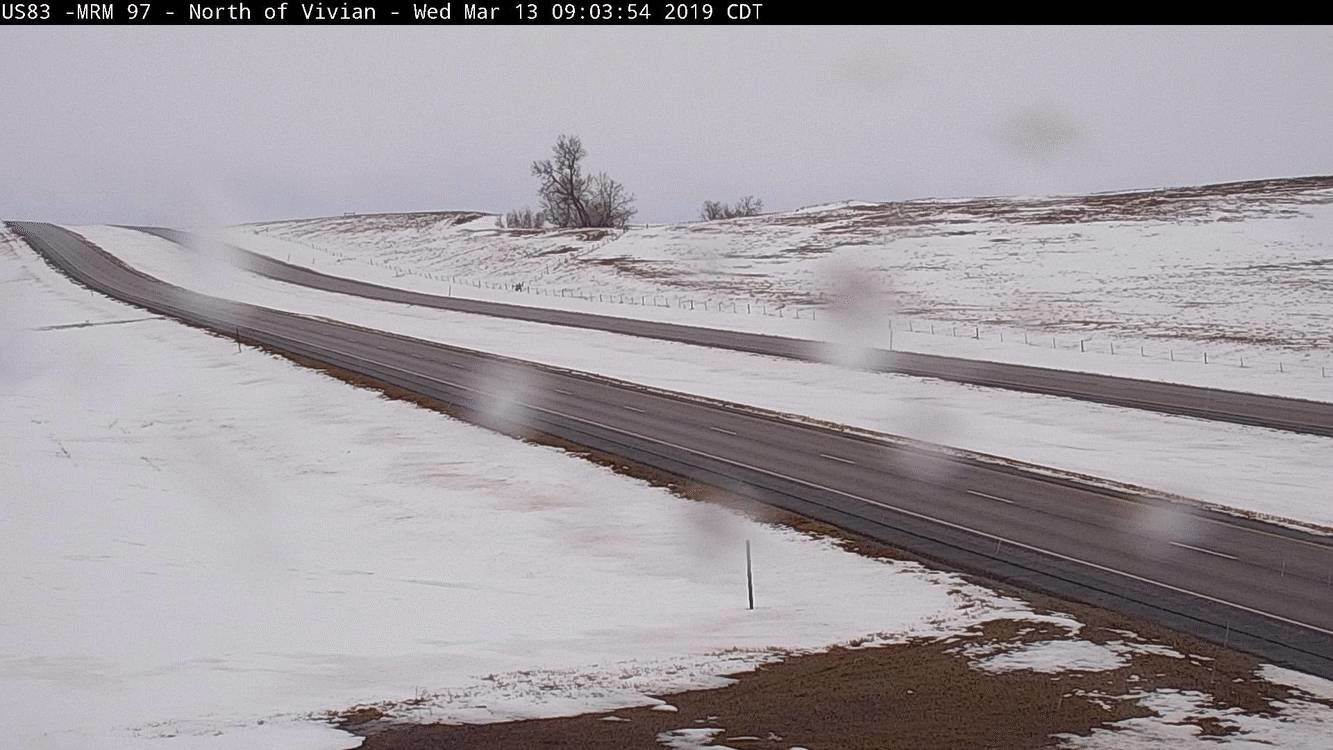
| SD DOT Cam from 3 miles west of Murdo, at 9am Mar 13, 4pm Mar 13, 12pm Mar 14, and then 6pm Mar 14 | SD DOT Cam from Tolstoy, at 9am Mar 13, 4pm Mar 13, 12pm Mar 14, and then 6pm Mar 14 | SD DOT Cam from 9 miles NNW of Vivian, at 9am Mar 13, 4pm Mar 13, 12pm Mar 14, and then 6pm Mar 14 | Blizzard conditions near Frederick at 9am on March 14th, courtesy of Mark Sumption |
 |
 |
 |
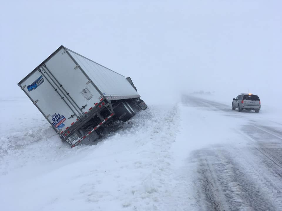 |
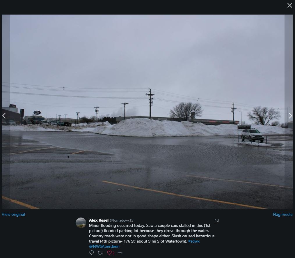
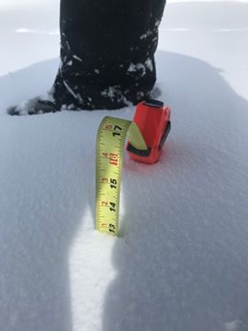
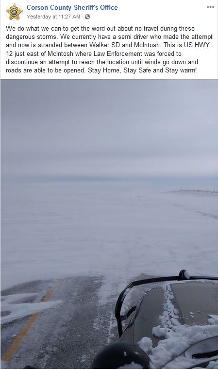
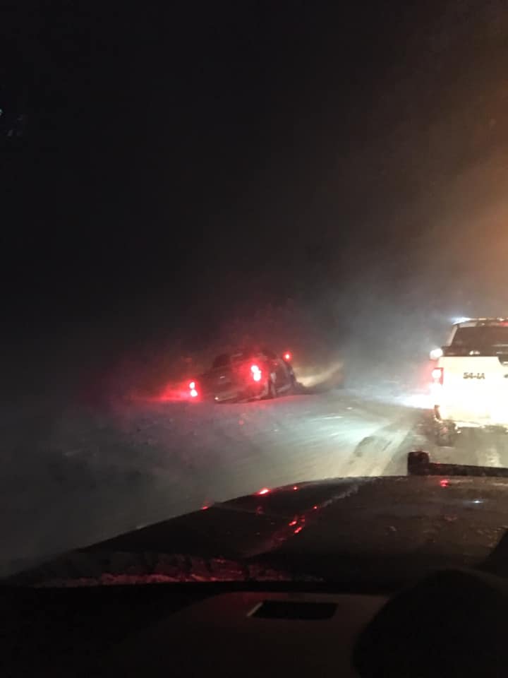
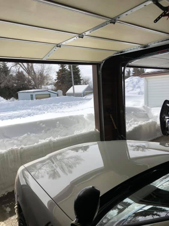
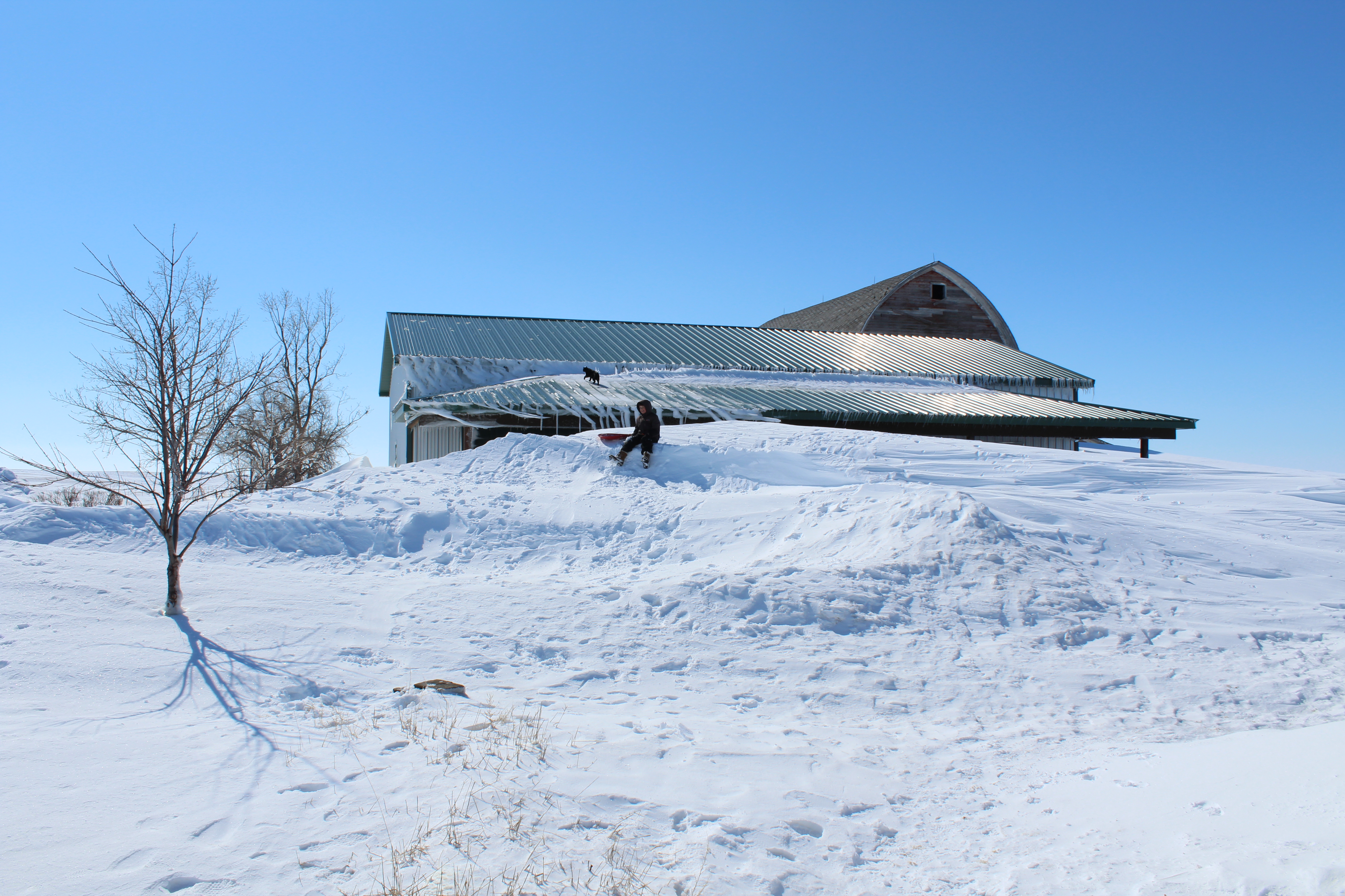
| Minor flooding observed in Watertown on March 13th, courtesy of Alex Resel | Heavy snow measured 14 miles west of Leola at storm's end on March 14th, courtesy of Arlene Swenson | Snow making roads impassable in Corson County at 11am on March 14th, courtesy of the Corson County Sheriff | Semi in the ditch on March 14th, courtesy of the Hand County Sheriff |
 |
 |
 |
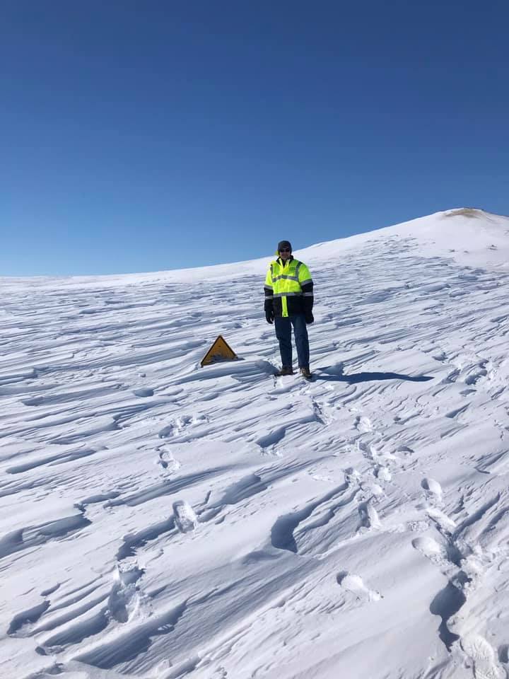 |
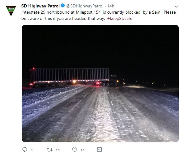
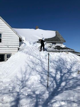
| Semi blocking a portion of I-29 at 8pm on March 14th, courtesy of the SD Highway Patrol | Blizzard conditions on the 14th were widespread and severe on March 14th. Photo courtesy of the SD Highway Patrol | Snow drifts as high as the clothes line in Hosmer by March 15th. Photo courtesy of Elli Haerter | ~7 foot drifts across the highway 25 miles southeast of Fort Pierre. Photo taken by Dean VanDeWiele, relayed via the SDDOT |
 |
 |
 |
 |
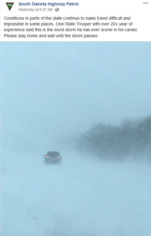
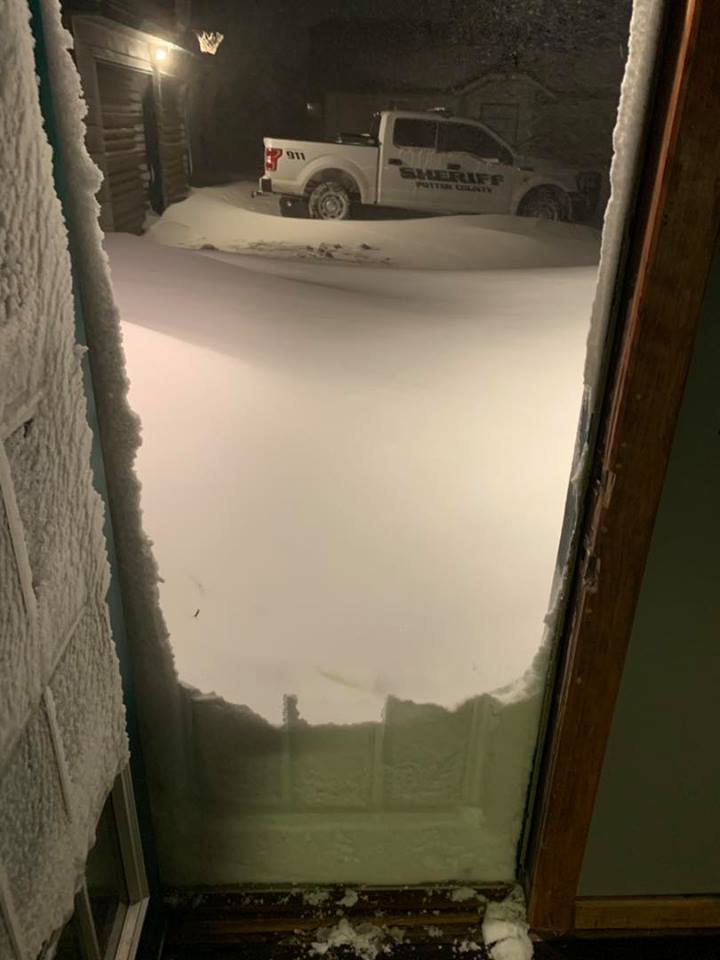
| Photo courtesy of the Potter County Sheriff on the early morning of March 14th | Blizzard conditions during the early morning of March 14th, courtesy of the Potter County Sheriff | Photo courtesy of the SD Highway Patrol | Photo courtesy of the SD Highway Patrol on Hwy 12 near Bath on March 14th |
 |
 |
 |
 |
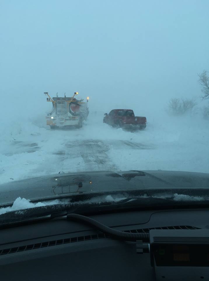
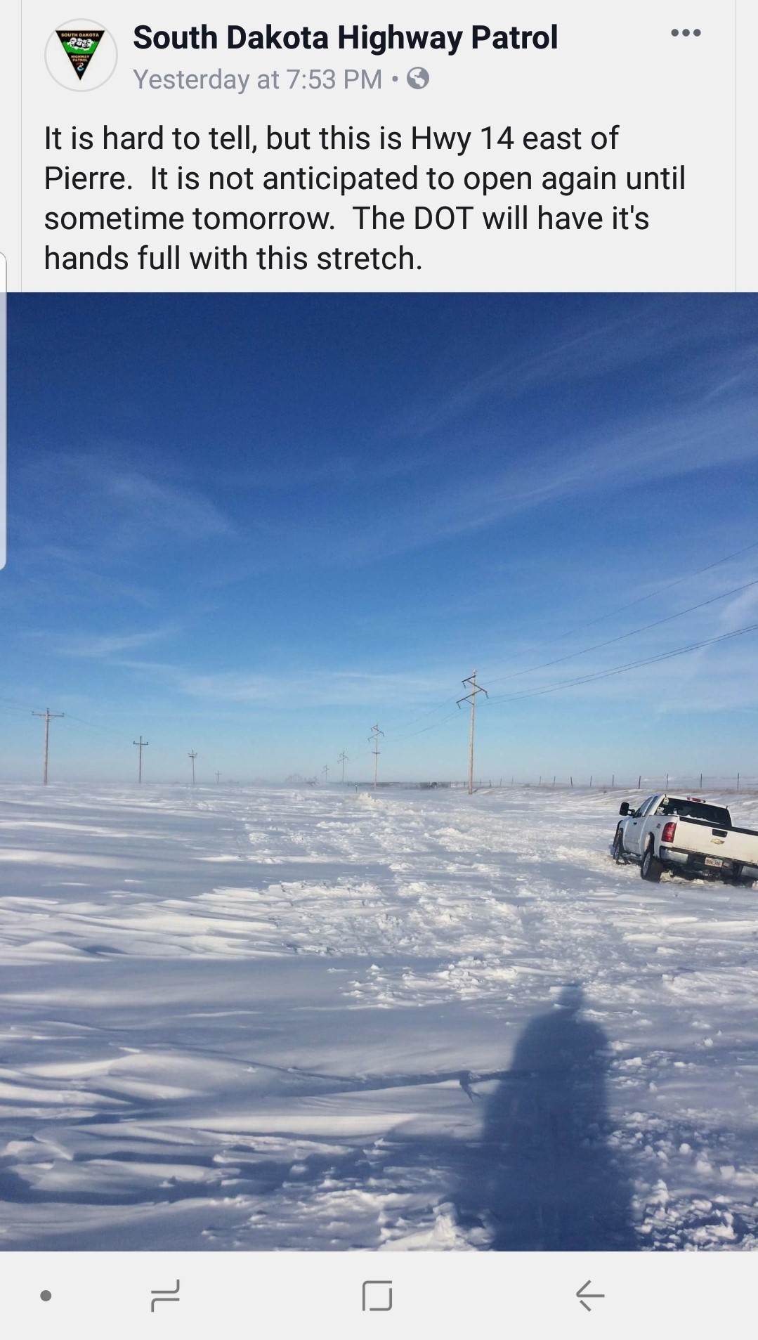
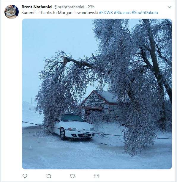
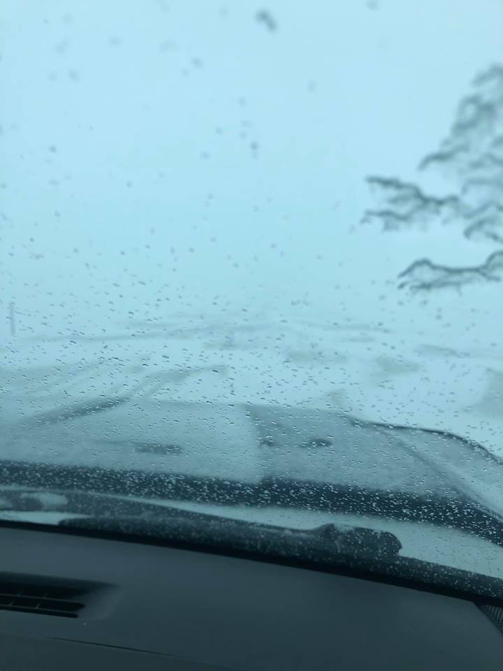
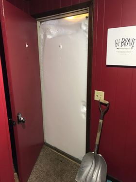
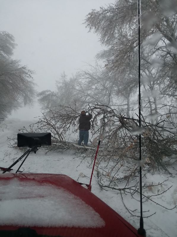
| Hwy 14, east of Pierre, on March 14th. Photo courtesy of the SD Highway Patrol | Damage after freezing rain and strong winds in Summit. Photo courtesy of Morgan Lewandowski, relayed via Brent Nathaniel | Selby on March 13th, courtesy of the Walworth County Sheriff | Heavy snow/drifting observed by the Walworth County Sheriff |
 |
 |
 |
 |
| Westport, after the blizzard, courtesy of Julie Daggett-Brotzel | Westport, after the blizzard, courtesy of Julie Dagget-Brotzel | Damage after freezing rain and strong winds 1 mile west of Summit, courtesy of Diane Knutson | 12 foot drift in southwest Edmunds County, courtesy of a NWS employee |
Radar, Satellite, Pressure
 |
 |
.gif) |
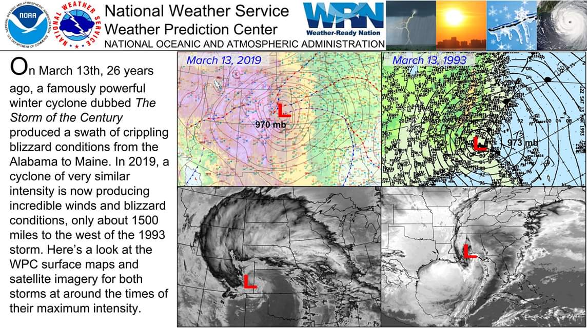 |
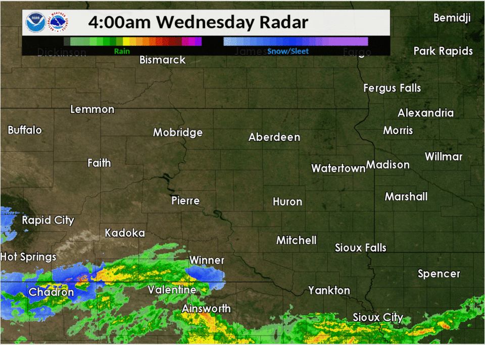
| Radar reflectivity with approximate precipitation type from 4am Wed, March 13th through 4pm Thu, March 14th | Approximate rain/snow line as of 3pm on March 13th | GOES-16 Infrared Satellite Imagery from 7am to 1pm CDT on March 13th, from the CIRA RAMMB - SLIDER | Comparison of two very intense, historic storm systems, courtesy of the WPC |
 |
 |
||
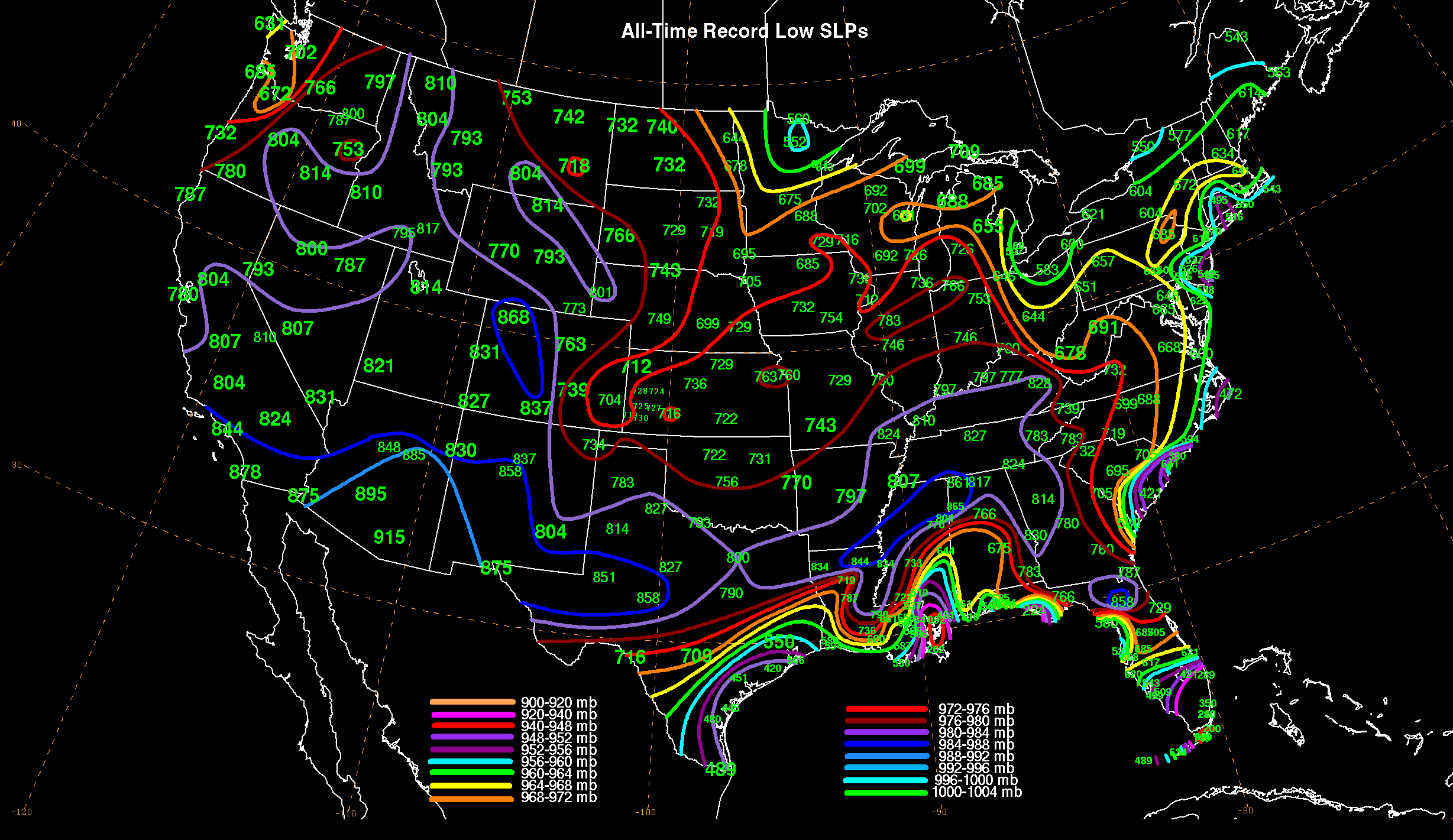
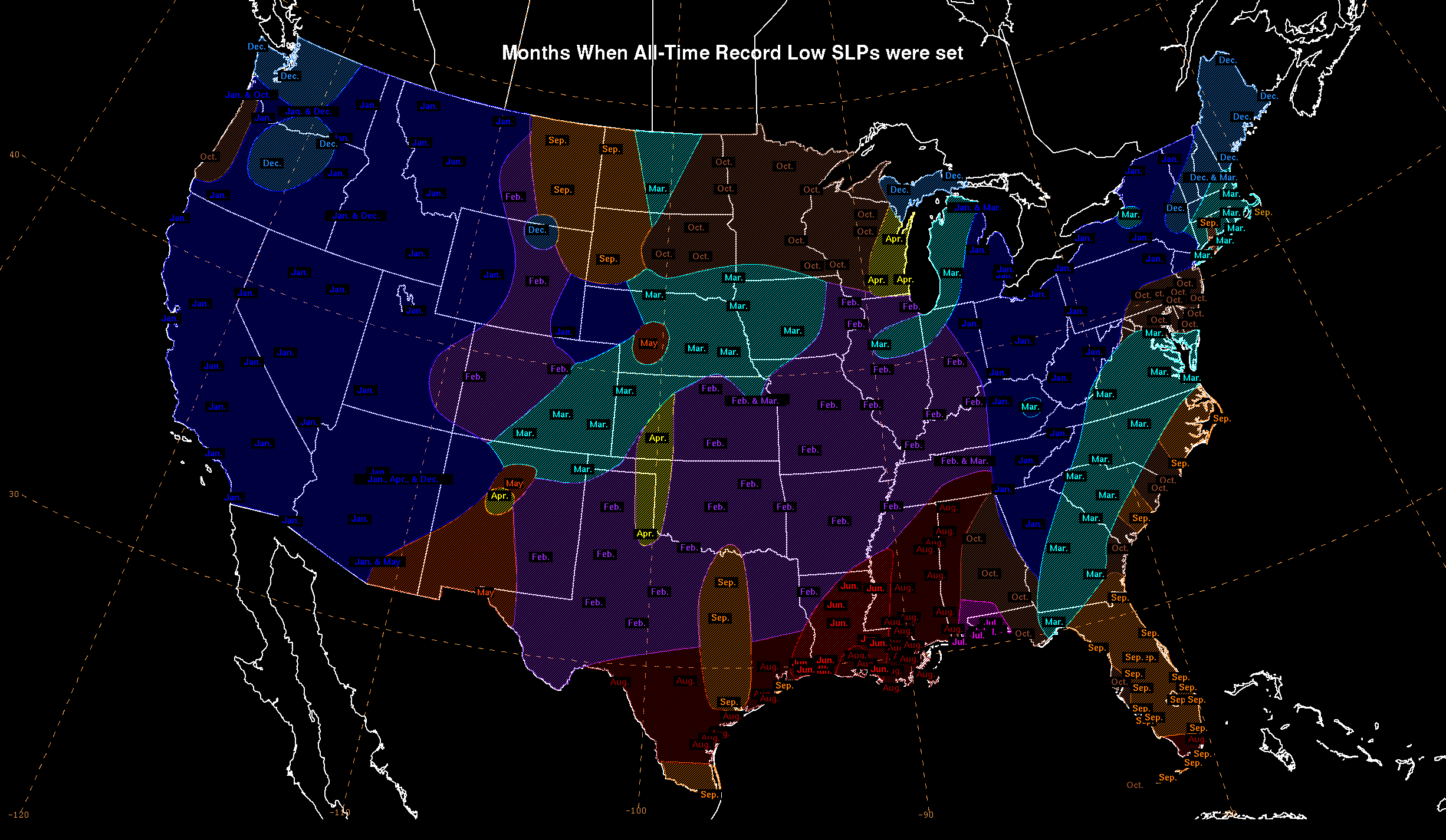
| A preliminary all-time Colorado state record low pressure was recorded in Lamar: 970.4 mb. Above image from the WPC shows all-time record low pressure values nationwide for comparison | Months in which nationwide all-time record low pressure values have been set, from the WPC |
 |
Media use of NWS Web News Stories is encouraged! Please acknowledge the NWS as the source of any news information accessed from this site. |
|

