Anchorage, AK
Weather Forecast Office
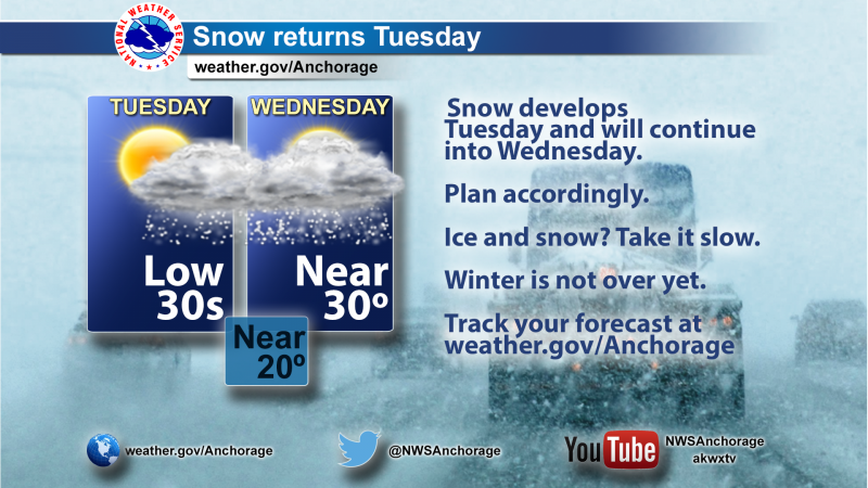
Accumulating snow will begin in Western Prince William Sound and the Kenai Peninsula Tuesday morning. Snow will move into Anchorage and the Matanuska and Susitna Valleys by midday.
Plan accordingly. Snow will increase in intensity during the Tuesday afternoon and evening commute. Expect winter driving conditions through Wednesday as snow will fall through the day.
Check road conditions at 511.alaska.gov.
While snowfall intensity may not reach heavy enough amounts for our team to send alerts (watches, warnings or advisories), the duration of snowfall may have impacts to your activities... especially after the recent dry stretch of weather. It is possible that snow will continue through the end of the week.
In the meantime, our meteorologists are updating their forecasts with the most up-to-date information and will have specific snowfall amounts available later this afternoon.
Track your forecast at weather.gov/Anchorage.
Send your snow reports to us at here.
US Dept of Commerce
National Oceanic and Atmospheric Administration
National Weather Service
Anchorage, AK
6930 Sand Lake Road
Anchorage, AK 99502
907-266-5105
Comments? Questions? Please Contact Us.

