The National Weather Service (NWS) issues messages for geographical areas that Weather Forecast Offices (WFOs) pre-determine, called forecast zones, across land and sea. For land-based forecast zones, these are referred to as “public forecast zones.” For marine environments, these are referred to as "marine forecast zones."
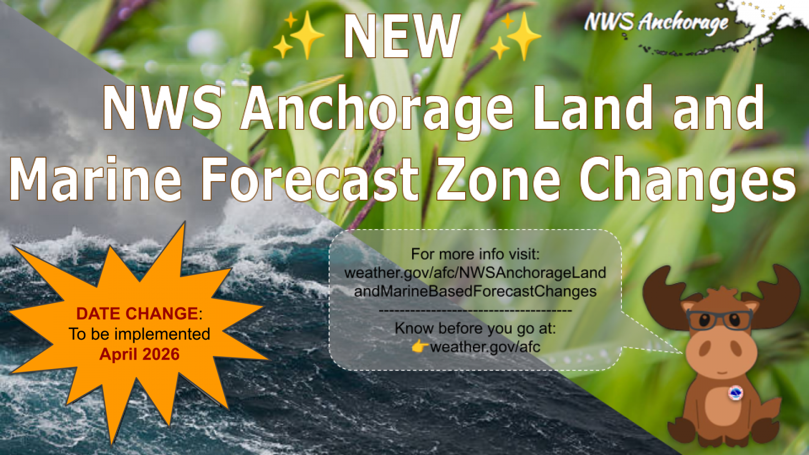
In an effort to continue to redefine our forecast zones, and be more in-tune with regional and local forecast needs, our forecast office worked closely with local community leadership and incorporated climatology, alert needs, and locally-identifiable naming conventions in the implementation of these new forecast changes. With this April’s forecast zone upgrade, NWS WFO Anchorage will make a series of edits to previous forecast zones. We believe this will provide a vast improvement to those who live and transit through the affected areas across Southern Alaska.
For the complete list of anticipated changes to forecast zone names and numbers, please refer to the Service Change Notice (linked below). Zone change implementation will occur April 16, 2026.
For now, know that the changes being made are as follows:
Of note, there will be one new marine zone created, zone AKZ768 and will be named Unimak Pass. This is the zone that will reflect the Unimak Pass area that is heavily used for shipping traffic. The adjacent zones 770-775 and 759 had their borders adjusted to accommodate this new marine zone and to ensure proper boundaries with public zones were maintained. These adjustments were minor so zone numbers and names remained the same. Importantly, numbers and names were kept the same at the request of partners and the communities in these areas.
The read the Service Change Notice for further details.
Preliminary shapefiles are available online as follows: for public, for marine, for fire weather forecast zones, and for County Warning Area boundaries. Final versions of these shapefiles will be available on March 24, 2026.
NWS partners and users should take the appropriate action to ensure systems recognize the new UGCs and new zone alignments and names. In addition, NOAA Weather Radio All Hazards (NWR) listeners using receivers equipped with Specific Area Message Encoding (SAME) will need to add new SAME location codes to their receivers prior to April 2026.
The NWS issues forecasts, watches, and warnings for public, fire and marine weather by zones. Local effects such as elevation or proximity to large bodies of water can cause highly variable weather across zones.
One of the ways the National Weather Service disseminates information is by broadcasting official watches, warnings, forecasts, and other hazard information 24 hours a day, 7 days a week via the NOAA Weather Radio All Hazards (NWR). This message alerting system functions based on areas defined by borough, census area, municipality, county and parish boundaries.
In hopes of providing quality public support, NWS Anchorage has been working on a multi-year, multi-phase effort to align forecast zone boundaries with borough, municipality, and census area boundaries, in addition to capturing microclimates in familiar naming conventions. With the implementation of these forecast zone changes by WFO Anchorage in April 2026, there should be a reduction in issues noted since the previous update in the last few years.
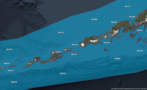
Akutan Island is currently grouped with the West Aleutian Census Area, when in fact, it's part of Aleutians East Borough. Akutan will grouped correctly into the appropriate Borough, aligning alerting needs. This will also aid with known wind climatology in the Unimak Pass and areas east within the Borough.
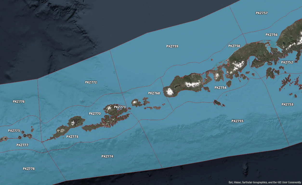
In April 2026, Akutan will be part of Land-Based zone AKZ781. This zone will be renamed "Aleutians East Borough." The offshore marine zones will be pulled west to align with the new land-based zone, helping to capture the gap winds in the area, and a new Coastal Waters Marine Zones (out to about 15 NM) will be created and called PKZ768, or "Unimak Pass."
Other naming convention changes will be made to eliminate confusion communicated to the NWS:
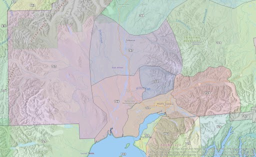
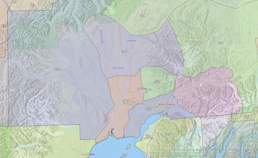
The Petersville community was split into three separate land-base zones: 745, 746 and 747. This will be fixed in April 2026. See image below. This change will also reflect the river basin more accurately and give the 745 zone a stronger identity.
The following zone changes will also be applied to the fire weather zones (numbers will remain the same), in addition to the public forecast zones to keep fire and public zones aligned to the best degree possible.
To better serve the fire community and better align with fire weather needs and fuel types, a minor change is planned along the leeside of the Kenai Mountain Range to pull the boundary back towards the base of the mountains. Please note that due to alerting needs, there will be no changes made to the public zones in the Kenai Peninsula Borough and that this change will only be reflected in the Fire Weather Zones.
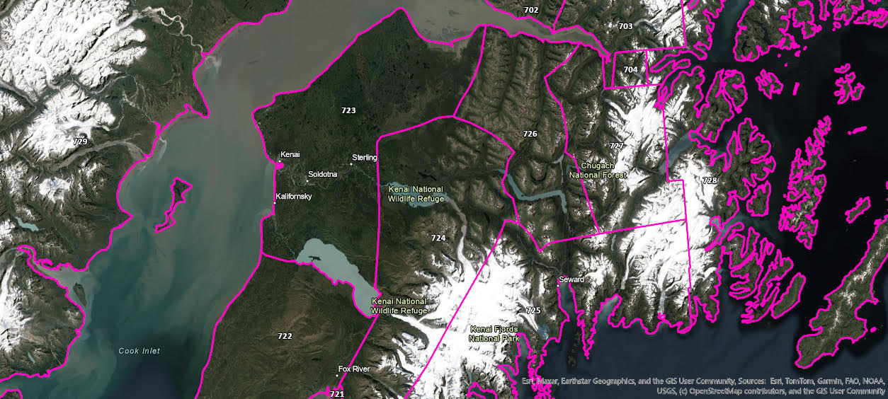
The image above will now only reflect the Public Forecast Zones.
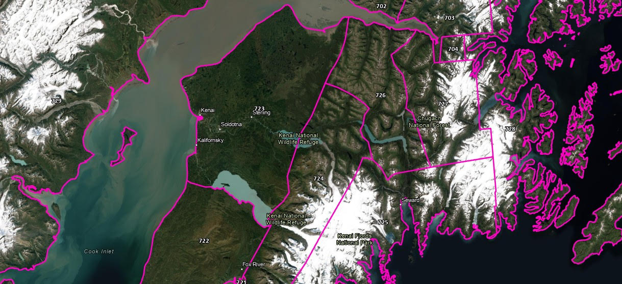
The image above will only reflect the new Fire Weather Zones in the Kenai Peninsula Borough. The new fire weather zones will change as follows:
We hope that as communities interact with our forecast zones, that they feel comfortable approaching us if zone names are deemed confusing or could be made to better represent their region. A list will be compiled with the goal of all zones reflecting the needs and names of the communities they are meant to serve. This includes incorporation of Native naming conventions.
Thank you for viewing

