Anchorage, AK
Weather Forecast Office
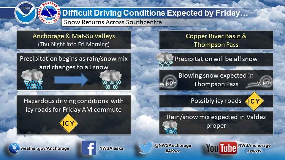
Difficult driving conditions are expected across Southcentral for the end of the week as a new system moving in from the northwest brings wintry weather to the area.
The highest amounts of snow will be found along west-facing slopes of the Talkeetna and Chugach mountains as well as the Northern Susitna Valley and Copper River Basin.
Expect precipitation to start as a rain/snow mix for Anchorage and Mat-Su Valleys Thursday night and change over to all snow by Friday morning. Snowfall amounts will vary in from a trace to 3 inches in the Anchorage area.
In the Copper River Basin and Thompson Pass regions, precipitation will fall as all snow on Friday. Strong winds will also accompany the snow for these areas. In Valdez proper, precipitation will remain a mix of rain/snow.
We appreciate your storm reports and pictures (post to Facebook or Twitter).
US Dept of Commerce
National Oceanic and Atmospheric Administration
National Weather Service
Anchorage, AK
6930 Sand Lake Road
Anchorage, AK 99502
907-266-5105
Comments? Questions? Please Contact Us.

