Overview
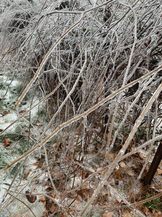
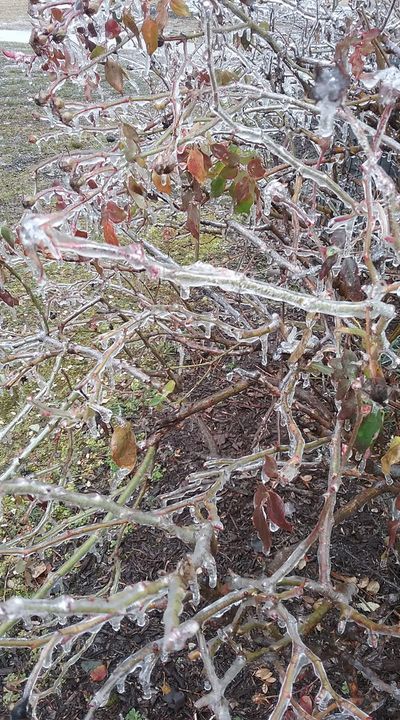
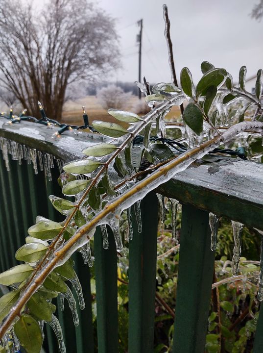
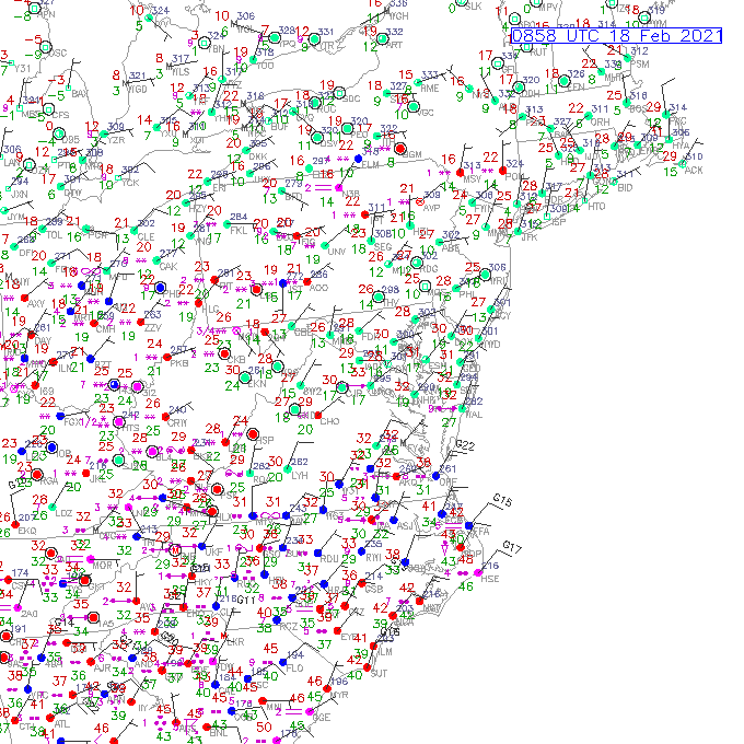
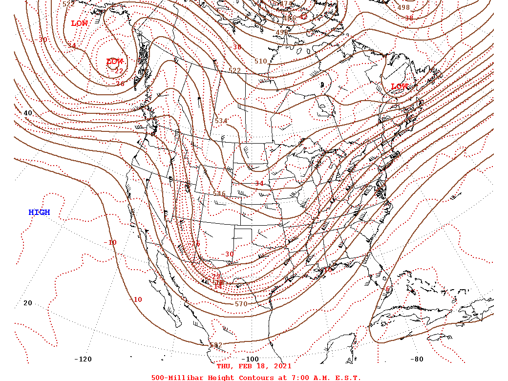
A large upper trough slowly moved from the Plains to the Mississippi River Valley from February 18th to 19th. This allowed for a prolonged period of moist SW flow in the mid levels to occur over the eastern CONUS during this time. Several spokes of shortwave energy in the flow aloft produced waves of precipitation over the eastern part of the country from the 18th to the 19th. Locally, there were two distinct waves of precipitation that moved across our area: one that occurred during the early morning-midday on the 18th and a second wave of light to moderate precipitation that moved across the area during the early to mid morning on the 19th. Strong surface high pressure centered from the Midwest to New England helped to supply low-level cold air to the area, as a prolonged Classic Cold Air Damming regime was in place throughout the duration of the event. With warmer air present aloft (with further warming from 925-700 mb throughout much of the event), precipitation fell in the form of sleet and freezing rain across most of the area during the morning of the 18th. NE flow off the water allowed precipitation to remain rain during the 18th to 19th across coastal portions of E/SE Virginia and NE NC. Most of the freezing rain during the morning of the 18th was confined to a 50 to 75 mile wide area with mainly sleet to the NW and rain to the SE. There were even a few rumbles of thunder across south-central/SE VA and NE NC during the morning of the 18th, as some elevated instability was in place due to strong warm air advection a few thousand feet above the surface. Ice accretion amounts of 0.10-0.20" were common from interior south-central VA to the Richmond metro by noon on the 18th. Precipitation was moderate to locally heavy in intensity across parts of the area during the morning of the 18th, and roads rapidly became icy where precipitation fell in the form of sleet (which was mainly over N and NW portions of the AKQ CWA). Sleet totals up to 1-1.5" were observed in spots! Fortunately, the ice on trees melted across parts of the area during the afternoon as the precipitation lightened in intensity and temperatures rose above freezing. This melting likely played a part in making the event less severe than it otherwise would have been.
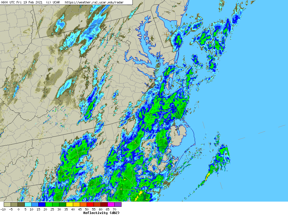
A second wave of precipitation overspread central/east/northeast portions of the area during the early morning hours on the 19th. By this time, temperatures aloft had warmed enough that precipitation type was rain or freezing rain. Temperatures had cooled to 29-31°F from South Central VA to the Richmond Metro to the VA Northern Neck before the the light to moderate precip moved in. This second wave of precipitation exited by late morning to midday, but not before an additional 0.10-0.30" of ice accretion was observed across parts of the area. While several trees and power lines were downed, power outages were much less widespread than what was observed during the 2/12-13 ice storm.
Ice/Sleet Reports
Public Information Statement
National Weather Service Wakefield VA
303 PM EST Fri Feb 19 2021

...FREEZING RAIN REPORTS...

Location                     Amount    Time/Date       Lat/Lon

...Maryland...

...Dorchester County...
2 SE East New Market         0.22 in   1141 AM 02/19   38.58N/75.90W
Hurlock                      0.20 in   1052 AM 02/19   38.63N/75.87W

...Virginia...

...Chesterfield County...
3 SSE Midlothian             0.35 in   0930 AM 02/19   37.47N/77.61W
Bon Air                      0.25 in   1207 PM 02/19   37.52N/77.57W
Chesterfield                 0.25 in   1142 AM 02/19   37.38N/77.51W

...City of Richmond County...
2 NNW Downtown Richmond      0.28 in   1127 AM 02/19   37.55N/77.48W
1 SW Downtown Richmond       0.25 in   1247 PM 02/19   37.52N/77.49W

...Dinwiddie County...
3 NNE Walkers                0.16 in   1227 PM 02/19   37.19N/77.69W

...Greensville County...
Purdy                        0.25 in   1242 PM 02/19   36.82N/77.59W

...Hanover County...
Studley                      0.40 in   0100 PM 02/19   37.68N/77.29W
Mechanicsville               0.20 in   1203 PM 02/19   37.63N/77.36W

...Henrico County...
Varina                       0.20 in   0700 AM 02/19   37.44N/77.35W

...Mecklenburg County...
3 NE Baskerville             0.25 in   1213 PM 02/19   36.72N/78.23W
Chase City                   0.13 in   1222 PM 02/19   36.80N/78.46W

...Nottoway County...
Crewe                        0.25 in   0136 PM 02/19   37.18N/78.13W

...Prince Edward County...
1 SSW Farmville              0.30 in   0700 AM 02/19   37.28N/78.40W

...Prince George County...
2 SSE Fort Lee               0.25 in   1100 AM 02/19   37.21N/77.32W
1 W Prince George            0.25 in   1056 AM 02/19   37.22N/77.30W

...Westmoreland County...
Oldhams                      0.25 in   0100 PM 02/19   38.00N/76.67W
&&
...SLEET REPORTS...

Location                     Amount    Time/Date       Lat/Lon

...Maryland...

...Dorchester County...
2 SE East New Market         0.5 in    1242 PM 02/18   38.58N/75.90W

...Virginia...

...Amelia County...
2 S Deatonville              0.5 in    0800 AM 02/19   37.29N/78.16W

...Caroline County...
Ladysmith                    1.5 in    0700 AM 02/19   38.01N/77.51W
Penola                       1.0 in    0111 PM 02/18   37.96N/77.37W
2 S Dawn                     0.8 in    0700 AM 02/19   37.81N/77.37W

...Hanover County...
Hewlett                      1.1 in    0700 AM 02/19   37.92N/77.58W
Ashland                      1.0 in    1030 AM 02/18   37.76N/77.48W
Montpelier                   0.6 in    0955 AM 02/18   37.81N/77.68W

...Henrico County...
Short Pump                   0.8 in    1220 PM 02/18   37.65N/77.61W

...Louisa County...
Louisa                       1.5 in    1035 AM 02/18   38.02N/78.00W

...Powhatan County...
Powhatan                     0.5 in    1046 AM 02/18   37.54N/77.92W
&&
Photos
 |
 |
 |
| Icing in Crewe, VA (source: Lori Lee - Facebook) |
Icing in Mechanicsville, VA (source: Star Canada - Facebook) |
Icing in Oldhams, VA (source: Alicia Eller - Facebook) |
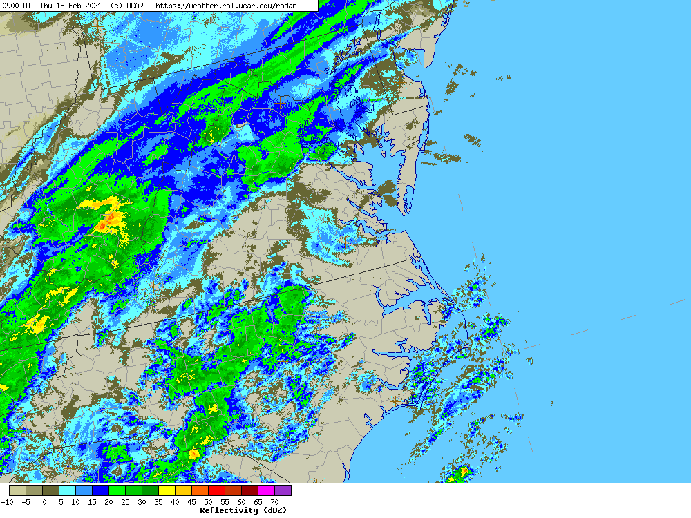
Radar and Observations
 |
 |
 |
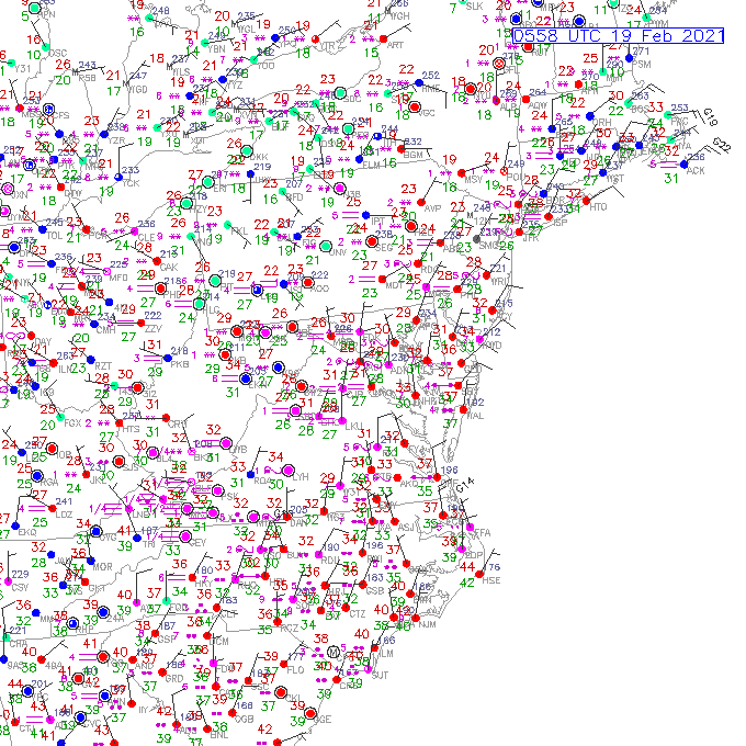 |
| Regional Radar Loop from 4 AM to 1 PM on 2/18 | Loop of Observations from 4 AM to 1 PM on 2/18 | Regional Radar Loop from 1 AM to 11 AM on 2/19 | Loop of Observations from 1 AM to 11 AM on 2/19 |
Selected Ice Storm Reports
1015 AM     ICE STORM        2 W DOWNTOWN RICHMOND   37.53N 77.50W
02/19/2021                   CITY OF RICHMOND   VA   UTILITY COMPANY

            TREE DAMAGE IN WESTOVER HILLS NEIGHBORHOOD.
0816 AM     ICE STORM        MILLERS TAVERN          37.83N 76.94W
02/19/2021                   ESSEX              VA   DEPT OF HIGHWAYS

            MULTIPLE TREES DOWN ON ROUTE 707 IN VICINITY
            OF MILLERS TAVERN ROAD.
0759 AM     ICE STORM        2 SE MIDLOTHIAN         37.48N 77.61W
02/19/2021                   CHESTERFIELD       VA   DEPT OF HIGHWAYS

            VDOT REPORTS MULTIPLE TREES DOWN IN THE
            ROADWAY.
0758 AM     ICE STORM        1 SSW MECHANICSVILLE    37.61N 77.36W
02/19/2021                   HANOVER            VA   DEPT OF HIGHWAYS

            VDOT REPORTS POWER LINES DOWN.
0745 AM     ICE STORM        3 ESE WARSAW            37.95N 76.72W
02/19/2021                   RICHMOND           VA   DEPT OF HIGHWAYS

            TREE DOWN CAUSING LANE CLOSURES ON RT 1102
            IN THE VICINITY OF RED WING LANE.
0725 AM     ICE STORM        1 WSW DOWNTOWN RICHMOND 37.52N 77.49W
02/19/2021                   CITY OF RICHMOND   VA   PUBLIC

            FALLEN STREETLIGHT WITH WIRES ON THE ROAD
            NEAR THE INTERSECTION OF PETERBOROUGH AND
            DEVONSHIRE STREETS.
0721 AM     ICE STORM        2 NNW DOLPHIN           36.87N 77.81W
02/19/2021                   BRUNSWICK          VA   DEPT OF HIGHWAYS

            VDOT REPORTS POWER LINES DOWN IN THE
            ROADWAY.
0720 AM     ICE STORM        3 W SCOTTS FORK         37.31N 77.94W
02/19/2021                   AMELIA             VA   DEPT OF HIGHWAYS

            POWER LINES DOWN ON ROUTE 627 IN VICINITY OF
            FIVE FORKS ROAD.
0616 AM     ICE STORM        4 SE MIDLOTHIAN         37.47N 77.59W
02/19/2021                   CHESTERFIELD       VA   BROADCAST MEDIA

            FALLEN TREE BLOCKING TRAVEL LANES OF POWHITE
            SOUTH NEAR COURTHOUSE RD.
Environment
Upper level synoptic summary.
 |
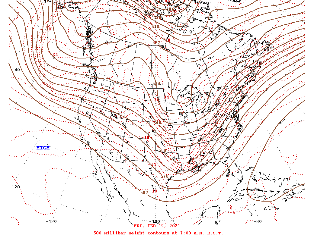 |
| 2/18 12z/7 AM 500 mb Analysis | 2/19 12z/7 AM 500 mb Analysis |
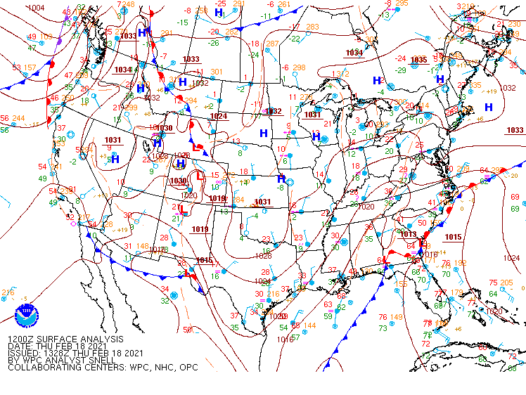
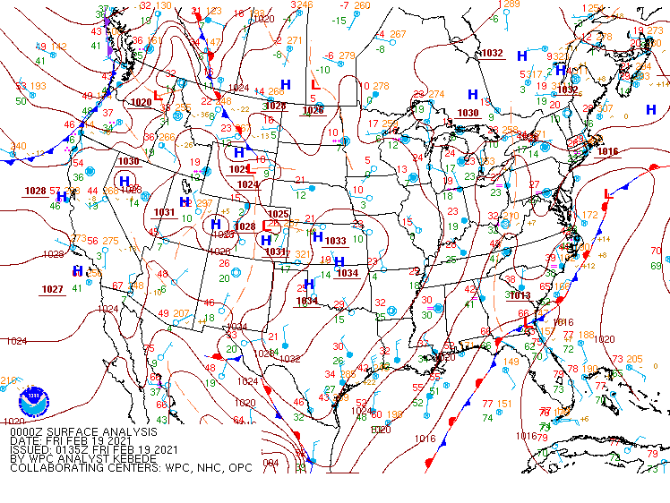
Synoptic Surface Summary.
 |
 |
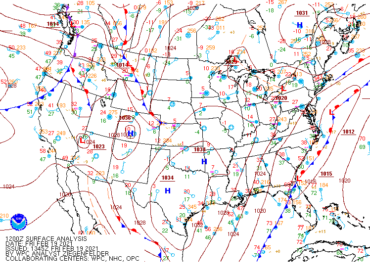 |
| 2/18 12z/7 AM WPC Surface Analysis | 2/19 00z/2-18 7 PM WPC Surface Analysis | 2/19 12z/7 AM WPC Surface Analysis |
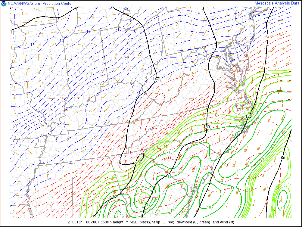
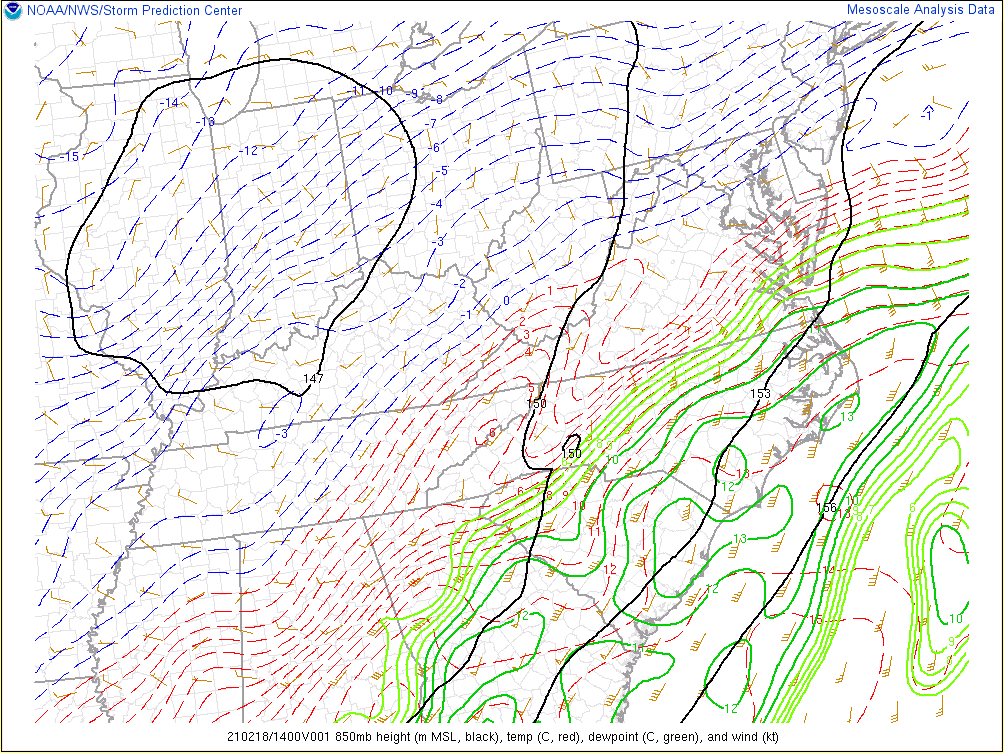
850 mb data.
 |
 |
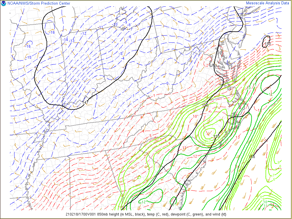 |
| 2/18 12z 850 mb Analysis | 2/18 15z 850 mb Analysis | 2/181 18z 850 mb Analysis |
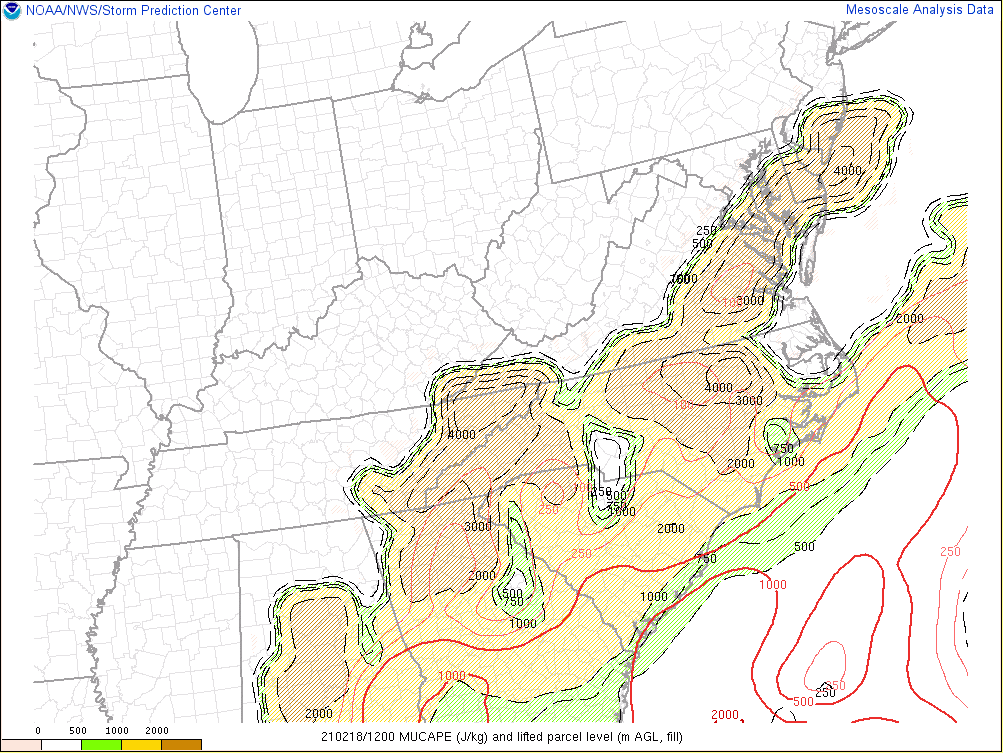
Additional environmental data.
 |
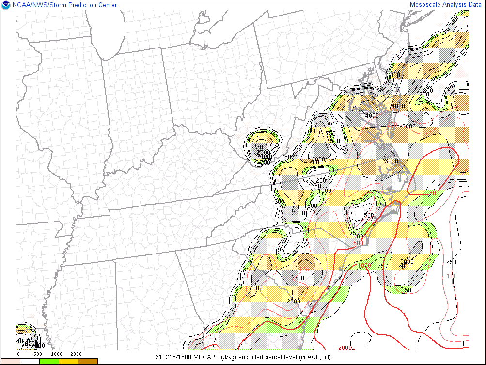 |
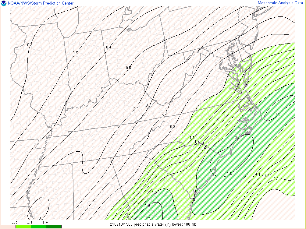 |
| 2/18 12z MUCAPE/LPL Height | 2/18 15z MUCAPE/LPL Height | 2/18 15z Precipitable Water |
 |
Media use of NWS Web News Stories is encouraged! Please acknowledge the NWS as the source of any news information accessed from this site. |
|


 Coastal Flood
 Heat
Heat