HOME
FORECAST
Local
Graphical
Aviation
Marine
Rivers and Lakes
Hurricanes
Severe Weather
Fire Weather
Sunrise/Sunset
Long Range Forecasts
Climate Prediction
Space Weather
PAST WEATHER
Past Weather
Astronomical Data
Certified Weather Data
SAFETY
INFORMATION
Wireless Emergency Alerts
Weather-Ready Nation
Brochures
Cooperative Observers
Daily Briefing
Damage/Fatality/Injury Statistics
Forecast Models
GIS Data Portal
NOAA Weather Radio
Publications
SKYWARN Storm Spotters
StormReady
TsunamiReady
Service Change Notices
EDUCATION
NEWS
SEARCH
Search For
NWS
All NOAA
ABOUT
About NWS
Organization
For NWS Employees
National Centers
Careers
Contact Us
Glossary
Social Media
NWS Transformation
Local forecast by
"City, St" or ZIP code
Sorry, the location you searched for was not found. Please try another search.
Multiple locations were found. Please select one of the following:
Location Help
News Headlines
July 2025 Monthly Weather Summary
NWS Wakefield YouTube Briefing (channel)
NWS Wakefield Daily Briefing (PDF updated by 930 am)
Customize Your
Weather.gov
Enter Your City, ST or ZIP Code
Remember Me
LOADING...
Wakefield, VA
Weather Forecast Office
NWS Wakefield Enhanced Grid Images
Weather.gov
>
Wakefield, VA
> NWS Wakefield Enhanced Grid Images
Current Hazards
Briefing Page
Winter
River Flooding
Local Outlook
Drought
Space
Thunderstorms
Hurricanes
Current Conditions
Air Quality
Observations (Map)
Satellite
Observations (List)
Rainfall
Marine Obs (Map)
Marine Obs (List)
Regional Radar&Satellite
Rainfall Monitor Page
Radar
Local Enhanced Radar
Local KAKQ Standard Radar (low bandwidth)
Regional Standard Radar (low bandwidth)
National Standard Radar (low bandwidth)
Dover Radar(low bandwidth)
Forecasts
Aviation
Map View
Forecasters' Discussion
Tropical
Hourly View
Marine
Beach & Surf
Fire Weather
Forecast Models
Agriculture Weather Page
Routine Text Product
Enhanced Forecast Graphics
Tide Forecast & Reference
Coastal Flood
Rivers and Lakes
Current & Past Streamflow
Ensemble River Guidance
River Forecast Centers
River Observations (Map)
River Forecasts (Map)
River Summary Page
James River Richmond White Water
Climate and Past Weather
CoCoRaHS
24 Hour Summary
Snowfall Records
Past Observed Weather
Past Rainfall
Drought Outlook
Historical Records
Climate Prediction
NWS Wakefield Main Climate Page
Tropical Cyclone Reports
Local Programs
Met Calculator
Office Newsletter
Office Tours
Past Office News Archive & Event Review
SKYWARN
Sun/Moon Data
Astronomical
NOAA WEATHER RADIO
Virtual Presentations
TEMPS
QPF
MARINE
WIND
RH
STATE GRAPHICS
SUB-SECTOR PAGE
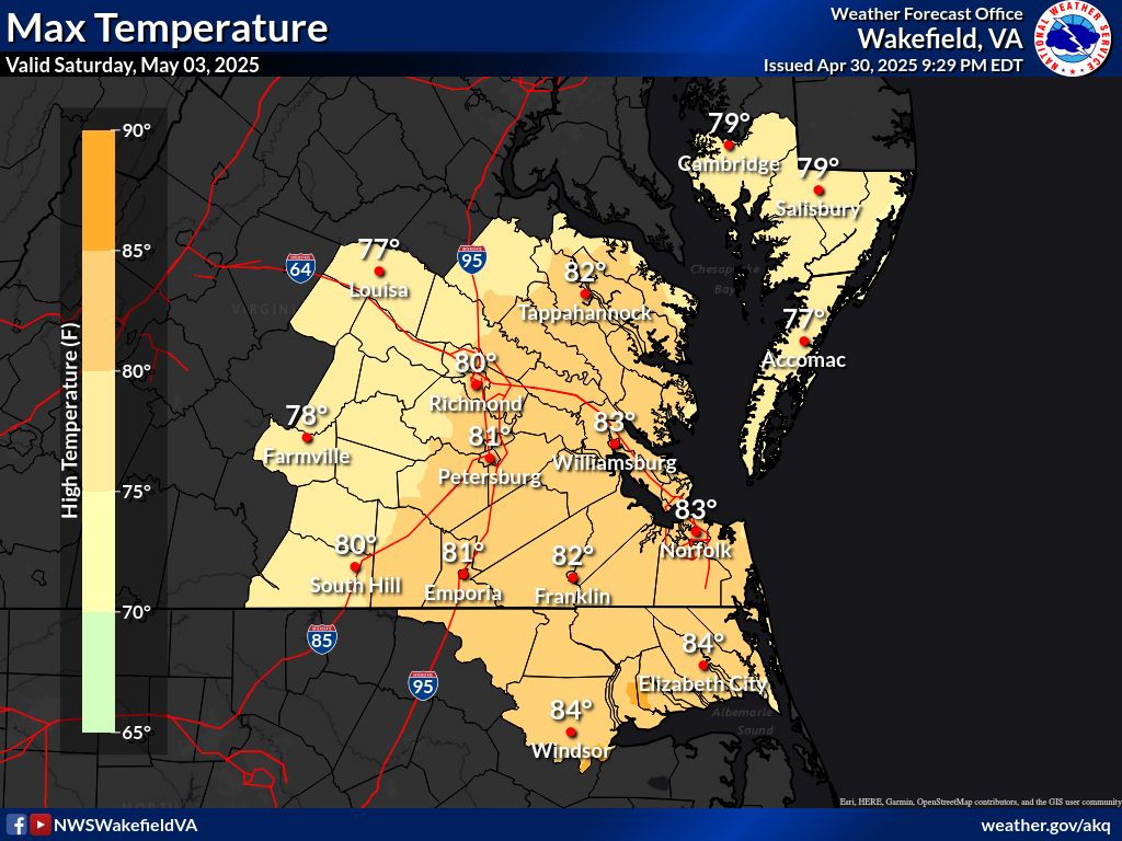
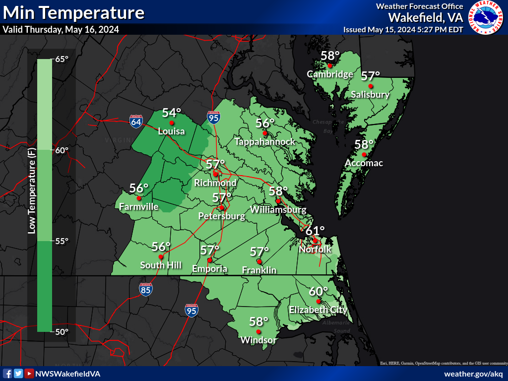
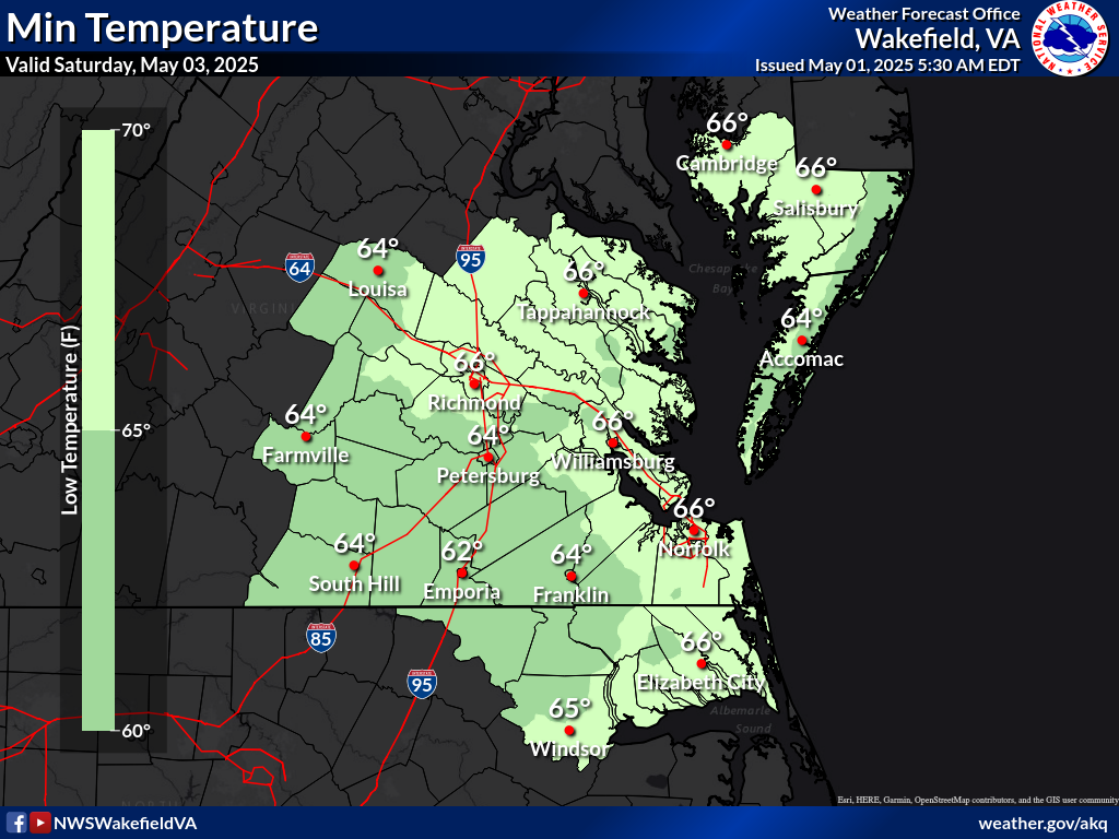
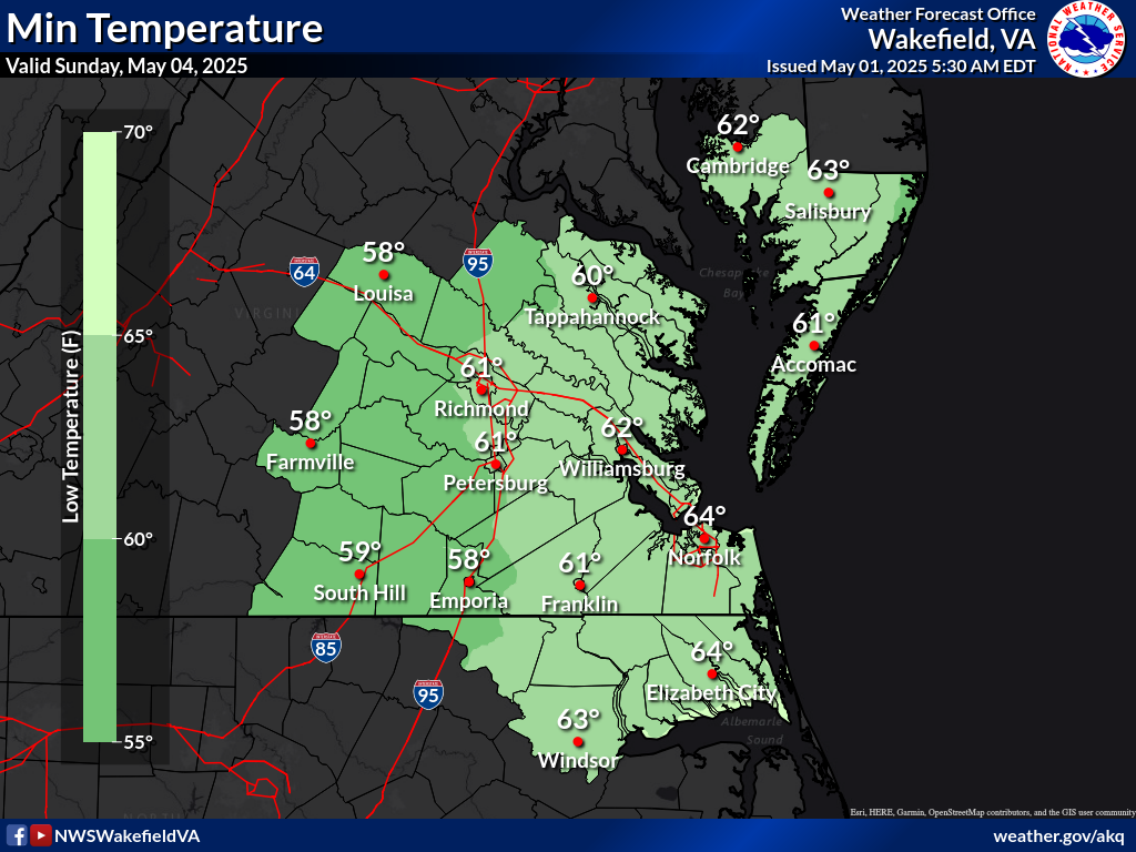
Max/Min Temperature Forecast
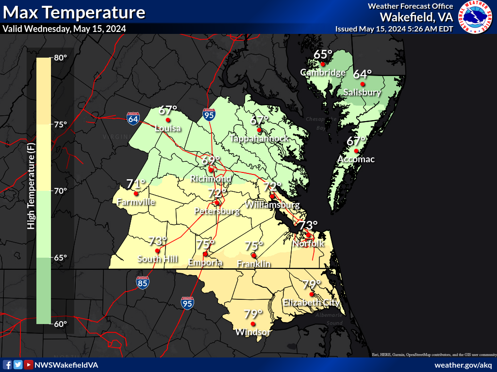
Today High Temp
Tomorrow High Temp
Day 3 High Temp
Tonight Low Temp
Tomorrow Night Low Temp
Day 3 Low Temp
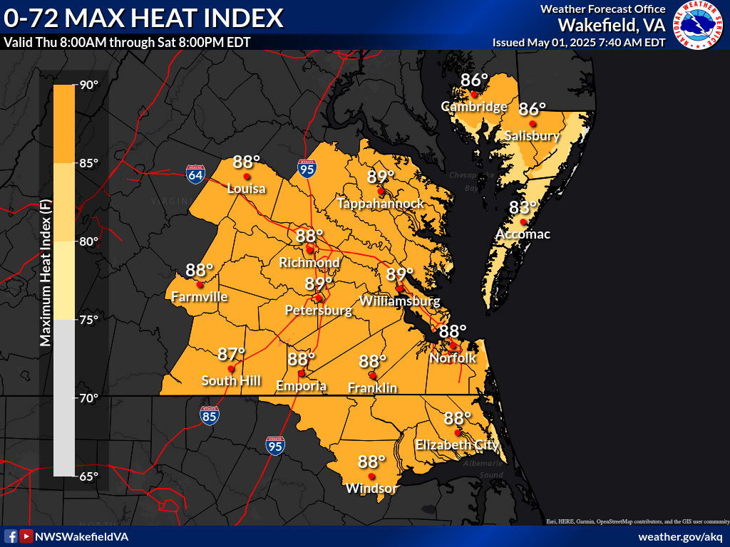
Max Apparent (Or Hottest "FEELING" TEMPS NEXT 24HRS)
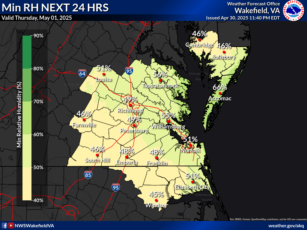
RELATIVE HUMIDITY (MIN)
Min RH Next 24 Hrs
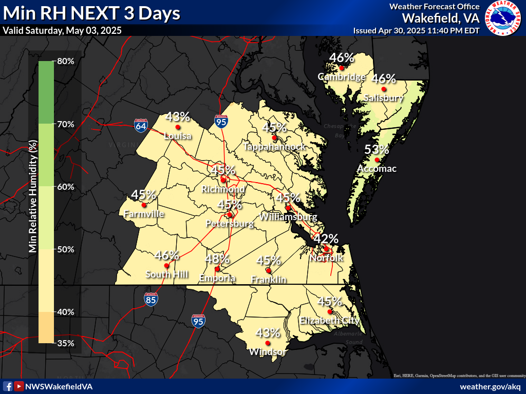
Min RH Next 72 Hrs
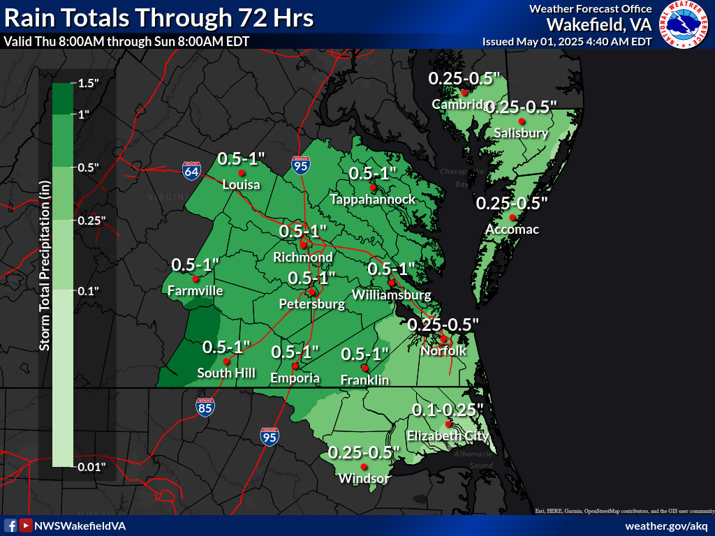
Rainfall Totals
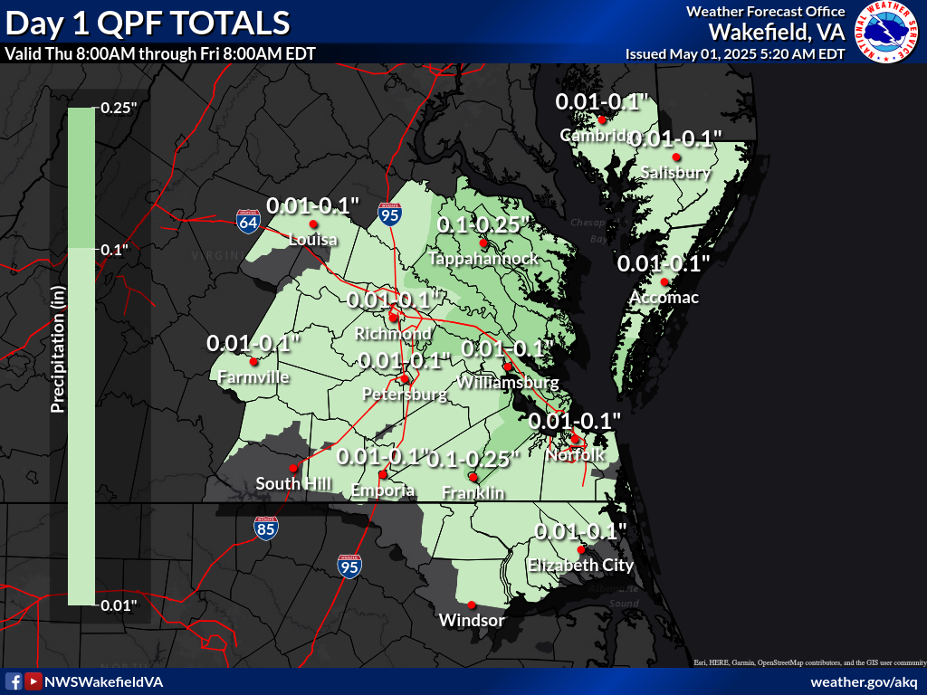
QPF DAY 1 TOTALS
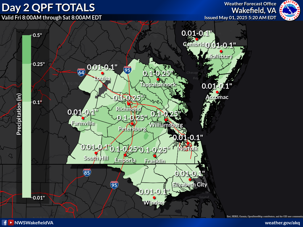
QPF DAY 2 TOTALS
QPF DAY 3 TOTALS
QPF Day 1-3 (72 HR) TOTAL
Marine Centric Data
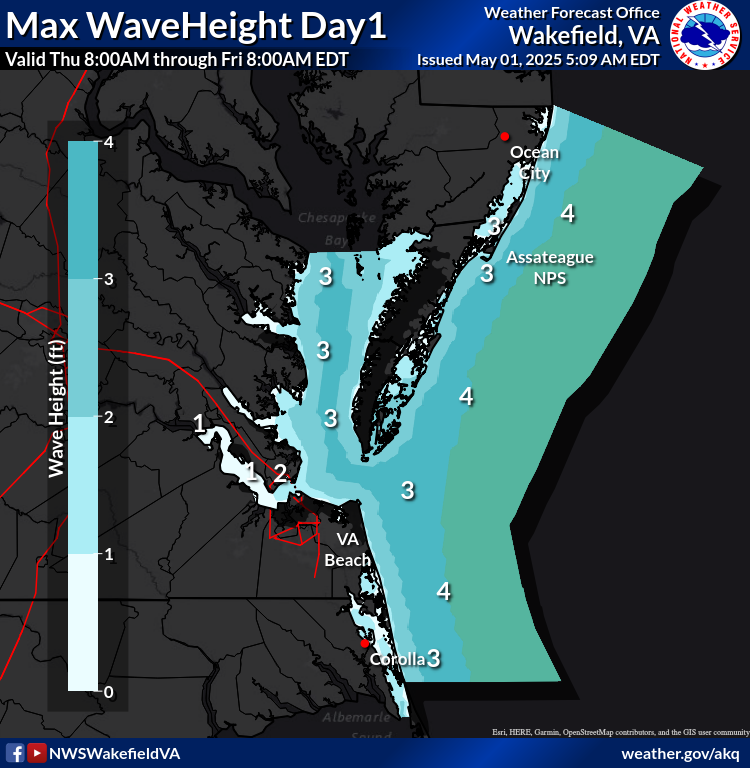
Sig Wave Height Day1
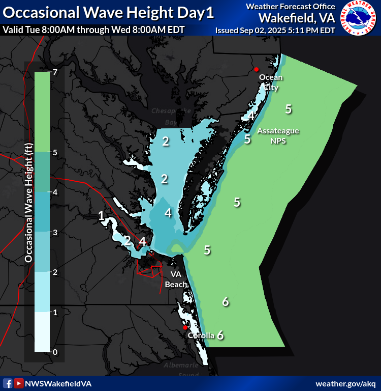
Occasional Wave Height Day1
Sig Wave Height Day2
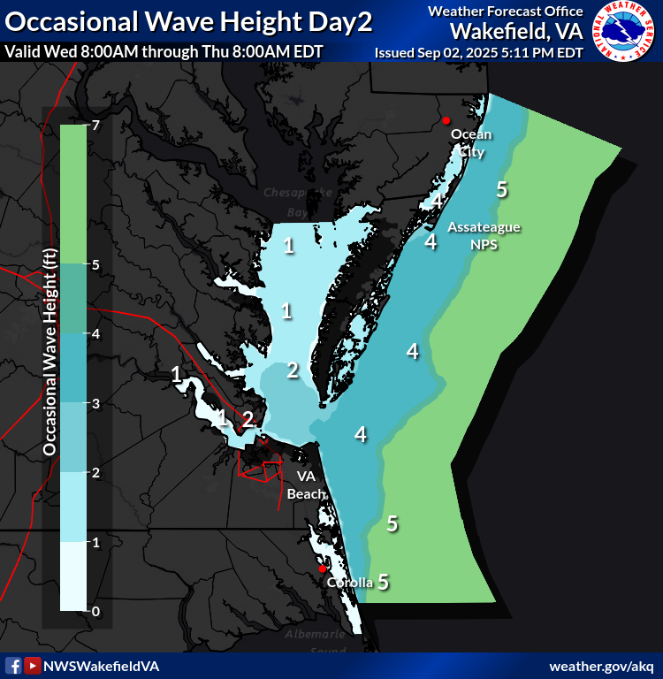
Occasional Wave Height Day2
Sig Wave Height Day3
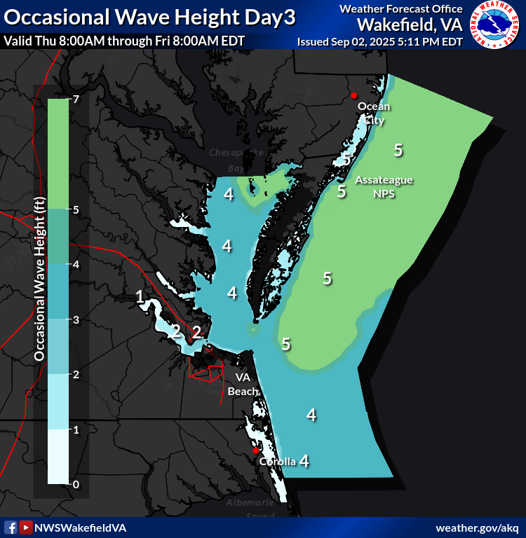
Occasional Wave Height Day3
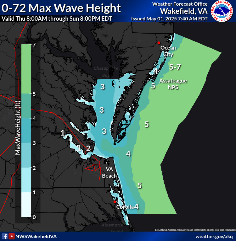
Sig Wave Height 0-72 HRS
Occasional Wave Height 0-72 HRS
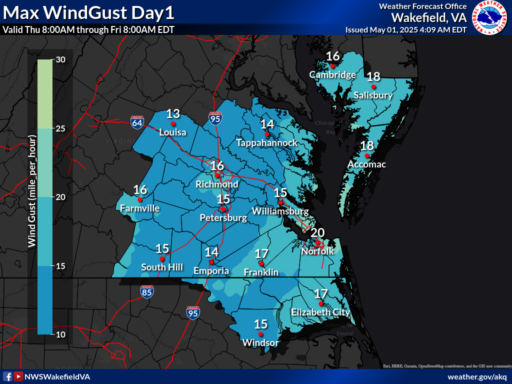
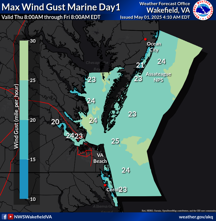
Max WindGust Day1
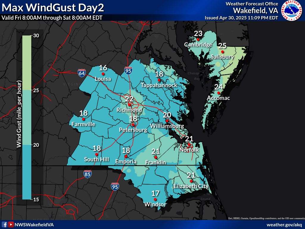
Max WindGust Day2
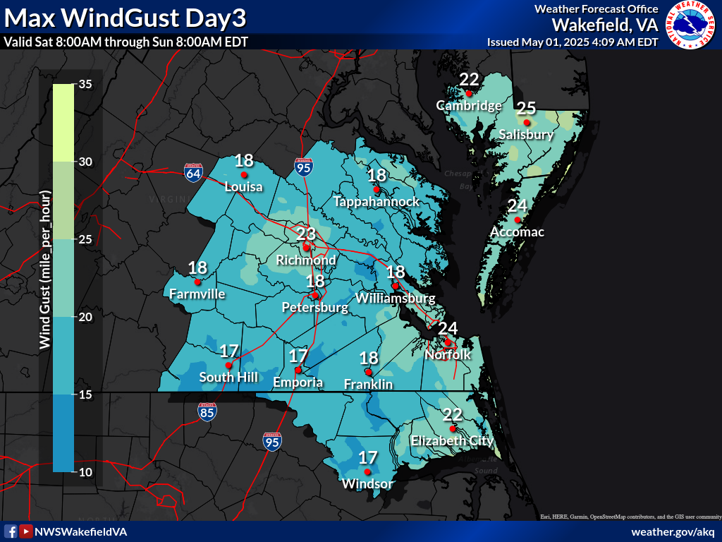
Max WindGust Day3
Max WindGust 0-72 Hrs
Forecast Sustained Wind Over Land
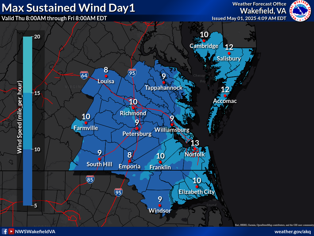
Max Sustained Wind Day1
Max Sustained Wind Day2
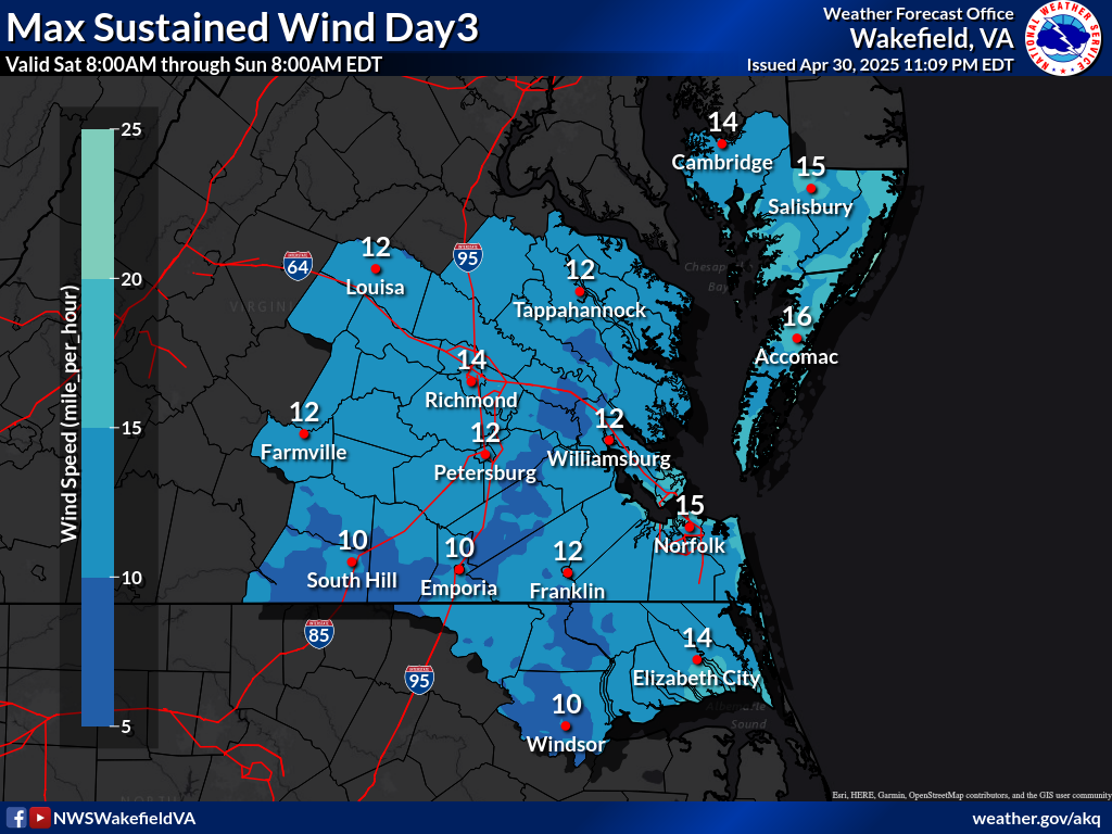
Max Sustained Wind Day3
Forecast Wind Gust Over Land
Max Wind Gust Day1
Max Wind Gust Day2
Max Wind Gust Day3
Max Wind Gust 0-72 Hr
Radar
Current Weather
Rivers & Lakes
Satellite
Forecast Maps
Hour by Hour Forecast
Tropical Weather
Graphical Hazards
Briefings
Marine Forecasts
Forecaster's Discussion
SKYWARN
Submit Storm Report
Climate Data
Fire Weather
Beach & Surf
Coastal Flood
Heat
Follow us on X
Follow us on Facebook
AKQ RSS Feed


 Coastal Flood
 Heat
Heat 