Overview
A mesoscale convective system (MCS) tracked south-southeastward across Lake Michigan during the early morning hours of July 29th. Its associated MCV moved to a position to just north of Fort Wayne, Indiana by ~7 AM on the 29th (as the MCS was weakening). WNW flow aloft allowed that MCV to move rather quickly to the east-southeast during the day on the 29th, entering far northwest VA by the middle of the afternoon. During the day, the convection immediately adjacent to the MCV remained sub-severe. By 4:30 PM, a lone thunderstorm near the center of the MCV began rapidly strengthening just to the north of Fredericksburg, Virginia. The storm quickly became a right moving supercell as it tracked from just north of Fredericksburg to near Williamsburg from 4:30 to just after 8 PM before weakening. The environment was characterized by moderate instability but anomalously strong deep layer shear (due to 40-45 knot west-northwesterlies at 500 mb). Extensive straight line wind damage (estimated wind speeds were 70-80 mph) was observed along its track. In addition, hail up to the size of half dollars was observed in the Wakefield forecast area along the track.
Photos
Storm Damage Photos
 |
 |
||
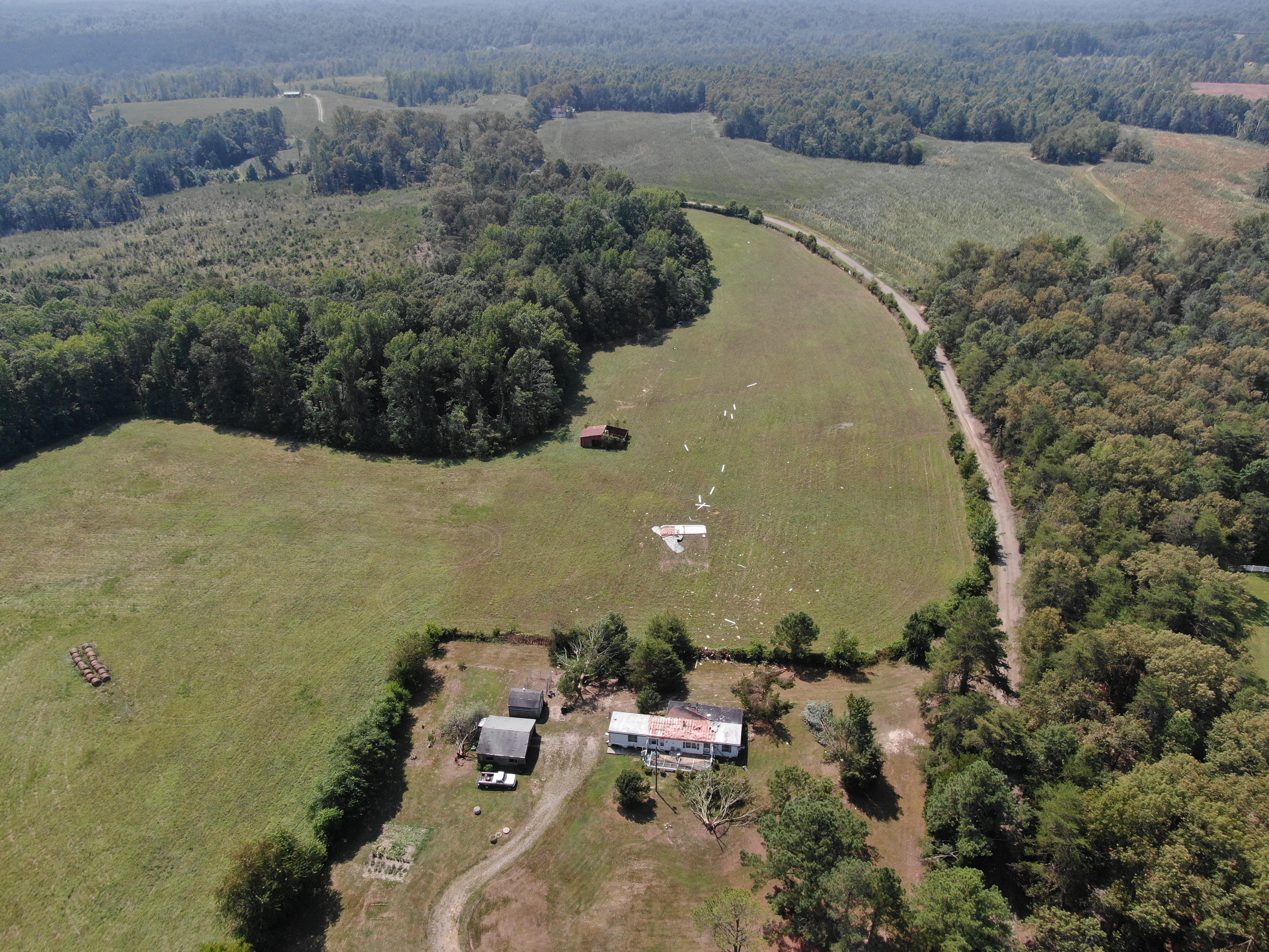
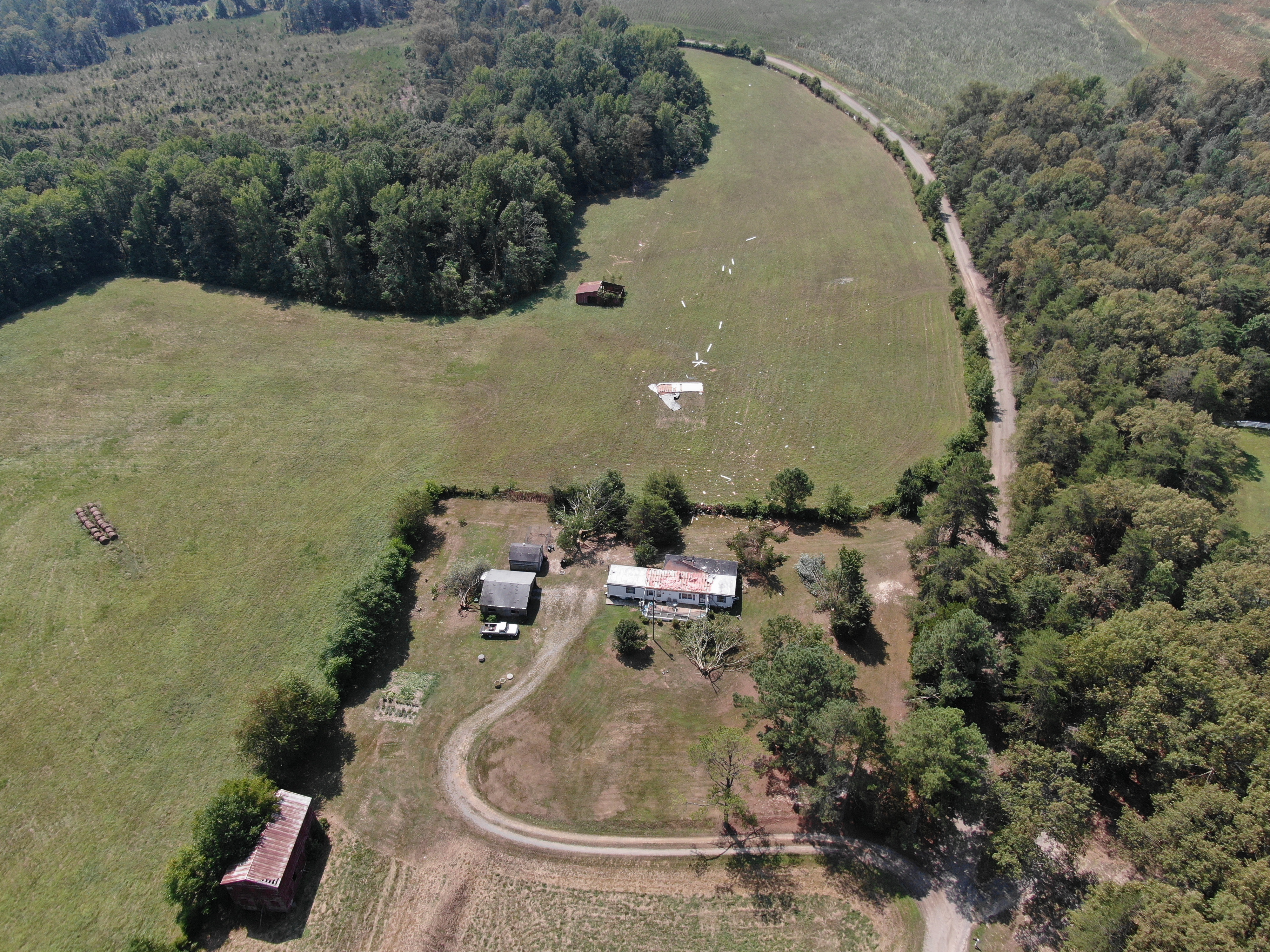
| Drone footage of damage in Caroline County (source: Caroline County Sheriff's Office) | Slightly difference view of drone footage of damage in Caroline County (source: Caroline County Sheriff's Office) | Caption (source) |
Caption (source) |
Radar
Selected Loops/Images
 |
 |
 |
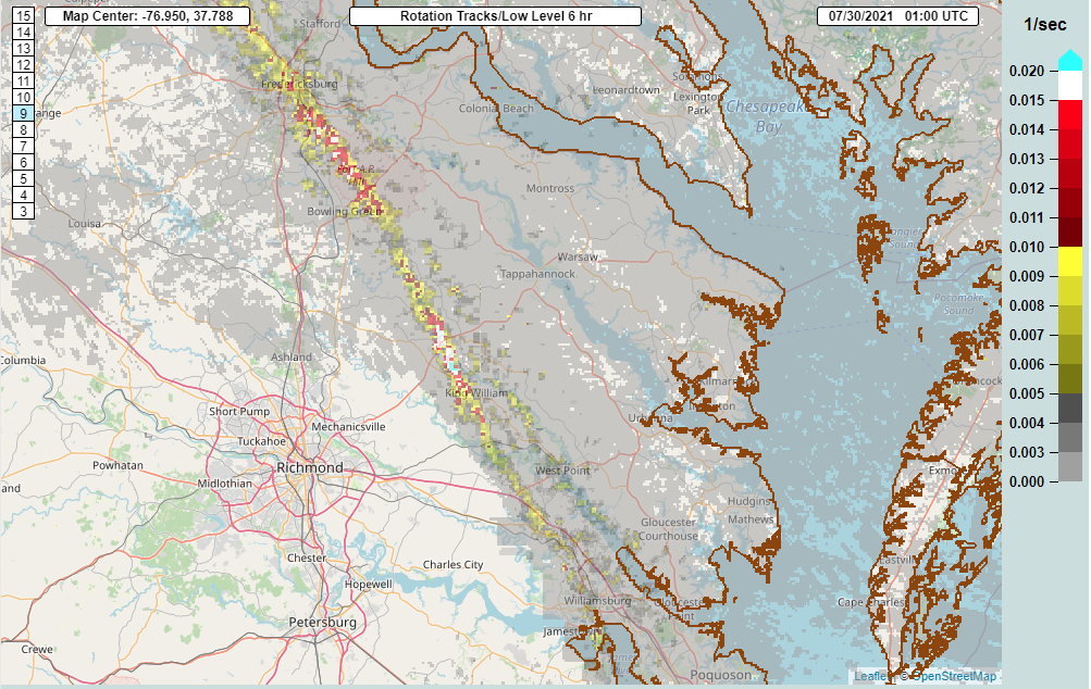 |
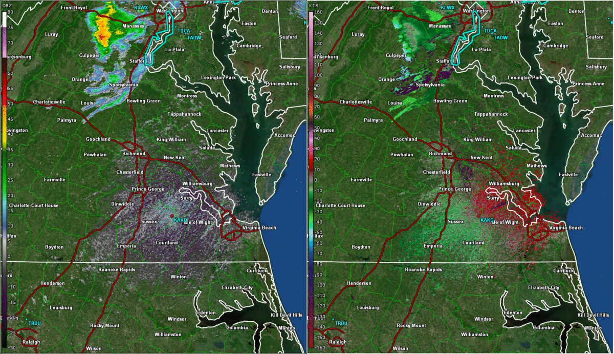
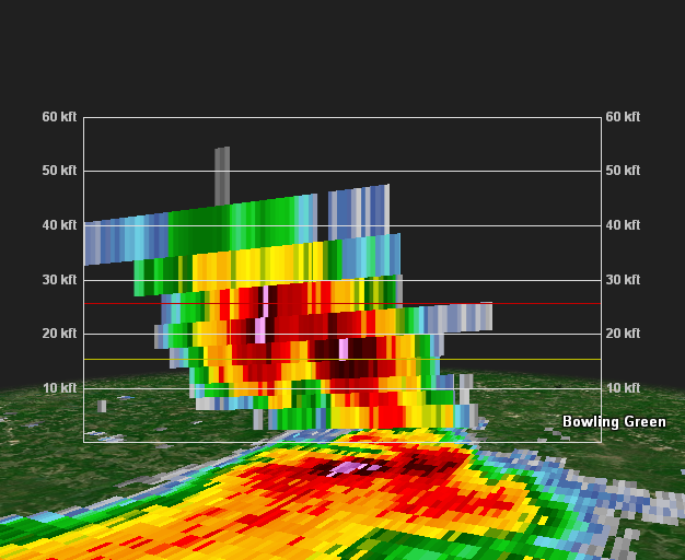
| Radar Loop from ~4:30 to 8:10 PM in approximately 10 minute increments. On the left is 0.5° Reflectivity and on the right is 0.5° Base Velocity | 6:26 PM Radar image of the supercell when it was over Caroline County. On the left is 0.5° Reflectivity and on the right is 0.5° Base Velocity | 6:26 PM Vertical Slice of Reflectivity. A bounded weak echo region (BWER) is clearly evident. In addition, there is a 65-70 dbz core to nearly 30,000 feet AGL. | MRMS Low Level Rotation tracks from 3 PM to 9 PM. |
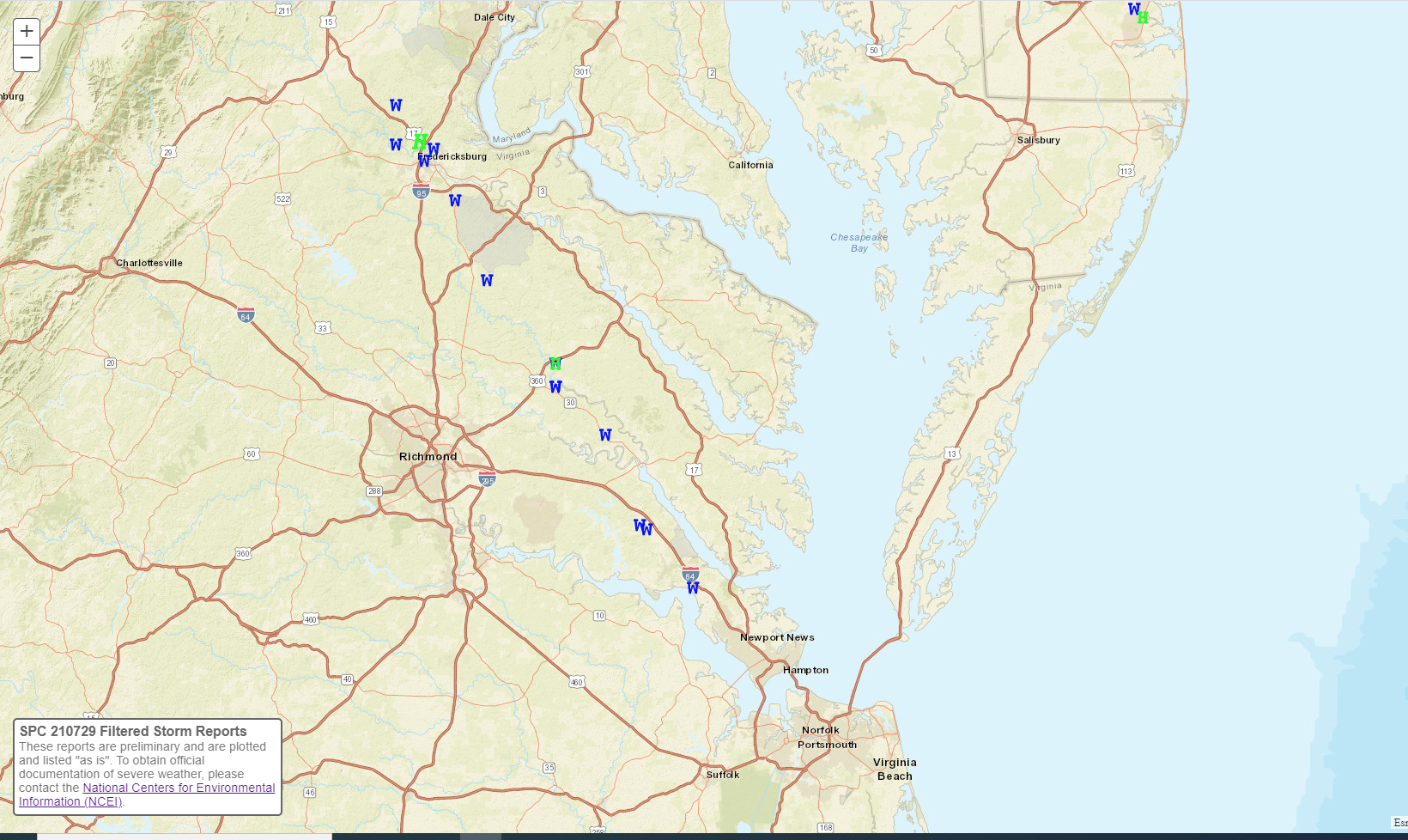
Storm Reports
Environment
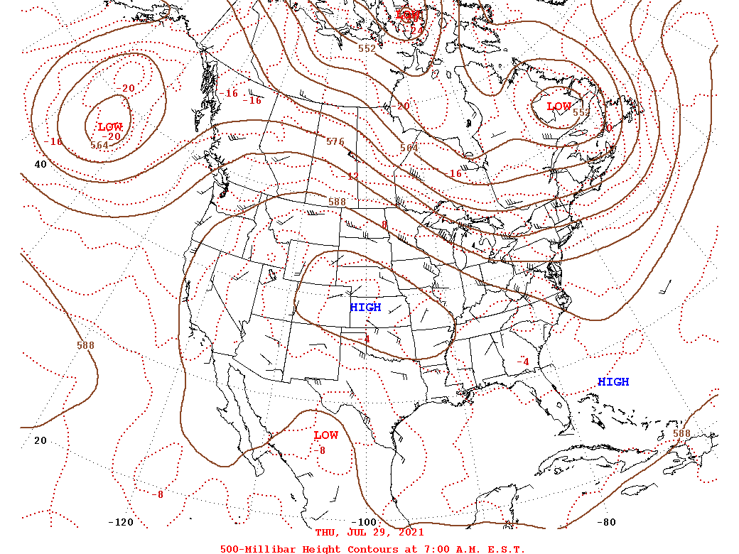
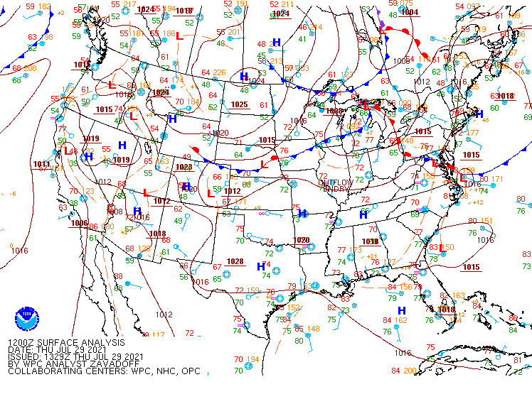
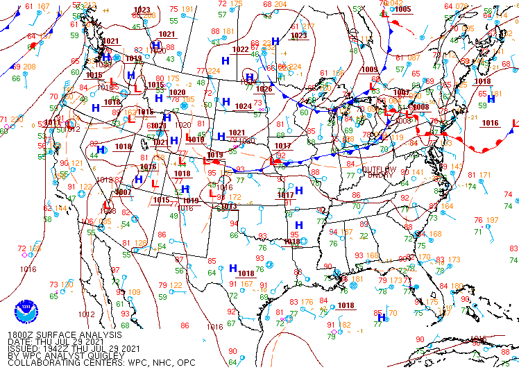
Synoptic summary.
 |
 |
 |
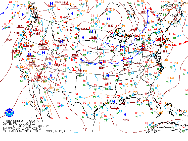 |
| 12z/8 AM EDT 7/29 500 mb Analysis | 12z/8 AM EDT 7/29 WPC Surface Analysis | 18z/2 PM EDT WPC Surface Analysis | 00z/8 PM EDT WPC Surface Analysis |
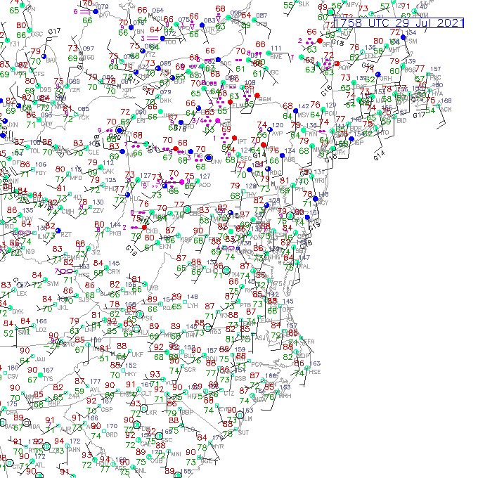
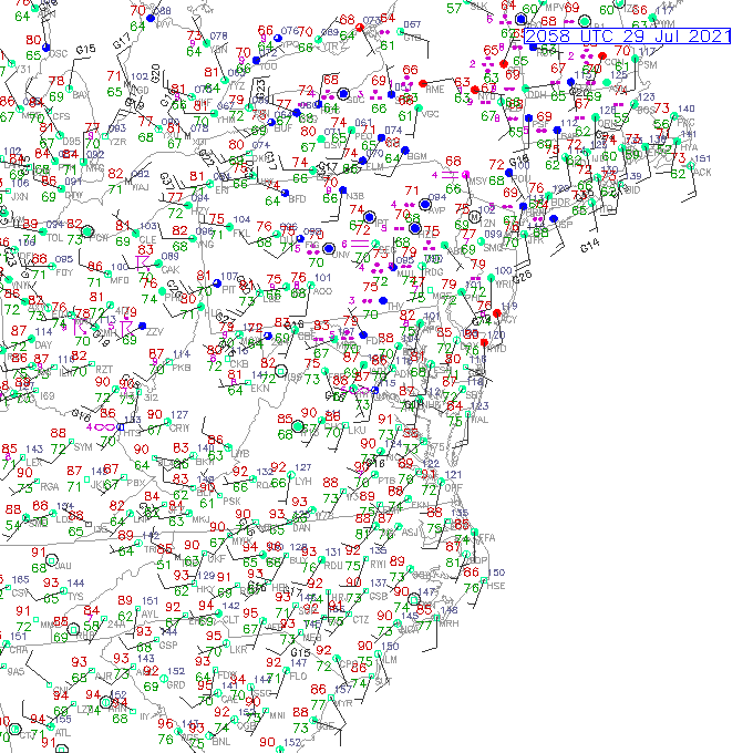
Near-storm observations.
 |
 |
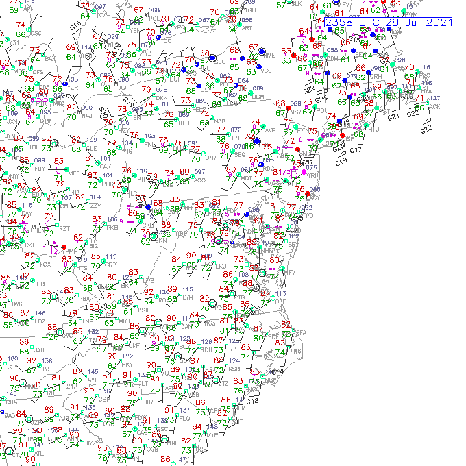 |
| 18z/2 PM Observations | 21z/5 PM Observations | 00z/8 PM Observations |
00z 7/30 (8 PM EDT 7/29) sounding data.
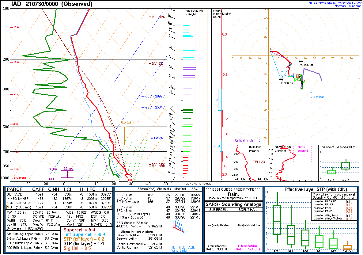 |
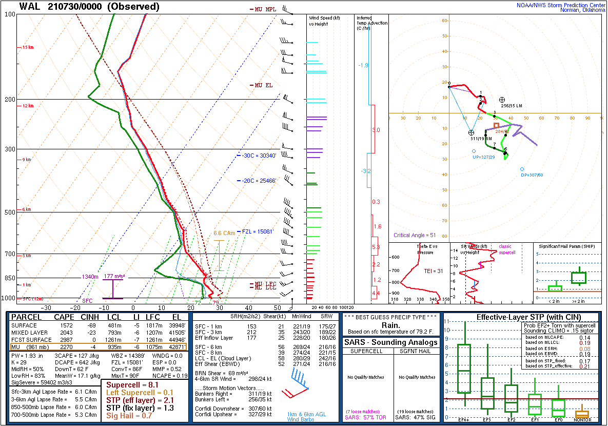 |
| Sounding from Washington Dulles (KIAD) | Sounding from Wallops Island (KWAL) |
 |
Media use of NWS Web News Stories is encouraged! Please acknowledge the NWS as the source of any news information accessed from this site. |
|


 Coastal Flood
 Heat
Heat