Overview
A strong low pressure system at the surface and aloft slowly filled in as it tracked over Lake Michigan during the day on Wednesday. Meanwhile, its associated warm front extended SE through the OH Valley and into far southern VA during the morning of 4/3. A secondary surface low had begun to develop over SW Virginia during the morning, with a trailing cold front extending south of the low just east/southeast of the southern Appalachians. As the secondary low moved NE during the day, the warm front lifted north before stalling from the south-central VA Piedmont to the Richmond Metro to the Northern Neck by early afternoon. Elevated convection moved into the Piedmont by noon-1 PM. While a couple of those cells exhibited strong rotation on radar, they failed to produce tornadoes, likely due to being on the "cool" side of the front (and thus having no surface based instability to work with). However, one of those elevated cells became surface based as it tracked into Essex/Richmond Counties SE of Tappahannock. The cell, located just to the SE of the stalled frontal boundary, produced an EF-1 tornado (estimated max winds of 95-100 mph) as it tracked from north-central Richmond County to just SW of Lewisetta. The environment was characterized by very strong shear with a meager to moderate amount of surface based instability. With the strong deep-layer shear, several cells in the warm sector (across SE VA/NE NC) exhibited supercellular characteristics, but failed to produce tornadoes. Importantly, surface winds were more SSW deep into the warm sector across SE VA/NE NC, while they were SSE near that secondary low over the northern neck. While 0-1km SRH values were similar in those two locations, there was more low-level directional shear closer to the low in the northern neck due to the SSE winds. This may very well have been the difference that resulted in one storm producing a tornado while others did not.Tornado:
|
Tornado - LOCATION
Track Map 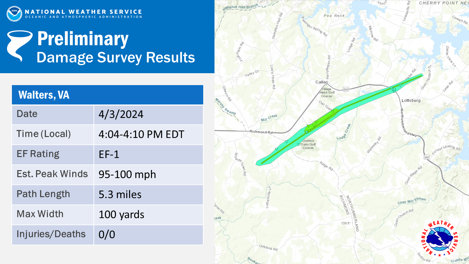 
|
||||||||||||||||
The Enhanced Fujita (EF) Scale classifies tornadoes into the following categories:
| EF0 Weak 65-85 mph |
EF1 Moderate 86-110 mph |
EF2 Significant 111-135 mph |
EF3 Severe 136-165 mph |
EF4 Extreme 166-200 mph |
EF5 Catastrophic 200+ mph |
 |
|||||
NWS Storm Survey Photos
Selected Images
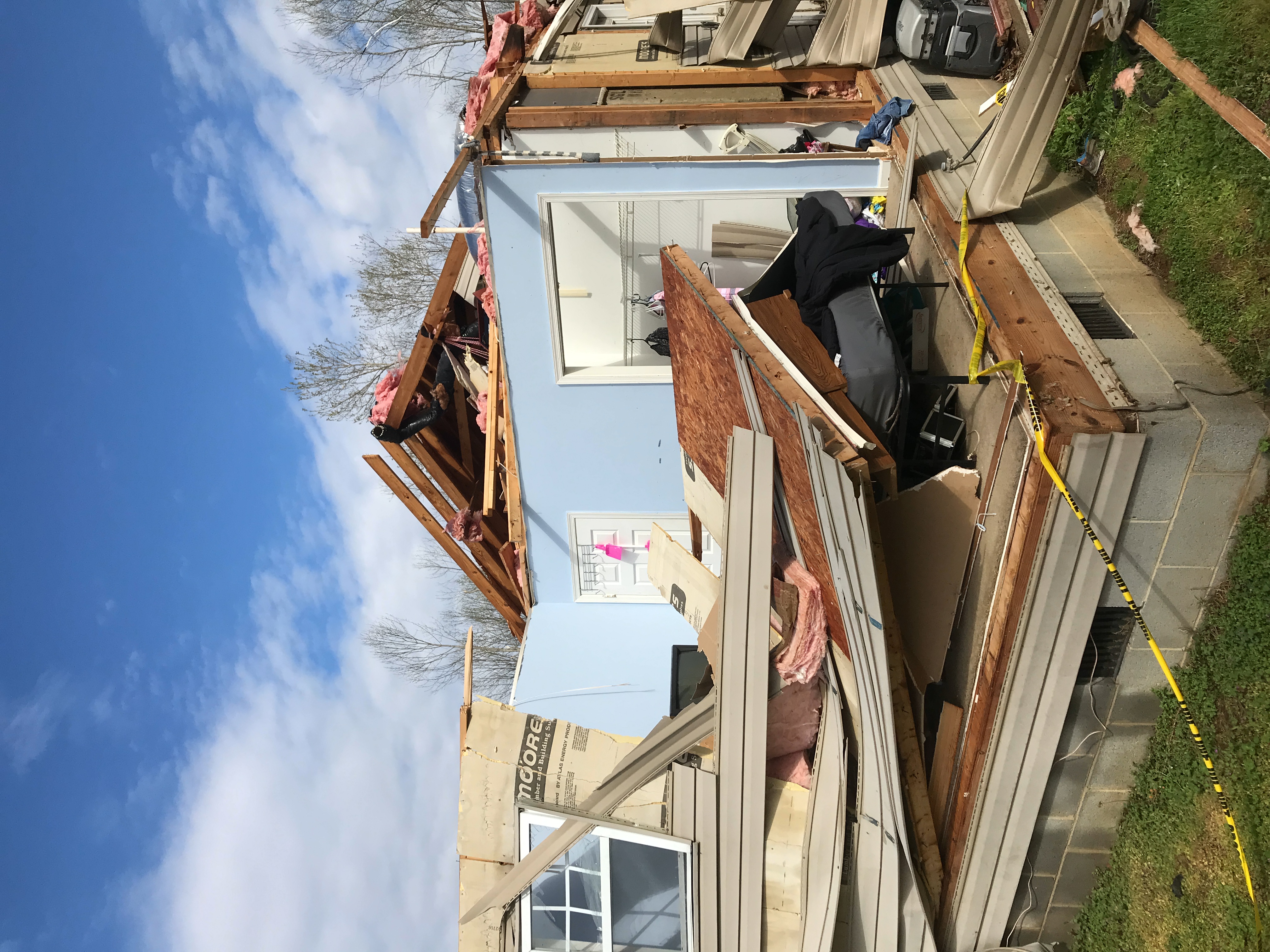 |
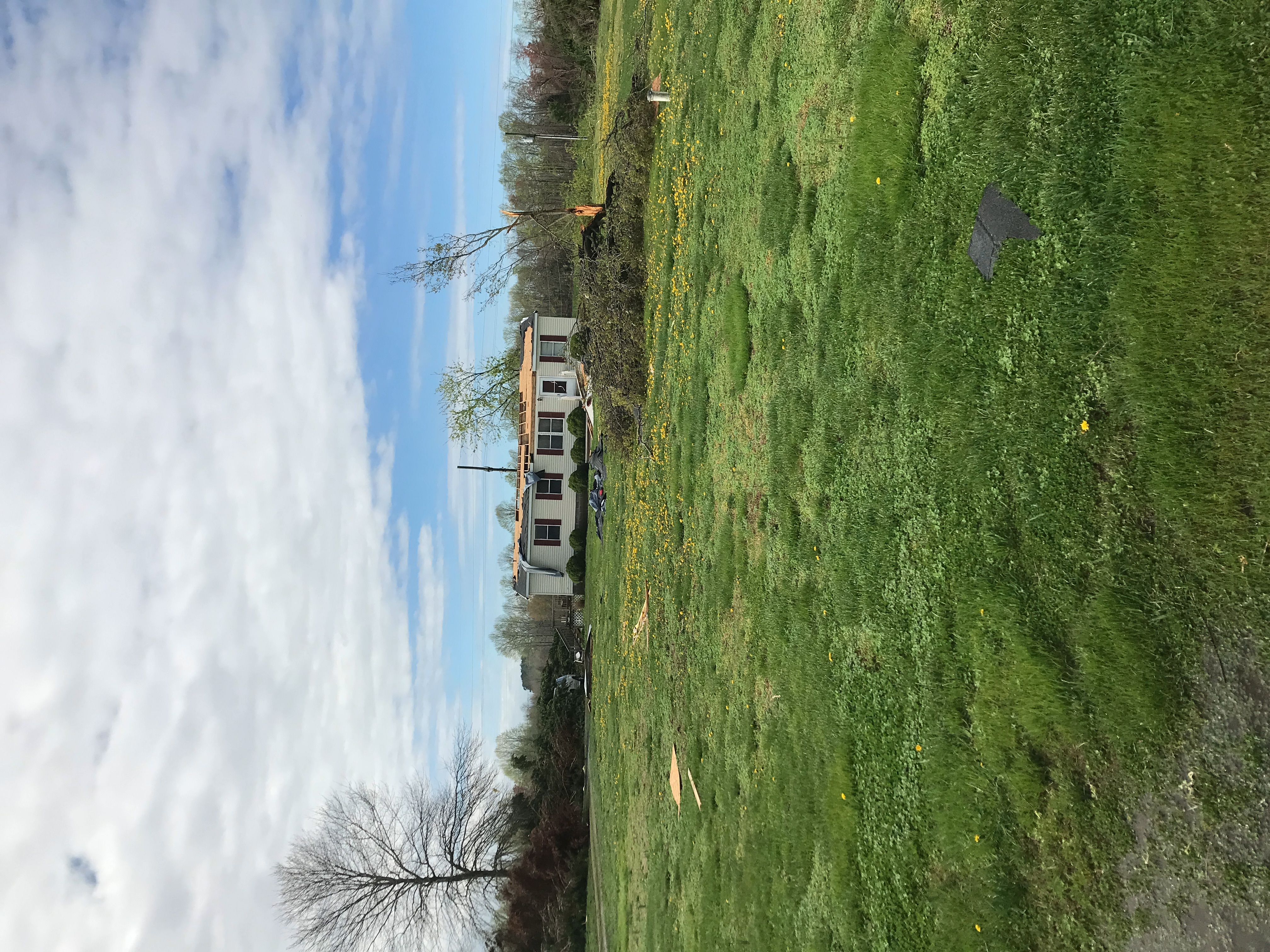 |
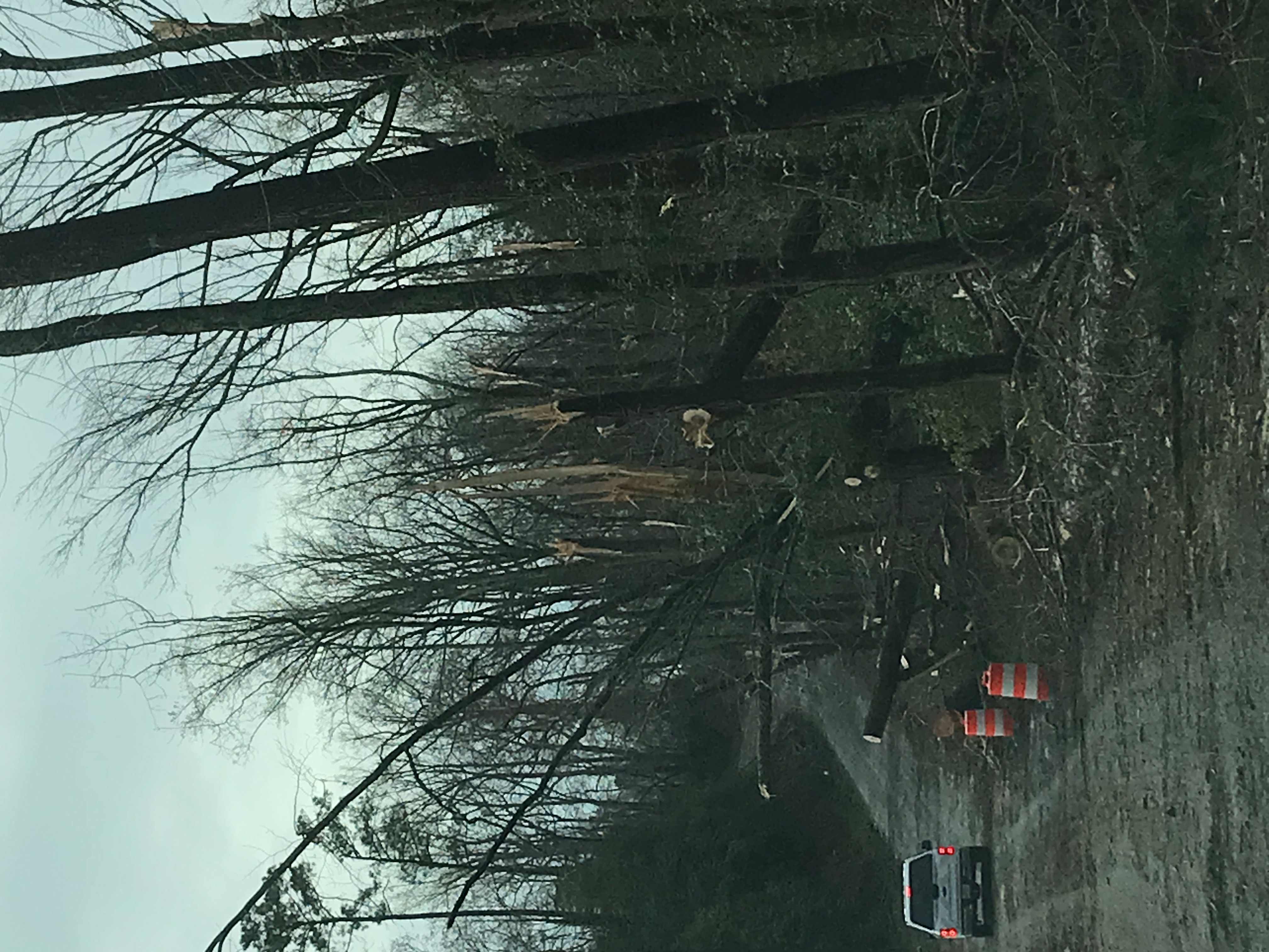 |
Radar
Loop of Time Around Tornado Track
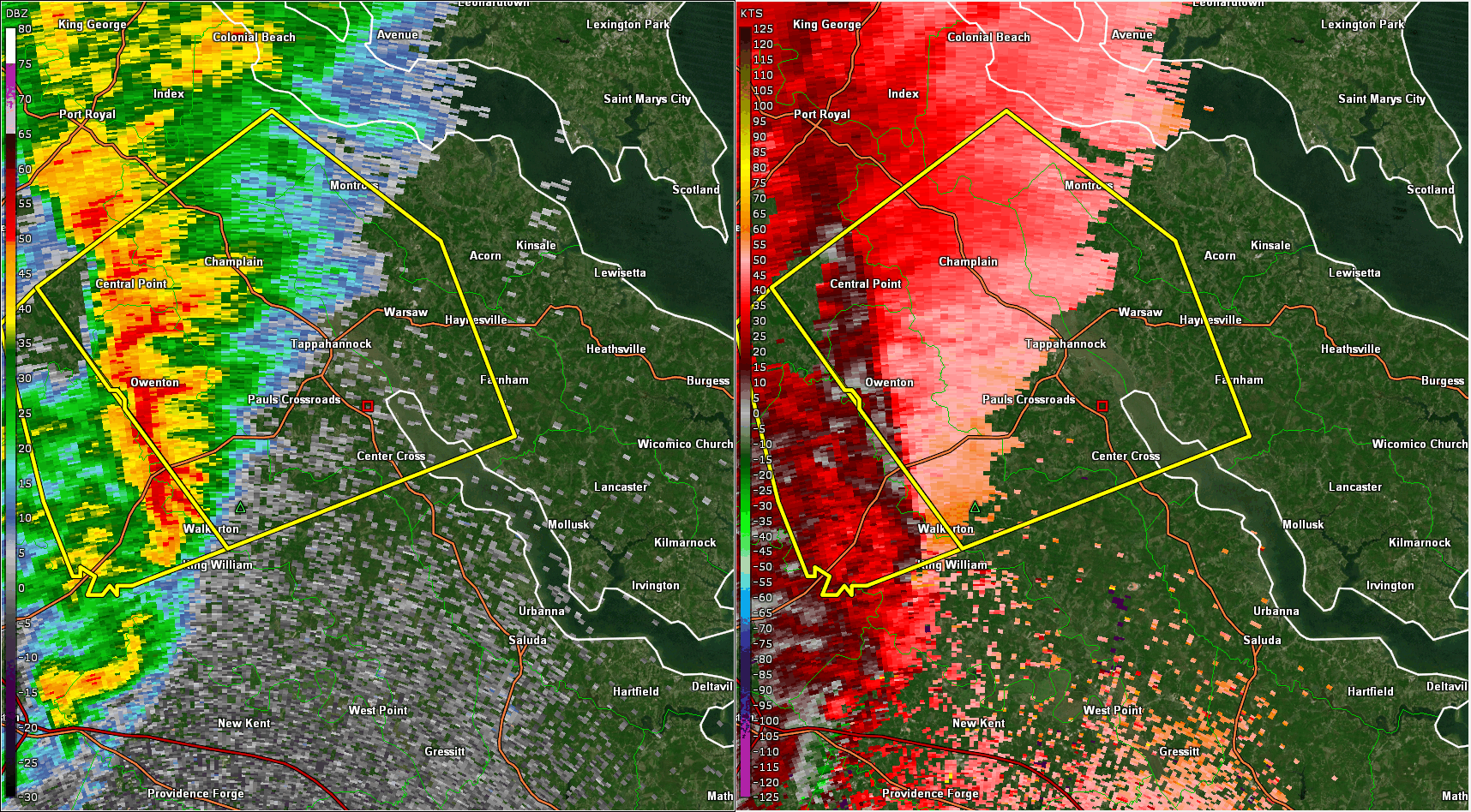 |
| Zoomed in loop of 0.5° Reflectivity (left) and Base Velocity (right) from 3:30 to 4:20 PM in ~2 minute increments. Note that the tornado lasted from 4:04 to 4:10 PM. Tornado Warnings are in red and Severe Thunderstorm Warnings are in yellow. |
Storm Reports
Coming soon!
Environment
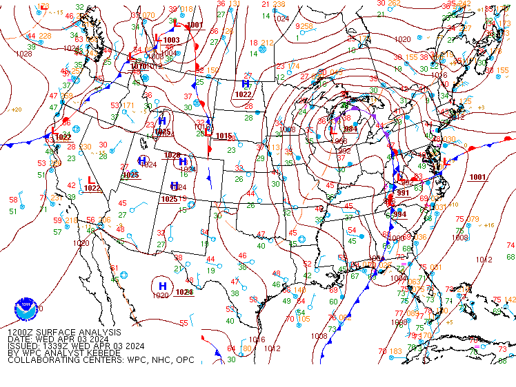
Synoptic summary.
 |
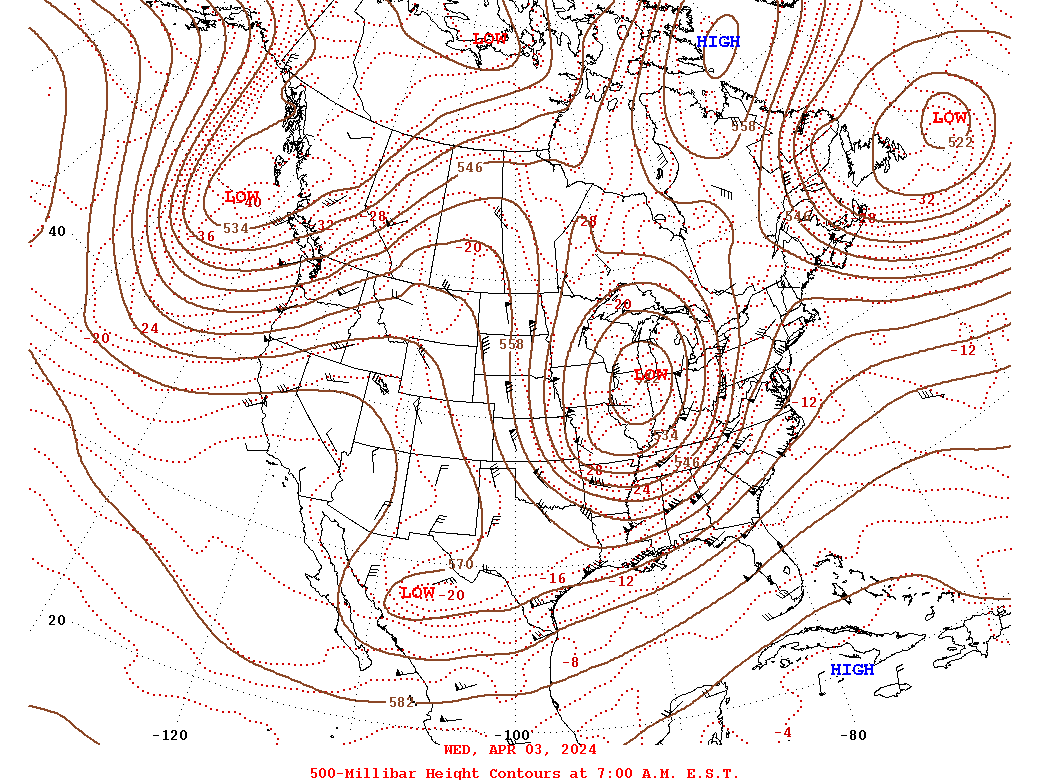 |
| Loop of WPC Surface Analysis from 12z/8 AM to 00z/8 PM on 4/3 | 12z/8 AM WPC 500mb Analysis on 4/3 and 4/4 |
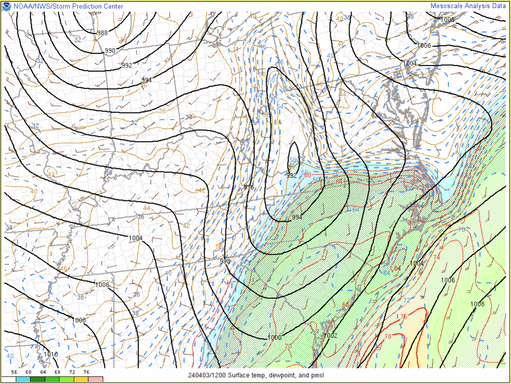
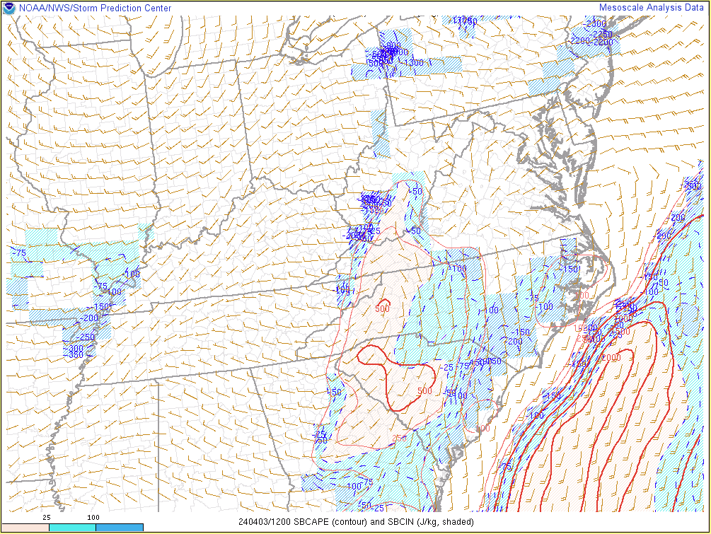
Near-storm environment summary.
 |
 |
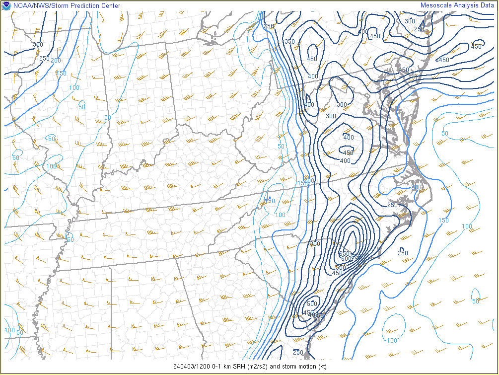 |
| Loop of T/Td/Regional Surface Analysis from 8 AM-8 PM in 1 hour increments | Loop of SBCAPE/SBCIN from 8 AM-8 PM in 3 hour increments | Loop of 0-1 km SRH from 8 AM-8 PM in 3 hour increments |
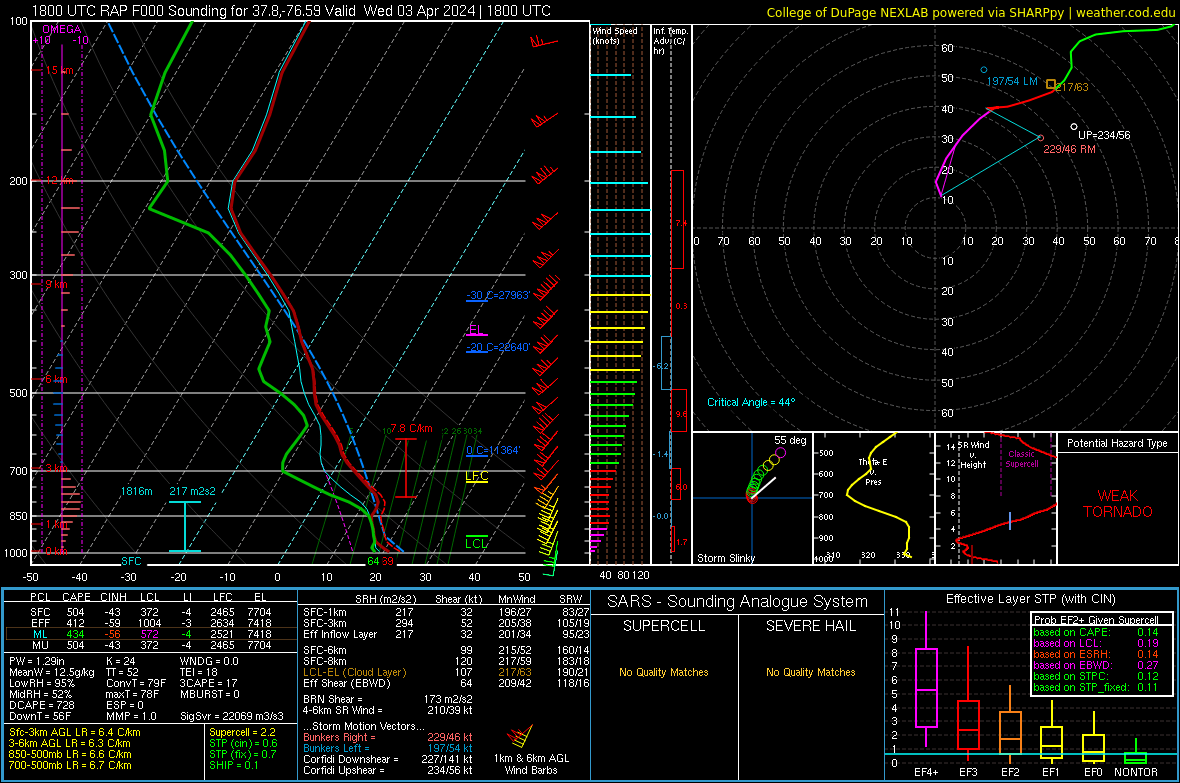
Additional environmental data.
 |
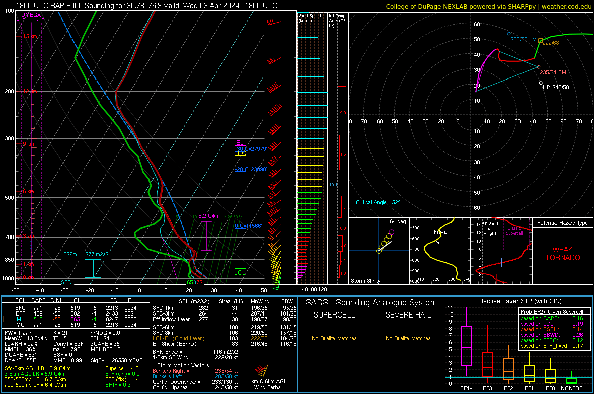 |
| 18z/2 PM RAP Analysis Sounding from the VA Northern Neck | 18z/2 PM RAP Analysis Sounding from NE NC |
 |
Media use of NWS Web News Stories is encouraged! Please acknowledge the NWS as the source of any news information accessed from this site. |
|


 Coastal Flood
 Heat
Heat