General Description: These graphics show the forecast freezing level across Alaska. The maps help identify areas where the atmosphere is below freezing throughout, as well as areas where the freezing level is elevated above the surface while the surface is below freezing.
Shaded Areas: The shaded areas show the height of the freezing level (32°F) above the surface. They indicate the elevation where temperatures transition between above and below freezing. When these areas occur inside the red dashed line, they indicate a layer of above-freezing air (an inversion) above below-freezing surface temperatures. The shaded freezing-level data above the surface are provided by the Alaska Aviation Weather Unit (AAWU).
Red Dashed Line: The red dashed line marks the boundary of areas where temperatures at the surface are below freezing. Areas inside the line have below-freezing temperatures at the ground, while areas outside the line generally have above-freezing surface temperatures. This line is derived from temperature grids from the Anchorage, Fairbanks, and Juneau Weather Forecast Offices.
Non-Shaded Background: Non-shaded (green) areas indicate that the atmosphere is below freezing (32°F) throughout the entire atmosphere. These areas have below-freezing temperatures from the surface upward, without an above freezing layer aloft.
These temperature profiles help determine the type of precipitation that reaches the ground and how it may affect river conditions. Snow falling through a layer of above-freezing air can partially or completely melt before reaching the surface. If that precipitation then encounters a sufficiently cold layer near the ground, it may refreeze into ice pellets or partially refrozen precipitation. These patterns help identify where rain or snow is most likely across river basins and assess the potential for snowmelt and runoff, both of which are important variables in river forecasting.
These charts are intended to support river forecasting and are not intended for flight-planning purposes. For official aviation weather forecasts, please refer to the Alaska Aviation Weather Unit.
Please send us an email if you have any questions or comments on these freezing level graphics.
View the National Blend of Models (NBM) Snow Level Forecast graphics for Alaska.
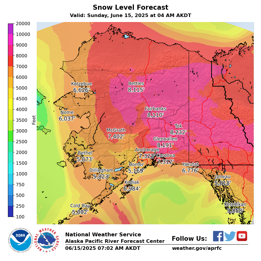
These graphics show the 11-day snow level forecast from the National Blend of Models (NBM). The products are produced once daily from the most recent NBM run.
The NBM snow level is determined from the wet-bulb-zero level, which is the lowest level in a sounding at which the wet-bulb temperature is 0°C. Snow level values are in feet above mean sea level. If the terrain elevation is higher than the forecast snow level, snow level should be interpreted as being at the surface.
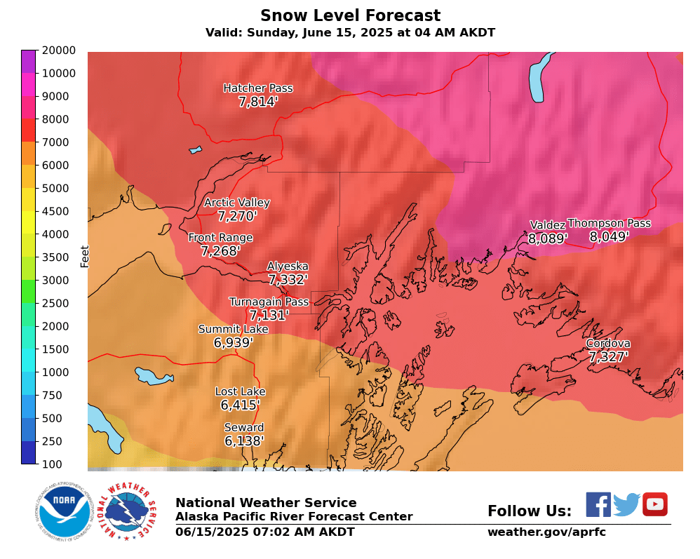
NBM snow level forecasts for selected Southcentral Alaska recreation areas. Click a graphic to view it at full size.


The Southcentral Alaska forecast provides a higher-resolution view of snow levels across the region. Snow level is based on the NBM wet-bulb-zero level and represents the approximate elevation where precipitation transitions from rain to snow.
The annotated plots provide additional point information for popular snow recreation areas. Elevation lines allow users to compare the forecast snow level with local elevations and terrain.