La Crosse, WI
Weather Forecast Office
|
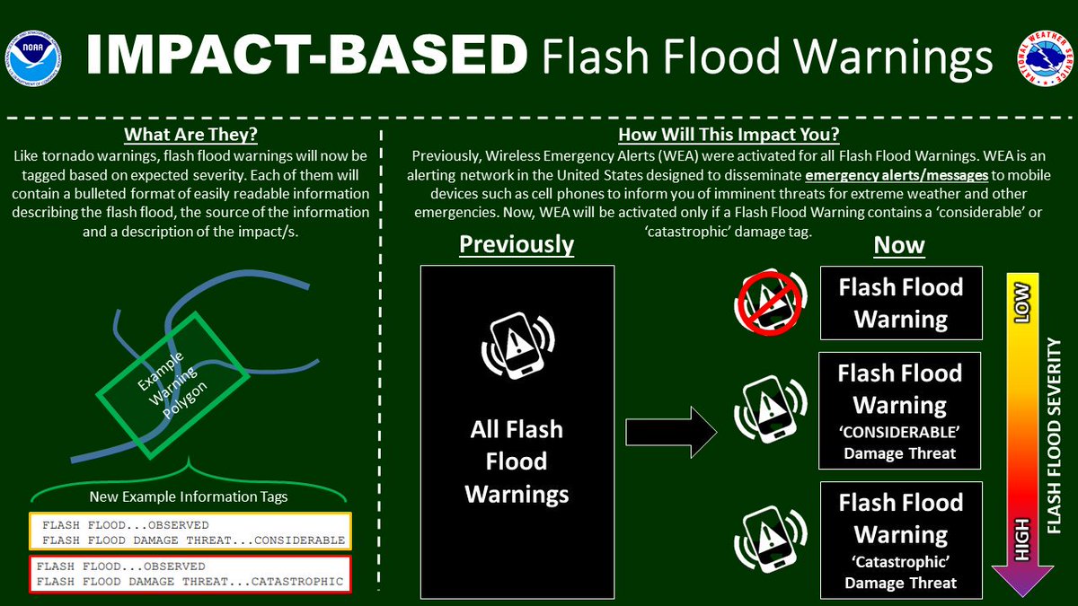
The National Weather Service has made changes to our Flash Flood Warnings that includes impact based information and tags at the bottom of the warnings based on expected severity. These features are similar to our current Severe Thunderstorm and Tornado Warnings. The Flash Flood Warnings (FFW) will now have tags and information at the bottom that includes:
IMPORTANT: Wireless Emergency Alerts (WEAs) via cell phones will ONLY forward warnings with the "considerable" or "catastrophic" tags. |
 |
Our Office
Community Involvement
Station / Location Info
Follow Us On Social Media
Student Opportunities
Additional Information
Storm Summaries
Cooperative Observers
Educational Resources
Science / Research
Weather Phenomenon
Mayfly Tracking
Latest
Temp/Pcpn Summary
Precipitation Reports
Forecast Discussion
Hazardous Weather Outlook
Hourly Weather
Public Information Statement
Local Storm Report
Lightning Plot Archive
River Stages
Water Temp
Observations
Precipitation Plotter
Soil Temps
US Dept of Commerce
National Oceanic and Atmospheric Administration
National Weather Service
La Crosse, WI
711 County Road FA
La Crosse, WI 54601
608-784-7294
Comments? Questions? Please Contact Us.


 Weather Story
 Weather Map
 Local Radar