Overview
|
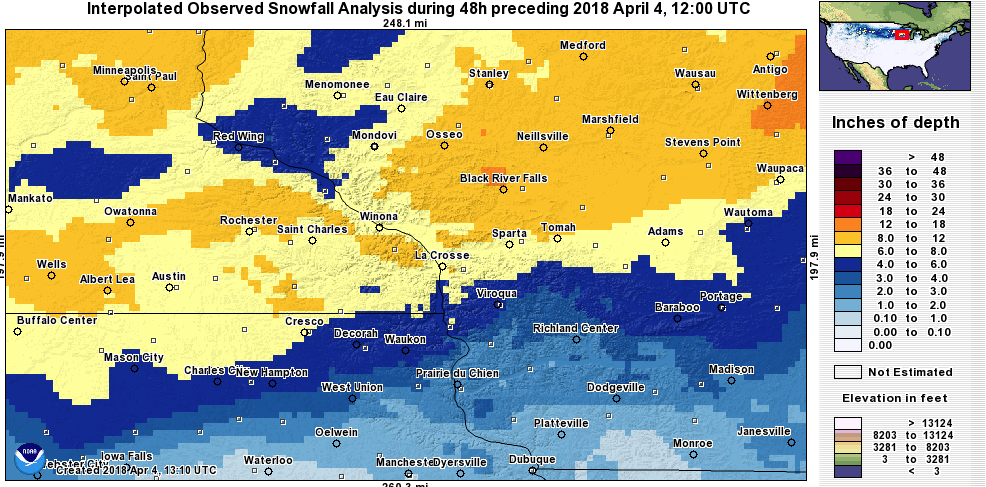
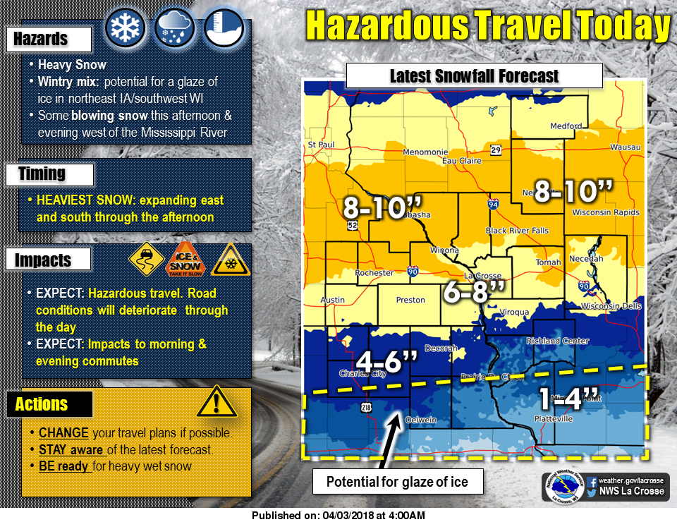
An early "spring" winter storm brought an extended period of snow to the region on Tuesday, April 3rd with a wide swath of 6 to 9 inches. The heaviest snow fell mostly along and north of Interstate 90 in Minnesota and Wisconsin. South of that area, freezing drizzle resulted in light glazing before all the precipitation turned to snow later in the day. While many area roads were snow covered and slick, some of the higher traffic highways and streets were mainly just wet - thanks to melting from the combination of slower snowfall rates, April temperatures, and traffic. |
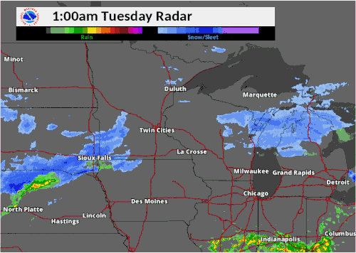 Radar loop from Tuesday, April 3rd - Wednesday, April 4th |
Snowfall Totals:
Location                     Amount

...IOWA...

...Chickasaw County...
Nashua 2N                    6.0 in

...Clayton County...
Monona WWTP                  3.1 in
Volga 1NE                    2.1 in
Guttenberg Dam 10            2.0 in
Edgewood                     2.0 in
Elkader 6SSW                 1.7 in
Strawberry Point             1.5 in

...Fayette County...
Waucoma 1WNW                 5.0 in
Oelwein                      2.2 in
2 NNW Fayette                2.0 in
Fayette                      1.4 in

...Floyd County...
Charles City                 5.2 in
Nashua 2SW                   4.5 in

...Howard County...
Elma                         6.3 in
Cresco 1NE                   6.0 in

...Mitchell County...
St Ansgar                    6.5 in

...Winneshiek County...
Decorah 7ENE                 5.8 in
Bluffton 4ESE                5.3 in

...MINNESOTA...

...Dodge County...
2 NE Kasson                  8.7 in
Hayfield                     6.6 in
Kasson 1N                    6.5 in

...Fillmore County...
Spring Valley 3E             8.2 in
1 W Fillmore                 7.7 in
1 S Peterson                 7.2 in
1 SSE Pilot Mound            7.1 in
Chatfield                    7.0 in
Spring Valley 4N             6.5 in
Mabel                        5.5 in

...Houston County...
1 NNW La Crescent            9.0 in
1 NE Mound Prairie           8.6 in
4 ESE Spring Grove           7.5 in
Eitzen 4NW                   7.5 in
Caledonia                    6.2 in

...Mower County...
Elkton 4W                    8.0 in
Grand Meadow                 8.0 in
Lansing 2NE                  7.0 in
Racine                       6.5 in
Austin 1W                    6.2 in
Austin 2SW                   5.3 in
Austin WWTP                  4.3 in

...Olmsted County...
Elgin 2SSW                   8.1 in
2 NE Rochester               8.0 in
Rochester Intl Airport       7.4 in
2 S Predmore                 7.3 in
Elba 4.7 SW                  6.1 in

...Wabasha County...
Plainview                    9.0 in
Wabasha 1N                   9.0 in
Lake City                    8.0 in
Millville                    8.0 in

...Winona County...
Minnesota City Dam 5         8.0 in
Goodview 1ESE                7.4 in
Winona 1WSW                  7.1 in
Altura 5W                    7.0 in
Pickwick 3NNW                7.0 in
La Crescent Dam 7            7.0 in
Winona                       6.5 in
St Charles 4N                6.1 in

...WISCONSIN...

...Adams County...
Adams                        7.5 in
Friendship                   5.0 in

...Buffalo County...
Alma Dam 4                   4.3 in

...Clark County...
Loyal 1N                     9.0 in
Chili 6N                     8.0 in

...Crawford County...
De Soto 1SE                  7.3 in
Steuben 4SE                  2.5 in
Prairie Du Chien             2.3 in
Mt Zion 1WNW                 2.0 in
Lynxville Dam 9              1.0 in

...Grant County...
Lancaster                    2.5 in
Sinsinawa                    1.5 in

...Jackson County...
Black River Falls WWTP       9.5 in
Merrillan                    9.0 in
Black River Falls            8.5 in
Hatfield                     8.0 in

...Juneau County...
Mather 3NW                   9.3 in

...La Crosse County...
New Amsterdam 4NNE           8.0 in
Holmen 2S                    7.8 in
La Crosse Weather Office     7.5 in
La Crosse Regional Airport   7.3 in
West Salem                   7.2 in
La Crosse 3S                 7.0 in
La Crosse 4NNW               6.6 in

...Monroe County...
Warrens 4WSW                 8.8 in
Four Corners                 8.3 in
Cashton 3NNW                 7.6 in
Kendall 3WNW                 6.5 in
Tomah                        6.3 in

...Richland County...
Ithaca                       4.0 in
Lone Rock                    3.2 in
Richland Center 4N           3.0 in

...Taylor County...
Medford                     10.5 in
Gad                          7.0 in

...Trempealeau County...
2 SSE Elk Creek              9.0 in
Arcadia                      8.5 in
Ettrick 4WNW                 8.2 in
Trempealeau Dam 6            7.0 in
Galesville 2WSW              6.5 in

...Vernon County...
La Farge                     7.5 in
Stoddard                     6.1 in
Genoa Dam 8                  5.5 in
Viroqua 0.8 ESE              5.0 in
Hillsboro WSW                3.8 in
Westby 3ENE                  3.1 in

Observations are collected from a variety of sources with varying
equipment and exposures. We thank all volunteer weather observers
for their dedication. Not all data listed are considered official.
Services:
 |
 |
 |
|
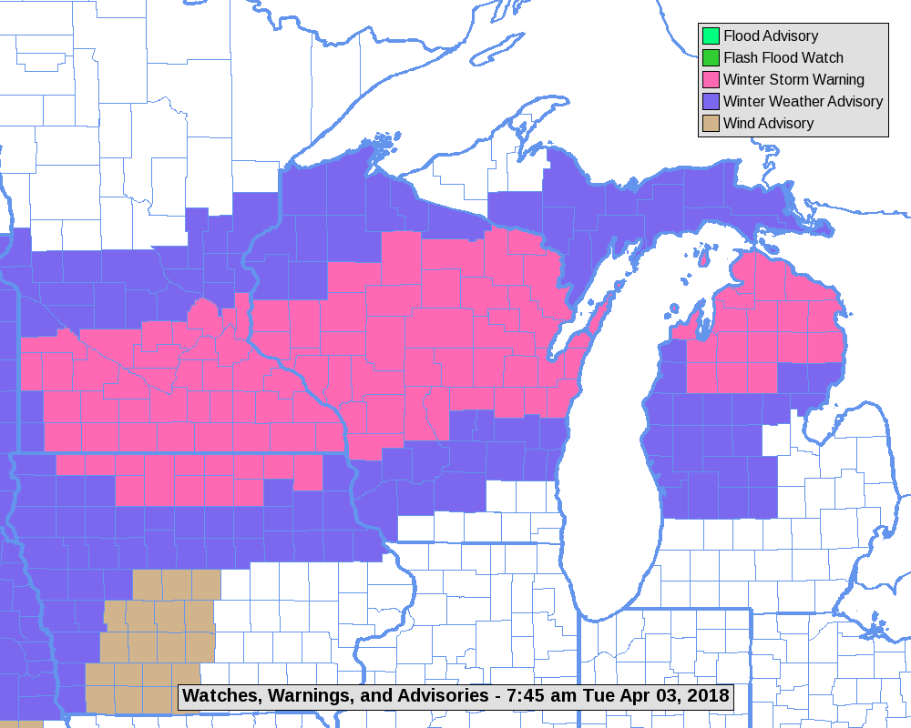
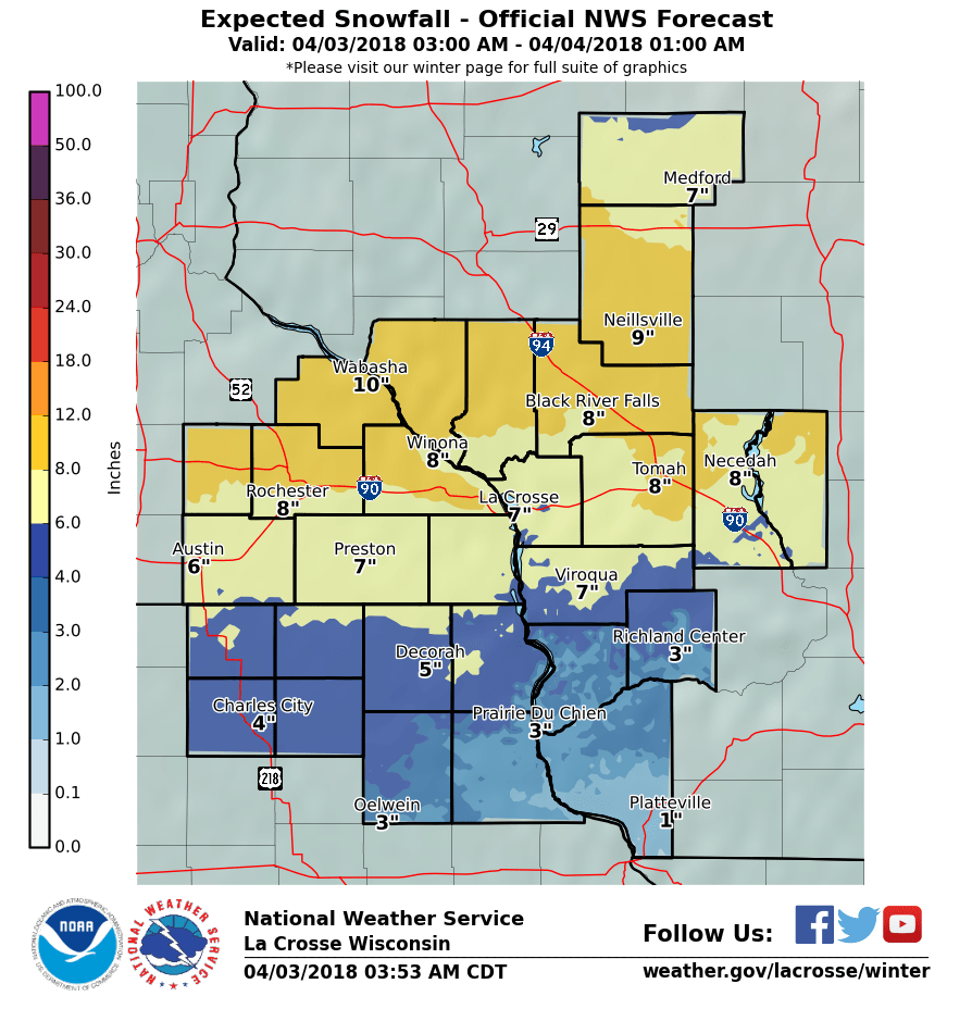
| Map showing where warnings and advisories were in effect during the storm. | Snow Forecast | Weather Story graphic issued for storm |
Photos:
 |
 |
||
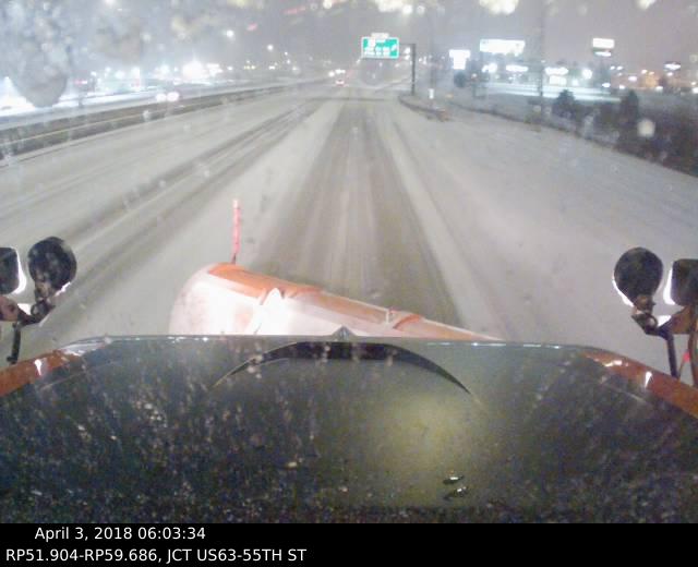
| Snow plow cam from Rochester, MN during the morning commute. (Source: MnDOT) |
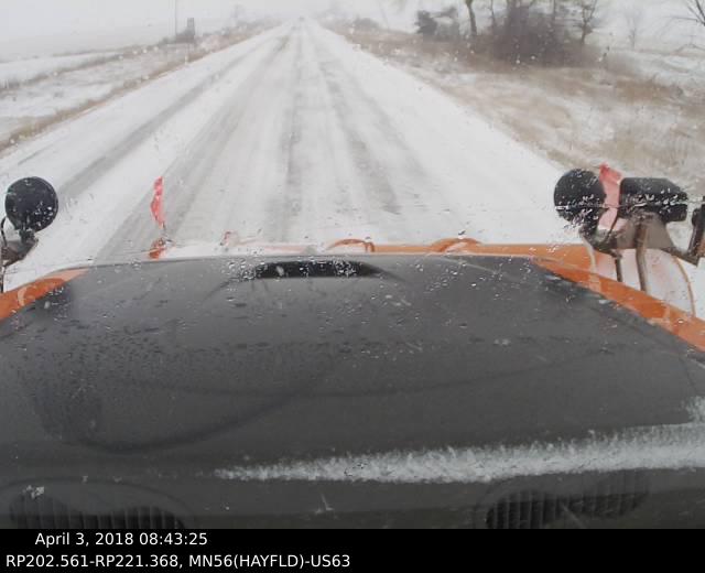
Snow plow cam near the Rochester Int'l Airport. (Source: MnDOT) |
 |
Media use of NWS Web News Stories is encouraged! Please acknowledge the NWS as the source of any news information accessed from this site. |
|


 Weather Story
 Weather Map
 Local Radar