Overview
|
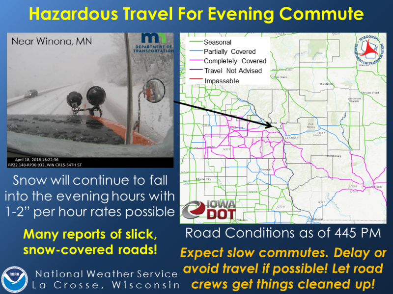
A late season winter storm brought heavy snow across a large part of the region on Wednesday, April 18th with a wide swath of 6 to 12 inches. The heaviest snow fell across northeast Iowa, far southeast Minnesota, and southwest Wisconsin. Snowfall rates of 1 to 2 inches per hour resulted in slick, snow covered roads for many areas. Thanks to melting and April temperatures, roads were cleared rather quickly after the heaviest snow moved out of the area. |
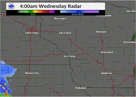 Radar loop of the storm |
Snow
Below is a look at total snow accumulation reported at various locations during this late season winter storm.
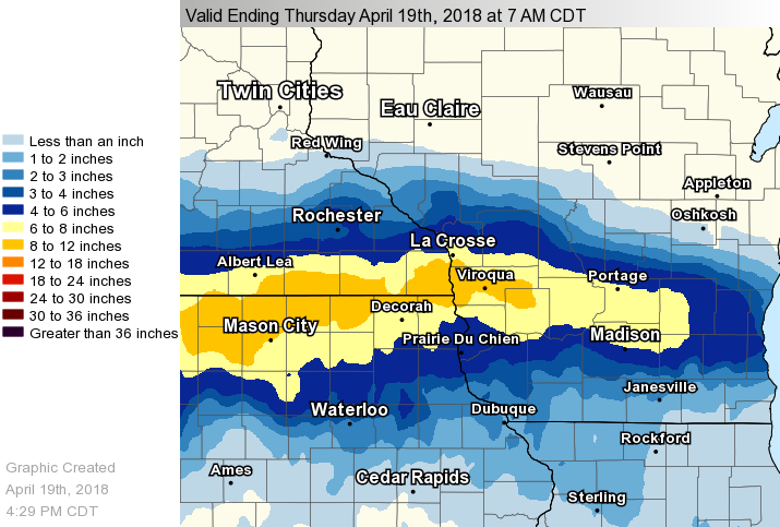 |
| Total snowfall |
...Snowfall Reports...

Location                     Amount

...Iowa...

...Allamakee County...
1 SE Dorchester              10.0 in
Harpers Ferry                 6.0 in
6 NE Postville                5.5 in

...Chickasaw County...
New Hampton                   8.0 in
Nashua                        5.5 in

...Clayton County...
Monona WWTP                   5.1 in
Volga 1NE                     4.1 in
Strawberry Point              3.6 in
Guttenberg Dam 10             3.0 in
Elkader 6SSW                  2.8 in
Edgewood                      2.5 in

...Fayette County...
Waucoma 1WNW                  5.0 in
1 E West Union                4.8 in
2 NNW Fayette                 4.8 in
Fayette                       3.6 in

...Floyd County...
Charles City                  6.6 in
Nora Springs 2.4 SSE          6.0 in
Nashua 2SW                    5.8 in

...Howard County...
Lime Springs                 12.5 in
1 NNW Chester                11.0 in
Riceville                    11.0 in
Cresco 1NNW                   9.5 in
Cresco 1NE                    9.0 in
Cresco 3N                     9.0 in

...Mitchell County...
Stacyville                   12.8 in
Saint Ansgar                 11.0 in
2 SE Mona                    10.0 in
Osage                         8.5 in

...Winneshiek County...
9 NE Bluffton                 9.0 in
3 ESE Bluffton                8.8 in
Bluffton                      8.0 in
Decorah 7ENE                  8.0 in
1 NNE Calmar                  6.8 in
Decorah                       6.0 in
Decorah 5ESE                  5.8 in

...Minnesota...

...Dodge County...
Hayfield                      4.1 in
Berne                         2.0 in
Kasson                        1.8 in

...Fillmore County...
Harmony                      10.0 in
Mabel                         7.8 in
Peterson 1S                   7.4 in
6 WSW Harmony                 6.8 in
Preston                       6.5 in
Fillmore 1W                   6.5 in
2 E Whalan                    5.0 in
Chatfield                     4.0 in

...Houston County...
3 SE Spring Grove            10.5 in
4 SE Spring Grove            10.5 in
Caledonia                     8.8 in
5 SE Spring Grove             8.0 in
Spring Grove                  8.0 in
Hokah 4NW                     7.9 in
1 ENE Mound Prairie           7.2 in
3 WSW La Crescent             7.0 in
4 NNE Mound Prairie           6.0 in
La Crescent 1N                5.9 in

...Mower County...
Le Roy                       12.0 in
Adams                        10.0 in
1 SW Austin                   9.3 in
Taopi                         8.5 in
Austin WWTP                   8.0 in
1 ESE Grand Meadow            7.0 in

...Olmsted County...
Elgin 2SSW                    4.5 in
3 ESE Douglas                 4.1 in
Byron                         4.0 in
Rochester Intl Airport        4.0 in
4 N Stewartville              3.9 in
1 SSW Rochester               3.8 in
Stewartville                  3.8 in
4 ESE Douglas                 3.5 in
3 NNW Rochester               2.0 in

...Wabasha County...
Zumbro Falls 3SW              4.0 in
Wabasha                       1.6 in

...Winona County...
La Crescent Dam 7             7.5 in
3 S Ridgeway                  5.5 in
Saint Charles                 5.5 in
2 NW Wilson                   4.5 in
Winona 1WSW                   4.0 in

...Wisconsin...

...Adams County...
Friendship                    3.7 in
1 N Arkdale                   3.0 in

...Buffalo County...
5 NE Montana                  1.5 in
Alma Dam 4                    1.0 in

...Crawford County...
1 SSE De Soto                10.0 in
DESOTO 1SE                   10.0 in
Lynxville Dam 9               7.0 in
1 N Prairie Du Chien          6.5 in
Prairie du Chien              4.3 in
1 SSE Prairie Du Chien        3.0 in

...Grant County...
Muscoda                       4.5 in
Cuba City                     3.5 in
Lancaster 4WSW                2.6 in
Lancaster                     1.8 in

...Juneau County...
Union Center                  7.5 in
Mauston 1SE                   5.0 in
4 ESE Lemonweir               4.1 in

...La Crosse County...
La Crosse NWS Office          7.3 in
Barre Mills                   7.0 in
3 W Saint Joseph              6.5 in
5 SSE La Crosse               6.4 in
5 NNE Stoddard                6.4 in
La Crosse Regional Airport    6.0 in
5 SSE La Crosse               5.8 in
1 W West Salem                5.8 in
1 SW Saint Joseph             5.5 in
1 N French Island             5.5 in
2 NNW Onalaska                5.3 in
Holmen 2S                     5.3 in

...Monroe County...
Cashton                       7.0 in
2 NE Sparta                   5.8 in
Warrens 4WSW                  4.9 in
5 NNE Norwalk                 4.3 in
Tomah                         4.0 in
Four Corners                  4.0 in
2 SW Melvina                  3.8 in

...Richland County...
5 ESE Ithaca                  7.0 in
1 NE Richland Center          6.8 in

...Trempealeau County...
Trempealeau Dam 6             4.0 in
Ettrick 4WNW                  3.4 in
Independence 3NE              1.5 in

...Vernon County...
Purdy                        11.5 in
La Farge                      9.5 in
3 SSW Westby                  9.5 in
1 NE Genoa                    9.5 in
Stoddard                      9.3 in
Viroqua                       9.2 in
Stoddard 5NNE                 9.1 in
Readstown                     9.0 in
4 NNE Westby                  8.3 in
Coon Valley 2W                8.0 in
3 NE Stoddard                 7.8 in
Hillsboro WSW                 7.5 in
1 NW Valley                   7.5 in
Westby 3ENE                   7.2 in
2 NW Viola                    7.0 in
3 SW Hillsboro                6.5 in
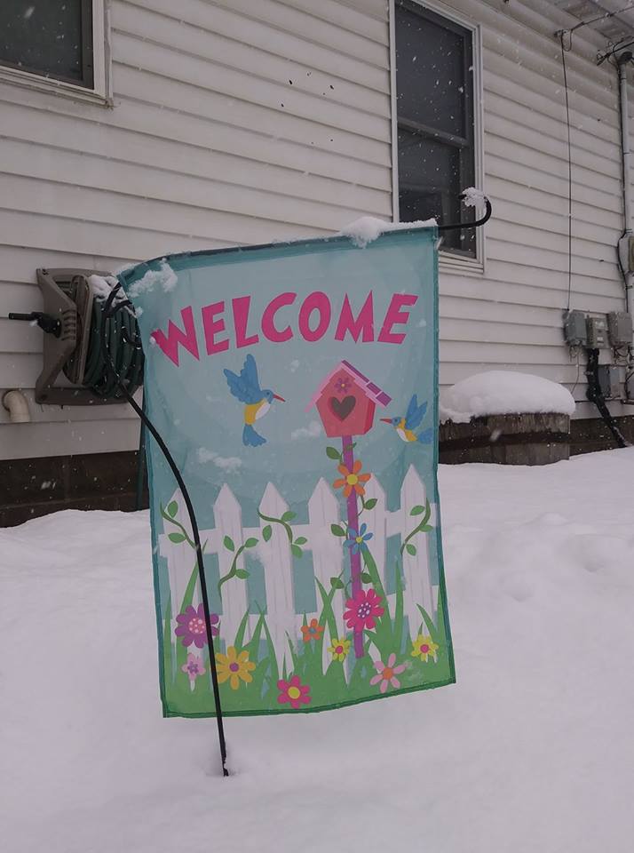
Photos:
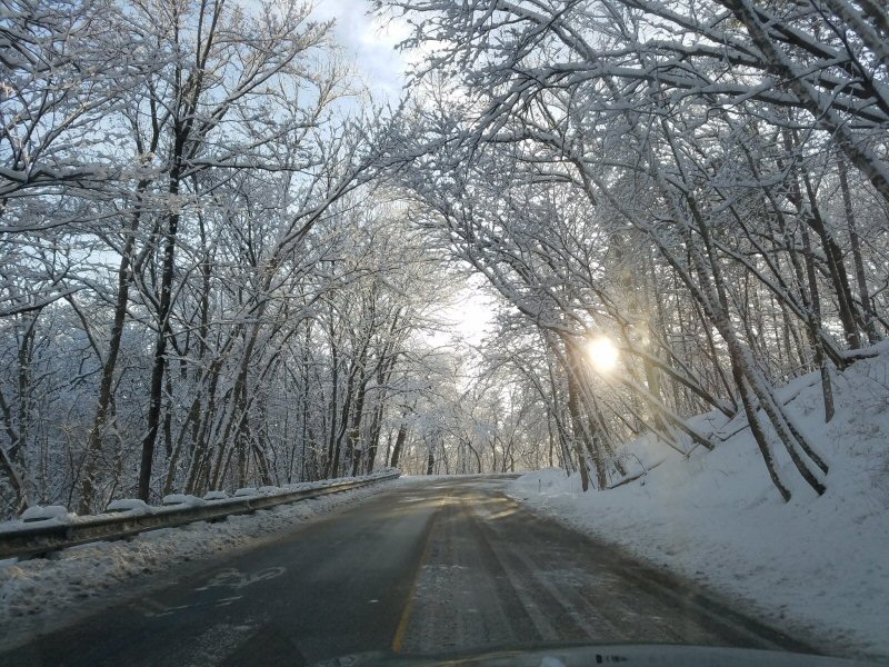
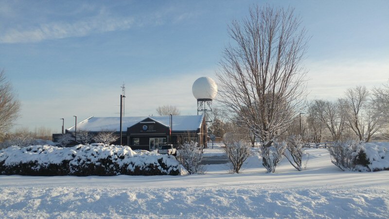
A look at some of the photos shared with us.
 |
 |
 |
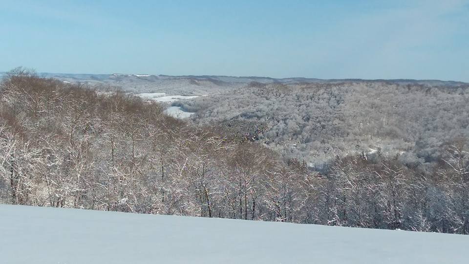 |
| Near La Crosse, WI (Photo by NWS La Crosse) |
NWS La Crosse (Photo by NWS La Crosse) |
Winona, MN (Photo by Cheryl Burge) |
(NWS La Crosse) |
Services:
A look at some of our services during this event.
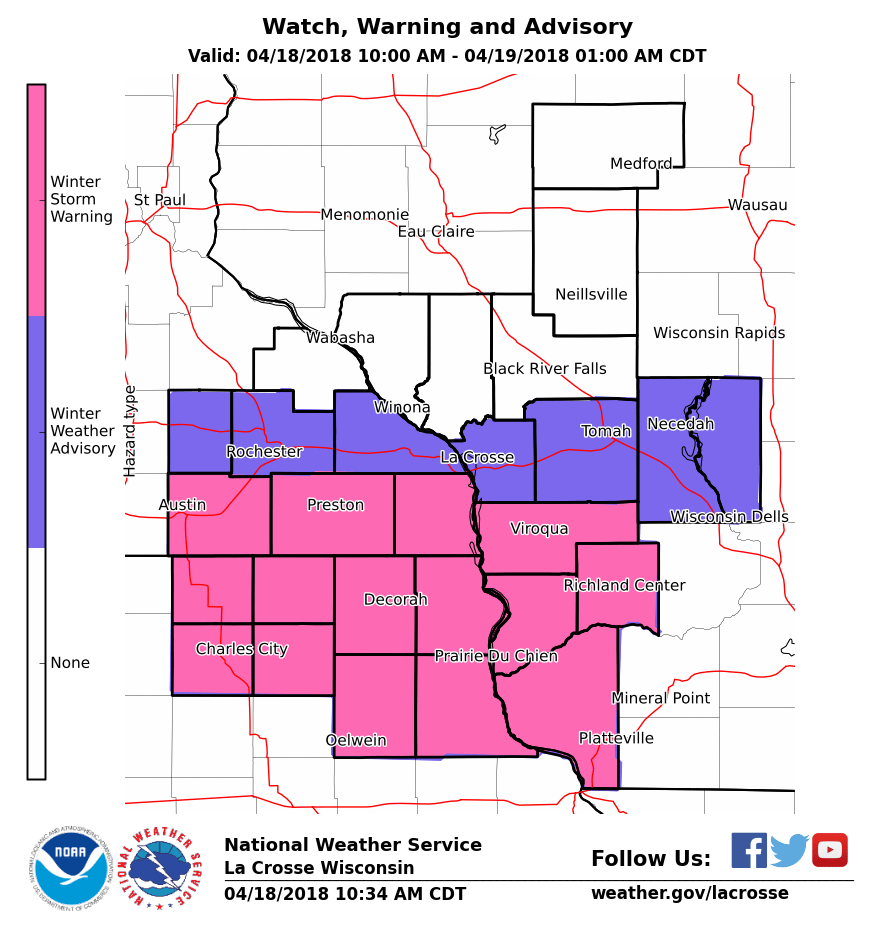 |
 |
||
| Watch Warning Advisory Map April 18 | Graphic issued at 4:48 p.m. |
 |
Media use of NWS Web News Stories is encouraged! Please acknowledge the NWS as the source of any news information accessed from this site. |
|


 Weather Story
 Weather Map
 Local Radar