
Wildfire smoke continues to impact air quality from the Great Lakes region into New England and the Mid-Atlantic today with widespread Air Quality Alerts in effect. Severe thunderstorms are expected across portions of the Ohio Valley and Lower Great Lakes into the Mid-Atlantic and Northeast, this afternoon into the evening. Monsoonal thunderstorms may bring areas of flooding to the Southwest. Read More >
Overview
|
During the late afternoon and evening of August 23rd, a warm front lifted north through central Wisconsin. At the same time, a strong upper level disturbance was moving across the Upper Midwest and northern Great Lakes. These two features combined to generate scattered severe thunderstorms over central Wisconsin that then moved off into east central Wisconsin during the evening. The storms initially produced large hail, some of which were the size of golf balls near Thorp in the northwestern section of Clark County. As the storms continued to move southeast, a tornado formed near the small community of Chili, WI. (see below) Shortly after this damage occurred, the storm began to weaken as it moved off into Wood and Jackson Counties. Another storm developed as the first one was dissipating, which tracked across southern Clark County into northern Jackson County. This storm produced walnut sized hail in Neillsville. The storm weakened as it left Jackson County and entered northern Juneau County. |
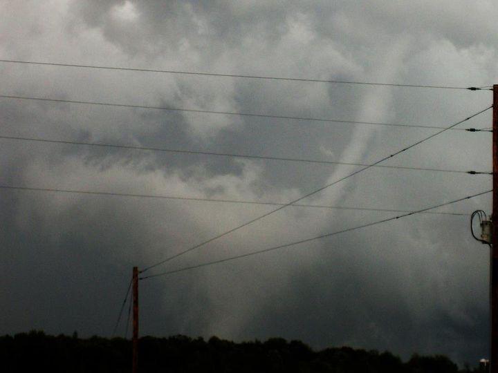
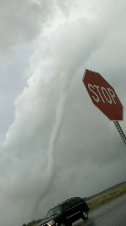
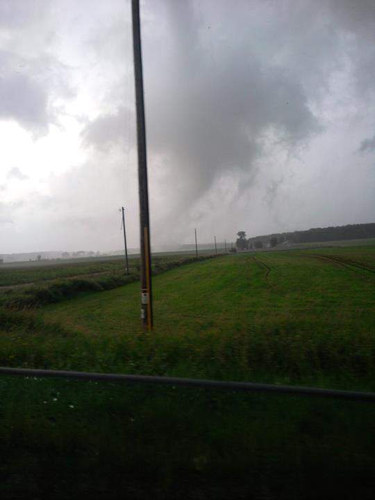 The tornado as seen from the Neillsville, WI area. |
Tornadoes:
|
Tornado - Chili, WI
Track Map 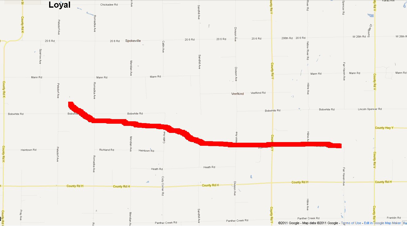  |
||||||||||||||||
The Enhanced Fujita (EF) Scale classifies tornadoes into the following categories:
| EF0 Weak 65-85 mph |
EF1 Moderate 86-110 mph |
EF2 Significant 111-135 mph |
EF3 Severe 136-165 mph |
EF4 Extreme 166-200 mph |
EF5 Catastrophic 200+ mph |
 |
|||||
Photos:
 |
 |
 |
 |
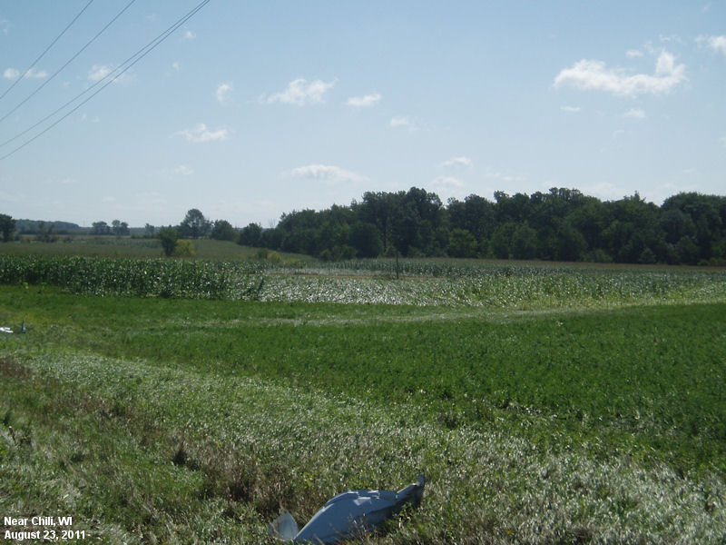
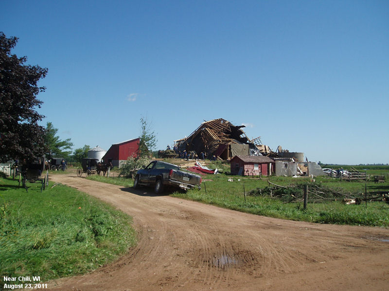
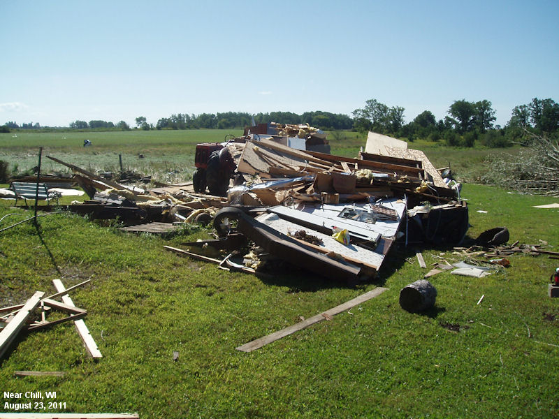
| Tornado evidence in the corn, beginning of track. | First barn to suffer a direct hit from tornado near Bobwhite Rd and Pelsdorf Ave. | Damage to mobile home storage unit near Bobwhite Rd. and Romadka Ave. | Home just missed as tornado passed to the south 100 yds. |
 |
 |
 |
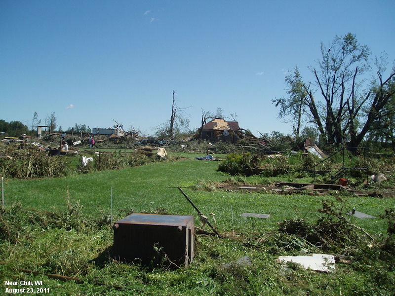 |
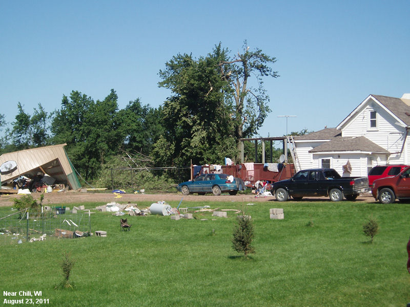
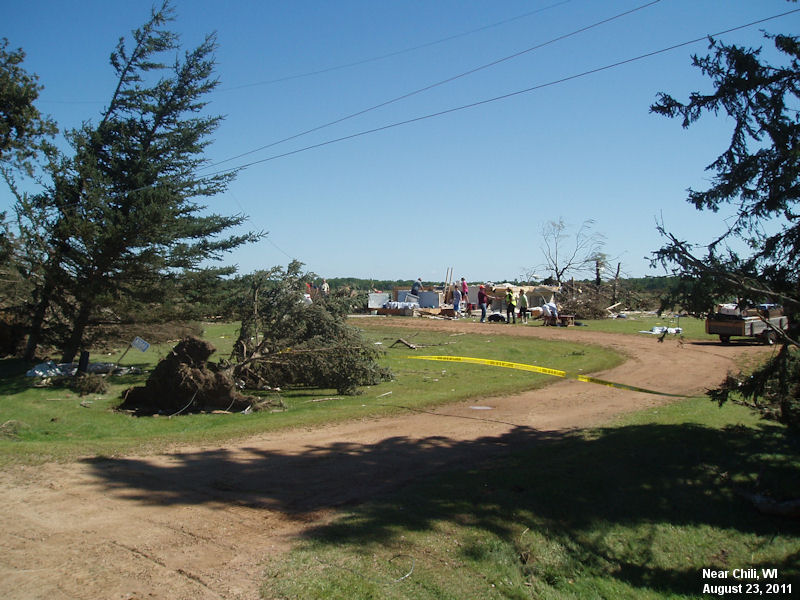
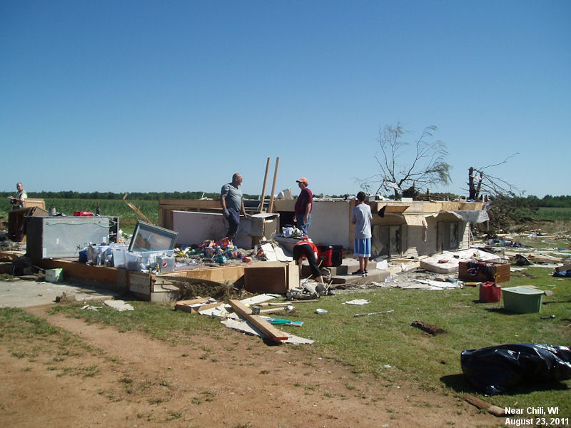
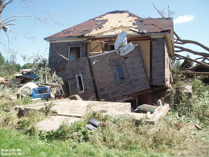
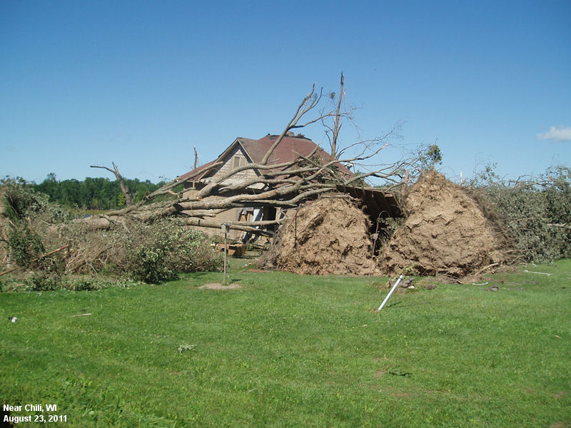
| Heavy damage to residence about 3 miles into tornado track. Higher end EF2 damage near Bobwhite Rd and Catlin Ave. | Closer image of higher end EF2 damage near Bobwhite Rd and Catlin Ave.Top floor and roof missing. Two persons survived in basement. | Second residence with heavy damage near Heintown Rd and Division Ave. Unanchored home was slid about 20 feet off foundation. EF1 to EF2 damage in this vicinity with 200 yard tornado width. | Larger picture of second residence with heavy damage near Heintown Rd and Division Ave. Facing due east along tornado path. |
 |
 |
 |
|
| West side of second residence with heavy damage near Heintown Rd and Division Ave. Two persons survived in the house. | Photo of tornado near Neillsville, WI (Photo courtesy of WSAW) |
Photo of tornado near Neillsville, WI (Photo courtesy of WSAW) |
Photo of tornado near Neillsville, WI (Photo courtesy of WSAW) |
 |
 |
||
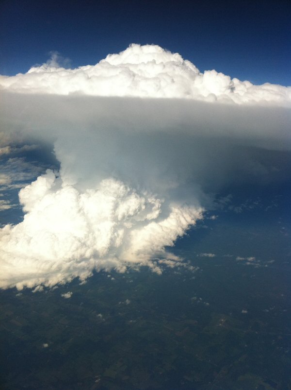
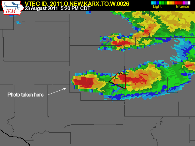
| Photo of Supercell near Neillsville taken from jet at 40,000ft. | Photo of Supercell near Neillsville taken from jet at 40,000ft. |
Radar:
 |
 |
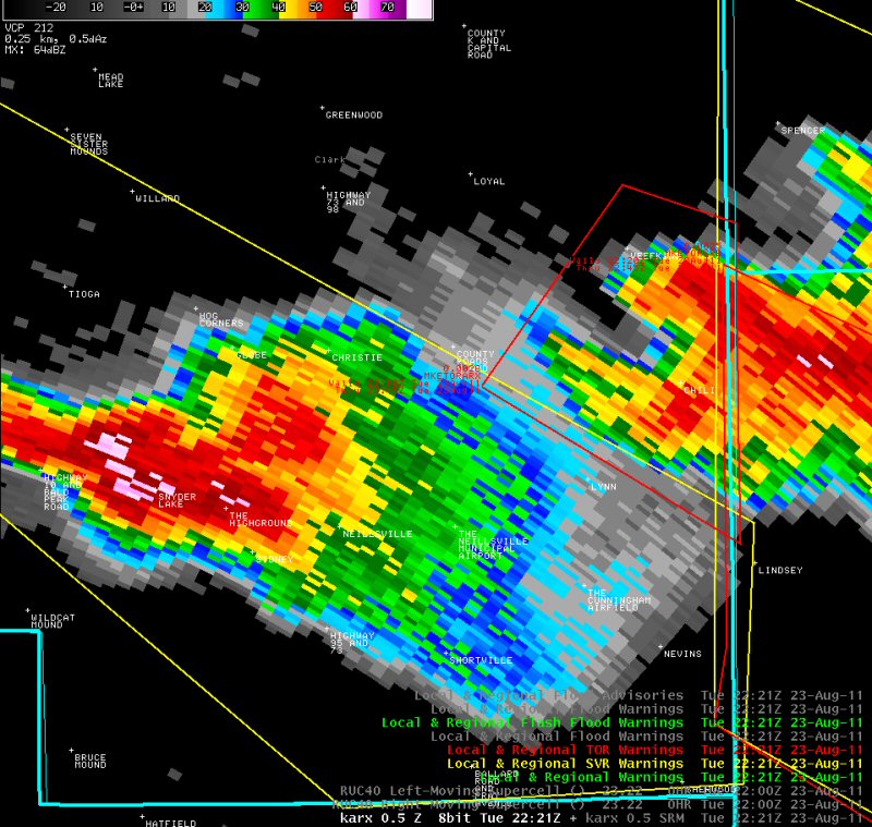 |
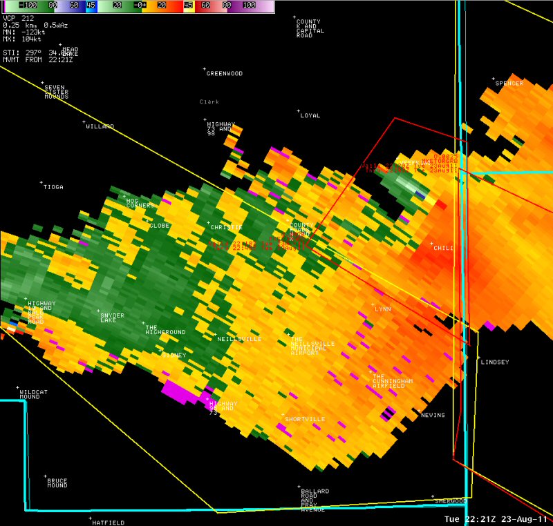 |
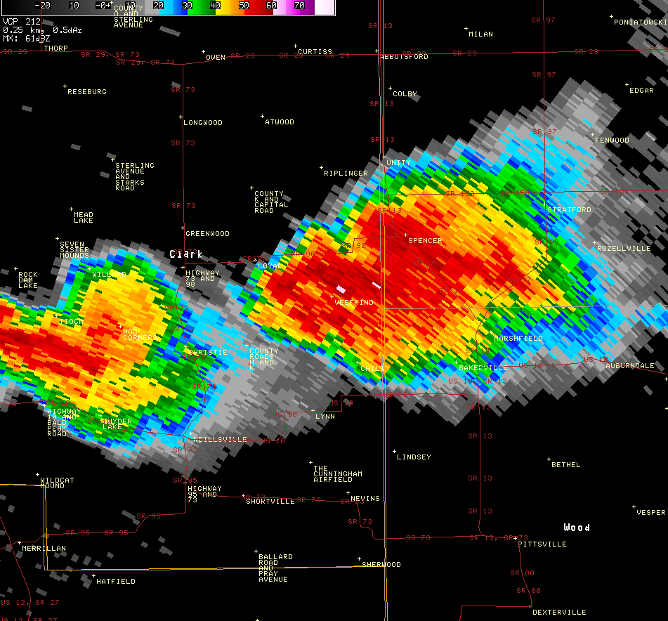
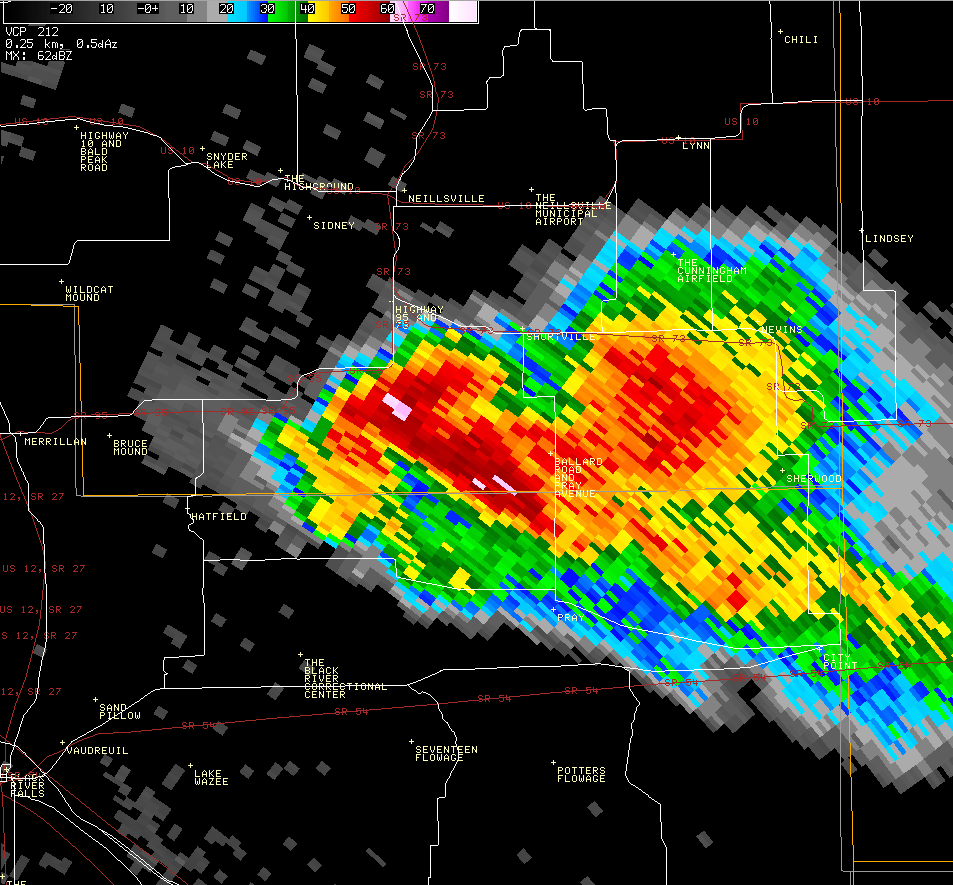
| Caption | Caption | Reflectivity at 5:21 p.m. | Storm Relative Velocity at 5:21 p.m. |
 |
|||
| Caption |
Storm Reports
PRELIMINARY LOCAL STORM REPORT...SUMMARY
NATIONAL WEATHER SERVICE LA CROSSE WI
856 PM CDT TUE AUG 23 2011
..TIME... ...EVENT... ...CITY LOCATION... ...LAT.LON...
..DATE... ....MAG.... ..COUNTY LOCATION..ST.. ...SOURCE....
..REMARKS..
0424 PM HAIL THORP 44.96N 90.80W
08/23/2011 M1.75 INCH CLARK WI TRAINED SPOTTER
0444 PM HAIL 3 S THORP 44.92N 90.80W
08/23/2011 M1.00 INCH CLARK WI LAW ENFORCEMENT
0501 PM HAIL LOYAL 44.74N 90.50W
08/23/2011 M1.00 INCH CLARK WI PUBLIC
0515 PM TORNADO 5 NW CHILI 44.68N 90.42W
08/23/2011 CLARK WI PUBLIC
0520 PM TSTM WND DMG 1 S CHILI 44.62N 90.35W
08/23/2011 CLARK WI TRAINED SPOTTER
0520 PM TSTM WND DMG 1 S CHILI 44.62N 90.35W
08/23/2011 CLARK WI TRAINED SPOTTER
POWER LINES DOWN ON PINE CREEK ROAD AND COUNTY Y
0530 PM TORNADO CHILI 44.63N 90.35W
08/23/2011 CLARK WI EMERGENCY MNGR
HOUSE OFF FOUNDATION...POWER LINES DOWN...ROOFS OFF
HOUSES...AND BARNS DESTROYED
0544 PM HAIL NEILLSVILLE 44.56N 90.59W
08/23/2011 M1.25 INCH CLARK WI TRAINED SPOTTER
0558 PM TSTM WND DMG 2 NE CHILI 44.65N 90.32W
08/23/2011 CLARK WI TRAINED SPOTTER
POWER LINES DOWN. POSSIBLE TORNADO DAMAGE.
 |
Media use of NWS Web News Stories is encouraged! Please acknowledge the NWS as the source of any news information accessed from this site. |
|


 Weather Story
 Weather Map
 Local Radar