Overview
|
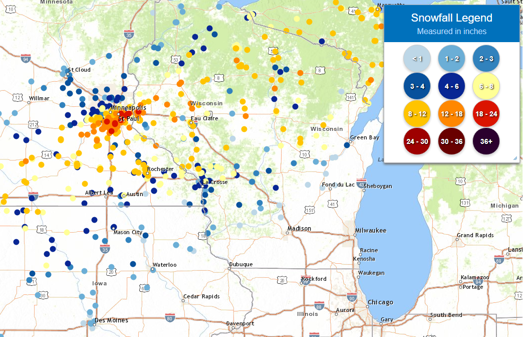
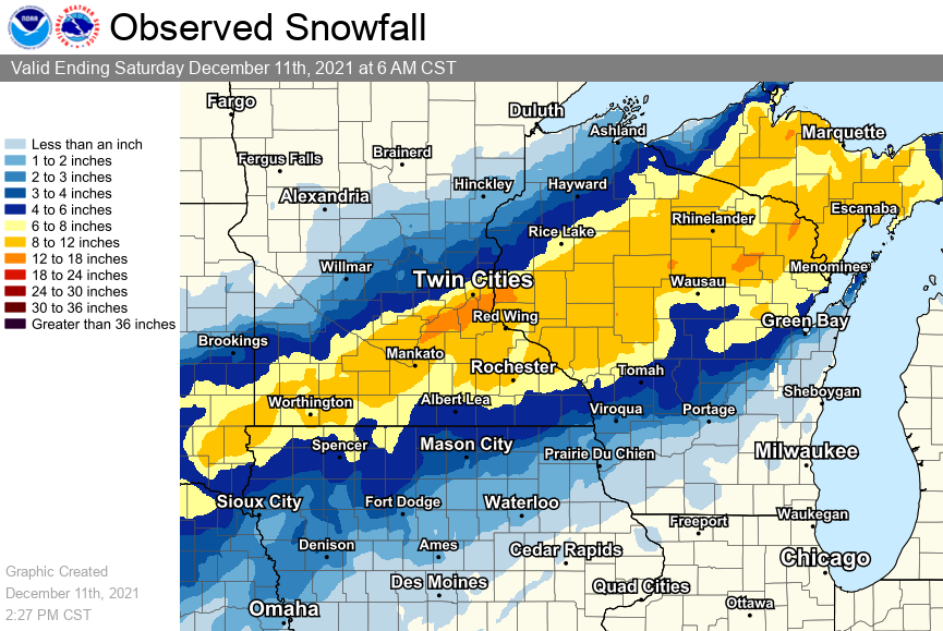
A strong winter storm brought heavy snow to northern parts of the area, with a swath of 7 to locally 12 inches laid out north of Interstate 90. Snowfall amounts were less further south of the I-90 corridor. Compounding the travel difficulties posed by intense snowfall were blowing and drifting impacts due to northerly winds gusting 30 to 45 mph overnight. Roads quickly became snow-covered and dangerous. Areas from northeast Iowa into southwest Wisconsin received more of a wintry mix, including some freezing rain. Isolated power outages occurred where moderate icing accumulated on trees and power lines. Just north of the NWS La Crosse forecast area, this system produced a very narrow band of intense snow from south of the Twin Cities into northwest Wisconsin where amounts ranged from 15 to locally 21 inches! Snowfall forecasts become very difficult when extremely narrow snow bands like this come into play. Not only does the narrow band's placement need to be accurately pinned down in advance (a difficult task in and of itself), but if the band remains stationary for any length of time the intense snow rates can lead to impressive amounts of snow piling up in very little time. |
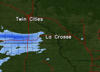 Radar loop from December 10-11, 2021 |
Snow Reports
 |
 |
 |
| Map of storm total snowfall reports | Smoothed map of storm total snowfall (Note: only an approximation of snow amounts) |
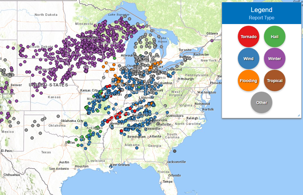
Same system that brought us winter weather spawned severe weather further south |
Public Information Statement
National Weather Service La Crosse WI
912 PM CST Sat Dec 11 2021

...SNOWFALL REPORTS...

Location                     Amount    Time/Date       Lat/Lon

...Iowa...

...Allamakee County...
Harpers Ferry 6.4 SSW        1.6 in    0700 AM 12/11   43.11N/91.20W
Postville 5.5 NE             1.2 in    0700 AM 12/11   43.14N/91.49W
Harpers Ferry 4.1 SW         1.0 in    0800 AM 12/11   43.16N/91.21W

...Chickasaw County...
Ionia 2W                     3.0 in    0700 AM 12/11   43.03N/92.50W
New Hampton 0.4 SW           3.0 in    0700 AM 12/11   43.06N/92.32W
Fredericksburg 0.3 S         1.4 in    0945 AM 12/11   42.96N/92.20W

...Clayton County...
Elkader 6.8 WSW              1.3 in    0630 AM 12/11   42.81N/91.52W
Strawberry Point             1.0 in    0700 AM 12/11   42.69N/91.53W
Elkader 6SSW                 0.8 in    0700 AM 12/11   42.78N/91.45W
Guttenberg Dam 10            0.2 in    0800 AM 12/11   42.79N/91.10W

...Fayette County...
3 N Fayette                  2.0 in    0705 AM 12/11   42.88N/91.83W
Oelwein 1 E                  1.0 in    0630 AM 12/11   42.68N/91.88W

...Floyd County...
Nora Springs 2.4 SSE         2.5 in    0700 AM 12/11   43.11N/92.99W
Charles City                 2.0 in    0700 AM 12/11   43.06N/92.67W
Marble Rock                  2.0 in    0651 AM 12/11   42.96N/92.87W
Colwell                      1.0 in    0817 AM 12/11   43.16N/92.59W

...Howard County...
Elma                         2.1 in    0700 AM 12/11   43.24N/92.44W

...Mitchell County...
St Ansgar                    5.6 in    0630 AM 12/11   43.38N/92.92W

...Winneshiek County...
7 ENE Decorah                3.1 in    0847 AM 12/11   43.34N/91.64W
Decorah 4.9SE                2.0 in    0700 AM 12/11   43.26N/91.70W

...Minnesota...

...Dodge County...
1 NE Kasson                  11.0 in   0825 AM 12/11   44.04N/92.74W
Hayfield 0.3 SSE             8.5 in    0800 AM 12/11   43.89N/92.85W
Mantorville 1.9 ESE          8.5 in    0700 AM 12/11   44.05N/92.72W

...Fillmore County...
Chatfield                    7.8 in    0855 AM 12/11   43.84N/92.19W
1 S Lanesboro                6.5 in    0812 AM 12/11   43.71N/91.97W
Preston                      6.0 in    0800 AM 12/11   43.67N/92.07W
2 WSW Fillmore               5.5 in    0700 AM 12/11   43.74N/92.31W
Wykoff 3.1 NW                5.5 in    0700 AM 12/11   43.74N/92.31W
Chatfield 9.0 ESE            5.3 in    0700 AM 12/11   43.79N/92.03W
Mabel                        4.0 in    0700 AM 12/11   43.52N/91.76W

...Houston County...
Hokah 4 NW                   4.9 in    0700 AM 12/11   43.80N/91.43W
La Crescent                  4.8 in    0705 AM 12/11   43.83N/91.31W
Houston 6.9 E                4.5 in    0845 AM 12/11   43.76N/91.43W
Caledonia                    3.3 in    0845 AM 12/11   43.63N/91.50W
Caledonia 5.4 S              3.0 in    0800 AM 12/11   43.56N/91.51W

...Mower County...
1 SW Austin                  9.0 in    0556 PM 12/11   43.66N/92.98W
Waltham 2.0 SE               7.0 in    0800 AM 12/11   43.80N/92.85W
Austin 1.9 ENE               5.5 in    0800 AM 12/11   43.68N/92.94W
Austin 2.4 W                 5.0 in    0626 AM 12/11   43.67N/93.02W
2 NE Lyle                    4.0 in    0700 AM 12/11   43.53N/92.91W

...Olmsted County...
2 NNW Rochester              11.0 in   0700 AM 12/11   44.05N/92.49W
1 NW Rochester               10.5 in   0845 AM 12/11   44.02N/92.49W
5 E Douglas                  10.5 in   0837 AM 12/11   44.10N/92.48W
2 NE Rochester               10.5 in   0600 AM 12/11   44.04N/92.44W
1 SSW Oronoco                10.1 in   1019 AM 12/11   44.15N/92.54W
6 NNW Genoa                  10.0 in   1037 AM 12/11   44.19N/92.65W
2 NNE Rochester              9.7 in    0500 AM 12/11   44.04N/92.46W
3 SSE Douglas                9.5 in    0601 PM 12/11   44.08N/92.55W
2 NE Rochester               9.5 in    0923 AM 12/11   44.03N/92.45W
4 ESE Douglas                9.5 in    0850 AM 12/11   44.08N/92.51W
2 NW Rochester               9.3 in    0846 AM 12/11   44.03N/92.50W
Rochester 4.7 N              9.3 in    0700 AM 12/11   44.08N/92.48W
3 SE Rochester               8.9 in    1059 AM 12/11   43.98N/92.44W
Rochester 4.2 N              8.5 in    0630 AM 12/11   44.08N/92.49W
Byron                        8.1 in    0929 AM 12/11   44.03N/92.65W
1 NE Rochester               8.0 in    0255 PM 12/11   44.02N/92.46W
Rochester AP 2NE             7.4 in    0700 AM 12/11   43.93N/92.48W
1 NE Chatfield               7.0 in    0125 PM 12/11   43.85N/92.17W
Stewartville 4.3 E           7.0 in    0600 AM 12/11   43.86N/92.40W
Rochester 1.5 WSW            5.5 in    0700 AM 12/11   44.00N/92.50W
Elgin 2SSW                   5.0 in    0700 AM 12/11   44.10N/92.27W
3 SSW Predmore               4.5 in    0821 AM 12/11   43.90N/92.34W
Elba 4.7 SW                  4.0 in    0800 AM 12/11   44.04N/92.09W

...Wabasha County...
Lake City                    12.0 in   0817 AM 12/11   44.45N/92.27W
Millville                    10.0 in   0631 AM 12/11   44.25N/92.30W
Theilman 1 SSW               9.8 in    0730 AM 12/11   44.28N/92.19W
0.9 N Wabasha                9.6 in    0700 AM 12/11   44.38N/92.05W
Zumbro Falls 3.5 SSW         5.5 in    0733 AM 12/11   44.24N/92.46W

...Winona County...
4.2 N Rollingstone           10.0 in   0800 AM 12/11   44.16N/91.81W
1 WNW Winona                 7.5 in    0600 AM 12/11   44.05N/91.68W
Winona 2.0 ESE               7.1 in    0715 AM 12/11   44.04N/91.63W
Winona Dam 5A                7.0 in    0800 AM 12/11   44.09N/91.67W
2 S Goodview                 7.0 in    0635 AM 12/11   44.05N/91.71W
2 NNW Wilson                 6.5 in    0935 AM 12/11   43.98N/91.71W
Winona 1.3 SSW               6.0 in    0815 AM 12/11   44.03N/91.68W
Saint Charles                6.0 in    0654 AM 12/11   43.97N/92.06W
La Crescent 4.0 NNW          5.4 in    0745 AM 12/11   43.88N/91.34W
La Crescent Dam 7            4.5 in    0800 AM 12/11   43.87N/91.31W

...Wisconsin...

...Adams County...
Nekoosa 8.0 SSE              7.0 in    0700 AM 12/11   44.21N/89.85W
3 ESE White Creek            6.0 in    0708 AM 12/11   43.81N/89.80W
0.6 W Friendship             4.2 in    0700 AM 12/11   43.98N/89.83W
Oxford 4.0 W                 4.0 in    0700 AM 12/11   43.79N/89.64W
Friendship 6.4 N             3.5 in    0700 AM 12/11   44.06N/89.80W

...Buffalo County...
Mondovi                      10.0 in   0500 PM 12/11   44.56N/91.67W
Alma Dam 4                   8.6 in    0800 AM 12/11   44.33N/91.92W
Fountain City                8.0 in    0948 AM 12/11   44.12N/91.70W
Cochrane                     7.9 in    0800 AM 12/11   44.22N/91.83W

...Clark County...
Owen 1E                      10.0 in   0700 AM 12/11   44.95N/90.55W
2 N Dorchester               9.3 in    0746 AM 12/11   45.03N/90.33W
6 N Chili                    8.0 in    0828 AM 12/11   44.71N/90.34W

...Crawford County...
2.8 E Harpers Ferry          2.0 in    0800 AM 12/11   43.21N/91.10W
Prairie Du Chien 1.4 N       2.0 in    0700 AM 12/11   43.06N/91.14W
2 N Prairie Du Chien         1.6 in    0940 AM 12/11   43.07N/91.14W
Eastman 2.4 NNE              1.5 in    0900 AM 12/11   43.20N/91.00W
Steuben 4SE                  1.0 in    0820 AM 12/11   43.13N/90.84W
Eastman                      1.0 in    0815 AM 12/11   43.16N/91.02W

...Grant County...
Muscoda 0.5 WSW              1.3 in    0937 AM 12/11   43.18N/90.44W
Patch Grove 0.1 NNW          1.0 in    0700 AM 12/11   42.94N/90.97W
Cassville 7.8 ENE            0.2 in    0700 AM 12/11   42.75N/90.84W
Platteville                   T in     0651 AM 12/11   42.74N/90.48W
Cuba City                     T in     0639 AM 12/11   42.60N/90.43W
Boscobel                      T in     0630 AM 12/11   43.14N/90.70W

...Jackson County...
Black River Falls 1.7 NNE    9.2 in    0700 AM 12/11   44.32N/90.83W
Black River Falls            8.1 in    0830 AM 12/11   44.29N/90.85W
Hatfield                     8.0 in    0957 AM 12/11   44.42N/90.73W
4 W Melrose                  7.5 in    0726 AM 12/11   44.13N/91.07W
Melrose 3.6 W                7.5 in    0700 AM 12/11   44.13N/91.07W

...La Crosse County...
4 NE New Amsterdam           7.1 in    0709 AM 12/11   44.03N/91.27W
Holmen 1.7 SSE               6.2 in    0700 AM 12/11   43.93N/91.24W
Onalaska 1.9 E               6.0 in    0700 AM 12/11   43.89N/91.18W
4 WNW Stevenstown            5.8 in    0956 AM 12/11   44.05N/91.24W
2 E La Crosse                5.7 in    0600 AM 12/11   43.82N/91.19W
2 NNW Onalaska               5.3 in    0700 AM 12/11   43.91N/91.23W
French Island                5.3 in    0600 AM 12/11   43.86N/91.27W
La Crosse 4NNW               5.1 in    0730 AM 12/11   43.87N/91.27W
1 W West Salem               5.0 in    0953 AM 12/11   43.90N/91.10W
1 NNW Onalaska               5.0 in    0945 AM 12/11   43.90N/91.23W
Holmen                       5.0 in    0905 AM 12/11   43.96N/91.26W
La Crosse 4.4 SSE            5.0 in    0700 AM 12/11   43.77N/91.21W
West Salem                   4.5 in    0700 AM 12/11   43.90N/91.09W
Coon Valley 4.5 NNW          3.4 in    0700 AM 12/11   43.76N/91.06W
La Crosse                    3.0 in    0600 AM 12/11   43.86N/91.27W

...Monroe County...
3 ESE Melrose                7.3 in    0655 AM 12/11   44.12N/90.94W
Cataract                     7.3 in    0600 AM 12/11   44.09N/90.84W
Tunnel City                  6.3 in    0948 AM 12/11   44.01N/90.57W
Sparta                       6.0 in    0808 AM 12/11   43.94N/90.81W
Tomah                        5.5 in    0946 AM 12/11   43.99N/90.50W
Warrens 4.7 WSW              5.5 in    0700 AM 12/11   44.10N/90.59W
0.5 SW Sparta                5.0 in    0800 AM 12/11   43.94N/90.82W
Wilton 4.2 E                 4.4 in    0700 AM 12/11   43.81N/90.44W

...Richland County...
2 NNE Bloom City             3.0 in    0908 AM 12/11   43.52N/90.45W

...Taylor County...
2 N Medford                  11.5 in   0828 PM 12/11   45.17N/90.35W
0.6 SE Medford               11.0 in   0700 AM 12/11   45.13N/90.34W
1 W Medford                  8.5 in    0800 AM 12/11   45.14N/90.37W
Medford 0.8 ENE              8.3 in    0700 AM 12/11   45.14N/90.33W

...Trempealeau County...
1 NE Galesville              10.0 in   0828 AM 12/11   44.09N/91.34W
3 SSE Elk Creek              10.0 in   0811 AM 12/11   44.39N/91.38W
Arcadia                      9.0 in    0736 AM 12/11   44.25N/91.49W
Ettrick 4.0 WNW              8.2 in    0721 AM 12/11   44.19N/91.34W
Dodge                        8.0 in    0747 AM 12/11   44.13N/91.55W
Galesville                   7.0 in    0844 AM 12/11   44.08N/91.36W
Trempealeau Dam 6            6.0 in    0800 AM 12/11   44.00N/91.44W
2 WSW Frenchville            5.8 in    0930 AM 12/11   44.14N/91.36W

...Vernon County...
De Soto                      5.1 in    0711 AM 12/11   43.43N/91.20W
Hillsboro 2 SW               5.0 in    0700 AM 12/11   43.63N/90.38W
5 NE Stoddard                4.5 in    0700 AM 12/11   43.72N/91.16W
Stoddard 4.7 NNE             4.5 in    0700 AM 12/11   43.72N/91.17W
2 NE Stoddard                3.7 in    0808 AM 12/11   43.68N/91.19W
0.5 E Viroqua                3.2 in    0700 AM 12/11   43.56N/90.88W
Genoa Dam 8                  3.0 in    0700 AM 12/11   43.57N/91.23W
Viroqua 0.8 ESE              1.8 in    0700 AM 12/11   43.55N/90.87W
Hillsboro 0.5 WSW            1.0 in    0700 AM 12/11   43.65N/90.35W

Observations are collected from a variety of sources with varying
equipment and exposures. We thank all volunteer weather observers
for their dedication. Not all data listed are considered official.

$$
Wind Reports
PUBLIC INFORMATION STATEMENT
NATIONAL WEATHER SERVICE LA CROSSE WI
103 PM CST SAT DEC 11 2021

...HIGHEST WIND REPORTS FROM EARLY SATURDAY MORNING...

LOCATION                     SPEED     TIME/DATE       LAT/LON

...IOWA...

...FAYETTE COUNTY...
OELWEIN MUNICIPAL AIRPORT    41 MPH    0415 AM 12/11   42.68N/91.97W

...HOWARD COUNTY...
SARATOGA                     37 MPH    0346 AM 12/11   43.35N/92.42W

...WINNESHIEK COUNTY...
DECORAH MUNICIPAL AIRPORT    33 MPH    0435 AM 12/11   43.27N/91.72W

...MINNESOTA...

...DODGE COUNTY...
2 E KASSON                   40 MPH    0250 AM 12/11   44.02N/92.71W
DODGE CENTER AIRPORT         37 MPH    0235 AM 12/11   44.02N/92.82W

...FILLMORE COUNTY...
PRESTON AIRPORT              38 MPH    0415 AM 12/11   43.68N/92.17W

...MOWER COUNTY...
1 ENE DEXTER                 41 MPH    0250 AM 12/11   43.73N/92.68W
AUSTIN MUNICIPAL AIRPORT     38 MPH    0215 AM 12/11   43.67N/92.92W

...OLMSTED COUNTY...
ROCHESTER INTERNATIONAL AIRP 44 MPH    0250 AM 12/11   43.90N/92.50W
JCT CR 7 I-90 MILE POST 226  38 MPH    0305 AM 12/11   43.96N/92.21W
3 N STEWARTVILLE             37 MPH    0350 AM 12/11   43.90N/92.48W
MAYO HELIPAD                 35 MPH    0555 AM 12/11   44.02N/92.48W
ROCHESTER                    32 MPH    0247 AM 12/11   44.18N/92.41W

...WABASHA COUNTY...
1 SSE KELLOGG                34 MPH    0550 AM 12/11   44.28N/91.99W
LAKE CITY                    33 MPH    0216 AM 12/11   44.32N/92.44W

...WINONA COUNTY...
1 E RIDGEWAY                 37 MPH    0450 AM 12/11   43.91N/91.54W
WINONA MUNICIPAL AIRPORT     36 MPH    0555 AM 12/11   44.07N/91.70W

...WISCONSIN...

...GRANT COUNTY...
LANCASTER                    36 MPH    0841 AM 12/11   42.83N/90.69W
BOSCOBEL AIRPORT             32 MPH    0523 AM 12/11   43.15N/90.68W
PLATTEVILLE MUNICIPAL AIRPOR 32 MPH    0715 AM 12/11   42.68N/90.43W

...JUNEAU COUNTY...
NECEDAH                      31 MPH    0648 AM 12/11   44.03N/90.08W
MAUSTON AIRPORT              30 MPH    0655 AM 12/11   43.83N/90.13W

...LA CROSSE COUNTY...
LA CROSSE REGIONAL AIRPORT   36 MPH    0351 AM 12/11   43.88N/91.25W
ONALASKA                     35 MPH    0255 AM 12/11   43.89N/91.18W

...TAYLOR COUNTY...
3 NE LUBLIN                  31 MPH    0414 AM 12/11   45.11N/90.69W
MEDFORD AIRPORT              30 MPH    0515 AM 12/11   45.10N/90.30W

OBSERVATIONS ARE COLLECTED FROM A VARIETY OF SOURCES WITH VARYING
EQUIPMENT AND EXPOSURES. WE THANK ALL VOLUNTEER WEATHER OBSERVERS
FOR THEIR DEDICATION. NOT ALL DATA LISTED ARE CONSIDERED OFFICIAL.

$$
Photos & Video:
 |
 |
 |
 |
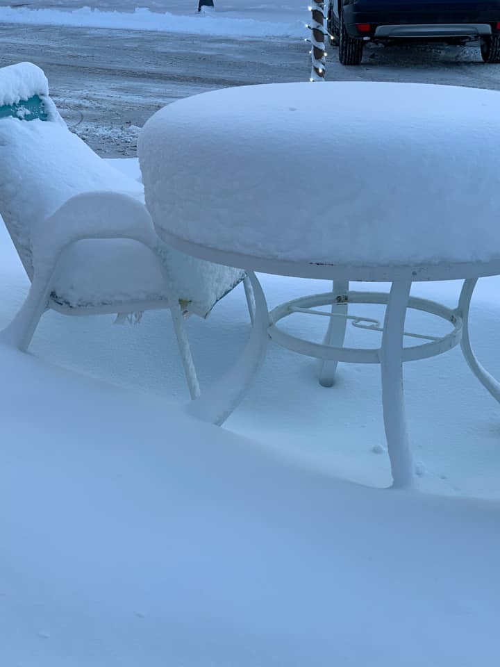
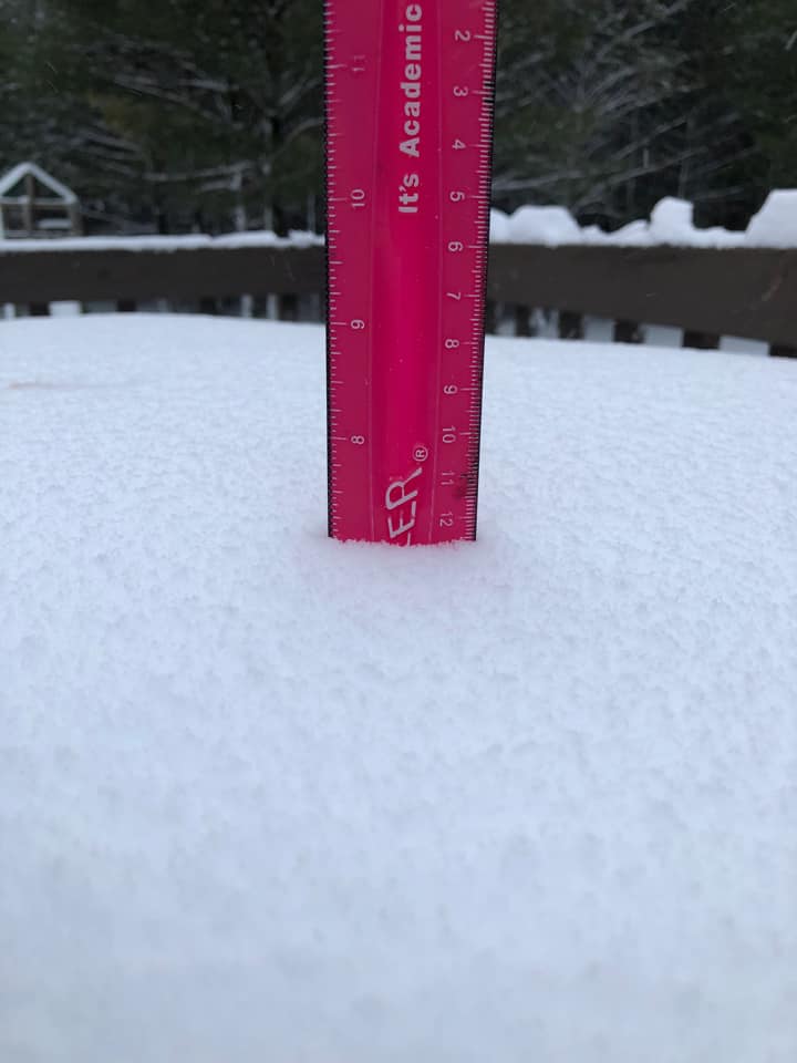
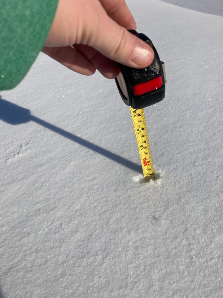
| Lake City, MN (courtesy Becca Weist) |
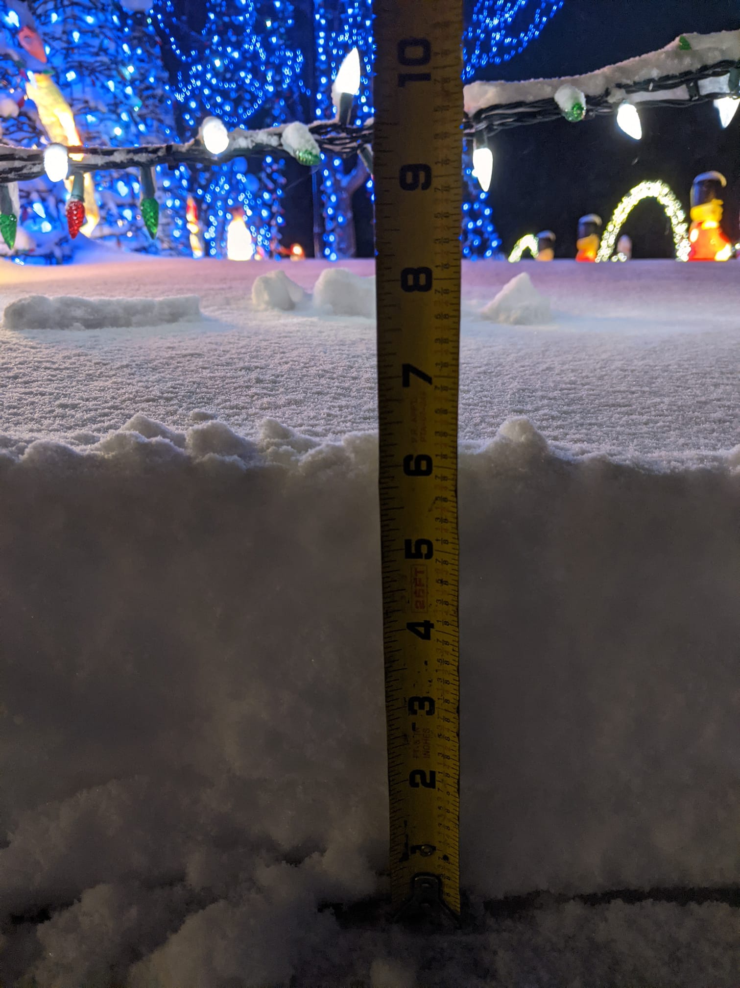
Onalaska, WI (courtesy Tim Berg) |
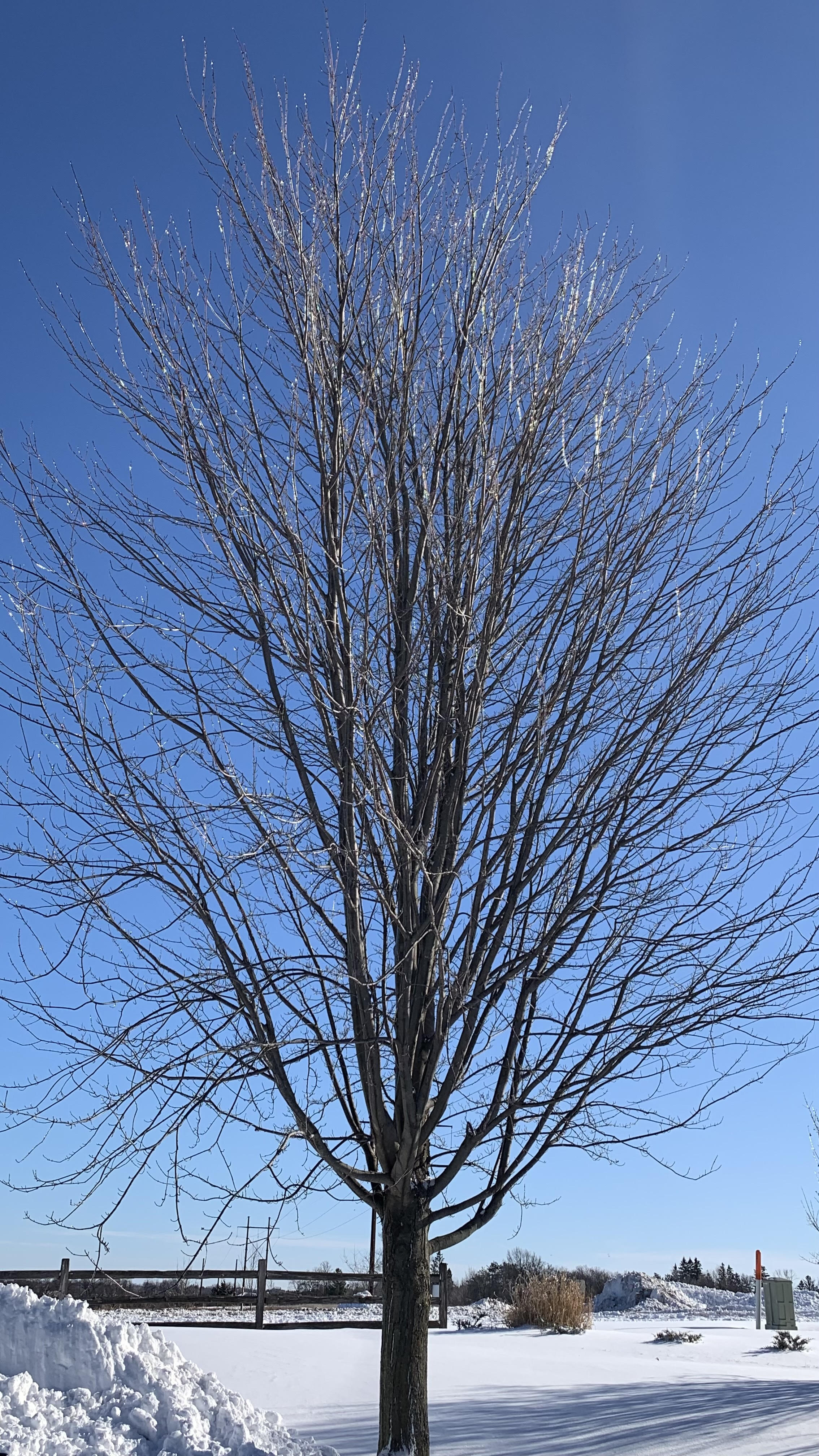
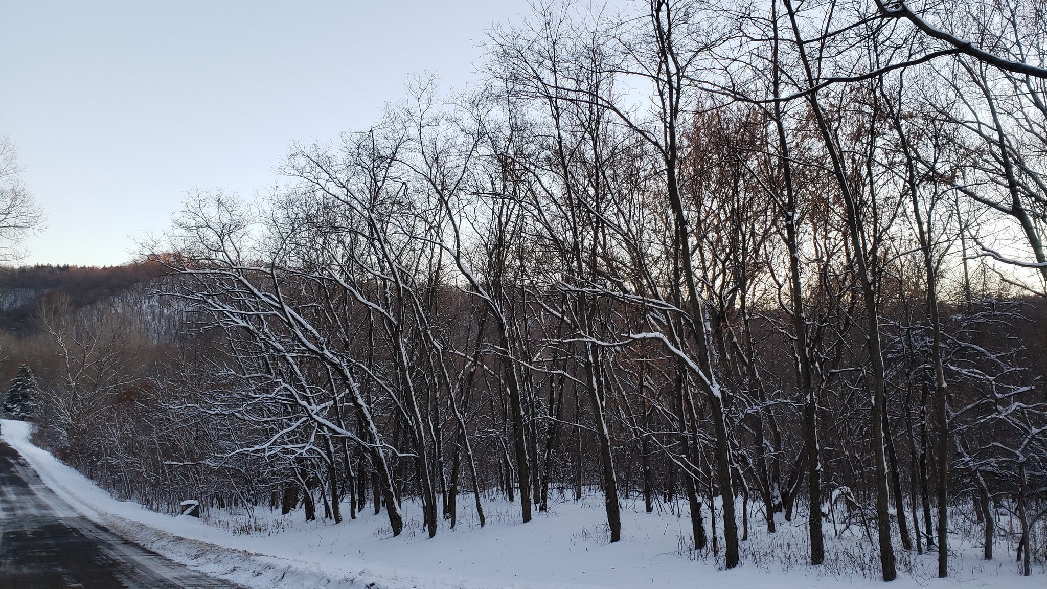
Glistening Tree Tops (NWS La Crosse) |
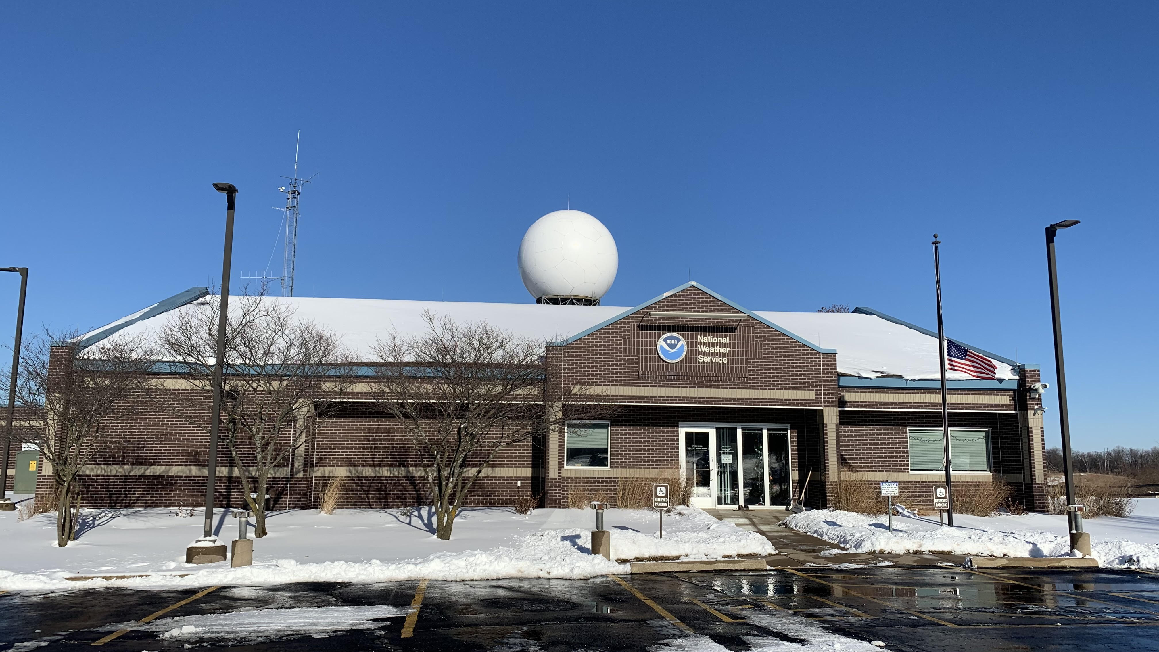
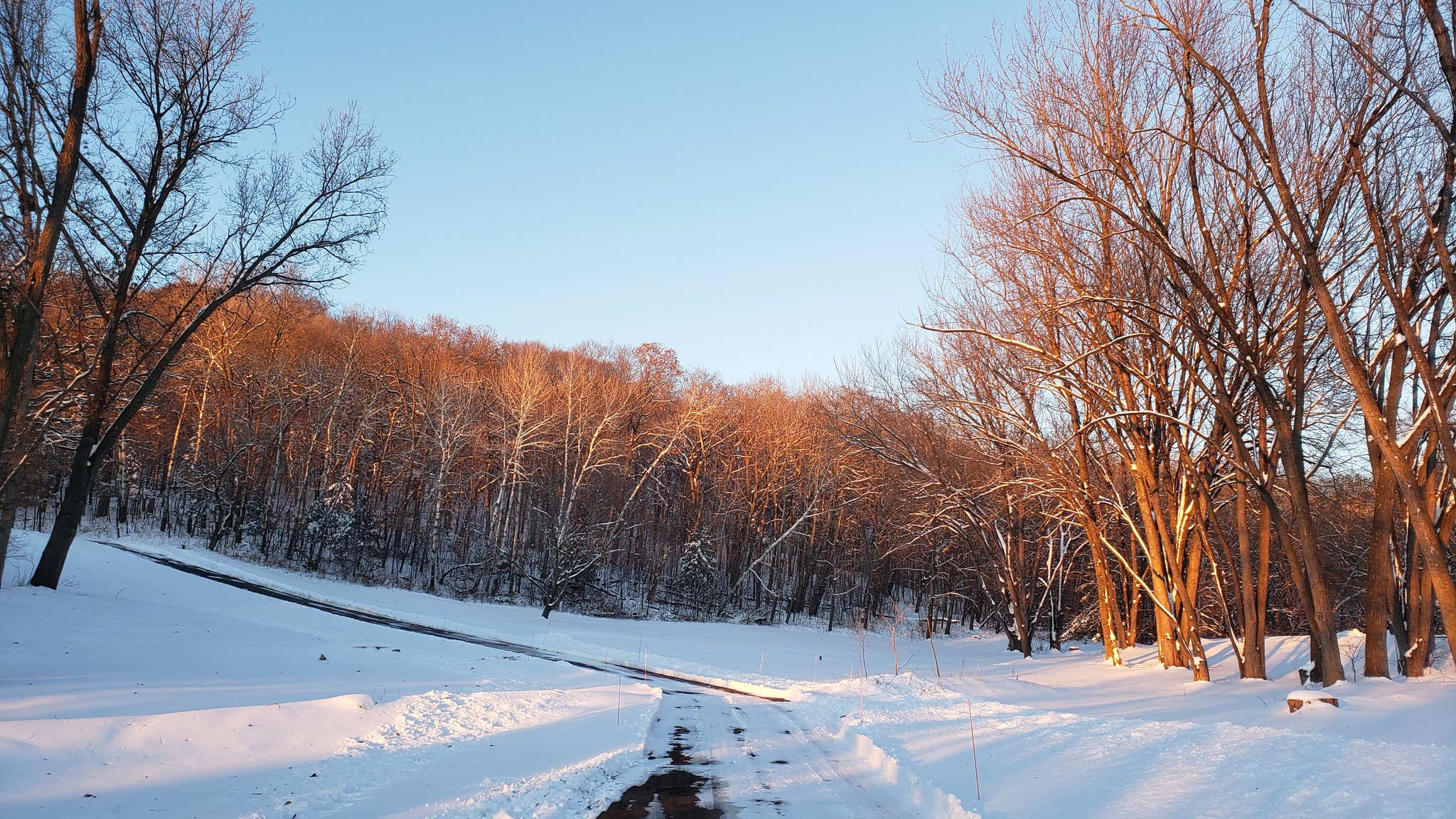
Blue Skies Behind the Winter Storm (NWS La Crosse) |
 |
 |
 |
 |
| Black River Falls, WI (courtesy Hannah Shaw) | NE Kasson, MN (courtesy Don Vaughan) |
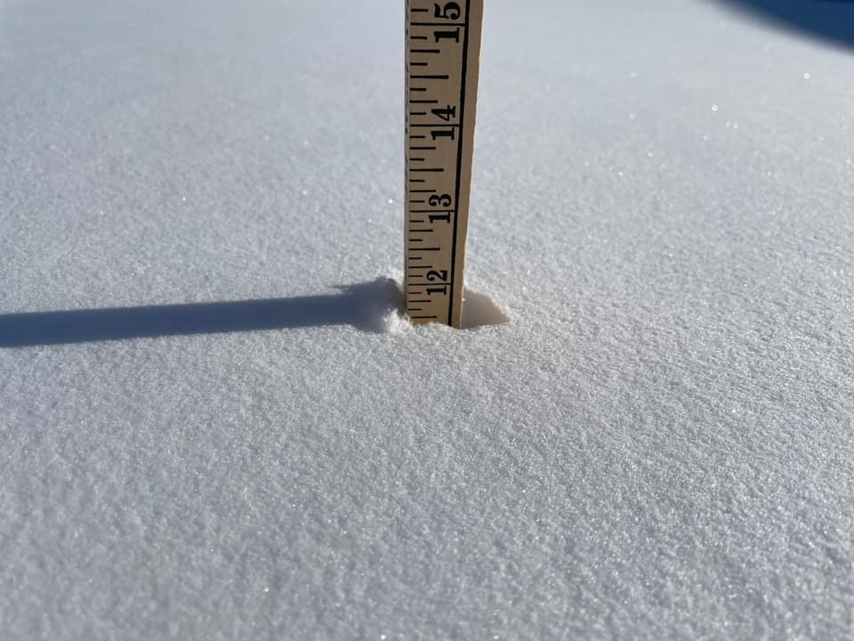
Rural Medford, WI (courtesy Diane Gerum) |
Millville, MN (courtesy Amy Tentis) |
 |
 |
 |
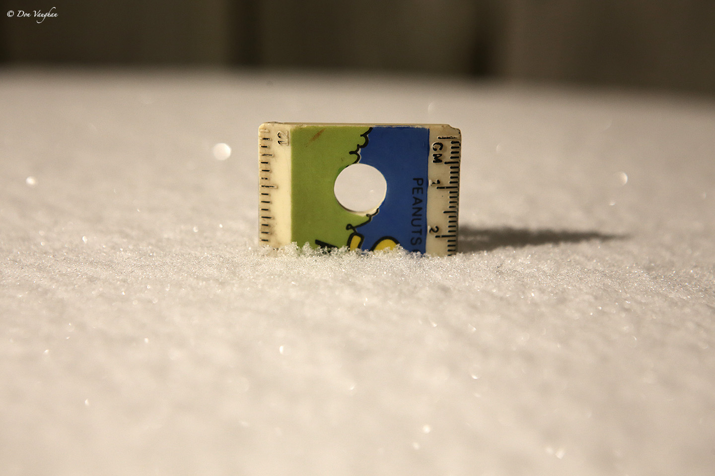
| NE Rochester, MN (courtesy Ajnos Nosdivad) |
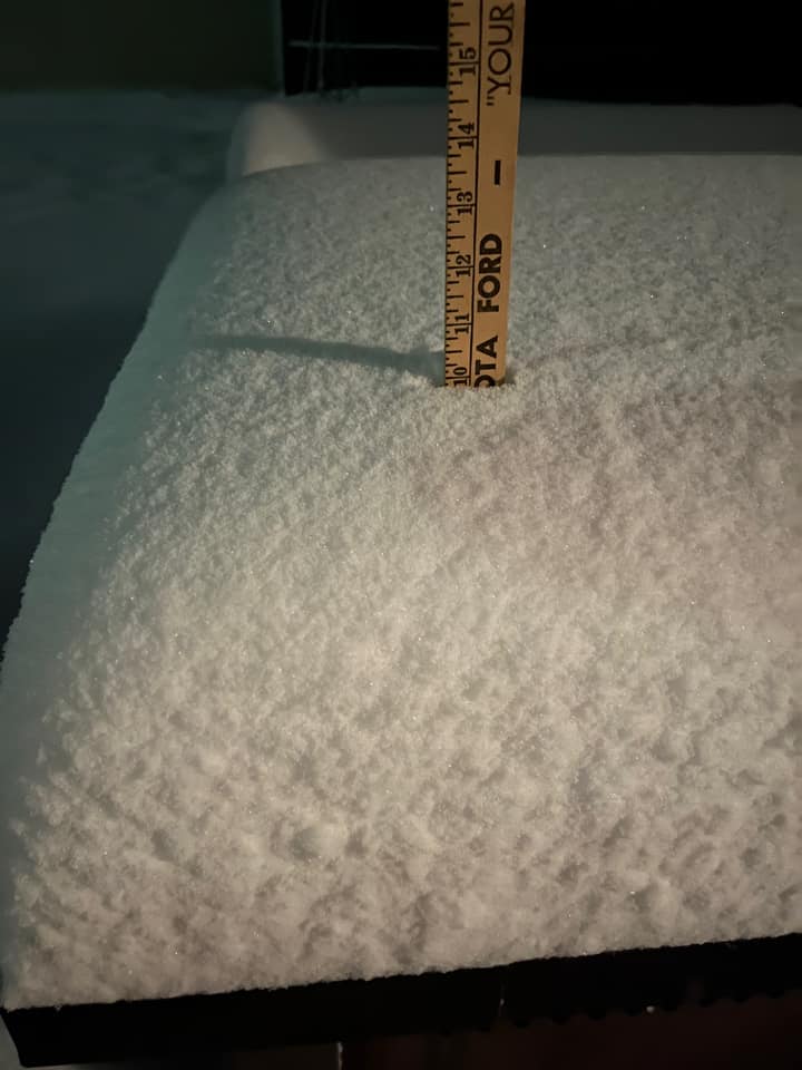
North of Holmen, WI (courtesy Mike Kurz) |
North of Holmen, WI (courtesy Mike Kurz) |
 |
Media use of NWS Web News Stories is encouraged! Please acknowledge the NWS as the source of any news information accessed from this site. |
|


 Weather Story
 Weather Map
 Local Radar