Overview
|
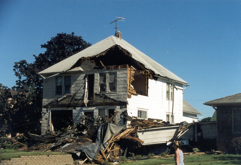
After a cool, cloudy start to the day, the atmosphere became very unstable during the afternoon of July 8, 1999 and produced significant thunderstorm activity. A tornado formed just northwest of the town of Lewiston, MN (Winona Co.), tracked right through town, and then dissipated southeast of town near a farm. There were a couple injuries and lots of damage in town. As the storms tracked into Wisconsin, they produced another brief tornado in Mondovi, WI (Buffalo Co.) along with areas of wind damage. Rotation from the same storm that struck Lewiston went across the Mississippi River valley near La Crosse and was witnessed by the La Crosse National Weather Service just east of town. Winds gusted to 72 mph at the NWS office, with other high gusts from different directions. There was wind damage across parts of central La Crosse County, WI. In summary, there were two tornadoes - one F2 and one F1 - and sporadic wind damage. |
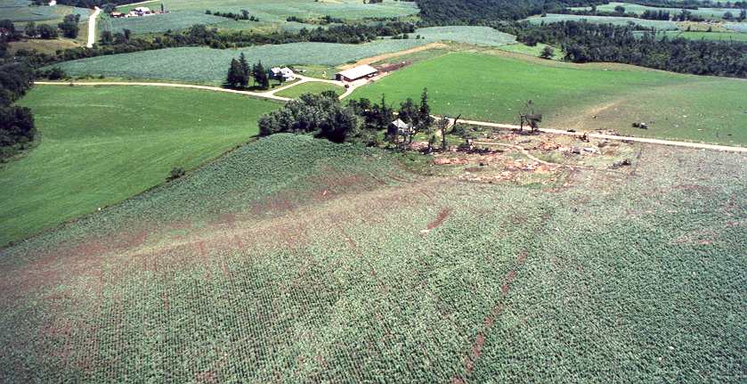 The clear path of the Lewiston, MN tornado as it moved into nearby farm fields on July 8, 1999 |
Tornadoes:
|
Tornado #1 - Lewiston, MN
Track Map 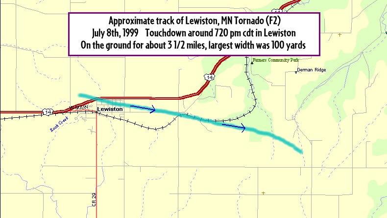 |
||||||||||||||||
|
Tornado #2 - Mondovi, WI
|
||||||||||||||||
Photos:
Lewiston, MN
 |
 |
 |
|
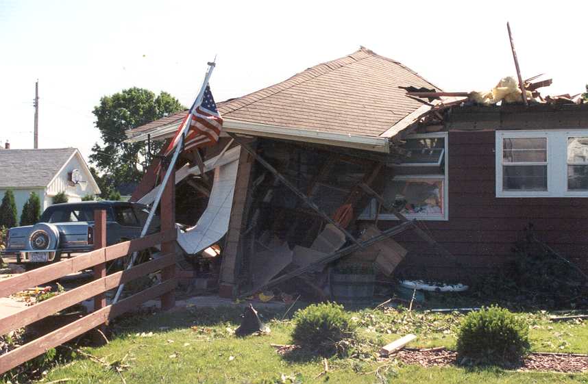
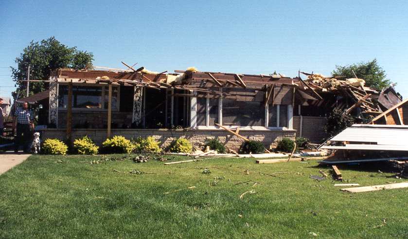
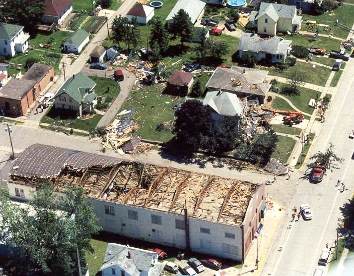
| House damage in Lewiston | F-2 damage on Main St. in Lewiston | Roof damage | The path of the tornado east of town, impacting a nearby farm |
 |
 |
 |
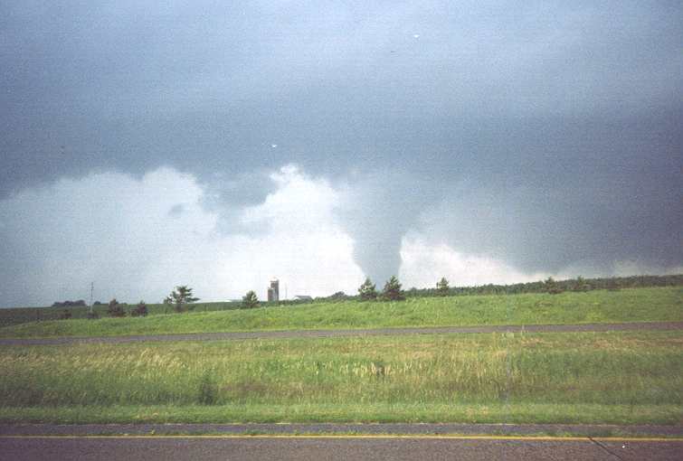 |
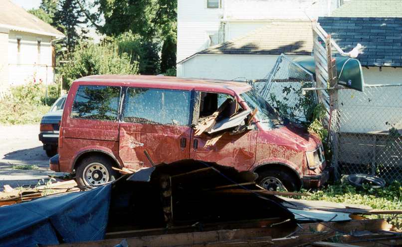
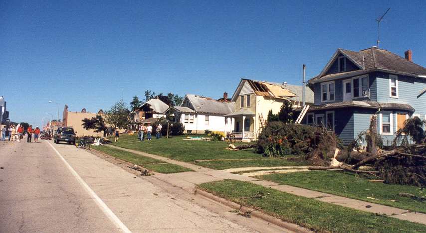
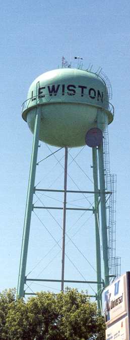
| Debris heavily damaged a van on Main St. | A look down Main St. with damaged homes | The water town was left untouched | One view of the tornado |
 |
 |
 |
|
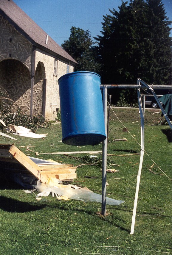
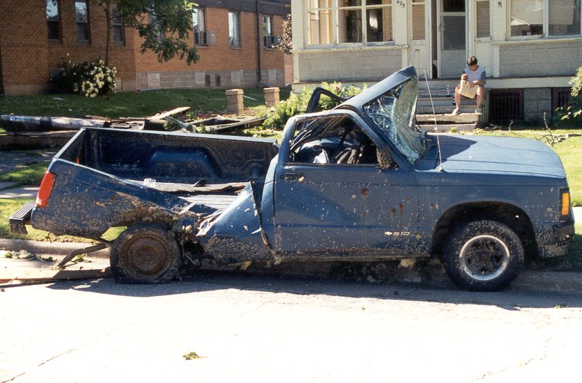
| Debris thrown on a clothes line | Home damage in Lewiston | Truck heavily damaged from falling debris |
Radar & Maps:
 |
 |
 |
|
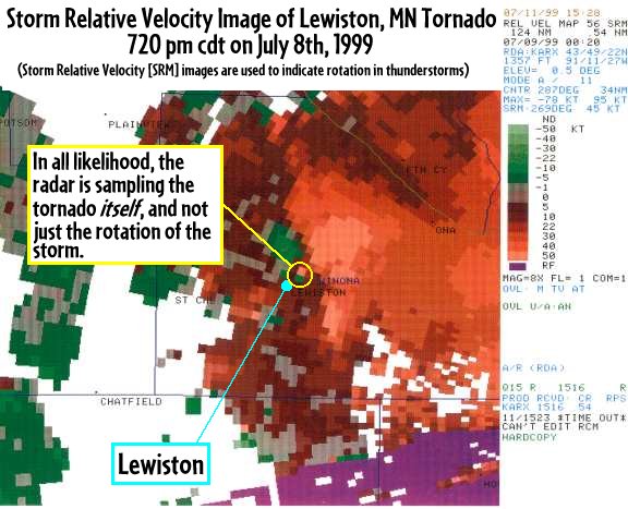
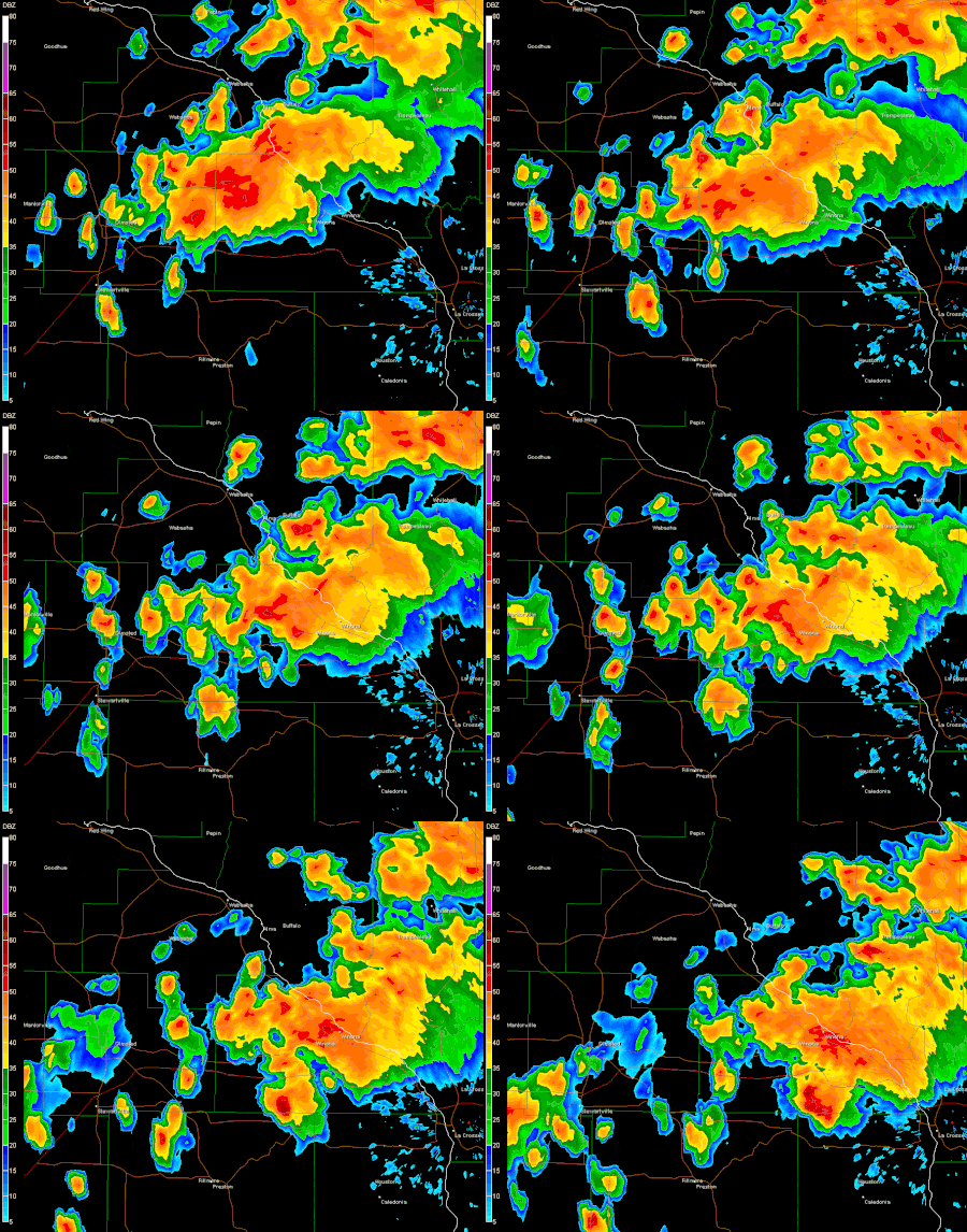
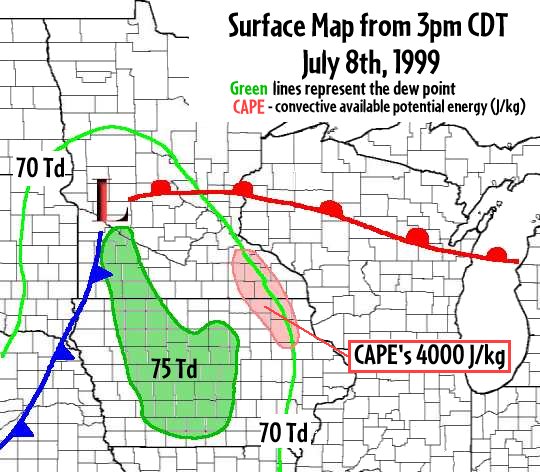
| At the time, the most significant tornado sampled by the relatively new WSR-88D radar at NWS La Crosse. The rotation is clearly depicted by this storm-relative velocity image at tornado time. | Animation of storm cells going through Winona County, including the storm that produced the Lewiston, MN tornado. | Surface map for July 8, 1999 |
Reports
 |
|||
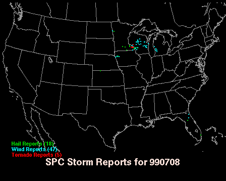
| Storm Reports from July 8, 1999 |
Warning Lead Time
| Counties & Issuance Time | Lead Time |
 |
Media use of NWS Web News Stories is encouraged! Please acknowledge the NWS as the source of any news information accessed from this site. |
|



 Weather Story
 Weather Map
 Local Radar
 Follow us on X
 Follow us on Facebook
 Follow us on YouTube
 ARX RSS Feed