Overview
|
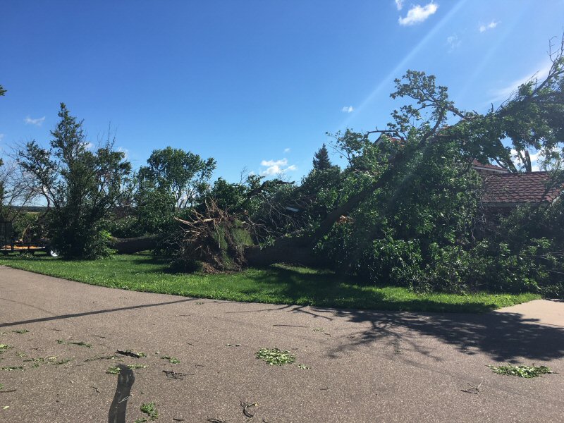
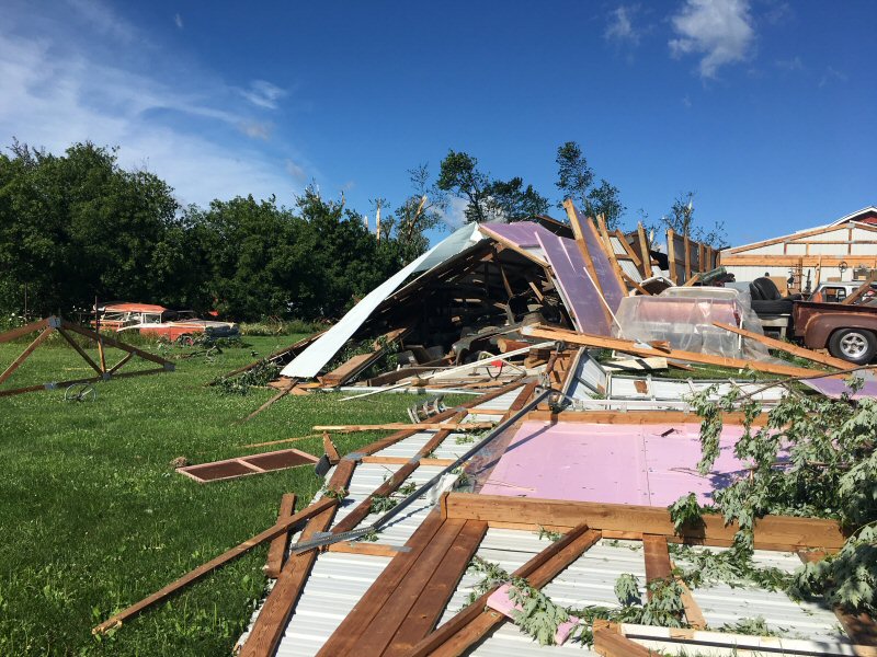
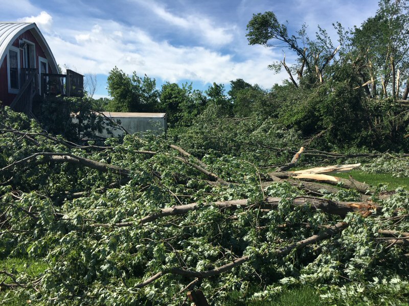
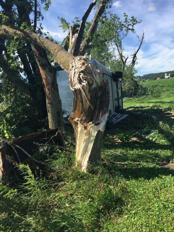
Early morning storms brought hail, sporadic damaging winds, and a tornado to portions of western and central Wisconsin Sunday, July 19th. Most of the severe weather occurred between midnight and 4 a.m. The tornado hit a few miles southwest of Osseo, WI (Trempealeau County) and was on the ground for approximately 3 1/2 miles. There was damage to outbuildings, trees and crops. |
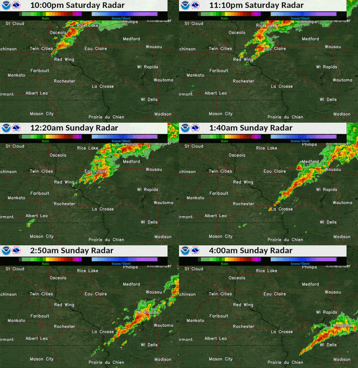 Radar loop from late Sat night-early Sun morning (July 18-19, 2020) |
Tornadoes:
|
Tornado - Osseo, WI
|
||||||||||||||||
The Enhanced Fujita (EF) Scale classifies tornadoes into the following categories:
| EF0 Weak 65-85 mph |
EF1 Moderate 86-110 mph |
EF2 Significant 111-135 mph |
EF3 Severe 136-165 mph |
EF4 Extreme 166-200 mph |
EF5 Catastrophic 200+ mph |
 |
|||||
Photos:
Damage southwest of Osseo, WI
 |
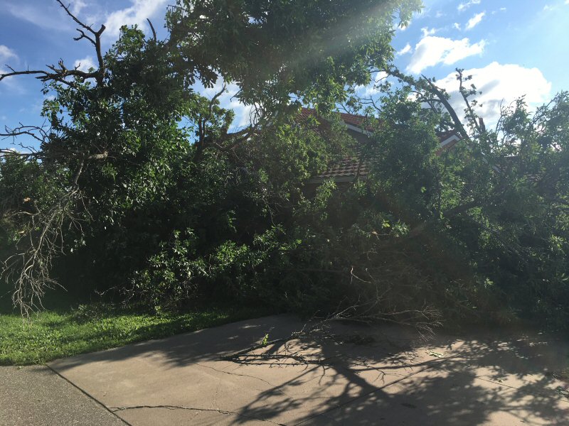 |
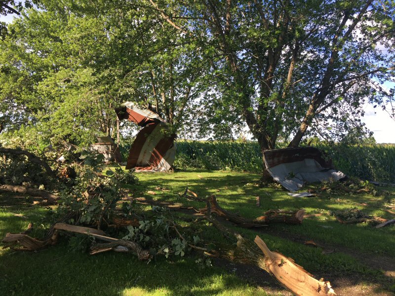 |
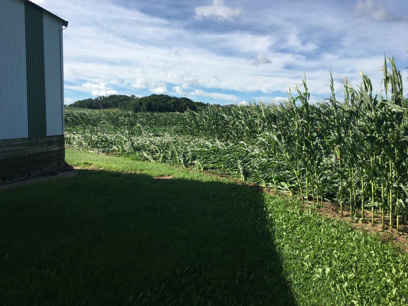 |
(credit: Trempealeau Co, EM) |
(credit: Trempealeau Co, EM) |
(credit: Trempealeau Co, EM) |
(credit: Trempealeau Co, EM) |
 |
 |
 |
 |
(credit: Trempealeau Co, EM) |
(credit: Trempealeau Co, EM) |
(credit: Trempealeau Co, EM) |
(credit: Trempealeau Co, EM) |
Radar:
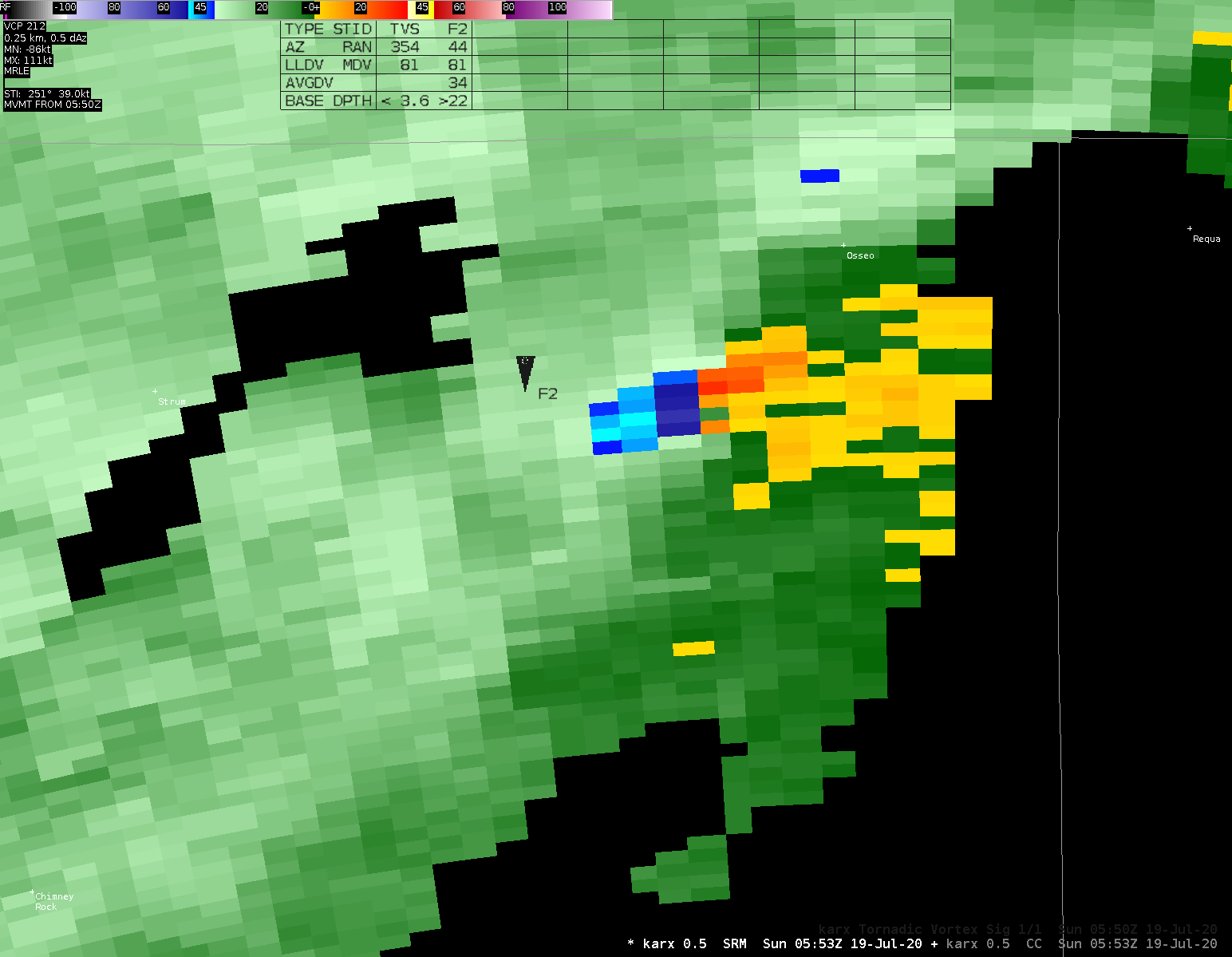 |
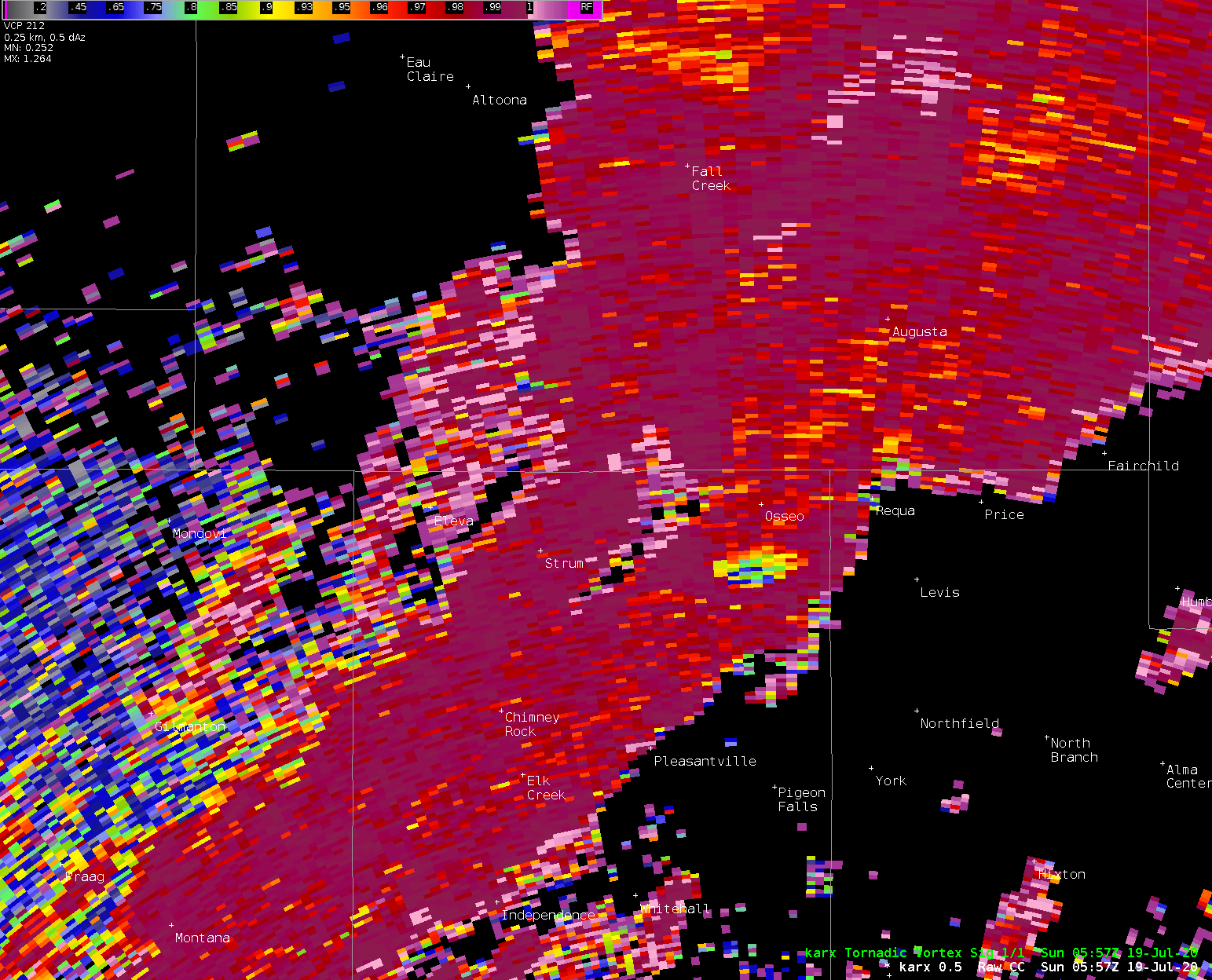 |
||
| Tornadic circulation (storm relative velocity) image of Osseo tornado | Correlation Coefficient dropout associated with tornadic debris |
Storm Reports
PRELIMINARY LOCAL STORM REPORT...SUMMARY
NATIONAL WEATHER SERVICE LA CROSSE WI
549 PM CDT SUN JUL 19 2020

..TIME...   ...EVENT...      ...CITY LOCATION...     ...LAT.LON...
..DATE...   ....MAG....      ..COUNTY LOCATION..ST.. ...SOURCE....
            ..REMARKS..

1250 AM     TORNADO          3 SW OSSEO              44.54N 91.26W
07/19/2020                   TREMPEALEAU        WI   NWS STORM SURVEY

            NUMEROUS TREES SNAPPED OR UPROOTED AND
            SEVERAL FARM OUTBUILDINGS DESTROYED IN A
            PATH FROM 4 WSW OSSEO TO 3 S OSSEO. DAMAGE
            CONFIRMED VIA PHOTOS AND VIDEO FROM
            TREMPEALEAU COUNTY EMERGENCY MANAGEMENT.

0100 AM     FUNNEL CLOUD     1 N OSSEO               44.59N 91.22W
07/19/2020                   TREMPEALEAU        WI   TRAINED SPOTTER


0130 AM     HAIL             2 S THORP               44.93N 90.80W
07/19/2020  E1.00 INCH       CLARK              WI   PUBLIC

            RELAYED FROM PICTURE ON SOCIAL MEDIA. TIME
            ESTIMATED FROM RADAR.

0332 AM     TSTM WND DMG     2 NNE FRIENDSHIP        44.00N 89.81W
07/19/2020                   ADAMS              WI   LAW ENFORCEMENT

            NUMEROUS TREES DOWN IN THE PRESTON AREA AND
            NEAR ROCHE-A-CRI STATE PARK. TIME ESTIMATED
            FROM RADAR.

0409 AM     TSTM WND DMG     4 S BROOKS              43.78N 89.64W
07/19/2020                   ADAMS              WI   LAW ENFORCEMENT

            A FEW TREES DOWN AROUND THE TOWN OF JACKSON.
            TIME ESTIMATED FROM RADAR.


&&

$$
 |
Media use of NWS Web News Stories is encouraged! Please acknowledge the NWS as the source of any news information accessed from this site. |
 |