
Scattered strong to severe thunderstorms may pose a risk for damaging wind gusts over the Carolinas, southeast Virginia, and the Tennessee Valley Sunday afternoon then the northern Plains from late afternoon into Sunday night. Monsoonal thunderstorms may cause locally considerable flash, urban, and small stream flooding in the Southwest U.S. the next few days. Read More >
Event Summary:
A warm front swept through Wisconsin on Saturday, June 4th which triggered thunderstorms and a few tornadoes as it moved north during the late afternoon. Thunderstorms formed in the middle afternoon in western and central Wisconsin, then moved northeast of Interstate 94 before intensifying and eventually producing a few brief tornado touchdowns in parts of Clark and Taylor Counties in central and north central Wisconsin. There were no reports of injuries or deaths.
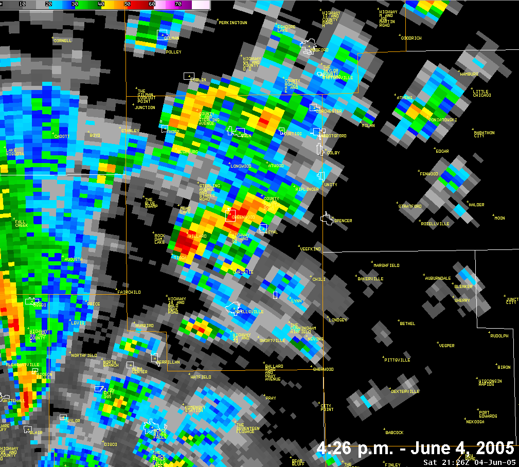
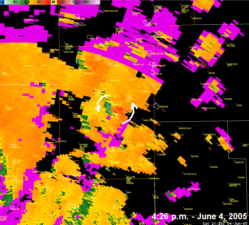
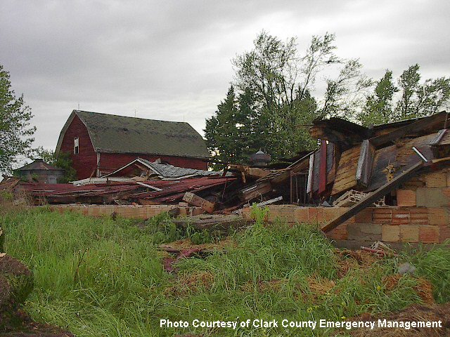
The first tornado (F1) touchdown appears to have been approx. 2 miles west of Loyal, WI (Clark County) along Highway 98 where some farm buildings were heavily damaged. The tornado then intermittently touched down as it continued north-northeast toward Medford, WI (Taylor County), covering approx. 20 miles. The initial rotating wall cloud report was received from a spotter (Frank Johnson - KC9HQR) at 4:18 p.m. and the tornado touched down at approx. 4:27 p.m. The Hazardous Weather Outlook had been updated at 2:40 p.m. discussing the possibility of tornadoes and a Tornado Watch had been issued at 3:15 p.m for the area.
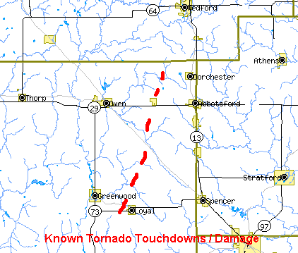
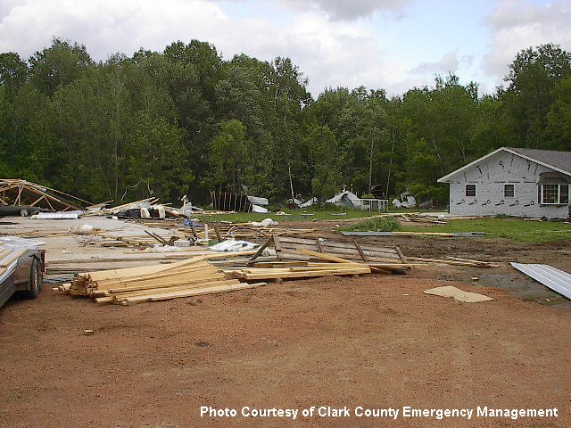
Damage along this path was reported at Rose Creek Road, along County Roads K and E, north of Curtiss on Pine Road, and west of the Dorchester area. Most of the damage was to farm buildings and trees with one business destroyed. This was rated as F0 and F1 on the Fujita Damage Scale.
Trees were also damaged in parts of eastern Taylor County from a possible brief touchdown or two. There were funnel cloud reports in this same area. The final reports from these storms came in around 530 p.m.
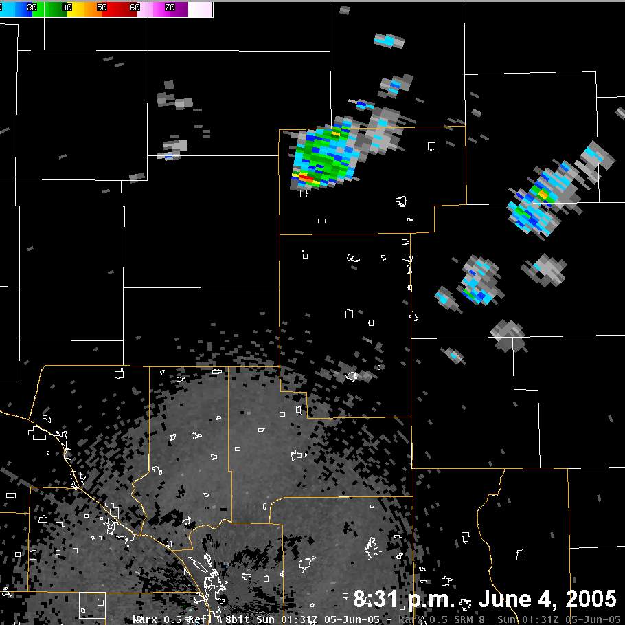
A few hours later, an isolated weak thunderstorm moved out of Chippewa County, Wisconsin into western Taylor County and produced a brief tornado touchdown north of Gilman, WI at approx. 8:31 p.m.. A house sustained severe damage, along with weaker damage to nearby barns and a boat. This damage was rated F0.
Storm spotters, amateur radio operators, law enforcement, and county Emergency Management officials were very helpful in passing along storm reports and follow-up information.
Radar Images:
 |
 |
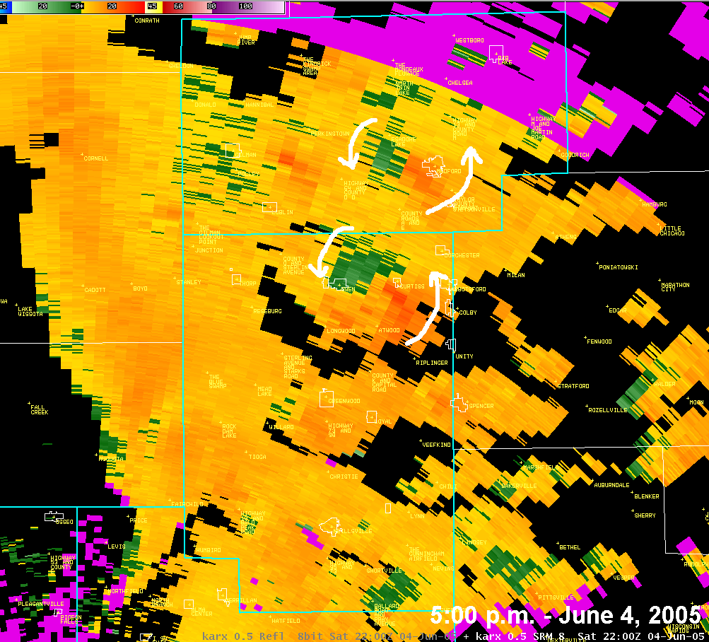 |
| Base Reflectivity (KARX) at 4:26 p.m. - storm west of Loyal, WI | Storm Relative Velocity (KARX) at 4:26 p.m. - rotation west of Loyal, WI | Storm Relative Velocity (KARX) at 5:00 p.m. - rotations near Curtiss and Medford, WI |
 |
||
| Base Reflectivity (KARX) at 8:31 p.m. - storm near Gilman, WI |
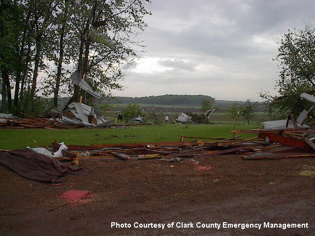
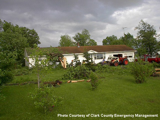
Damage Photos: - Courtesy of Clark and Taylor County Emergency Management
 |
 |
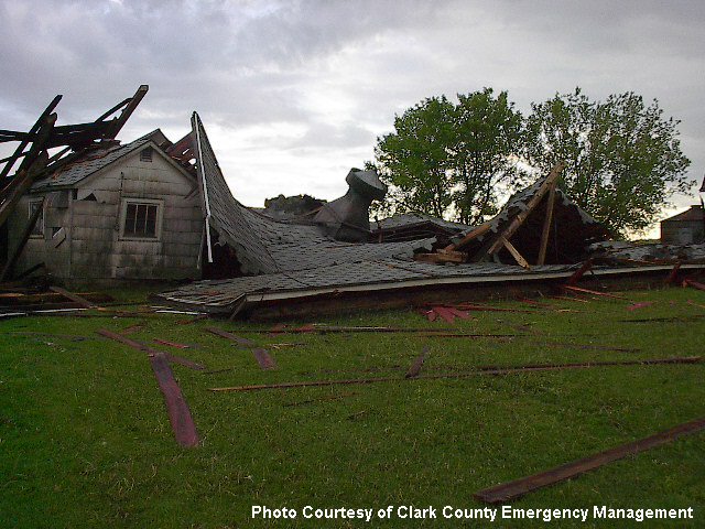 |
| Pole barn damaged west of Loyal, WI along Highway 98. | Damage along County Road E near Curtiss, WI | Barn damage along County Road A west of Dorchester, WI. |
 |
 |
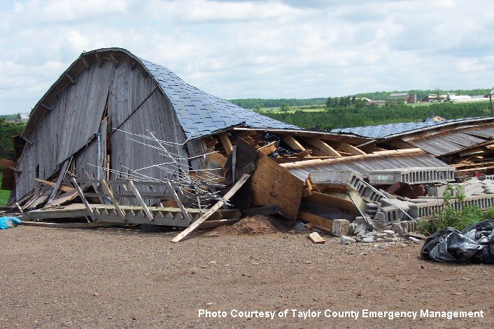 |
| Barn damage along County Road A. | Building damage along County Road K near Loyal, WI. | Barn destroyed near Gilman, WI (Taylor Co.) |


 Weather Story
 Weather Map
 Local Radar