Overview
|
Storms developed in the later afternoon on Sunday June 28th over southern Minnesota. The farthest southeast storm produced some large hail and wind gusts to around 60 mph. A few funnel cloud reports were received as the storm tracked through southeast Minnesota. Conditions were generally unfavorable for prolonged tornadoes - and a brief tornado did occur southwest of Winona, Minnesota around 8:40 pm.
|
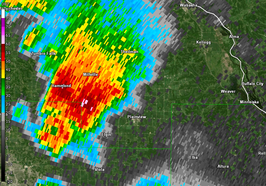
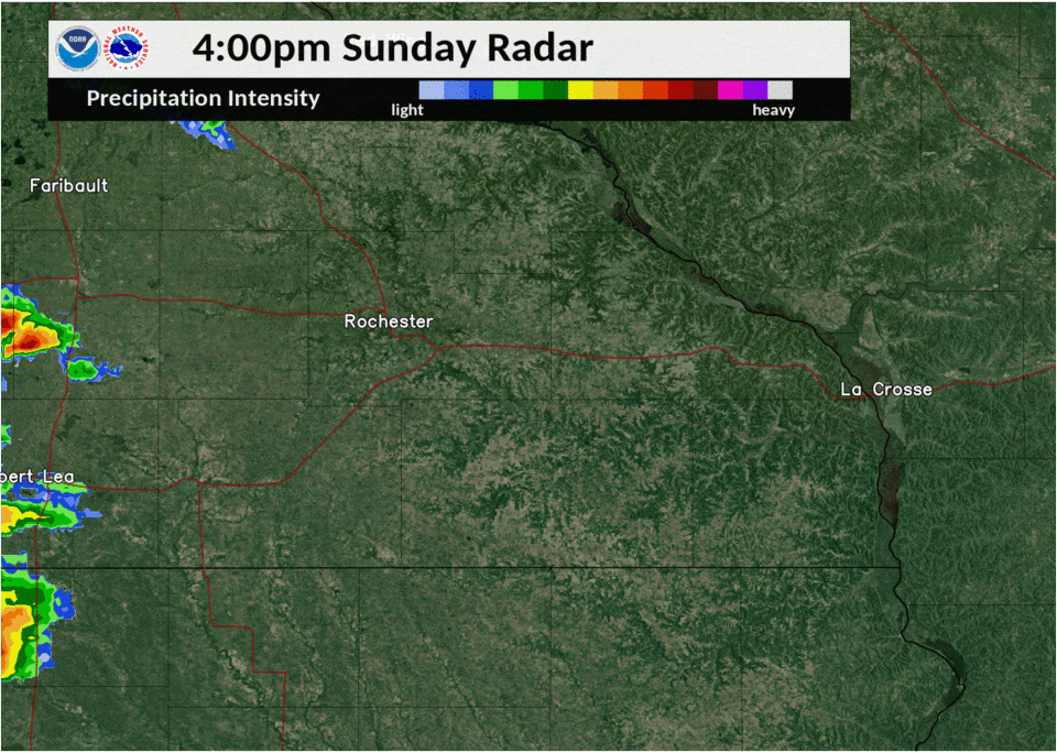 Radar loop from 4 pm to 10 pm June 28th 2020 |
Tornadoes:
|
Tornado - Near Stockton, Minnesota
Track Map 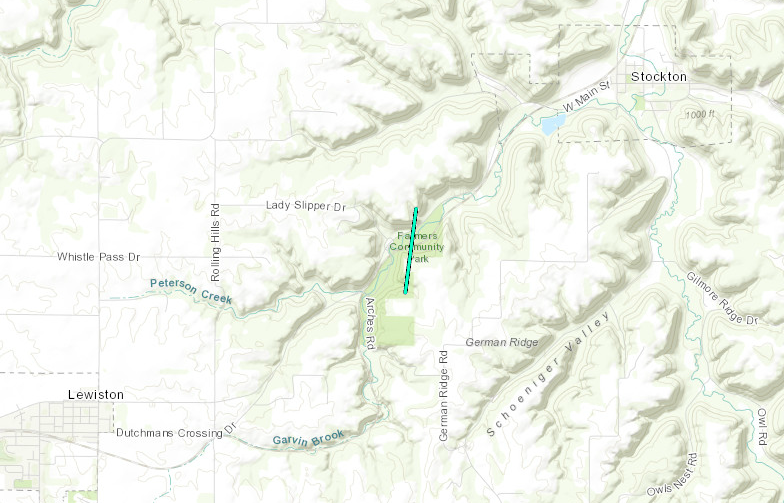 
Downloadable KMZ File |
||||||||||||||||
 |
 |
 |
|
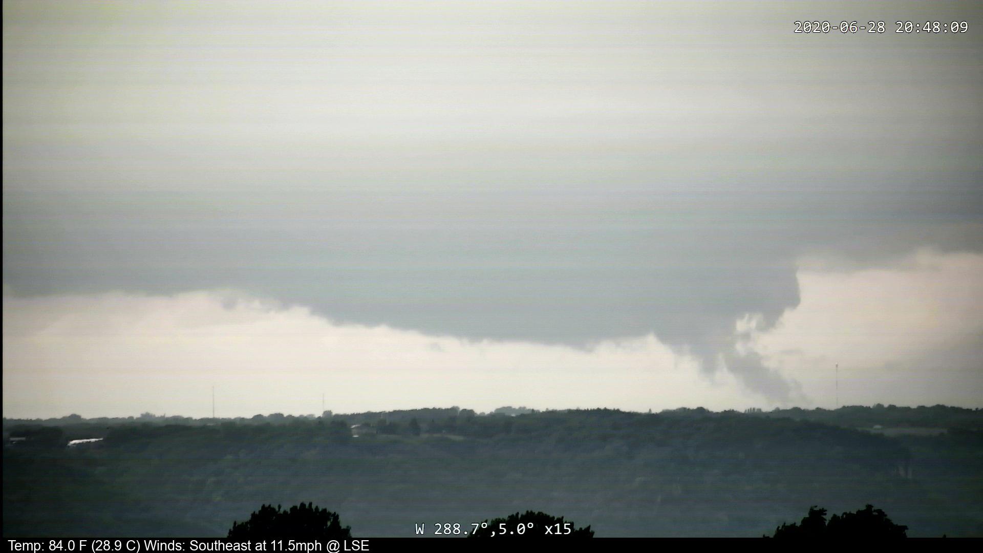
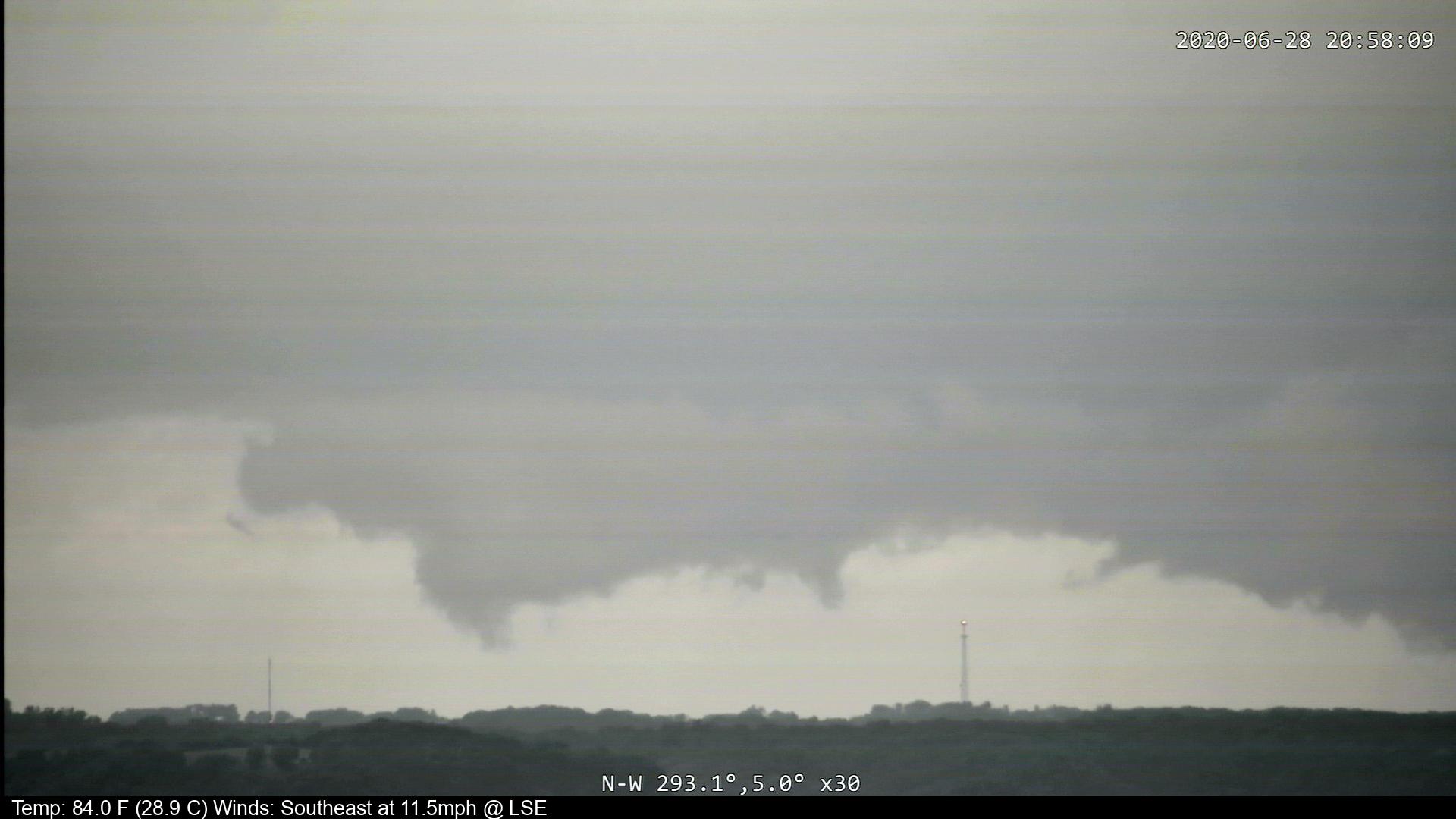
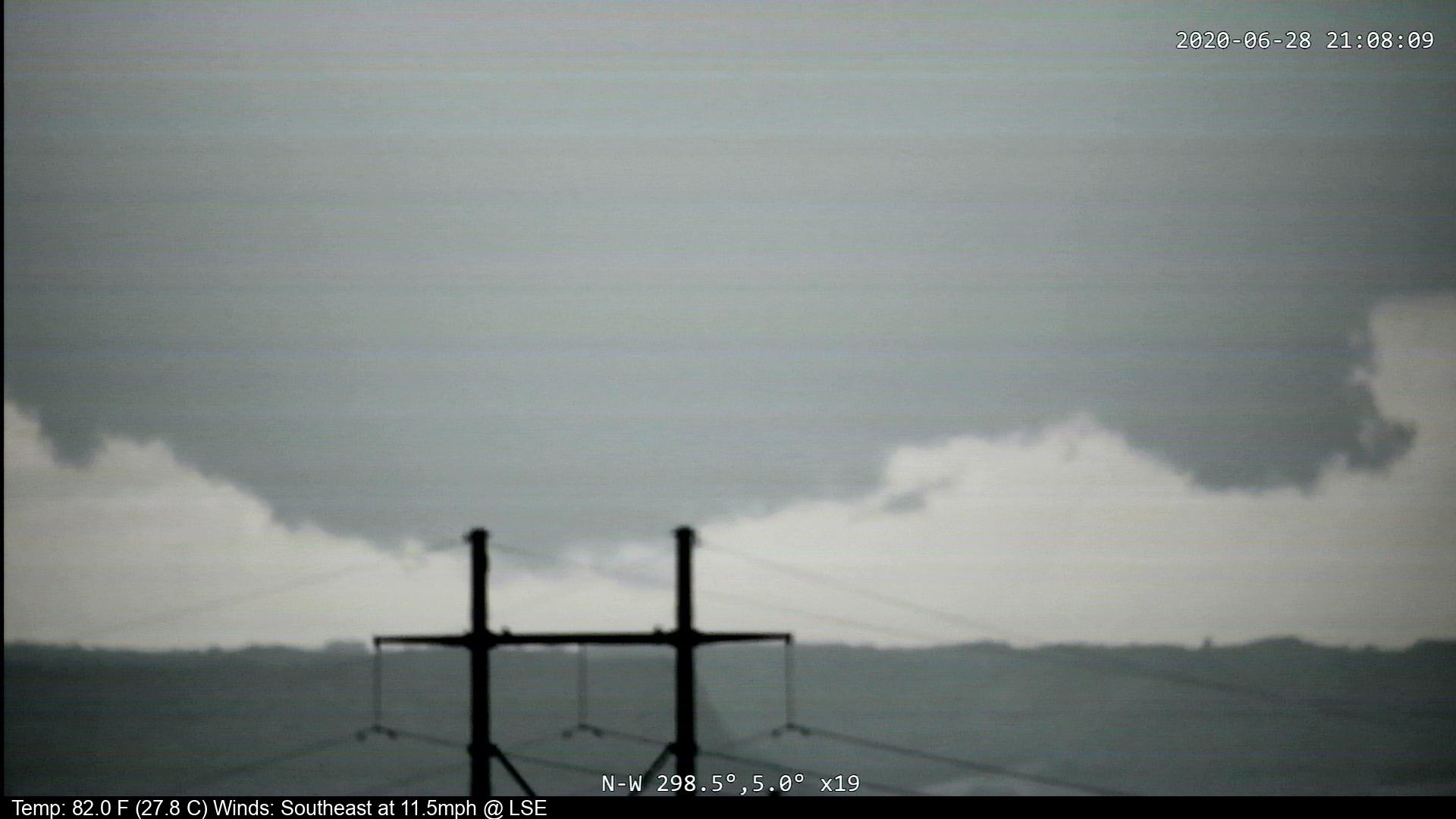
| Pictures taken of the Winona county storm around tornado time, looking northwest, from the NWS La Crosse webcam | |||
The Enhanced Fujita (EF) Scale classifies tornadoes into the following categories:
| EF0 Weak 65-85 mph |
EF1 Moderate 86-110 mph |
EF2 Significant 111-135 mph |
EF3 Severe 136-165 mph |
EF4 Extreme 166-200 mph |
EF5 Catastrophic 200+ mph |
 |
|||||
Photos:
 |
 |
 |
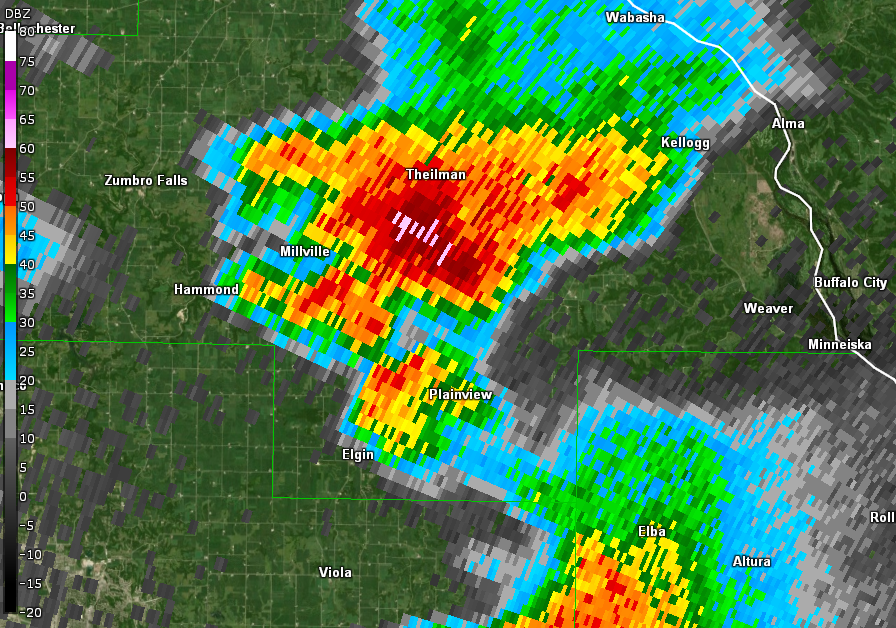 |
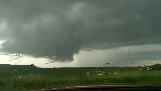
| 6:53 pm: 7 miles west of Elgin, MN looking north /Wabasha county/ (Courtesy of Hunter Anderson) |
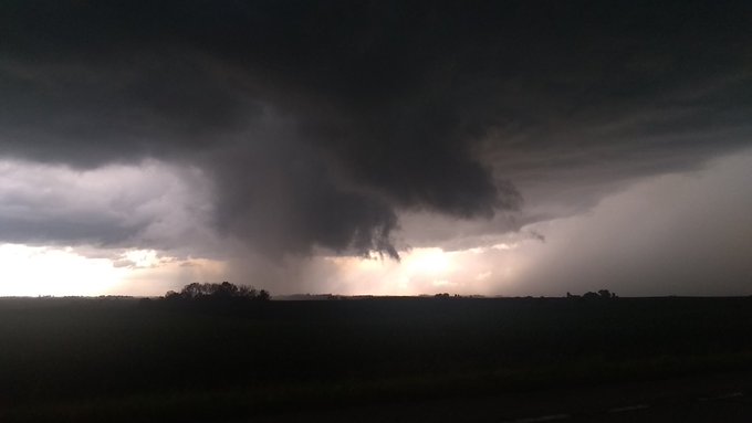
7:20 pm: 4 miles north of Plainview, MN looking northwest /Wabasha county/ (Courtesy of Hunter Anderson) |
||
 |
|||
| Large hail observed in Lyle, MN (Courtesy of Karen Coleman) |
|||
Storm Reports
PRELIMINARY LOCAL STORM REPORT...SUMMARY
NATIONAL WEATHER SERVICE LA CROSSE WI
924 PM CDT SUN JUN 28 2020

..TIME...   ...EVENT...      ...CITY LOCATION...     ...LAT.LON...
..DATE...   ....MAG....      ..COUNTY LOCATION..ST.. ...SOURCE....
            ..REMARKS..

0500 PM     HAIL             3 W LYLE                43.51N 93.00W
06/28/2020  M1.75 INCH       MOWER              MN   BROADCAST MEDIA

            VIEWER REPORT FROM KAAL OF GOLF BALL SIZED
            HAIL. TIME ESTIMATED BASED ON RADAR.

0504 PM     HAIL             5 W LYLE                43.51N 93.04W
06/28/2020  E1.00 INCH       MOWER              MN   PUBLIC

            RELAYED VIA SOCIAL MEDIA. APPROXIMATE
            LOCATION.

0515 PM     FUNNEL CLOUD     2 NE LYLE               43.53N 92.91W
06/28/2020                   MOWER              MN   PUBLIC

            PICTURE RELAYED ON SOCIAL MEDIA TAKEN FROM
            NORTH OF LYLE. LOCATION ESTIMATED BASED ON
            RADAR.

0540 PM     FUNNEL CLOUD     3 S ELKTON              43.62N 92.72W
06/28/2020                   MOWER              MN   TRAINED SPOTTER

            SPOTTER REPORTS FUNNEL CLOUD SOUTH OF
            ELKTON. LOCATION ESTIMATED.

0542 PM     FUNNEL CLOUD     3 S ELKTON              43.62N 92.71W
06/28/2020                   MOWER              MN   TRAINED SPOTTER

            .

0625 PM     HEAVY RAIN       MANTORVILLE             44.07N 92.76W
06/28/2020  M1.02 INCH       DODGE              MN   PUBLIC

            MOST FELL WITHIN 10 MINUTES.

0636 PM     HAIL             3 E ORONOCO             44.15N 92.47W
06/28/2020  E0.50 INCH       OLMSTED            MN   PUBLIC

            REPORT FROM MPING: HALF-INCH (0.50 IN.).

0640 PM     HAIL             8 W OF CHATFIELD        43.85N 92.35W
06/28/2020  M1.00 INCH       OLMSTED            MN   TRAINED SPOTTER

            DELAYED REPORT - 1.15 INCHES OF RAIN TOO.

0640 PM     TSTM WND GST     8 W OF CHATFIELD        43.85N 92.35W
06/28/2020  E60 MPH          OLMSTED            MN   TRAINED SPOTTER

            DELAYED REPORT.

0644 PM     HAIL             2 S CUMMINGSVILLE       43.84N 92.27W
06/28/2020  M0.70 INCH       FILLMORE           MN   LAW ENFORCEMENT

            DIME SIZE HAIL AND ESTIMATED 30 MPH WINDS
            BETWEEN STEWARTVILLE AND CHATFIELD.

0707 PM     HAIL             2 ESE EYOTA             43.98N 92.18W
06/28/2020  M0.25 INCH       OLMSTED            MN   LAW ENFORCEMENT

            PEA SIZED BETWEEN EYOTA AND DOVER.

0720 PM     HAIL             1 N DOVER               43.98N 92.13W
06/28/2020  M0.70 INCH       OLMSTED            MN   LAW ENFORCEMENT

            DIME SIZE HAIL NORTH OF DOVER.

0723 PM     HAIL             SAINT CHARLES           43.97N 92.06W
06/28/2020  M1.00 INCH       WINONA             MN   LAW ENFORCEMENT

            .

0724 PM     HAIL             1 S SAINT CHARLES       43.96N 92.07W
06/28/2020  M0.50 INCH       WINONA             MN   PUBLIC

            REPORT FROM MPING: HALF-INCH (0.50 IN.).

0727 PM     HAIL             1 SSE SAINT CHARLES     43.95N 92.06W
06/28/2020  M0.25 INCH       WINONA             MN   LAW ENFORCEMENT

            PEA SIZED HAIL SOUTH OF ST. CHARLES NEAR
            I-90.

0742 PM     FUNNEL CLOUD     8 W OF KELLOGG          44.31N 92.16W
06/28/2020                   WABASHA            MN   STORM CHASER

            TWO VERY BRIEF FUNNEL CLOUDS.

0748 PM     HAIL             2 S UTICA               43.95N 91.96W
06/28/2020  E0.25 INCH       WINONA             MN   TRAINED SPOTTER

            PEA SIZED HAIL 2 MILES SOUTH OF UTICA.

0750 PM     HAIL             1 W BETHANY             44.03N 91.94W
06/28/2020  M1.00 INCH       WINONA             MN   TRAINED SPOTTER

            QUARTER SIZE HAIL 3 S OF ALTURA, MN. TIME
            ESTIMATED BY RADAR.

0755 PM     HAIL             2 S LEWISTON            43.96N 91.87W
06/28/2020  M0.88 INCH       WINONA             MN   TRAINED SPOTTER


0800 PM     HAIL             LEWISTON                43.99N 91.86W
06/28/2020  E0.50 INCH       WINONA             MN   PUBLIC


0810 PM     TSTM WND DMG     LEWISTON                43.98N 91.87W
06/28/2020                   WINONA             MN   FIRE DEPT/RESCUE

            LARGE TREE BRANCHES DOWN.

0812 PM     HAIL             LEWISTON                43.99N 91.86W
06/28/2020  M1.00 INCH       WINONA             MN   TRAINED SPOTTER

            .

0829 PM     HAIL             1 W STOCKTON            44.03N 91.79W
06/28/2020  M0.75 INCH       WINONA             MN   PUBLIC

            .

0838 PM     FUNNEL CLOUD     2 SSE STOCKTON          44.00N 91.75W
06/28/2020                   WINONA             MN   TRAINED SPOTTER

            VIEWED FROM I-90/43 S EXIT. LOCATION
            ESTIMATED BASED ON RADAR.

0839 PM     TORNADO          3 NW WILSON             43.99N 91.72W
06/28/2020                   WINONA             MN   TRAINED SPOTTER

            PRELIMINARY REPORT.


0845 PM     TORNADO          3 SE STOCKTON           44.00N 91.72W
06/28/2020                   WINONA             MN   TRAINED SPOTTER

            PRELIMINARY REPORT.


0853 PM     FUNNEL CLOUD     2 ESE STOCKTON          44.02N 91.72W
06/28/2020                   WINONA             MN   TRAINED SPOTTER

            WALL CLOUD WITH A FUNNEL.


&&

$$
 |
Media use of NWS Web News Stories is encouraged! Please acknowledge the NWS as the source of any news information accessed from this site. |
|


 Weather Story
 Weather Map
 Local Radar