Widespread showers and thunderstorms, some severe, may produce heavy downpours and flash flooding across much of the eastern and central U.S. Dangerous heat will continue in the Pacific Northwest and expand across portions of the East. Deep tropical moisture and associated thunderstorms will bring heavy rainfall and localized flash flooding across portions of Florida into the central Gulf Coast. Read More >
La Crosse, WI
Weather Forecast Office
|
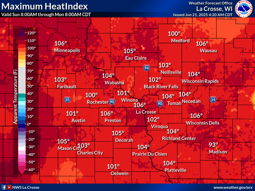
The heat will be easing slowly southeast today, lingering over portions of northeast IA and southwest/central WI. Afternoon heat indices are expected to reach 100 for these locations, and a heat advisory remains in effect until early evening. Take precautions to protect yourself, family, and pets from the heat today. Today: Heat Continues For Some
Additional Information:
|
• Submit Report • Severe Monitor Hazardous Weather Outlook Heat Advisory Storm Reports Latest Reports

Radar |
Our Office
Staff
Community Involvement
Station / Location Info
Follow Us On Social Media
Student Opportunities
Additional Information
Storm Summaries
Cooperative Observers
Educational Resources
Science / Research
Weather Phenomenon
Mayfly Tracking
Latest
Temp/Pcpn Summary
Precipitation Reports
Forecast Discussion
Hazardous Weather Outlook
Hourly Weather
Public Information Statement
Local Storm Report
Lightning Plot Archive
River Stages
Water Temp
Observations
Precipitation Plotter
Soil Temps
US Dept of Commerce
National Oceanic and Atmospheric Administration
National Weather Service
La Crosse, WI
711 County Road FA
La Crosse, WI 54601
608-784-7294
Comments? Questions? Please Contact Us.