Overview
|
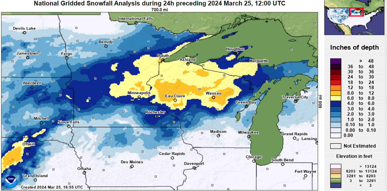
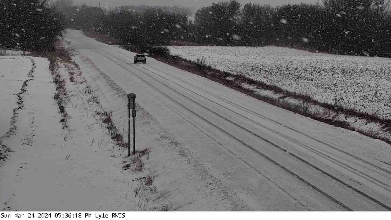
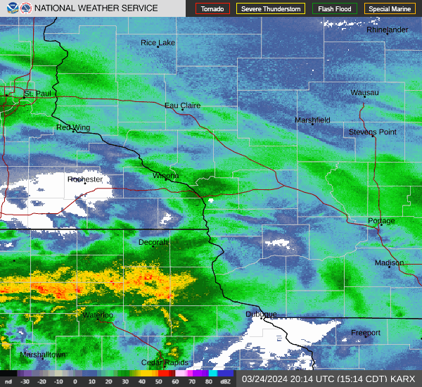
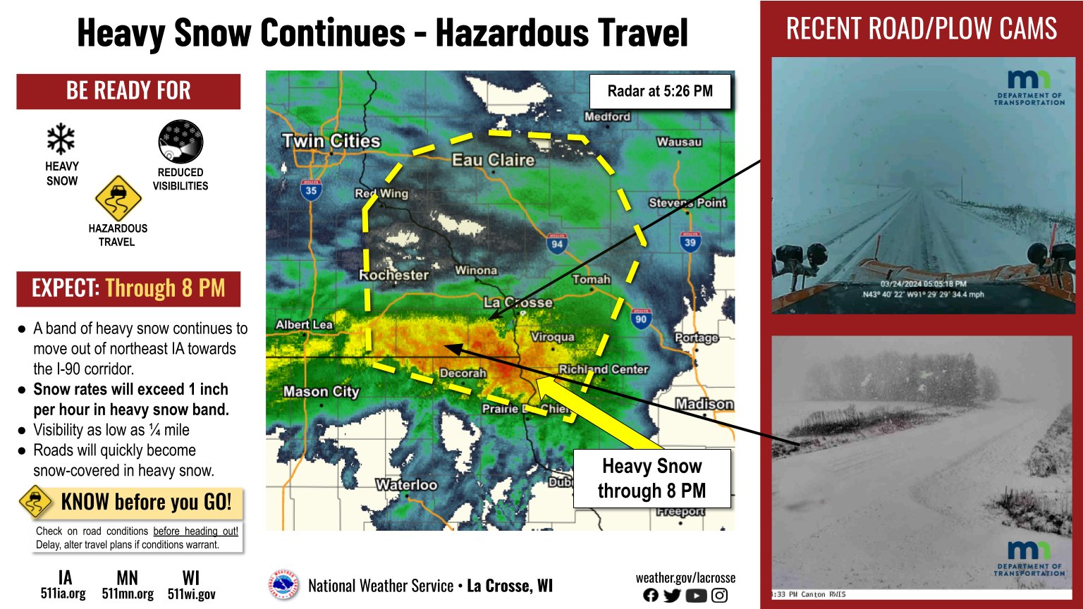
An early spring storm brought a return to winter weather across the region starting Sunday, March 24th. While gradual snow accumulation of 1-3" fell earlier in the day, an intense band of heavy, wet snow formed across northeast Iowa by afternoon and moved northeast across the area into Sunday evening. Snowfall rates exceeded 2 inches per hour at times with reports of thunder during the most intense rates. Many areas received a quick 2-5" of snow but as the snow band approached the Interstate 90 areas in southeast Minnesota and Wisconsin, some totals were in the 5-8" range. |
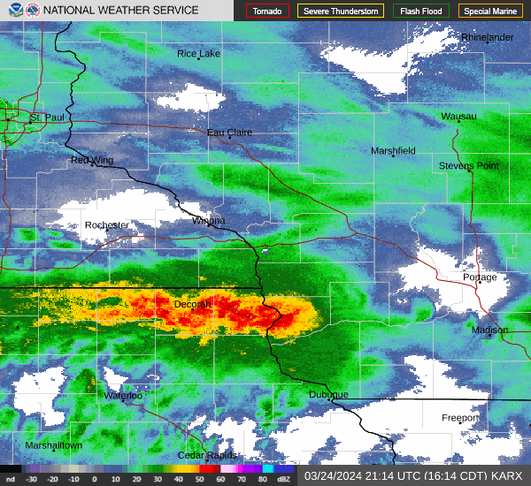 Radar loop Sunday afternoon, March 24th, as intense snowfall rates moved through the area. |
Snow Totals
 |
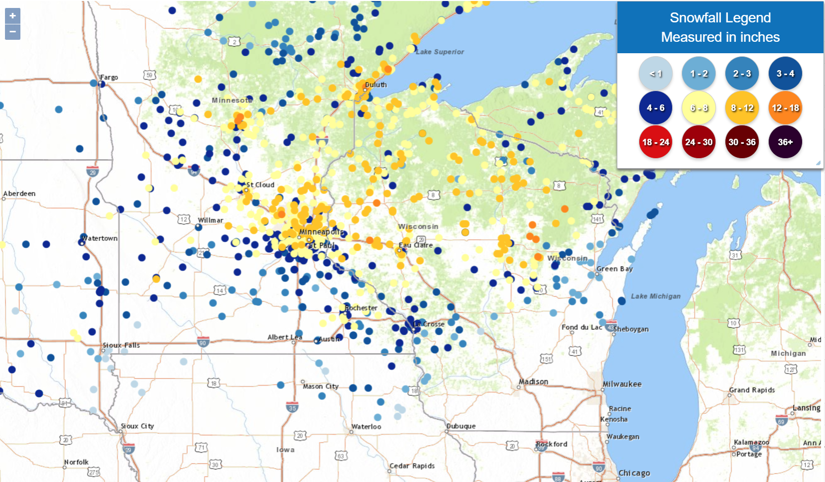 |
Public Information Statement
National Weather Service La Crosse WI
1014 AM CDT Mon Mar 25 2024

...SNOWFALL REPORTS...

Location                     Amount    Time/Date       Lat/Lon

...Iowa...

...Chickasaw County...
New Hampton                  3.0 in    0700 AM 03/25   43.06N/92.32W
New Hampton 0.4 SW           3.0 in    0700 AM 03/25   43.06N/92.32W

...Clayton County...
Elkader 6SSW                 0.8 in    0700 AM 03/25   42.78N/91.45W
Strawberry Point             0.5 in    0700 AM 03/25   42.69N/91.53W
Elkader 6.8 WSW              0.3 in    0615 AM 03/25   42.81N/91.52W

...Fayette County...
Waucoma 1 WNW                3.0 in    0700 AM 03/25   43.06N/92.05W
Fayette                      2.5 in    0650 AM 03/25   42.88N/91.83W
Oelwein 1 E                  1.4 in    0630 AM 03/25   42.68N/91.88W

...Floyd County...
Marble Rock                  2.0 in    0548 PM 03/24   42.96N/92.87W

...Mitchell County...
St Ansgar                    1.4 in    0630 AM 03/25   43.38N/92.92W
Osage                        0.3 in    0730 AM 03/25   43.28N/92.81W

...Winneshiek County...
7 ENE Decorah                4.5 in    0835 AM 03/25   43.34N/91.64W
Decorah                      2.0 in    0700 PM 03/24   43.30N/91.80W

...Minnesota...

...Dodge County...
Hayfield 0.3 SSE             6.0 in    0630 AM 03/25   43.89N/92.85W
Mantorville                  5.0 in    0817 PM 03/24   44.07N/92.76W

...Fillmore County...
Wykoff 3.1 NW                3.9 in    0700 AM 03/25   43.74N/92.31W
2 WSW Fillmore               3.9 in    0826 PM 03/24   43.74N/92.31W
Chatfield 9.0 ESE            3.4 in    0700 AM 03/25   43.79N/92.03W
Preston                      3.2 in    0800 AM 03/25   43.67N/92.07W
Mabel                        2.2 in    0600 AM 03/25   43.52N/91.76W

...Houston County...
Hokah 4 NW                   4.6 in    0700 AM 03/25   43.80N/91.43W
1 ENE Mound Prairie          4.6 in    0645 AM 03/25   43.79N/91.42W
Caledonia                    4.0 in    0821 PM 03/24   43.63N/91.50W
2 ENE Money Creek            4.0 in    0821 PM 03/24   43.83N/91.57W
La Crescent 0.7 N            3.2 in    0730 AM 03/25   43.84N/91.30W
Caledonia 5.4 S              3.0 in    0800 AM 03/25   43.56N/91.51W

...Mower County...
Grand Meadow                 5.5 in    0530 AM 03/25   43.71N/92.56W
Austin 1.1 ESE               3.0 in    0730 AM 03/25   43.67N/92.95W
Austin 1.9 ENE               1.2 in    0800 AM 03/25   43.68N/92.94W

...Olmsted County...
4 WSW Elba                   7.2 in    0819 AM 03/25   44.05N/92.09W
5 SW Elba                    7.2 in    1101 PM 03/24   44.05N/92.09W
Elba 4.7 SW                  7.2 in    1030 PM 03/24   44.04N/92.09W
1 SSW Oronoco                6.7 in    0950 PM 03/24   44.15N/92.54W
Elgin 2SSW                   6.5 in    0700 AM 03/25   44.10N/92.27W
3 SSW Rochester              6.5 in    0918 PM 03/24   43.97N/92.50W
3 ESE Douglas                6.5 in    0839 PM 03/24   44.09N/92.51W
2 NE Rochester AP            6.0 in    0700 AM 03/25   43.93N/92.47W
Rochester 5.7 N              5.7 in    0700 AM 03/25   44.10N/92.46W
2 NE Rochester               5.7 in    0530 AM 03/25   44.04N/92.44W
Rochester 4.2 N              5.5 in    0600 AM 03/25   44.08N/92.49W
2 NNW Rochester              5.5 in    0804 PM 03/24   44.04N/92.49W
1 SSW Rochester              5.5 in    0738 PM 03/24   44.00N/92.48W
Rochester 3.9 ESE            5.4 in    0730 AM 03/25   43.99N/92.41W
2 NNW Rochester              5.0 in    0700 AM 03/25   44.05N/92.49W
Rochester 1.5 WSW            5.0 in    0600 AM 03/25   44.00N/92.50W
Stewartville 4.3 E           5.0 in    0400 AM 03/25   43.86N/92.40W
Rochester 3.0 N              4.0 in    0700 AM 03/25   44.06N/92.47W
Rochester 6.9 NNE            3.2 in    0730 AM 03/25   44.11N/92.43W
Chatfield 2.7 NNW            2.4 in    0800 AM 03/25   43.88N/92.22W

...Wabasha County...
Theilman 1 SSW               7.2 in    0730 AM 03/25   44.28N/92.19W
1 N Wabasha                  7.0 in    0940 PM 03/24   44.38N/92.04W
Kellogg 0.1 N                6.0 in    0630 AM 03/25   44.31N/92.00W
Zumbro Falls 3.5 SSW         3.8 in    0730 AM 03/25   44.24N/92.46W
Wabasha 6.2 WNW              2.9 in    0700 AM 03/25   44.39N/92.16W

...Winona County...
Lewiston                     6.0 in    0819 PM 03/24   43.99N/91.87W
Winona                       5.0 in    1125 PM 03/24   44.05N/91.66W
La Crescent 4.0 NNW          4.4 in    0700 AM 03/25   43.88N/91.34W
2 SSE Dakota                 4.4 in    1128 PM 03/24   43.89N/91.34W
Winona 2.0 ESE               4.0 in    0700 AM 03/25   44.04N/91.63W
1 NW Winona                  3.5 in    0831 PM 03/24   44.05N/91.67W
La Crescent Dam 7            3.0 in    0730 AM 03/25   43.87N/91.31W
Winona 1.9 ESE               2.5 in    0650 AM 03/25   44.04N/91.63W

...Wisconsin...

...Adams County...
0.6 W Friendship             1.1 in    0700 AM 03/25   43.98N/89.83W

...Buffalo County...
Mondovi 12.1 SSE             6.0 in    0747 AM 03/25   44.40N/91.60W
Cochrane 0.6 ESE             3.8 in    0700 AM 03/25   44.23N/91.82W

...Clark County...
Thorp 0.5 NNE                7.1 in    0700 AM 03/25   44.97N/90.80W
6 N Chili                    7.0 in    0952 AM 03/25   44.72N/90.34W
Thorp 10.1 S                 5.0 in    0533 AM 03/25   44.81N/90.82W

...Crawford County...
1 S De Soto                  2.8 in    0619 PM 03/24   43.41N/91.19W
Eastman 2.4 NNE              1.5 in    0700 AM 03/25   43.20N/91.00W

...Grant County...
Cassville 7.8 ENE             T in     0700 AM 03/25   42.75N/90.84W

...Jackson County...
Melrose 3.6 W                3.2 in    0700 AM 03/25   44.13N/91.07W
Black River Falls            3.0 in    0830 AM 03/25   44.29N/90.85W

...Juneau County...
1.0 E Mauston                0.6 in    0800 AM 03/25   43.79N/90.06W

...La Crosse County...
2 E La Crosse                5.6 in    0700 AM 03/25   43.82N/91.19W
Onalaska 1.9 E               5.0 in    0700 AM 03/25   43.89N/91.18W
Holmen 2S                    4.7 in    0700 AM 03/25   43.93N/91.24W
Brice Prairie                4.5 in    0819 PM 03/24   43.94N/91.30W
French Island                4.4 in    0700 AM 03/25   43.86N/91.27W
2 SSW La Crosse              4.0 in    0818 PM 03/24   43.80N/91.24W
La Crosse 4NNW               3.2 in    0730 AM 03/25   43.87N/91.27W
1 WSW West Salem             2.3 in    0820 PM 03/24   43.90N/91.10W
Coon Valley 4.5 NNW          1.5 in    0700 AM 03/25   43.76N/91.06W

...Monroe County...
Warrens 4.7 WSW              3.7 in    0700 AM 03/25   44.10N/90.59W
Cashton 3 NNW                3.4 in    0740 AM 03/25   43.79N/90.80W
1 S Tomah                    2.4 in    1000 PM 03/24   43.97N/90.50W

...Taylor County...
Medford 0.8 ENE              9.5 in    0700 AM 03/25   45.14N/90.33W
3 SSW Stetsonville           9.1 in    0230 AM 03/25   45.04N/90.34W
1 W Medford                  8.2 in    0554 AM 03/25   45.14N/90.37W

...Trempealeau County...
Osseo                        7.5 in    1226 AM 03/25   44.58N/91.22W
2 SSE Elk Creek              6.0 in    0718 PM 03/24   44.39N/91.39W
4 NW Stevenstown             5.0 in    0710 PM 03/24   44.07N/91.23W
Ettrick 4.0 WNW              4.5 in    0702 AM 03/25   44.19N/91.34W

...Vernon County...
La Farge                     4.0 in    0547 PM 03/24   43.58N/90.64W
Viroqua 0.8 ESE              3.8 in    0700 AM 03/25   43.55N/90.87W
0.5 E Viroqua                3.6 in    0700 AM 03/25   43.56N/90.88W
Stoddard 1.5 NE              2.2 in    0730 AM 03/25   43.67N/91.19W
Hillsboro 2 SW               2.0 in    0700 AM 03/25   43.63N/90.38W

Observations are collected from a variety of sources with varying
equipment and exposures. We thank all volunteer weather observers
for their dedication. Not all data listed are considered official.
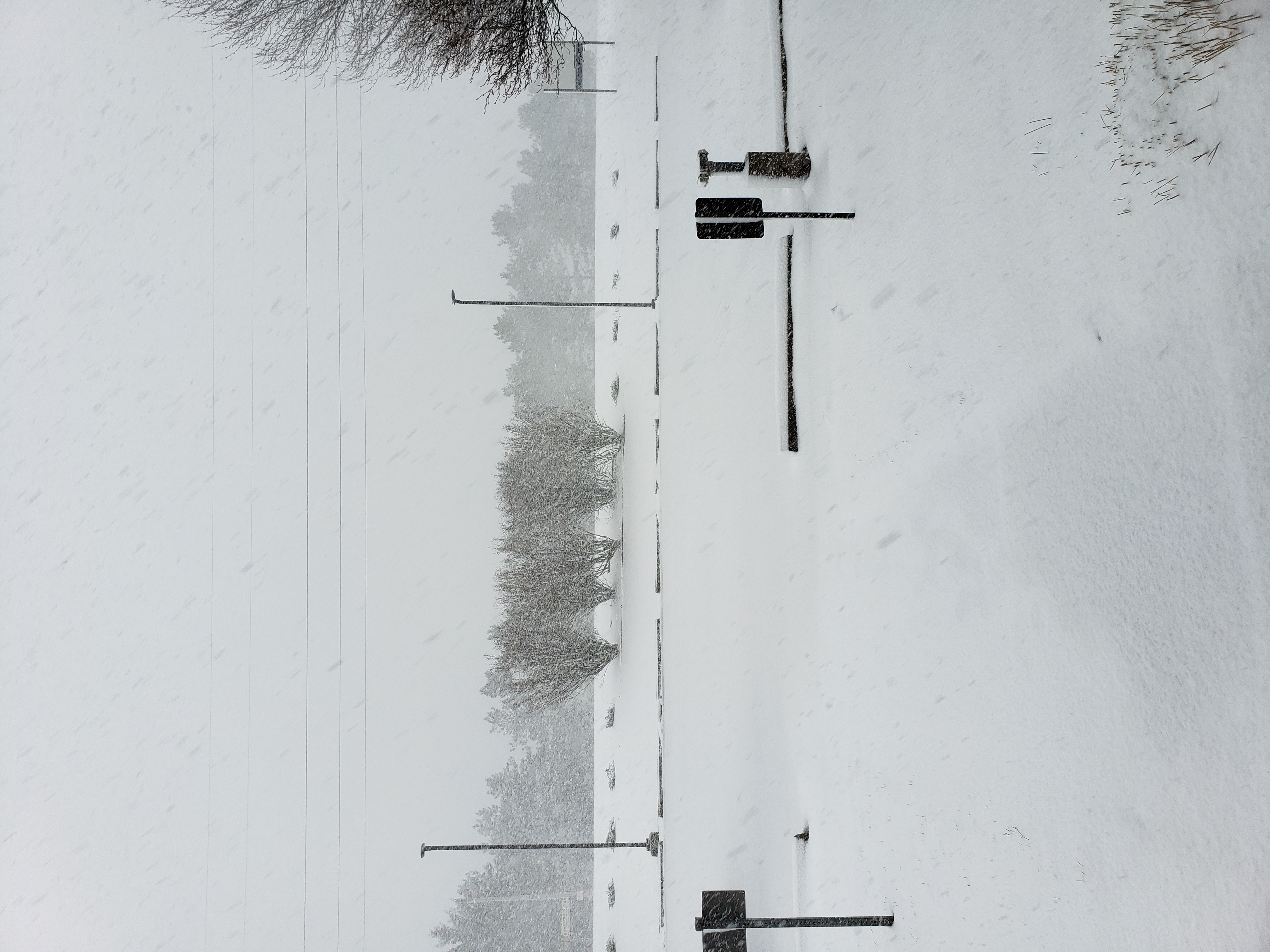
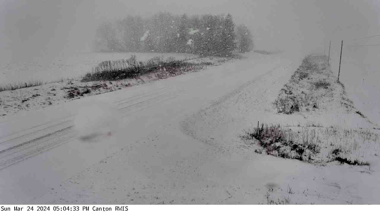
Photos:
 |
 |
 |
 |
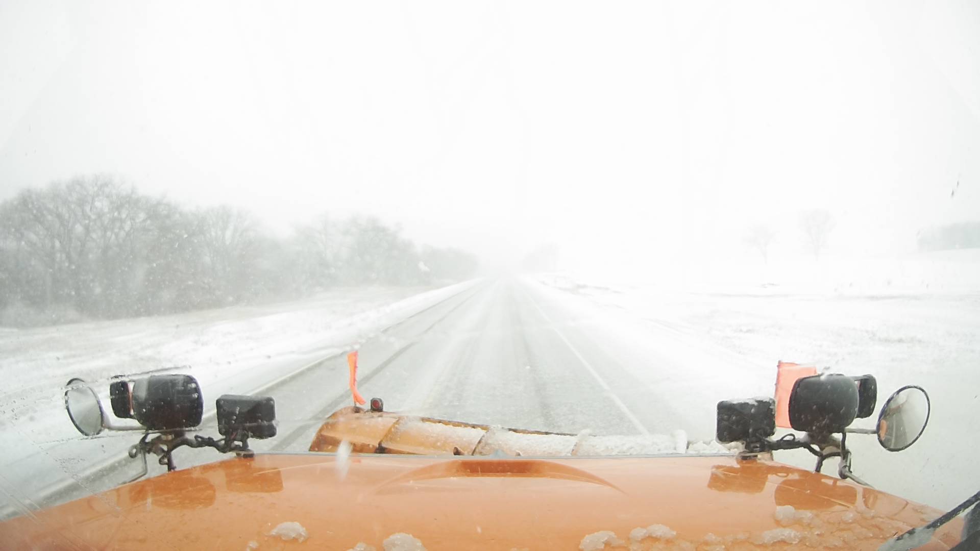
| Webcam image from northeast Iowa (IADOT) |
Snow plow cam from northeast Iowa (IADOT) |
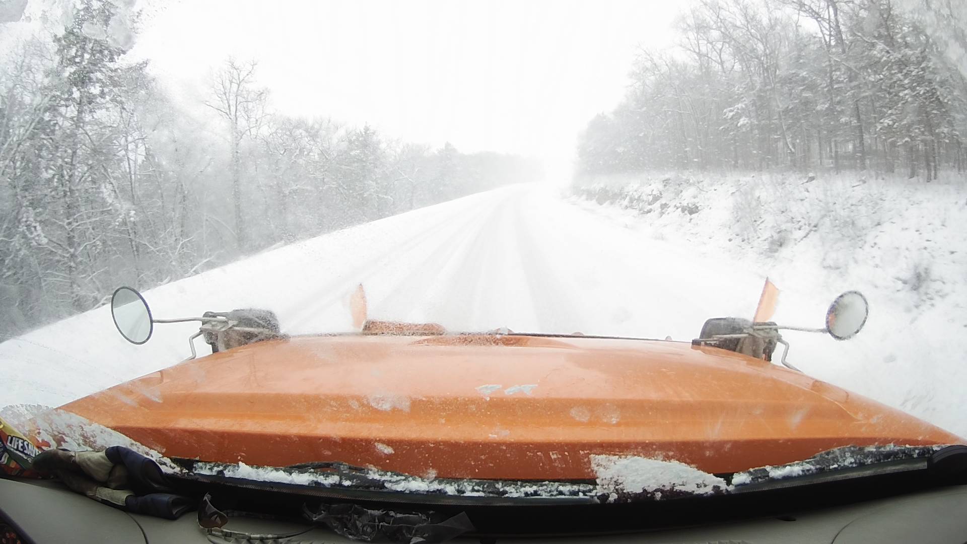
Snow plow cam near MN-IA stateline (IADOT) |
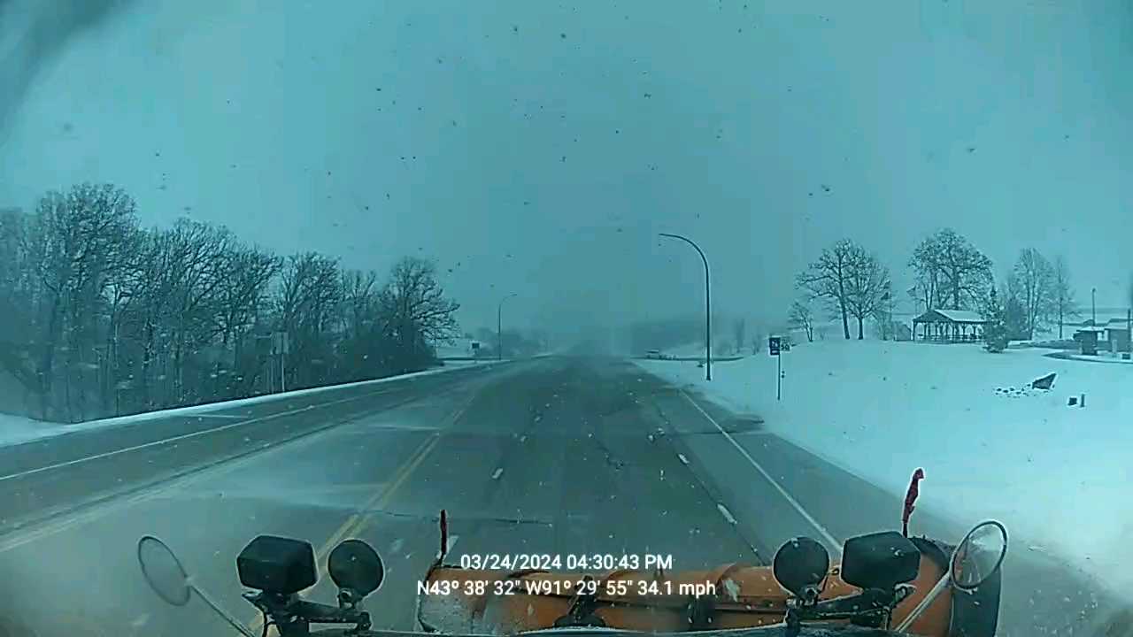
Snow plow cam from southeast Minnesota (MNDOT) |
 |
 |
 |
 |
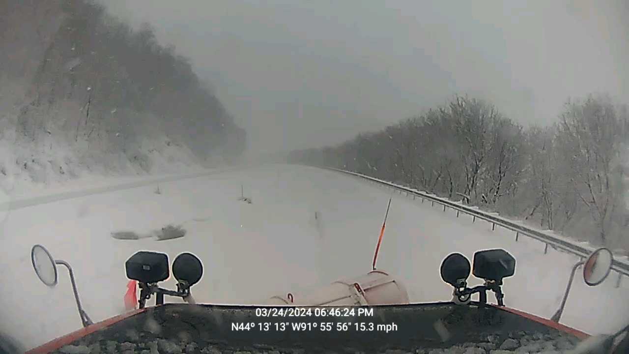
| Snow plow cam from Highway 61 near Winona MN (MNDOT) |
Snow plow cam from near Wabasha, MN after dark (MNDOT) |
Heavy snow falls at NWS La Crosse ~5pm Sunday (NWS La Crosse) |
Snow accumulation in northeast Iowa (IADOT) |
Radar:
 |
|
| 3:14-3:32 PM SUNDAY MARCH 24 | 4:14-4:32 PM SUNDAY MARCH 24 |
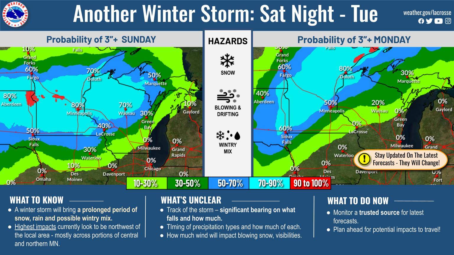
Forecast Graphics
 |
 |
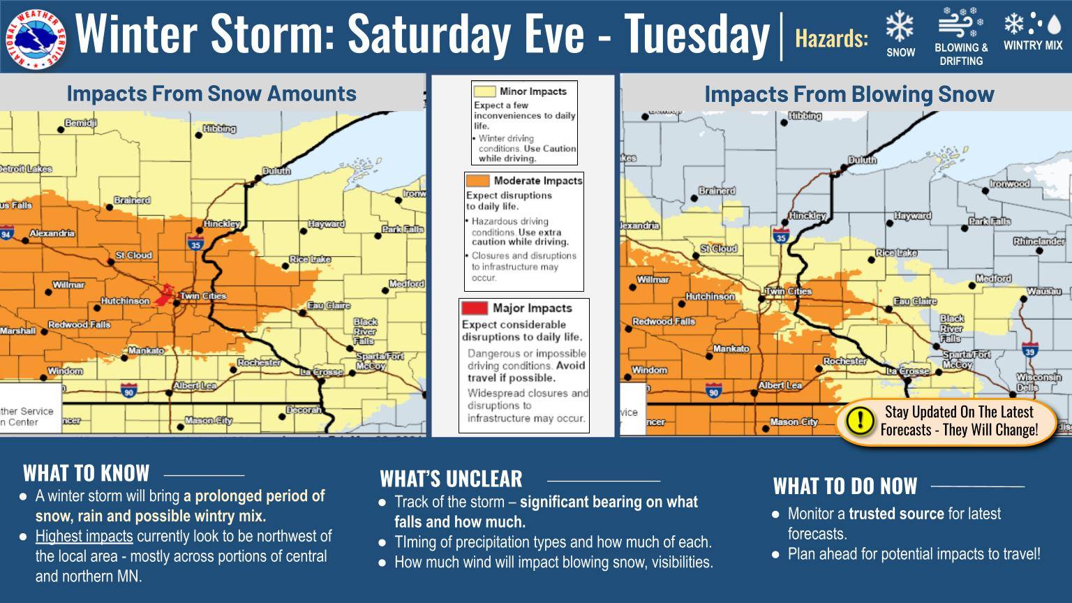 |
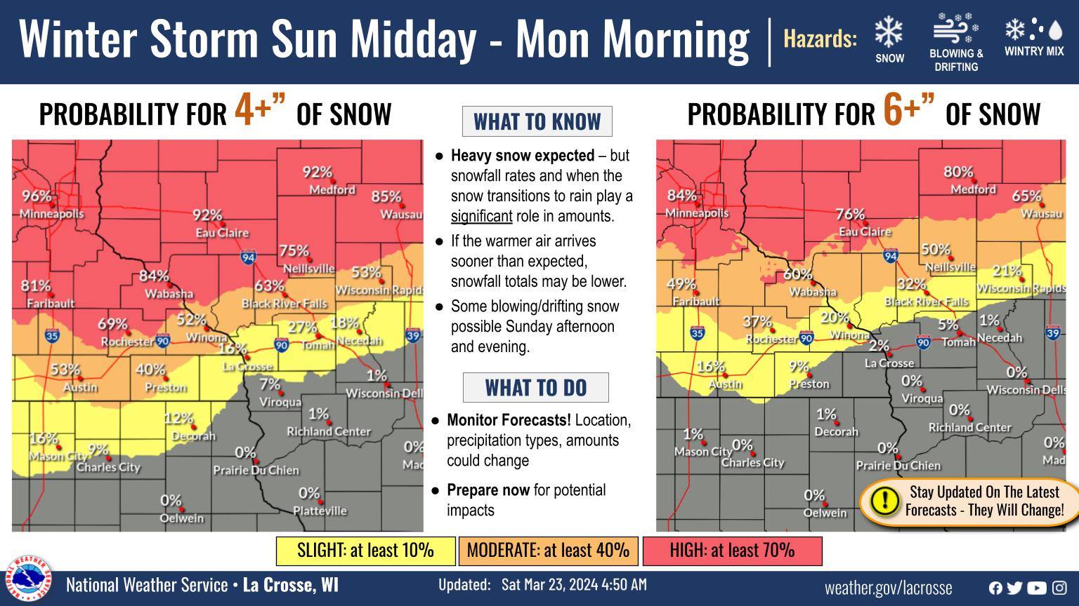
| Figure 1: Early Outlook for Heavy Snow Potential | Figure 2: Probability graphic showing area most likely to receive higher snow totals | Figure 3: Forecast travel impacts |
 |
 |
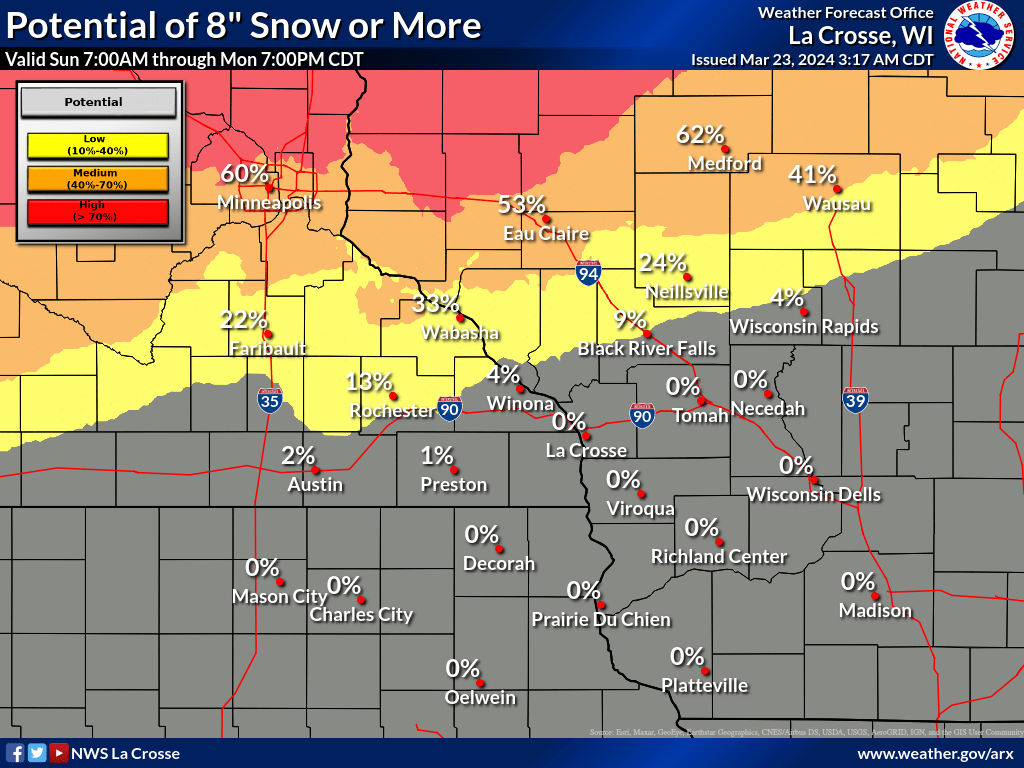 |
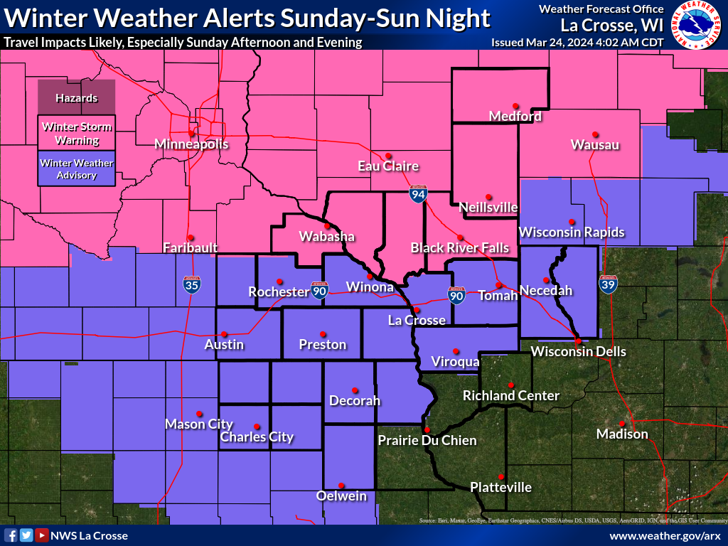
| Figure 4: Graphicast highlighting heavy snow band and expected impacts | Figure 5: Advisory and Warning Map | Figure 6: Probability of 8" or more of Snow graphic |
 |
Media use of NWS Web News Stories is encouraged! Please acknowledge the NWS as the source of any news information accessed from this site. |
|


 Weather Story
 Weather Map
 Local Radar