Overview
|
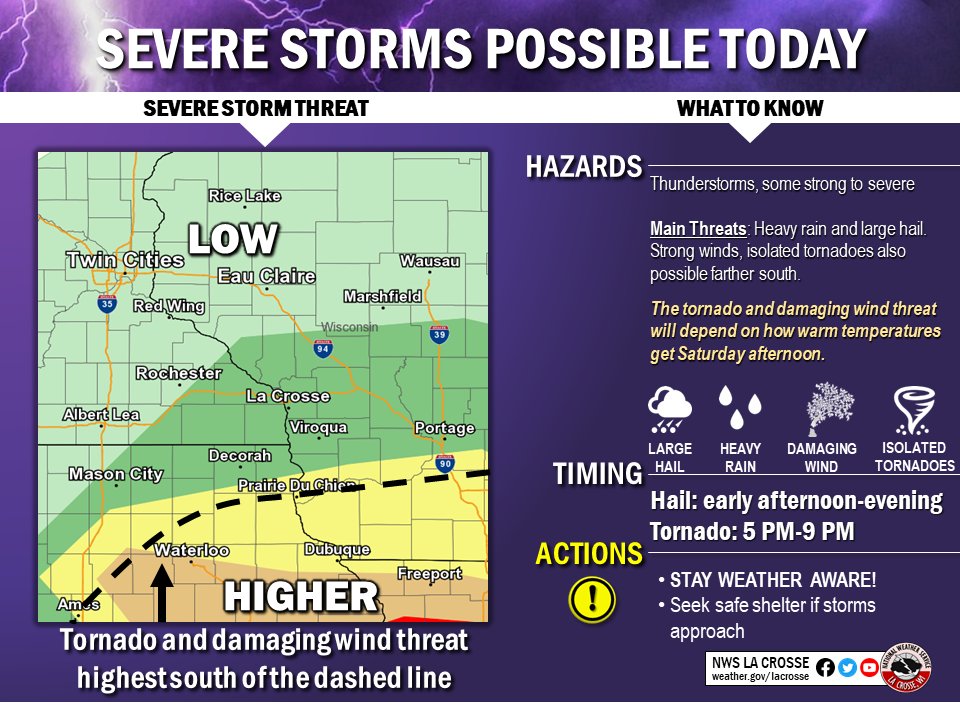
A strong storm system moved through the central U.S. on March 28, 2020. This brought a strong warm front northward into northeast Iowa and far southwest Wisconsin. Thunderstorms formed during the afternoon hours north of the warm front and brought many reports of small hail covering the ground. In the late afternoon and early evening, storms formed near the warm front and produced brief tornadoes which caused damage in Oelwein, Iowa, near Maynard, Iowa, and north of Potosi, Wisconsin. |
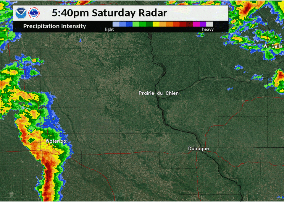 Radar Loop of the Tornado-producing Time Frame |
Tornadoes:
|
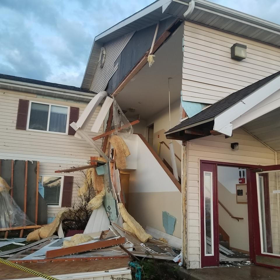
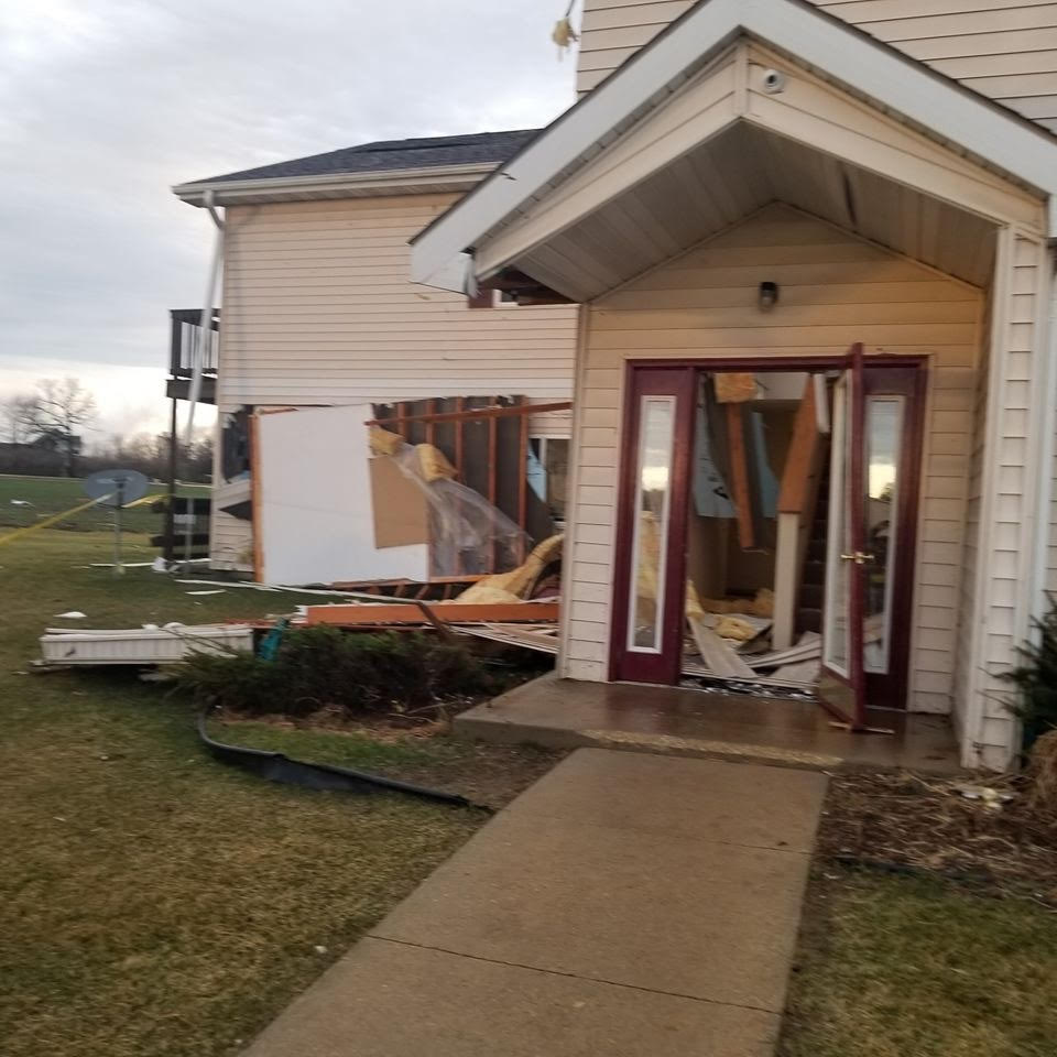
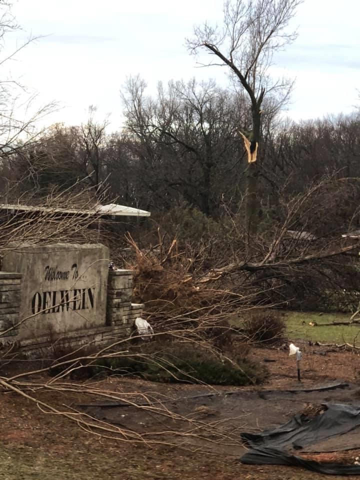
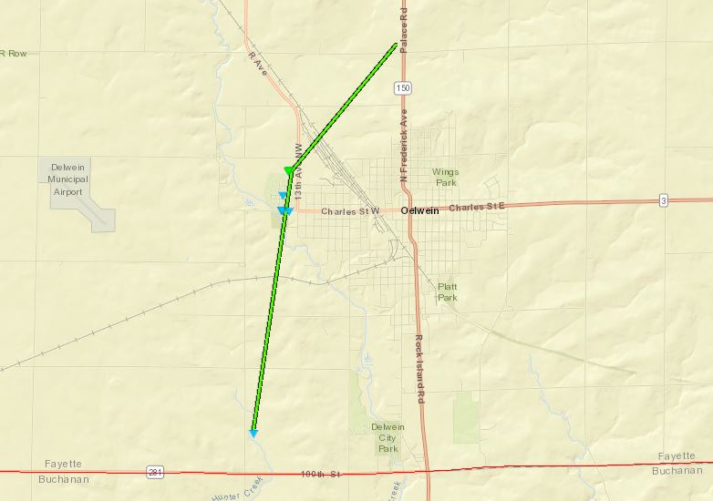
Tornado - Oelwein, IA
|
||||||||||||||||
 |
 |
 |
 |
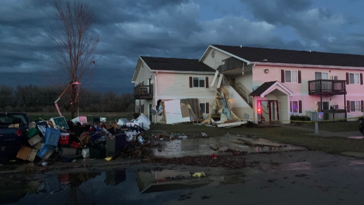
| Damage to apartments on west side of Oelwein, IA (Fayette Co. EMA) |
Damage to an apartment garage on west side of Oelwein, IA (Fayette Co. EMA) |
Damage to apartments on west side of Oelwein, IA (Fayette Co. EMA) |
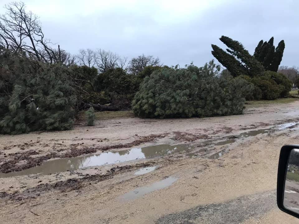
Damage to trees at Woodlawn Cemetery on west side of Oelwein, IA (Fayette Co. EMA) |
 |
 |
 |
|
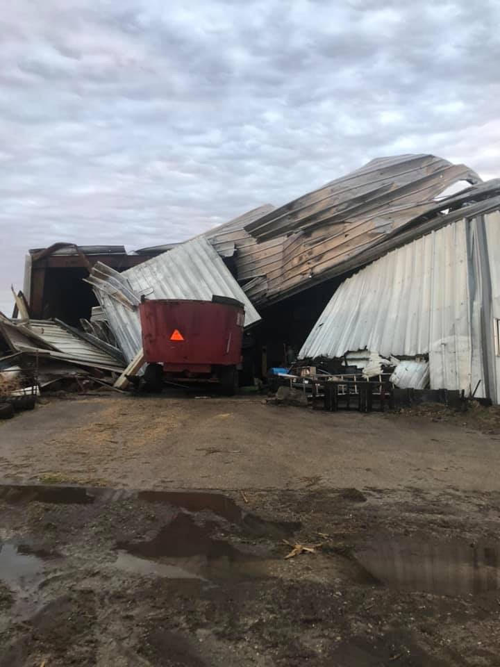
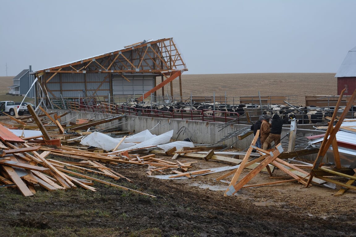
| Damage to farm northwest of Oelwein, IA (Fayette Co. EMA) |
Damage to farm northwest of Oelwein, IA (Fayette Co. EMA) |
Apartment damage in Oelwein. (KWWL TV) |
|
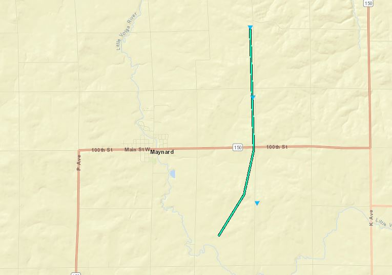
Tornado - Maynard, IA
|
||||||||||||||||
|
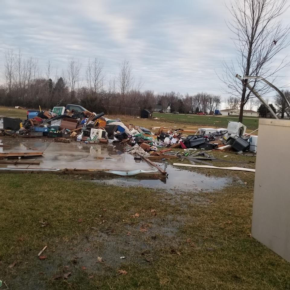
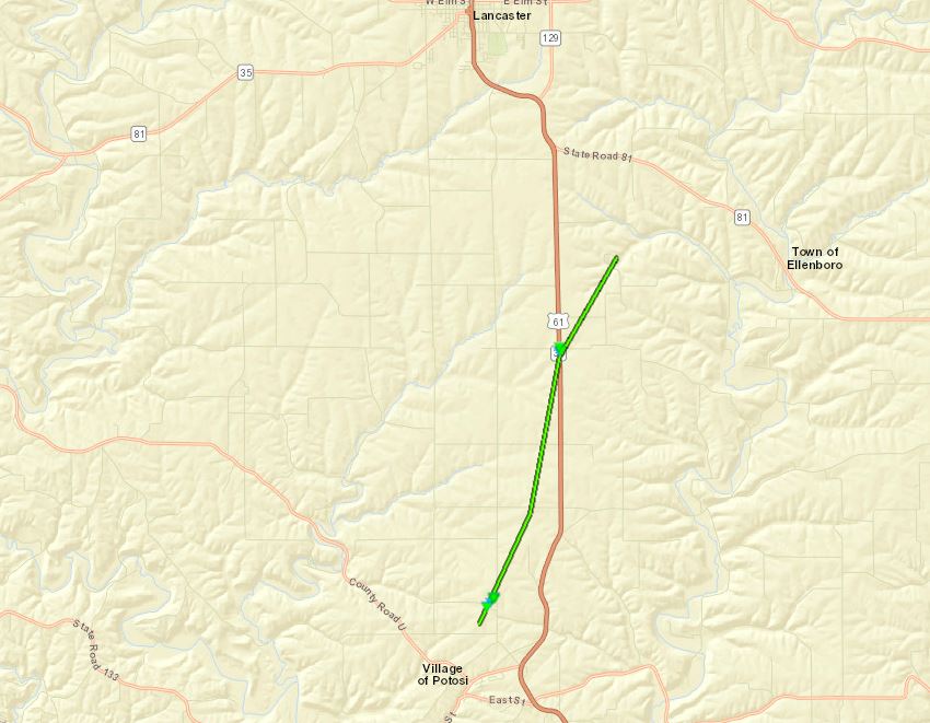
Tornado - Potosi WI
|
||||||||||||||||
 |
 |
 |
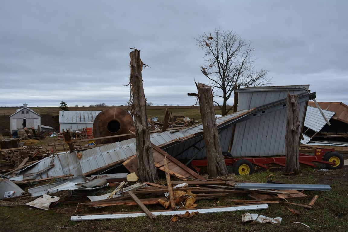 |
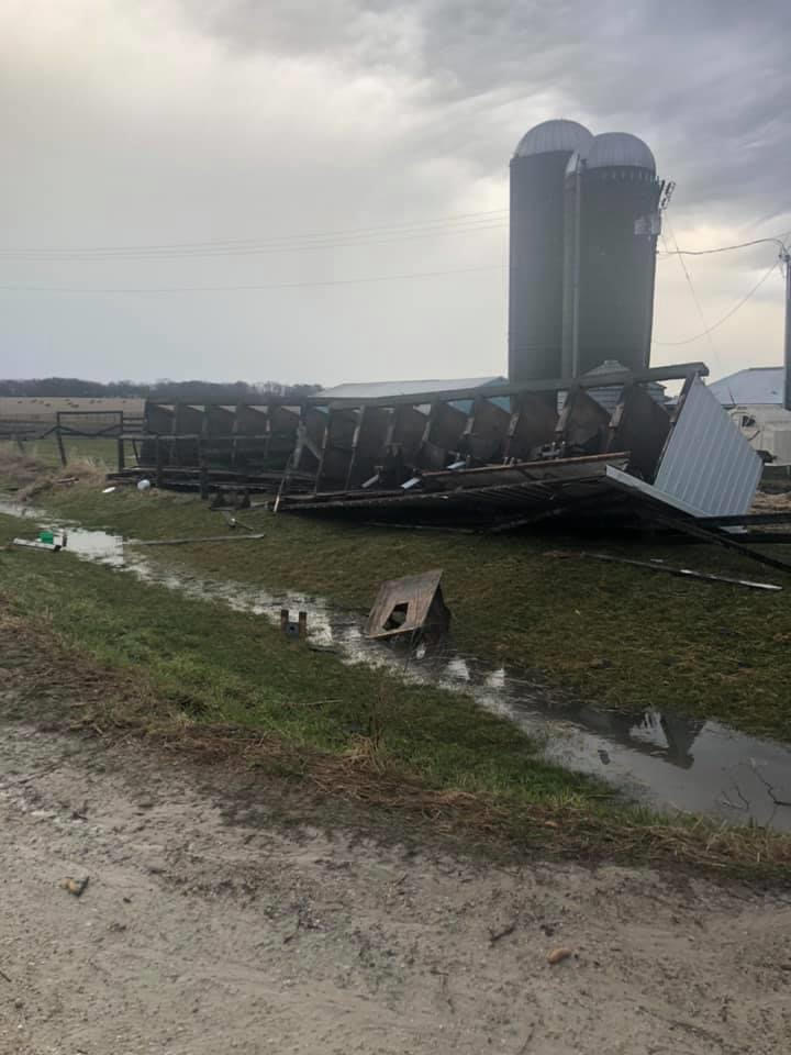
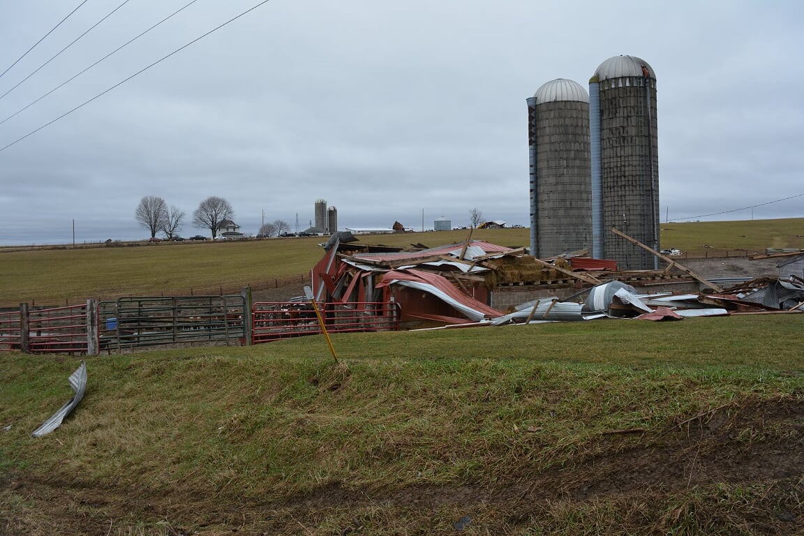
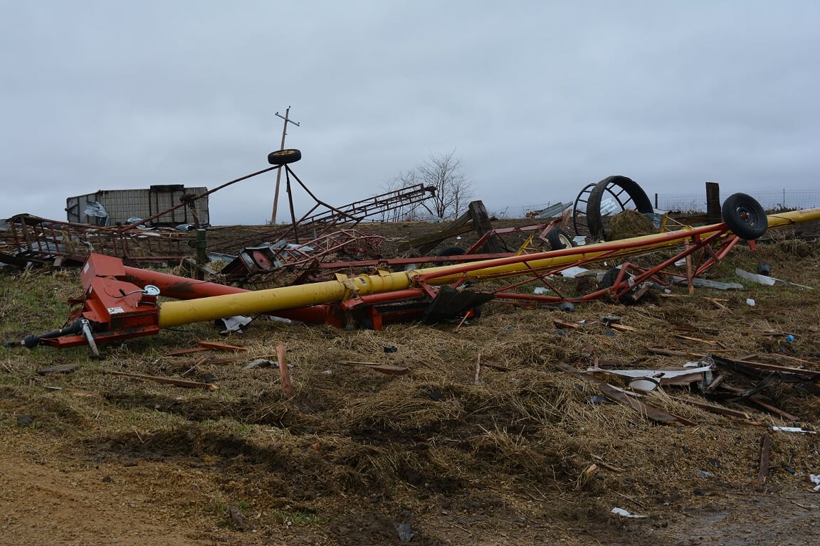
| Barn damage near Highway 61 and Substation Rd. (Grant Co. EMA) |
Barn damage in the Stage Rd. area north of Potosi, WI (Grant Co. EMA) |
Damage in the Seemore Ridge area north of Potosi, WI (Grant Co. EMA) |
Additional damage in the Seemore Ridge area north of Potosi, WI (Grant Co. EMA) |
The Enhanced Fujita (EF) Scale classifies tornadoes into the following categories:
| EF0 Weak 65-85 mph |
EF1 Moderate 86-110 mph |
EF2 Significant 111-135 mph |
EF3 Severe 136-165 mph |
EF4 Extreme 166-200 mph |
EF5 Catastrophic 200+ mph |
 |
|||||
Photos:
 |
 |
||
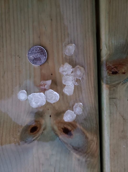
| Hail in Monona, IA (Brian Cooley) |
Tree damage at Red Gate Park in Oelwein. (Fayette Co. EMA) |
Radar / Graphics / YouTube Briefing:
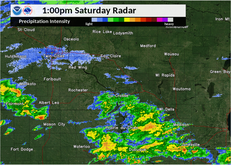 |
| Radar Loop |
 |
 |
 |
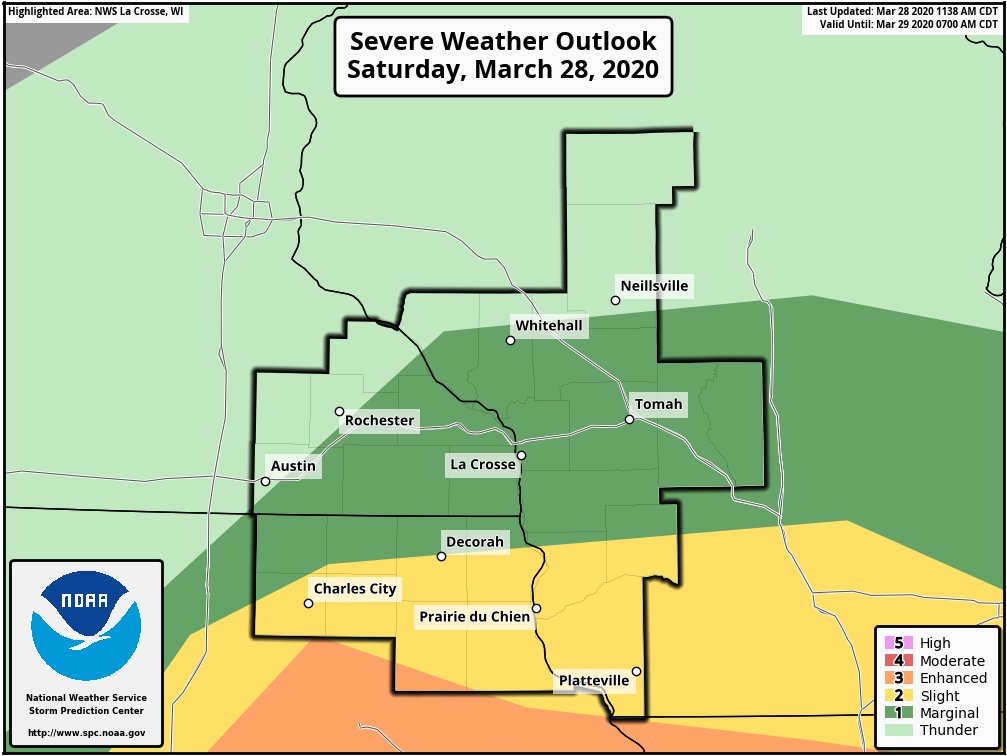 |
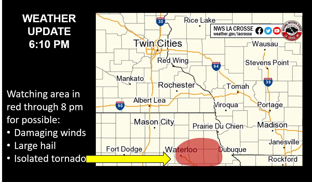
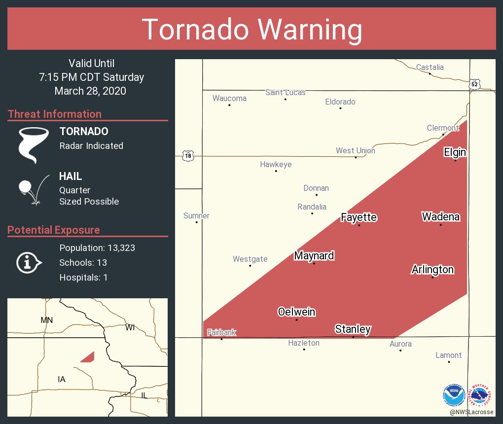
| Graphic disseminated showing threat area - approx. 20 min before first tornado. | Tornado Warning for Fayette Co. Iowa (issued at 6:30pm) based on spotter reports and radar information. | Graphic disseminated earlier in the day highlighting the risk areas. | Severe Weather Outlook for Saturday, March 28th (from Storm Prediction Center) |
Storm Reports
PRELIMINARY LOCAL STORM REPORT...SUMMARY
NATIONAL WEATHER SERVICE LA CROSSE WI
245 PM CDT SUN MAR 29 2020

..TIME...   ...EVENT...      ...CITY LOCATION...     ...LAT.LON...
..DATE...   ....MAG....      ..COUNTY LOCATION..ST.. ...SOURCE....
            ..REMARKS..

0221 PM     HAIL             KASSON                  44.02N 92.75W
03/28/2020  E0.70 INCH       DODGE              MN   BROADCAST MEDIA


0330 PM     HAIL             MONDOVI                 44.57N 91.67W
03/28/2020  E0.50 INCH       BUFFALO            WI   CO-OP OBSERVER


0335 PM     HAIL             2 SW PLATTEVILLE        42.71N 90.51W
03/28/2020  E0.50 INCH       GRANT              WI   PUBLIC

            .

0336 PM     HAIL             MONDOVI                 44.57N 91.67W
03/28/2020  M0.25 INCH       BUFFALO            WI   TRAINED SPOTTER

            .

0343 PM     HAIL             STRAWBERRY POINT        42.69N 91.53W
03/28/2020  E0.25 INCH       CLAYTON            IA   CO-OP OBSERVER

            .

0435 PM     HAIL             1 NNW ROCHESTER         44.03N 92.48W
03/28/2020  E0.25 INCH       OLMSTED            MN   PUBLIC

            LASTED ABOUT 15 SEC.

0451 PM     HAIL             1 ENE RICHLAND CENTER   43.34N 90.36W
03/28/2020  E0.25 INCH       RICHLAND           WI   PUBLIC


0457 PM     HAIL             TREMPEALEAU             44.01N 91.44W
03/28/2020  E0.25 INCH       TREMPEALEAU        WI   PUBLIC

            .

0502 PM     HAIL             1 W STOCKTON            44.03N 91.79W
03/28/2020  E0.25 INCH       WINONA             MN   PUBLIC


0530 PM     HAIL             WABASHA                 44.37N 92.04W
03/28/2020  E0.25 INCH       WABASHA            MN   LAW ENFORCEMENT

            REPORTED FROM DISPATCH.

0537 PM     HAIL             5 SSW SPARTA            43.88N 90.83W
03/28/2020  E0.25 INCH       MONROE             WI   PUBLIC

            REPORTED FROM LEON AREA.

0541 PM     HAIL             1 SW SPARTA             43.93N 90.83W
03/28/2020  E0.25 INCH       MONROE             WI   LAW ENFORCEMENT

            .

0630 PM     HAIL             1 NW STEWARTVILLE       43.87N 92.49W
03/28/2020  U0.25 INCH       OLMSTED            MN   PUBLIC


0633 PM     TORNADO          1 W OELWEIN             42.68N 91.94W
03/28/2020                   FAYETTE            IA   EMERGENCY MNGR

            CONFIRMED WITH VIDEO. DAMAGE TO APARTMENT
            BUILDINGS AND TREES IN RED GATE PARK. ENTIRE TORNADO
            WAS 630 TO 636 PM.

0640 PM     TORNADO          2 SE MAYNARD            42.75N 91.84W
03/28/2020                   FAYETTE            IA   EMERGENCY MNGR

            CONFIRMED DAMAGE TO BARNS SOUTHEAST AND EAST OF MAYNARD.
            ENTIRE TORNADO WAS 640 TO 642 PM.


0650 PM     HAIL             WADENA                  42.84N 91.66W
03/28/2020  E0.50 INCH       FAYETTE            IA   TRAINED SPOTTER


0700 PM     FUNNEL CLOUD     1 SSW FAYETTE           42.83N 91.81W
03/28/2020                   FAYETTE            IA   STORM CHASER

            POSSIBLE TORNADO. REPORTED ROPE FUNNEL
            APPROXIMATELY 5 TO 7 MILES NORTHEAST OF
            MAYNARD, IA APPROXIMATELY 7 PM.

0715 PM     FUNNEL CLOUD     SAINT OLAF              42.93N 91.39W
03/28/2020                   CLAYTON            IA   TRAINED SPOTTER


0715 PM     HAIL             ELKADER                 42.86N 91.40W
03/28/2020  E1.00 INCH       CLAYTON            IA   LAW ENFORCEMENT


0720 PM     HAIL             2 N FARMERSBURG         42.99N 91.37W
03/28/2020  E0.25 INCH       CLAYTON            IA   PUBLIC


0720 PM     HAIL             MONONA                  43.05N 91.39W
03/28/2020  E1.00 INCH       CLAYTON            IA   PUBLIC

            RELAYED VIA SOCIAL MEDIA. TIME ESTIMATED
            FROM RADAR.

0721 PM     HAIL             MONONA                  43.05N 91.39W
03/28/2020  U0.75 INCH       CLAYTON            IA   PUBLIC

            REPORT FROM MPING: DIME (0.75 IN.).

0745 PM     HAIL             HARPERS FERRY           43.20N 91.15W
03/28/2020  E0.25 INCH       ALLAMAKEE          IA   BROADCAST MEDIA

            REPORTED BY WXOW. STRONG WINDS ALSO
            REPORTED.

0756 PM     HAIL             PATCH GROVE             42.94N 90.97W
03/28/2020  E0.50 INCH       GRANT              WI   PUBLIC


0800 PM     FUNNEL CLOUD     2 WSW GUTTENBERG        42.77N 91.14W
03/28/2020                   CLAYTON            IA   LAW ENFORCEMENT

            EARLIER REPORT OF FUNNEL CLOUD NEAR GARBER
            RD/OSTERDOCK RD. TIME ESTIMATED FROM RADAR.

0816 PM     HAIL             2 E BAGLEY              42.90N 91.07W
03/28/2020  U0.50 INCH       GRANT              WI   PUBLIC

            REPORT FROM MPING: HALF-INCH (0.50 IN.).

0828 PM     HAIL             BOSCOBEL                43.14N 90.71W
03/28/2020  E0.25 INCH       GRANT              WI   PUBLIC


0837 PM     TSTM WND GST     POTOSI                  42.69N 90.71W
03/28/2020  E40 MPH          GRANT              WI   FIRE DEPT/RESCUE

            RELAYED VIA EMERG MGMT. POWER ALSO WENT OUT
            IN TOWN.

0838 PM     TSTM WND DMG     4 WSW ELLENBORO         42.77N 90.68W
03/28/2020                   GRANT              WI   EMERGENCY MNGR

            TREES AND POWER LINES BLOWN DOWN.

0838 PM     TORNADO          1 NNE POTOSI            42.71N 90.70W
03/28/2020                   GRANT              WI   EMERGENCY MNGR

            APPROXIMATELY A 4 MILE TRACK PRELIMINARY
            SURVEYED BY EM. TRACK WAS NORTHEAST OF THIS
            POINT TO 1 MI NW OF ELLENBORO. 1 HOUSE,
            MULTIPLE FARM OUTBUILDINGS, AND TREES
            DAMAGED.

0839 PM     TSTM WND DMG     4 S LANCASTER           42.79N 90.70W
03/28/2020                   GRANT              WI   EMERGENCY MNGR

            SEVERAL BARNS DESTROYED BETWEEN POTOSI AND
            LANCASTER.

0900 PM     HAIL             1 WSW HILLSBORO         43.65N 90.35W
03/28/2020  M0.50 INCH       VERNON             WI   PUBLIC

            COCORAHS OBSERVER.


&&

$$
NWS LA CROSSE
 |
Media use of NWS Web News Stories is encouraged! Please acknowledge the NWS as the source of any news information accessed from this site. |
|


 Weather Story
 Weather Map
 Local Radar