
Strong to severe storms are expected to develop from mid afternoon through early evening. Damaging winds will be the main threat, but large hail and tornadoes are also possible. Have multiple ways to receive warnings and stay weather aware if you have outdoor plans. Read More >
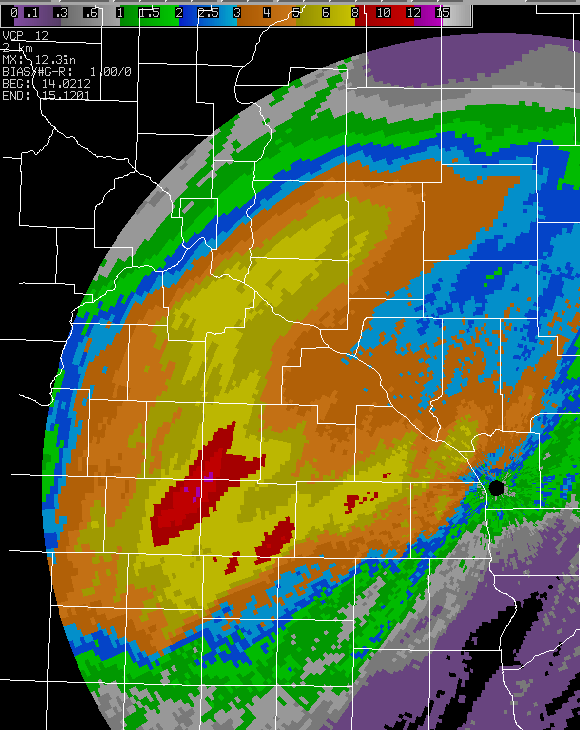
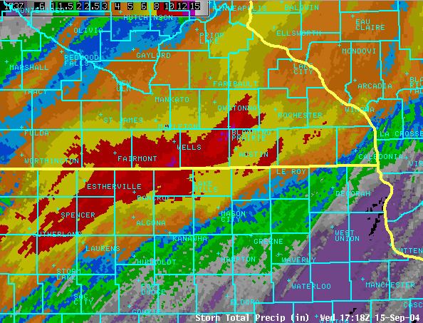
After a relatively dry month, a potent late summer storm system brought very heavy rain to parts of southeast Minnesota and northeast Iowa on Tuesday, Sept.14th, and Wednesday, Sept.15th. Rain was most intense from near Mason City, Iowa through the Albert Lea/Austin, MN area to areas around Rochester, MN. There were many areas that had over 4 inches of rain, with isolated higher amounts. In fact, the highest unofficial totals were out of the Blooming Prairie, MN area with 11.50 inches and 13.00 inches reported.
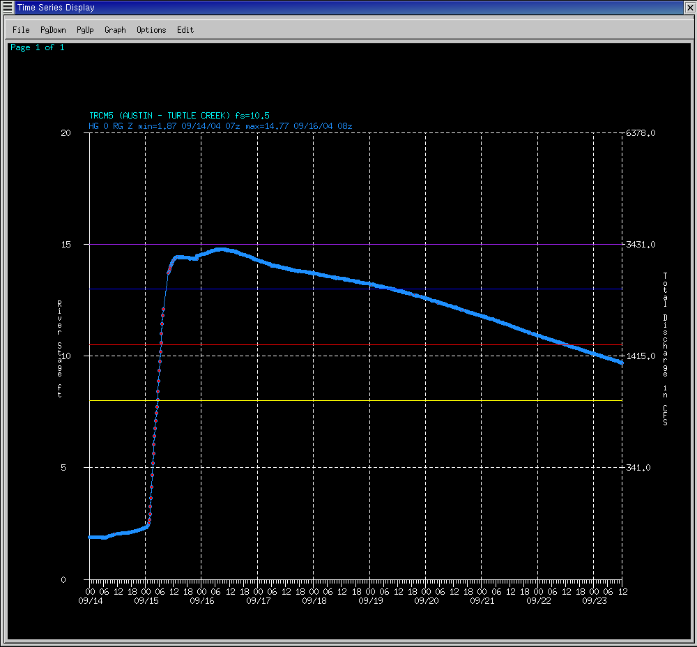
Flash Flooding was the initial problem, but as all that rain drained into river basins, many of the regional rivers and creeks saw dramatic rises overnight Tuesday into Wednesday morning. The Austin, MN area saw very high to record crest levels on the Cedar River and creeks leading into it. Other rivers affected included the Upper Iowa, Zumbro, and Root.
Hardest hit was the Austin, MN area where flooding affected parts of the city and widespread sand bagging efforts took place. A 20-year old man, who was walking to work, walked into high water and was swept away. A 51-year old man also died of a heart attack while sand bagging.
River Crests
A Flood Watch had been in effect for southern Minnesota by Tuesday morning, and was expanded to the Mississippi River Tuesday afternoon. Numerous Flash Flood and River Flood Warnings were issued starting Tuesday evening and continued through Thursday, Sept.16th.
Images
 |
 |
|
| Storm Total Rainfall estimates from KARX Doppler Radar. | Regional view of estimated rainfall. | |
 |
 |
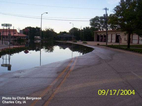 |
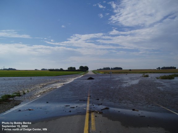
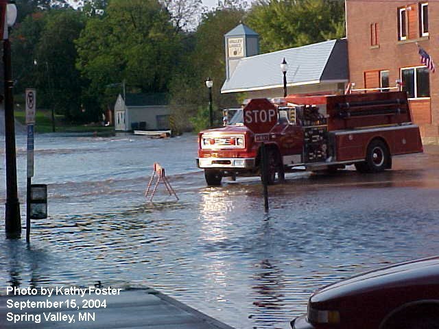
| Flooding in Dodge Co., MN. Photo by Bobby Benke. | Flooding in Spring Valley, MN. Photo by Kathy Foster. | Flooding in Charles City, IA. Photo by Chris Bergeson. |
 |
 |
 |
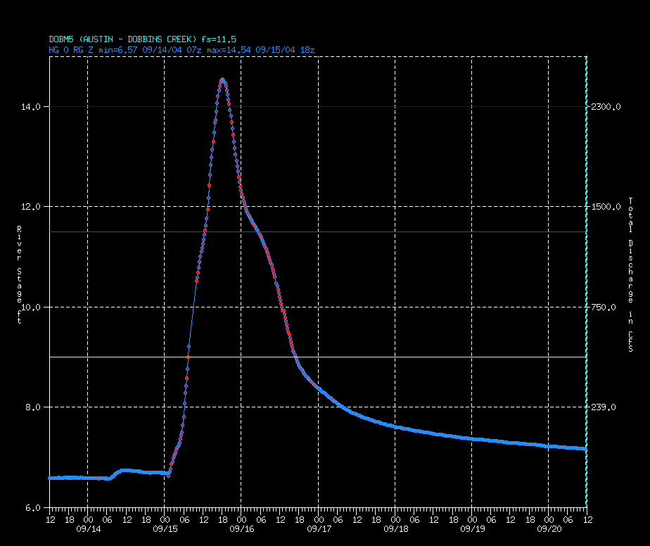
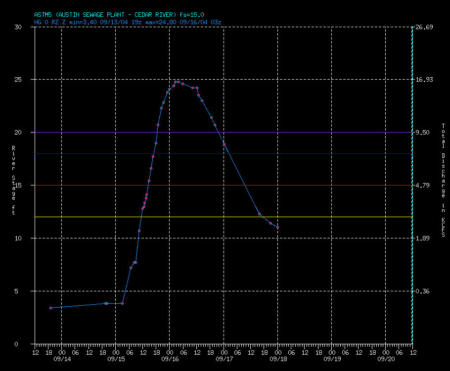
| Hydrograph from Dobbins Creek, Austin, MN. | Hydrograph from Austin, MN. | Hydrograph from Charles City, IA. |
 |
 |
|
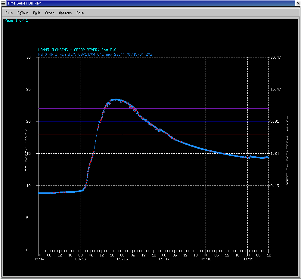
| Hydrograph from Lansing, MN. | Hydrograph from Turtle Creek, near Austin, MN. |
Minnesota Climatology Working Group summary of event - click here


 Weather Story
 Weather Map
 Local Radar