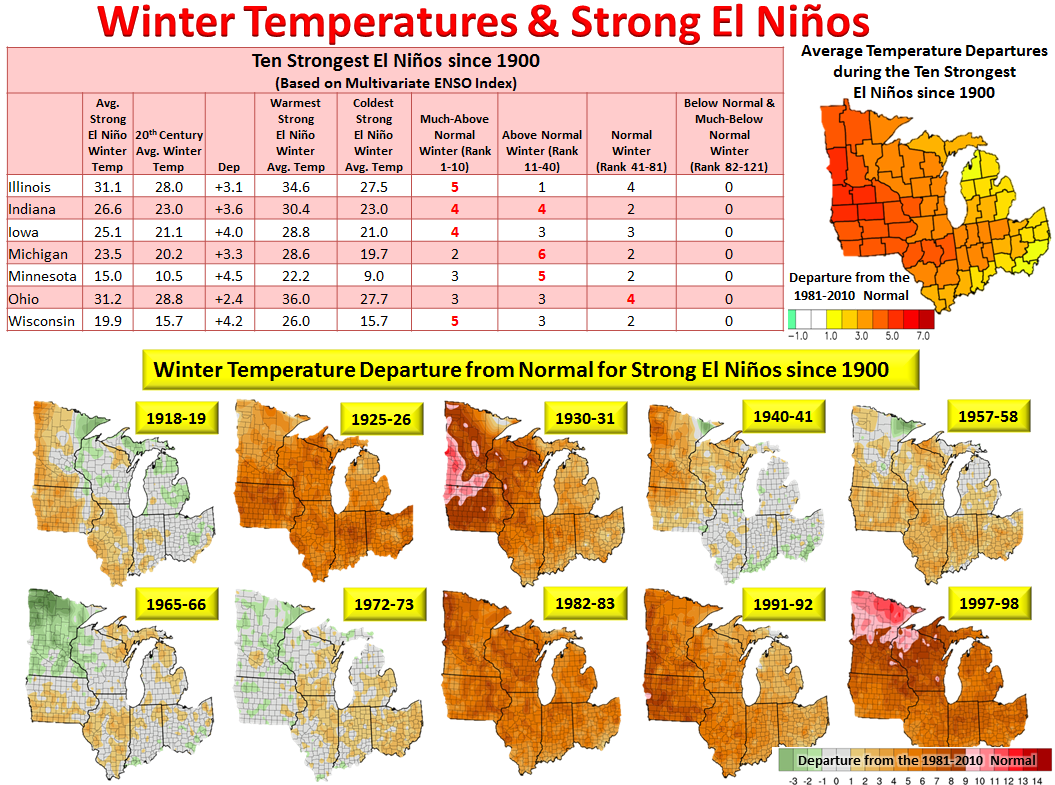
With a strong El Niño in progress, many have asked about how winter temperatures, precipitation, and seasonal snowfall are likely to play out across the Upper Mississippi Valley through the winter months. During the 10 strongest (based on Multivariate ENSO Index) El Niños since 1900, the average winter temperature has been either near- or above-normal across the Upper Midwest and Great Lakes region. Half of these winters were among the ten warmest in Wisconsin. Minnesota's warmest winter (average temperatures of 22.2F or 11.7F above normal) occurred during the 1997-98 strong El Niño. These winters also produced their 5th and 7th warmest winter. Finally, in Iowa, 4 of the ten warmest winters occurred during these winters.
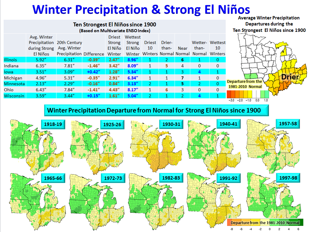
While there is a strong signal for warmth during strong El Niños, precipitation can be highly variable across Iowa, Minnesota, and Wisconsin. During these same strong El Niño winters, Minnesota had their driest (0.84" in 1930-31) and second driest (1.06 inches in 1957-58) winters along with their 15th (3.13" in 1918-19) and 20th wettest (3.06" in 1965-66) winters. Iowa saw their 2nd (1.28" in 1930-31) and 3rd driest (5.34" in 1982-83) winter along with their 10th wettest (4.79" in 1972-73) winter. Finally, Wisconsin had their 3rd (1.61" in 1930-31) and 5th driest (1.66" in 1957-58) winters along with their 8th (5.04" in 1982-83), 9th (4.77" in 1965-66), and 14th wettest (4.77" in 1972-73) winters.
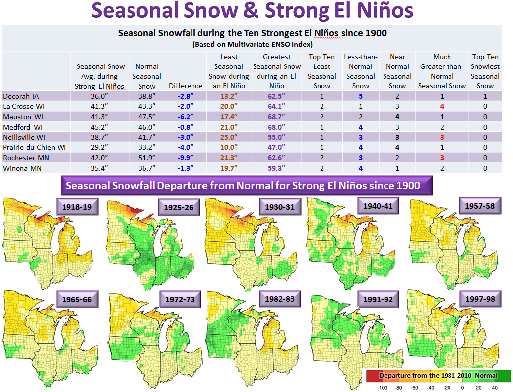
While seasonal snowfall tends to average up to 10 inches below normal in the Upper Mississippi River Valley during strong El Niños, up to a third of them have produced above normal snowfall. On average, there is around a 45 inch difference between the lowest and highest seasonal snowfall...so needless to say they can be quite variable.


 Weather Story
 Weather Map
 Local Radar