La Crosse, WI
Weather Forecast Office
Fallstreaks
What are they?
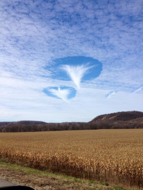
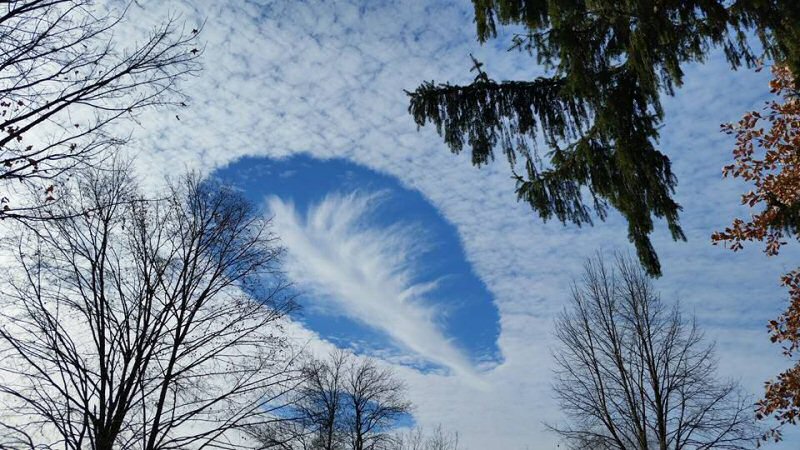
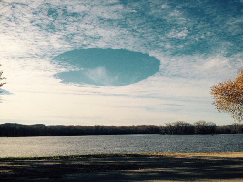
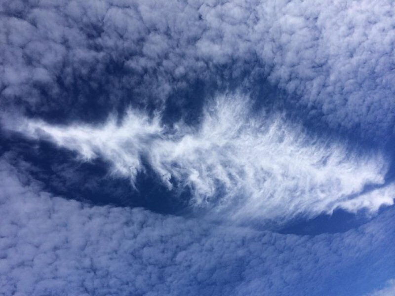
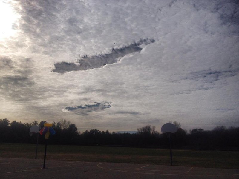
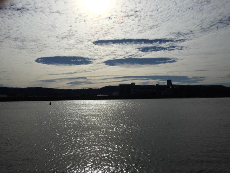
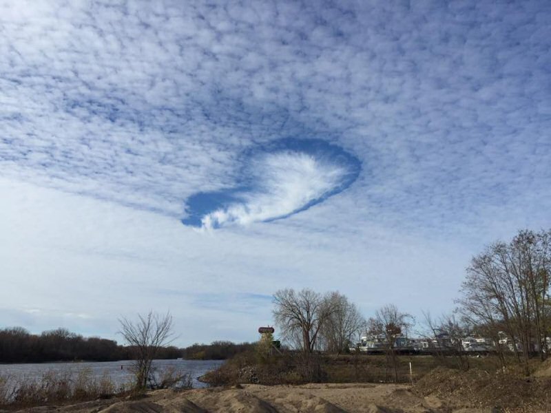
A fallstreak hole (also known as a "hole punch cloud") is a large circular or elliptical gap that can appear in cirrocumulus or altocumulus clouds.
How do they form?
High to mid level clouds, such as altocumulus, are often composed of tiny water droplets that are much colder than freezing, but have yet to freeze. These "supercooled" water droplets need a "reason" to freeze, which usually comes in the form of ice crystals. Planes passing through the cloud layer can bring these ice crystals.
Once the ice crystals are introduced, the water droplet quickly freeze, grow and start to fall. A hole is left behind, which will start to expand outward as neighboring droplets start to freeze.
The images below are from fallstreaks that developed on November 1, 2014 - contributed through facebook and twitter.
 |
 |
 |
 |
| Houston, MN - Jamie Vix | Houston, MN - Lisa Shultz | La Crosse, WI - Maddie Schlittler | Minnesota City, MN - Tricia Duren |
 |
 |
 |
|
| Rochester, MN - Grant Sherwin | Winona, MN - Jay Burros | Winona, MN - Jay Burros | ... |
Our Office
Community Involvement
Station / Location Info
Follow Us On Social Media
Student Opportunities
Additional Information
Storm Summaries
Cooperative Observers
Educational Resources
Science / Research
Weather Phenomenon
Mayfly Tracking
Latest
Temp/Pcpn Summary
Precipitation Reports
Forecast Discussion
Hazardous Weather Outlook
Hourly Weather
Public Information Statement
Local Storm Report
Lightning Plot Archive
River Stages
Water Temp
Observations
Precipitation Plotter
Soil Temps
US Dept of Commerce
National Oceanic and Atmospheric Administration
National Weather Service
La Crosse, WI
711 County Road FA
La Crosse, WI 54601
608-784-7294
Comments? Questions? Please Contact Us.


 Weather Story
 Weather Map
 Local Radar