
Multiple chances exist for severe thunderstorms today. Initial storms this morning will be travelling southeast through the area. Subsequent round of storms possible through the early evening into tonight. How the morning thunderstorms evolve will dictate strength, and exact timing or location of subsequent storms. An earlier departure to morning storms increases subsequent local severe threat. Read More >
| Typically at the beginning and ending of the growing seasons, the possibility of frost/freezes threaten sensitive vegetation and agriculture. For La Crosse, the average last freeze occurs on April 26th and the average first freeze occurs on October 10th. For Rochester, the average last/first freeze is May 7th and September 30th, respectively.
|
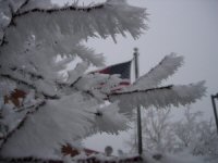 |
The following list are some meteorological conditions that can lead to frost conditions:
A local study done on frost formation relating temperature to dew point has these guidelines for frost: temperatures from 38 to 42 F can lead to patchy frost, 33 to 37 areas of frost, and 32 and below widespread frost/freeze. Note that the study did not factor in other considerations to frost, such as sky cover and wind speeds.
Other local effects, such as soil moisture/temperature and stage of vegetation "greenness" are factors that can affect the possibility of frost forming.


 Weather Story
 Weather Map
 Local Radar