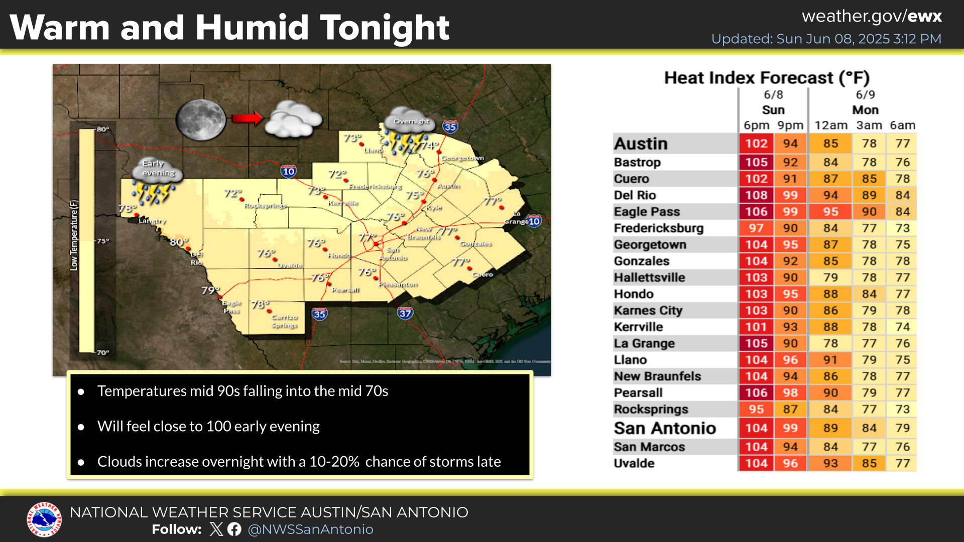
A Heat Advisory is in effect Wednesday from 12 PM to 8 PM, generally along and east of the I-35 corridor. Hot temperatures and high humidity may cause heat related illnesses. Remember to stay hydrated, limit time spent outdoors, and wear light-weight light-colored clothing.
10 AM Update: Tropical Storm Bertha is forecast to approach the Texas coast as a tropical depression by early Friday. Wind shear, dry air and land interaction could limit the storms organization as it approaches Texas late week. No impacts are expected for South Central Texas through Thursday night. Friday into the weekend, moisture from Bertha or its remnants could bring a low chance (20-30%) of showers, favoring the Coastal Plains. Please follow us and other trusted sources including hurricanes.gov through the week.
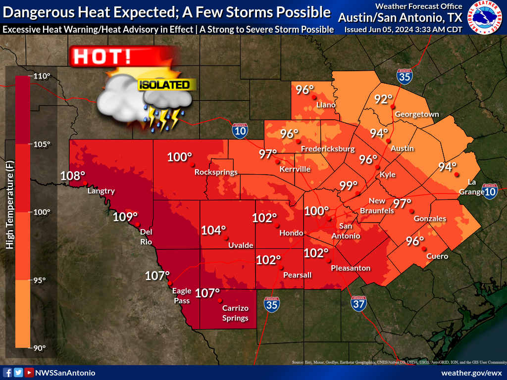
Hot and dry conditions across South Central Texas. Highs are forecast to range from the mid to upper 90s and up to 104 across the southern part of the Rio Grande Plains.
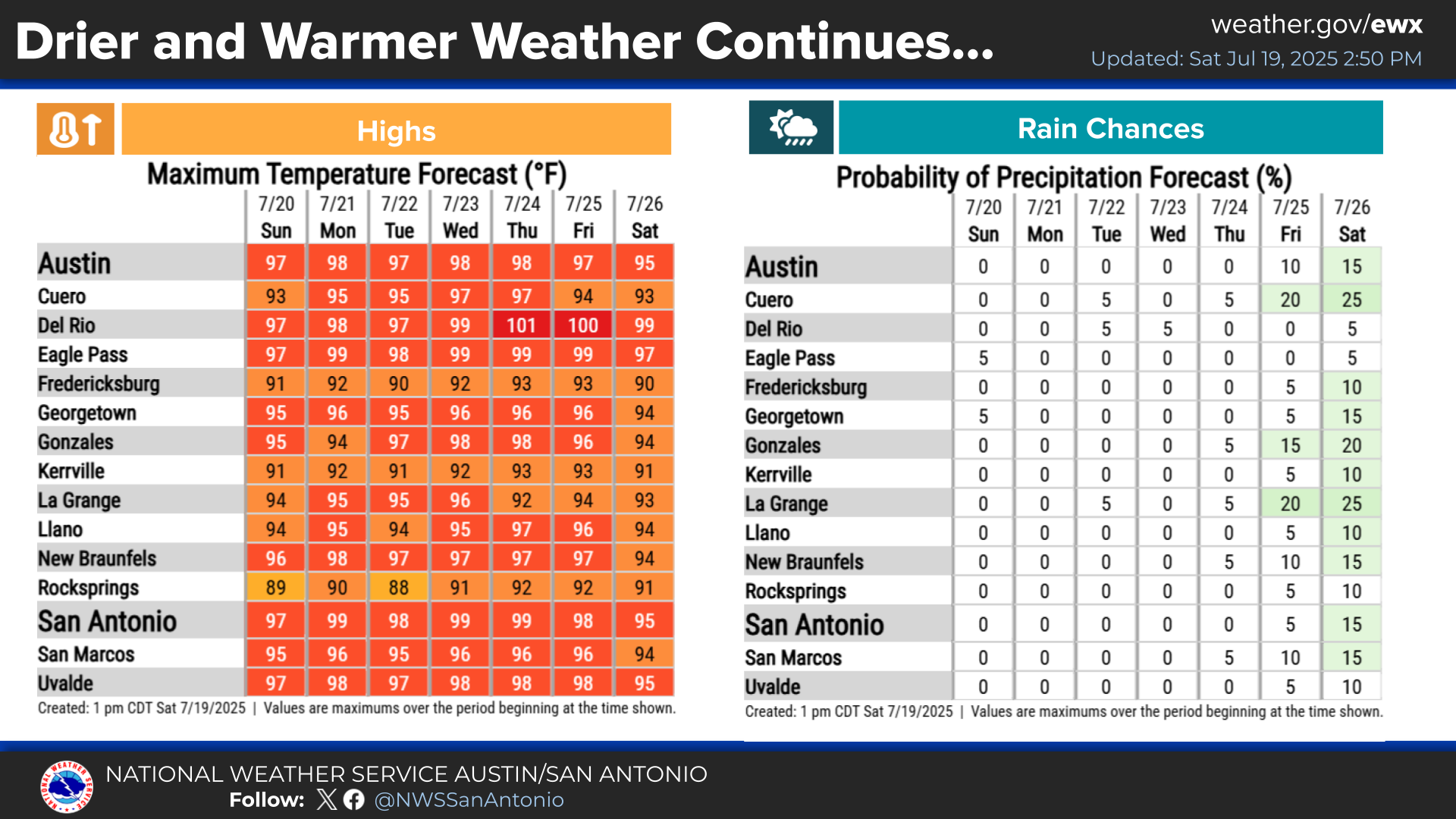
Typical summer heat and dry weather is forecast for the work week into early next week. Temperatures will continue to climb with highs in the mid to upper 90s to around 103 degrees and heat indices nearing 110 to 112 at times on Wednesday and Thursday. This will lead to a moderate to major heat risk across the region. Stay hydrated and practice heat safety!


 Austin/San Antonio Radar
 Weather Map
 Satellite Imagery
 Del Rio Radar
 Digital Forecast Map
 Tropical Outlook
 Drought Status
 Air Quality
 Fire Weather Forecasts
 Observed Rainfall
 Observed Temperatures
 Daily Climate Graphs