Winter Weather Awareness Week for New York is from October 27 through November 2, 2024.
Please join us in promoting winter weather safety during this year's "Winter Weather Awareness Week". The National Weather Service asks emergency management, public safety officials, local media and Weather-Ready Nation Ambassadors to help join forces in improving the nation's readiness, responsiveness, and overall resilience against extreme weather during the winter weather season.
Each day this week, a different topic will be covered. Click on the tabs below for more winter weather preparedness information.
Winter can bring dangerously cold temperatures and create hazardous weather conditions that can create many threats to life and property if one is not prepared.
The National Weather Service urges everyone to be prepared for the upcoming winter season. Each day this week we will explore actions you can take to reduce the impact of winter weather.
Taking steps now to prepare for winter weather will help you to keep safe this winter and enjoy the season. For winter weather safety and preparedness information, please see: https://www.weather.gov/safety/winter
Information will also be disseminated by social media platforms such as Facebook, and on Twitter, @nwsbinghamton.
Please join us by using the following hashtags: #Winterprep, #Winter, and #AreYouReady.
Monday
We will explore what precautions you can take to mitigate against New York's harsh winters and how you can become ready and more resilient.
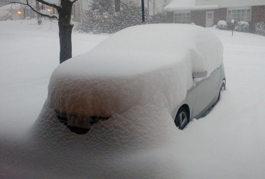
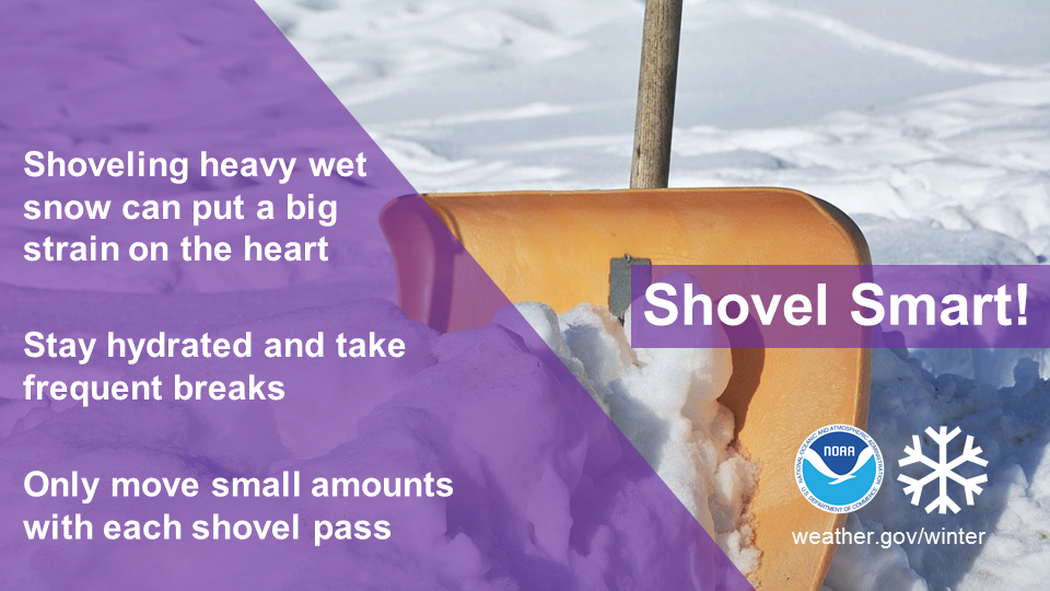
It has been proven that the best way to prepare for extreme weather is to have a plan. Never let a winter storm take you by surprise. If you are expecting to be at home or at work during an extreme winter weather event, you need to be concerned about losing power, heat, or cell / phone service. Losing one of these three services may create a life threatening situation. Make sure you have a back up plan.
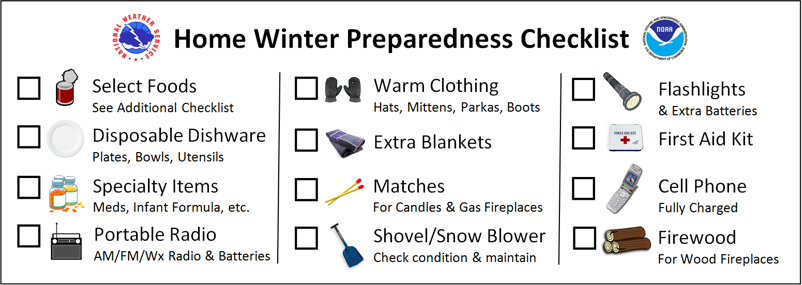
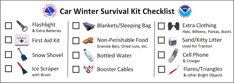
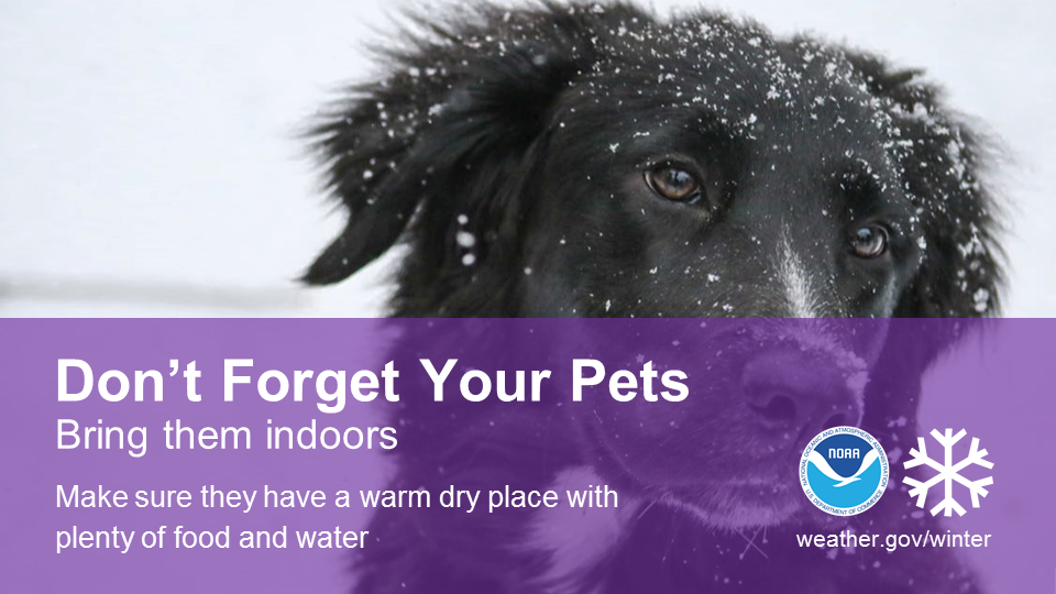
Whether you are at home, on the road or at work, one should always have an emergency kit. An emergency kit should include the following: a flashlight and extra batteries, a battery-powered NOAA Weather Radio, food and water, extra prescriptions, an emergency heat source, first-aid supplies and a cell phone.
The best action to take during a winter storm is to stay inside and not travel, unless it is an emergency.
If you must drive, slow down and allow extra time to reach your destination! Let someone know where you are going and what route you are going to take. If your car gets stuck in a storm, stay in your vehicle! If you leave your vehicle, you could become disoriented quickly if there is wind-driven snow and cold. Run the motor for a total of 10 minutes each hour for heat. While running the motor, open the window a little bit so that fresh air can get into the car to avoid carbon monoxide poisoning. Make sure you clear snow away from the exhaust pipe to avoid gas poisoning. Attach a bright cloth to your car door to draw attention to yourself, and when it stops snowing, raise the hood of your car to indicate to others you need help.
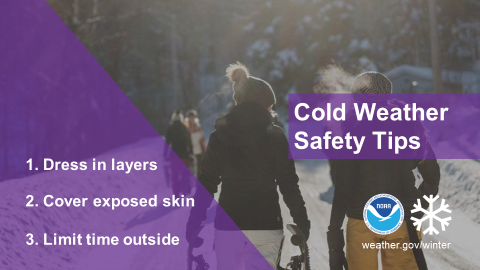
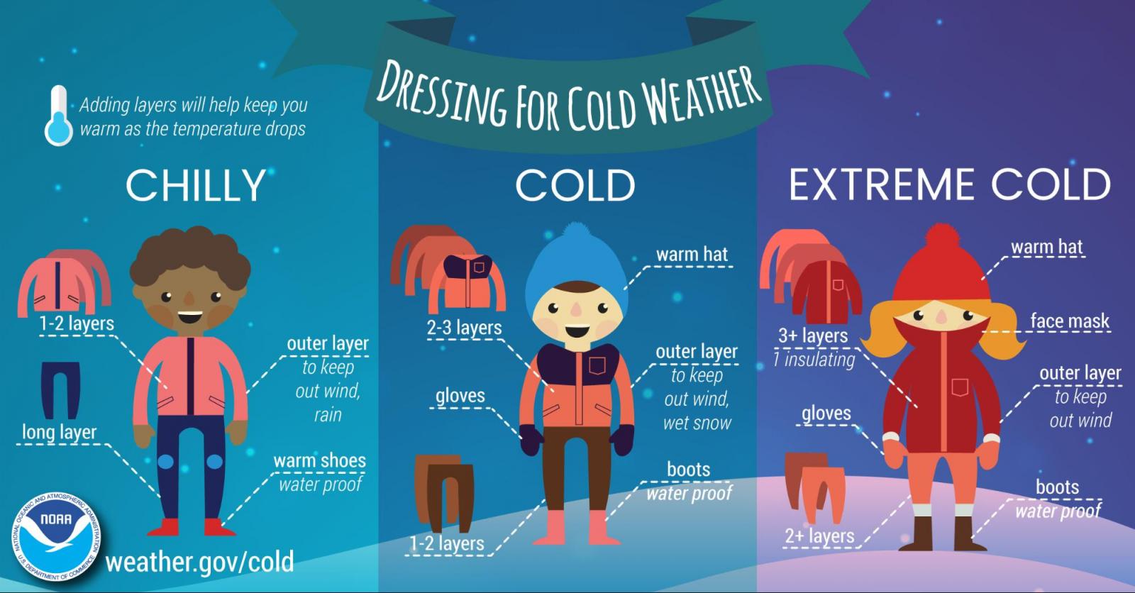
Several layers of loose fitting clothing are better than one tight fitting garment. Mittens are warmer than gloves. Do not forget your hat since your body’s greatest heat loss occurs from your head.
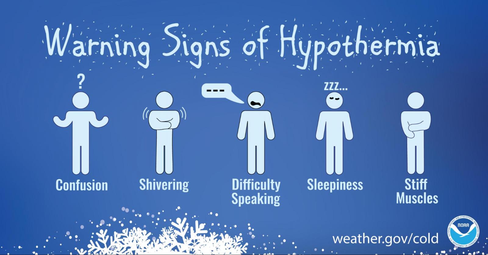
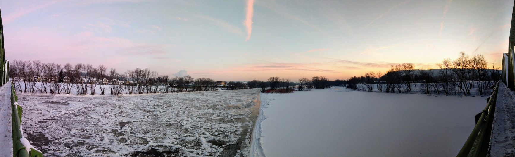
Wind chill, the combination of cold temperatures and wind, increases the danger of frostbite or hypothermia. Be especially cautious when venturing out onto an ice covered body of water. An ice thickness of at least four inches is recommended to support a person. Snowmobiles and ATVs need at least six inches of ice, while cars and light trucks require at least eight to 12 inches. Factors which can be used to assess the strength of the ice include the ice appearance, ice thickness, daily average temperature, snow cover and distribution of the load on the ice.
 |
 |
 |
 |
 |
|
Tuesday
Lake effect snow is a common weather phenomena in the Great Lakes region. Lake effect snow develops mainly in northern, central and western New York during the late fall and winter months. When cold, Canadian air moves over Lakes Ontario and Erie, the relatively warm and moist air from the lakes rise quickly, condenses, and forms lake effect snow.
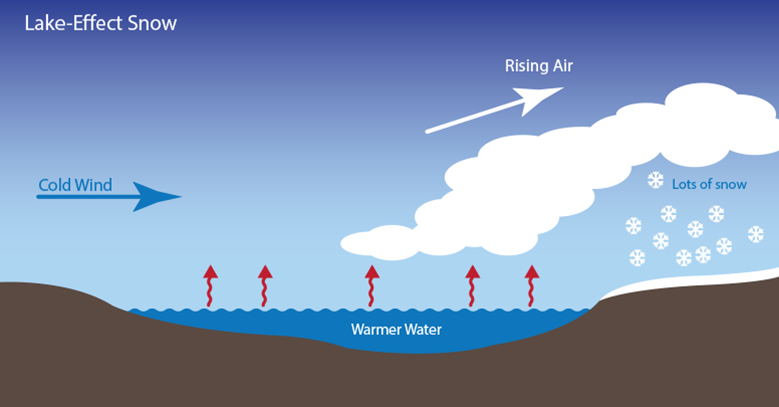
The direction of the wind is the most important factor of who will see the lake effect snow. Heavy snow could be falling at one location, while the sun may be shining just a mile or two away in either direction. The Tug Hill Plateau in upstate New York typically sees over 200 inches of snow per year mainly from Lake Effect.
Lake effect snow develops in bands. These bands can produce several feet of snow within a short period of time. From November 17th to 19th, 2014, up to 7 feet of snow fell downwind of Lake Erie just south of Buffalo.
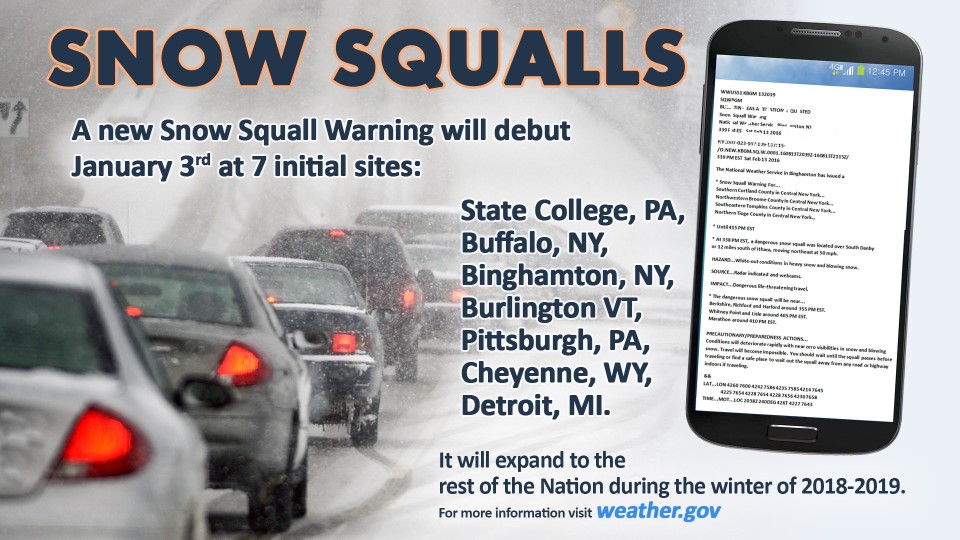
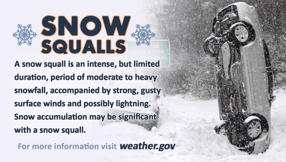
Snow squalls are intense short-lived bursts of very heavy snow. Snow squalls produce blizzard-like or white-out conditions that typically last less than 30 minutes. They produce rapid snowfall accumulations, rapid drop in visibility and flash freeze conditions on our roads. This makes snow squalls very dangerous to motorists. Nationwide, snow squalls can claim hundreds of lives each winter.
Take extreme caution while driving through both lake effect snow and snow squalls. Heavy snowfall in general creates very low visibilities. Lake effect snow and snow squalls can be narrow and intense with visibilities dropping quickly to less than a hundred feet without warning. Lake effect snow and snow squalls often have snowfall rates over 2-3 inches per hour. This leads to very hazardous driving conditions. If all possible, do not drive through intense lake effect snow or snow squalls.
 |
 |
| Click on image for a larger view | |
|---|---|
Wednesday
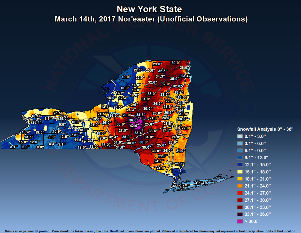
Over the past few winters, powerful snowstorms developed along the east coast and paralyzed cities across much of the northeast. These winter storms disrupted hundreds of thousands of lives ranging from loss of power to transportation difficulties.
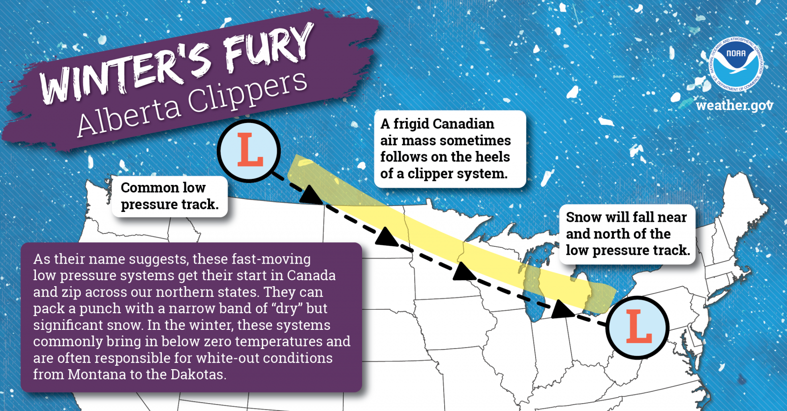
Large accumulations of snow can be produced by Nor'easters. Smaller more common snowfall events are often generated by systems called Alberta clippers.
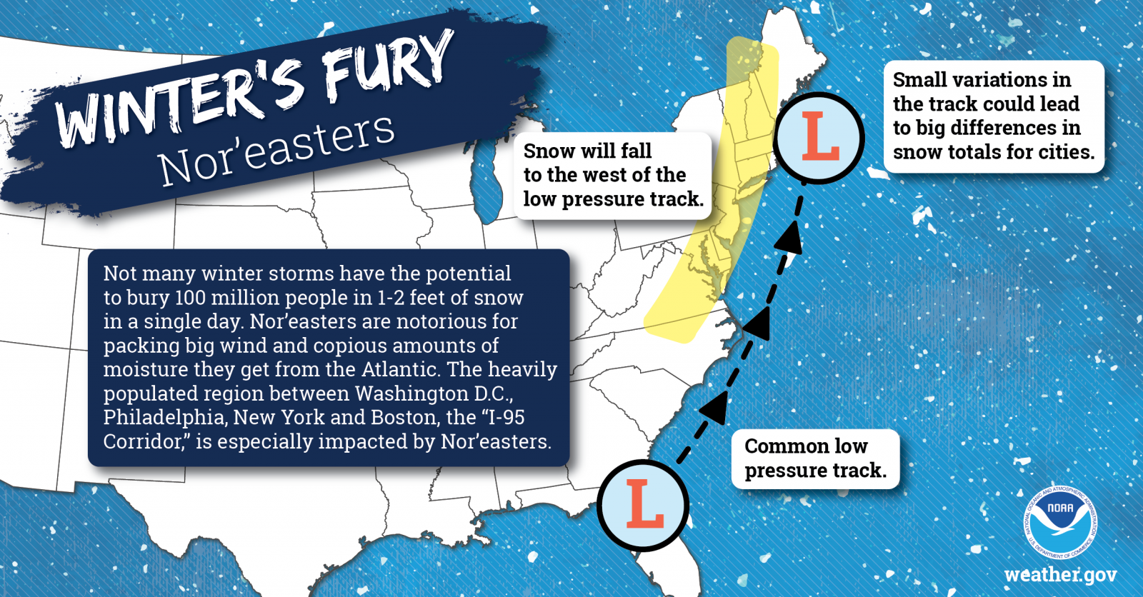
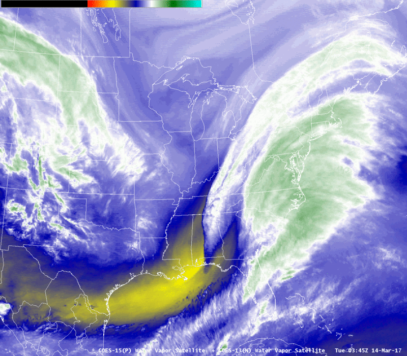
Nor'easters are intense low pressure systems that track along the eastern seaboard. Its name comes from mariners that experienced the strong northeast winds associated with these storms, but inland they are known for their heavy snow and at times blizzard conditions. Some memorable Nor'easters in recent years include the President's day Snowstorm of 2003, the Valentine's Day Snowstorm of 2007, the Blizzard of 2017, and most recently the December 2020 Snowstorm that produced 40 inches of snow at the Greater Binghamton Regional Airport. Snowfall rates in a Nor'easter can reach up to 3 to 6 inches per hour which can last for several hours.
|
Water vapor loop of the March 14, 2017 Nor'easter. Courtesy NWS New York. |
| Click on image for a larger view. |
Alberta clippers are common to our region bringing a quick round of snow. Alberta clippers are low pressure systems that developing or near the providence of Alberta, Canada. Alberta clippers move southeast very quickly and typically bring a few to several inches of snow. Their quick movement limits the snow amounts. Click on image for a larger view.
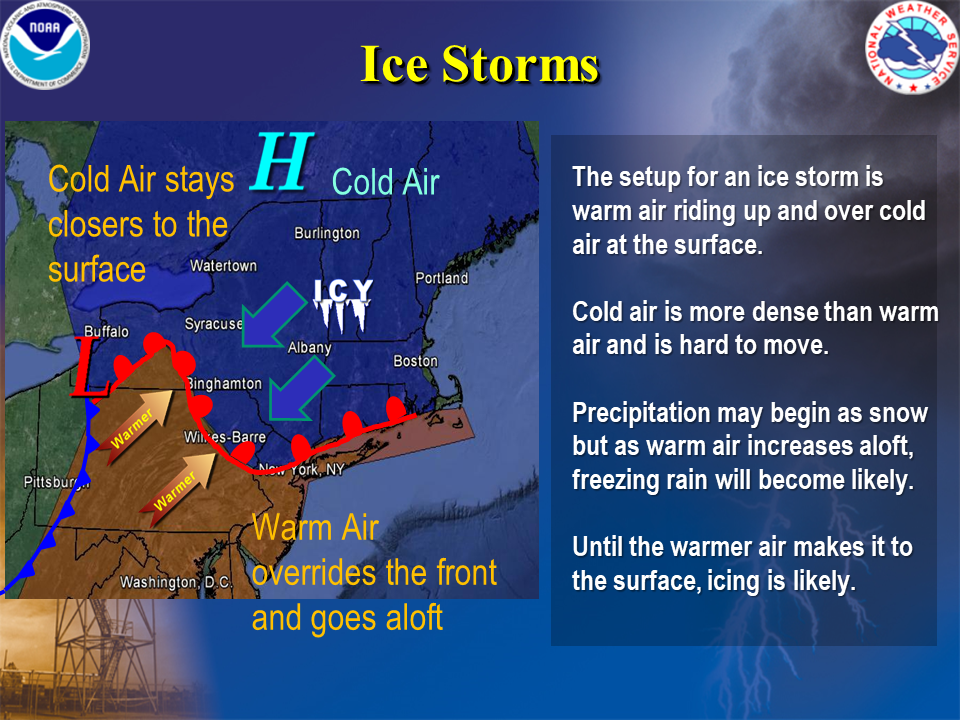
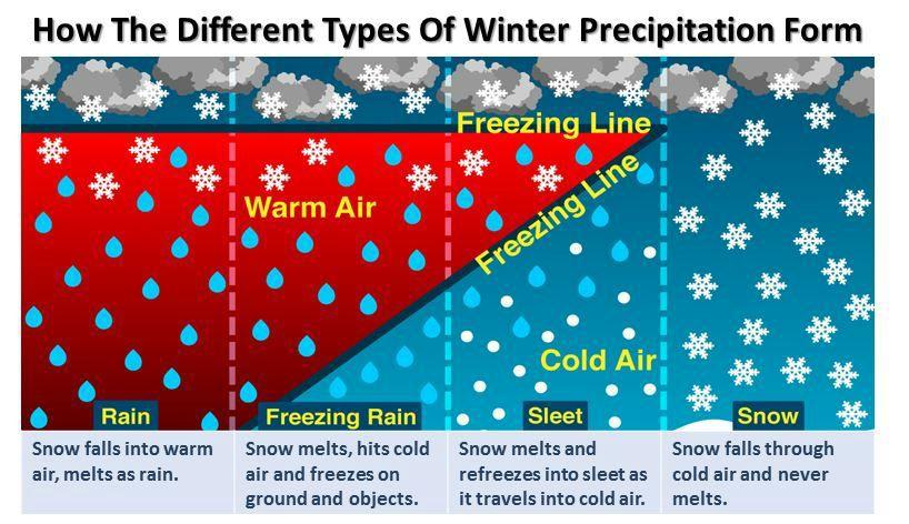
Ice Storms often cause widespread power outages. Ice accumulations can be extremely slippery for motorists and pedestrians. Bridges and overpasses are particularly dangerous because they freeze before other surfaces.
| Graphical information slide. Click for a larger view. | ||
|---|---|---|
 |
 |
 |
Graphical information slide. Click for a larger view.
Thursday
One of our deadliest winter weather hazards is flooding.
In the state of New York, one usually associates snow, ice, and bitter cold with winter. But sometimes nature throws a curve at us with unseasonably warm temperatures and heavy rain.
A number of different factors work together to produce floods in winter. When unseasonable warmth comes to the region it will often melt much, if not all of the snow on the ground especially in the lower elevations. The melting snow can saturate the ground and also swell the rivers. If the combination of unseasonably warm temperatures, heavy rain, and snow melt occurs, rivers may rise above their banks producing floods.
Some of our worst winter floods are created by an intense low pressure system that tracks from the Ohio valley northeast, down the Saint Lawrence Valley in Canada. These storms bring a lot of warm and moist air into the region from the Gulf of America and the Atlantic.
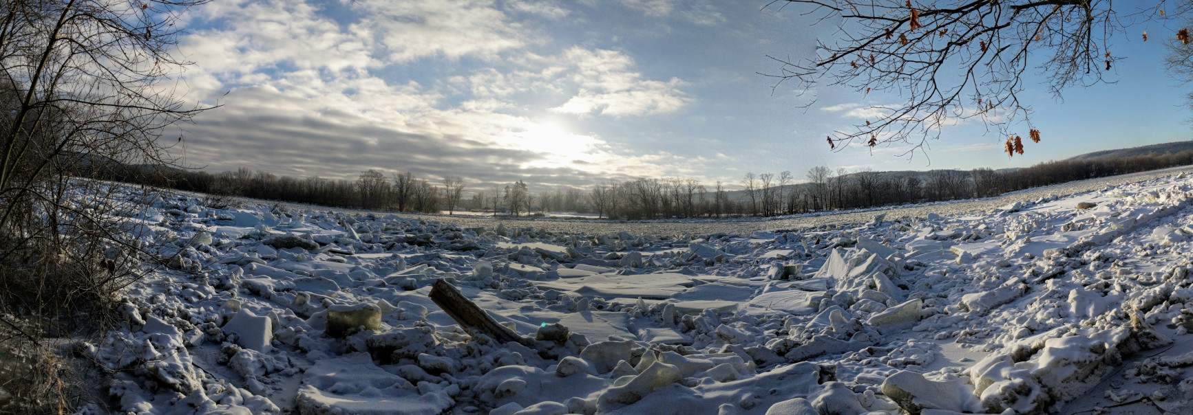
Flooding during the winter months can also be caused by ice jams. When river flows increase, water levels rise. Ice is less dense than water, thus ice floats. When enough pressure is applied by the river below, the ice will break. Ice typically breaks into slabs and floats downstream. When the ice interacts with an obstruction such as a bridge, bend in the river, island, or a wide shallow area, the ice will often pile up into an ice jam. he ice jam then prevents water from freely flowing, and forces the water to rise, creating a flood. Ice jams can form any time during the winter season.
Flooding on roads and poor drainage areas can also occur when mounds of plowed snow and ice block grates and storm drains. Standing water can cause dangerous black ice if it freezes.
Advanced Hydrologic Prediction Service (AHPS):
AHPS provides a suite of river and flood forecasts and water information to protect life and property, and helps ensure the nation's economic well-being. The main website to find this information is located at: water.noaa.gov
Flood inundation mapping:
The ability to look into the future to see how many city blocks and roads might be flooded is becoming clearer with the development of flood inundation mapping. National Weather Service and National Ocean Service are collaborating with the USGS, USACE, FEMA, and other partners to develop these inundation maps for flooding. weather.gov/bgm/floodinundation
Weather Prediction Center (WPC) Precipitation Forecasts:
WPC provides precipitation forecasts for the entire U.S., including Puerto Rico. WPC also issues excessive rainfall forecasts, short-range discussions on heavy rainfall events, and snowfall and freezing rain probabilities. www.wpc.ncep.noaa.gov
NWS River Forecast Centers (RFC):
The National Weather Service has a network of thirteen River Forecast Centers across the United States. These RFC locations collect, process, and provide water resource and river forecasts and information for major river basins across the country. water.noaa.gov
Flood Safety Awareness Website:
On this page, you will find information on what to do before, during and after a flood. www.weather.gov/safety/flood
Staying aware of an evolving weather situation can help you prepare when flooding or other weather hazards impact your area.
Friday
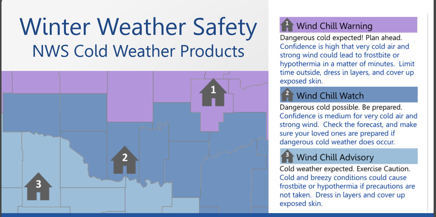
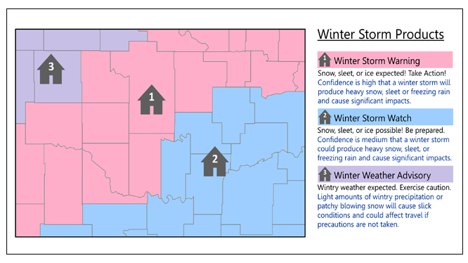
This message will provide you with some terms the National Weather Service uses to describe winter weather as well as the definitions of watches, warnings, and advisories issued for winter weather events.
Watches are issued when a storm is in it's early stage of development, and may create conditions that may harm life and property. Hazardous winter weather is only a possibility, not a certainty.
The following are the watch headlines issued for winter weather events:
Warnings are issued when the threat to life and property is imminent or has already begun from severe winter weather.
The following are the warning headlines issued for winter weather events:
Advisories are issued for less serious weather conditions that will not cause immediate threat to life and property. Advisories will be issued when weather conditions will impact motorists, outdoor activities, or public events. These events could become life-threatening if proper precautions are not taken.
The following are the advisory headlines issued for winter weather events:
| Graphical information slide. Click for a larger view. | |
|---|---|
 |
 |
You can also contact:
Bryan Greenblatt (bryan.greenblatt@noaa.gov) for additional information about NOAA's National Weather Service Winter Weather Awareness Week.