
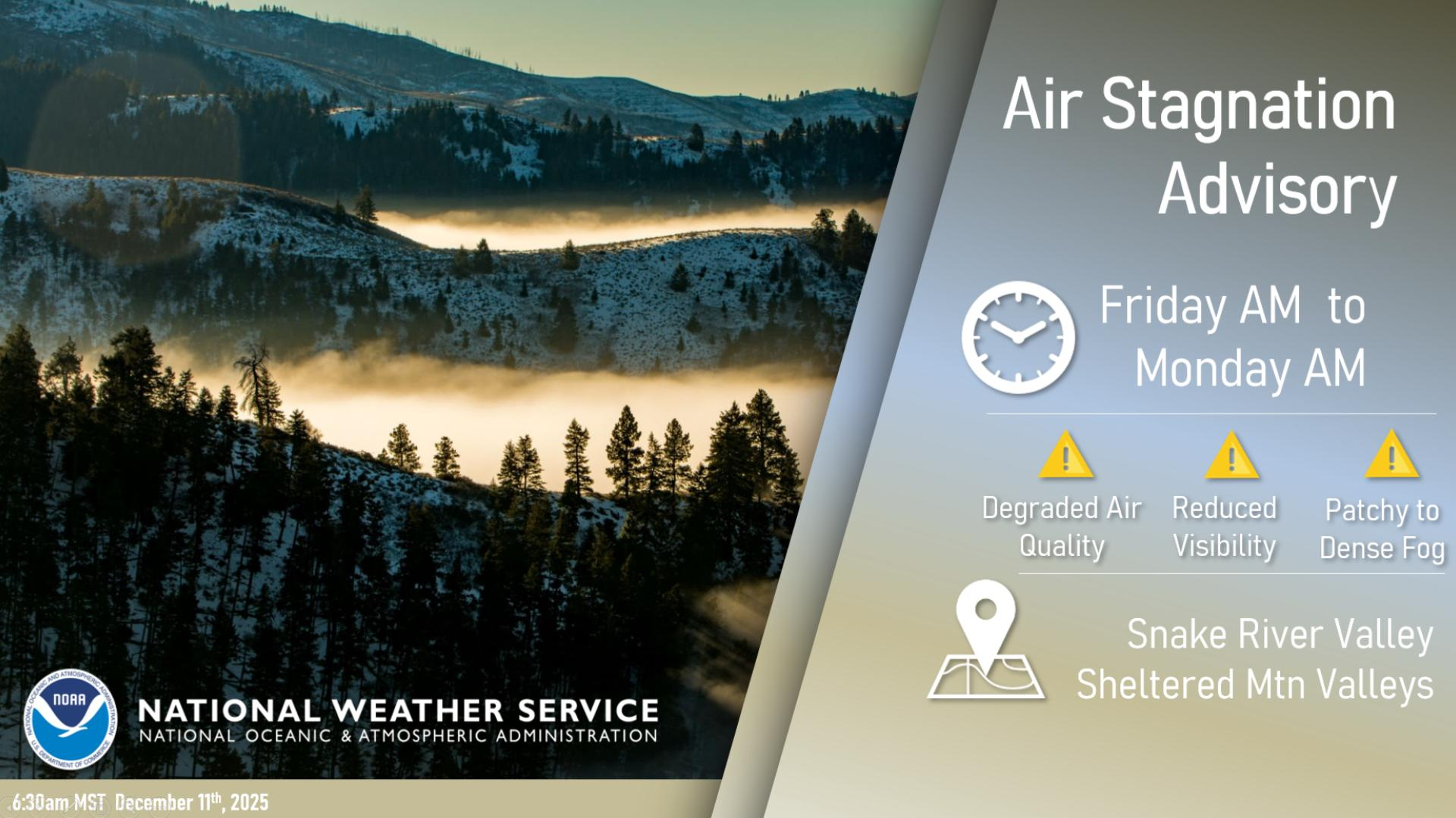
Extreme heat will continue across the Pacific Northwest into midweek before finally waning. Hot temperatures, low relative humidity, gusty winds, and isolated dry thunderstorms will bring critical fire weather into Tuesday. A refreshingly cool air mass has settled into much of the eastern two-thirds of the Rockies through the week. Read More >
Last Map Update: Mon, Aug 25, 2025 at 12:48:14 pm MDT


 Social Media
 Radar
Radar Satellite
 Surface Weather Maps
 Tabular Forecasts
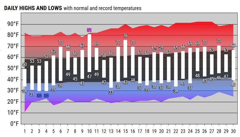 Month Charts
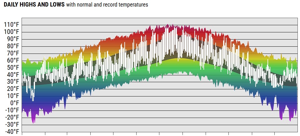 Year Charts
 Web Cameras
 Area Forecast Discussion
 Probabilistic Snow Information
 Experimental Smoke Forecast
 Aurora 30min Forecast
 Submit Reports