
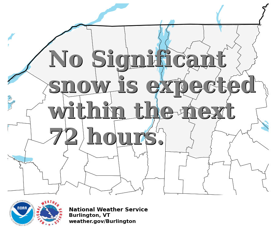
A Flood Watch remains in effect for south-central Vermont and eastern slopes of the Adirondacks due to the potential for heavy rain. Additional rainfall amounts of 1-3 inches with localized amounts of 3-5 inches along the spine of the southern Greens could produce excessive runoff and cause flooding in low-lying or flood prone areas. Read More >
Burlington, VT
Weather Forecast Office
| Selected City Charts | |
Expected
Snowfall - Box and Whisker Plot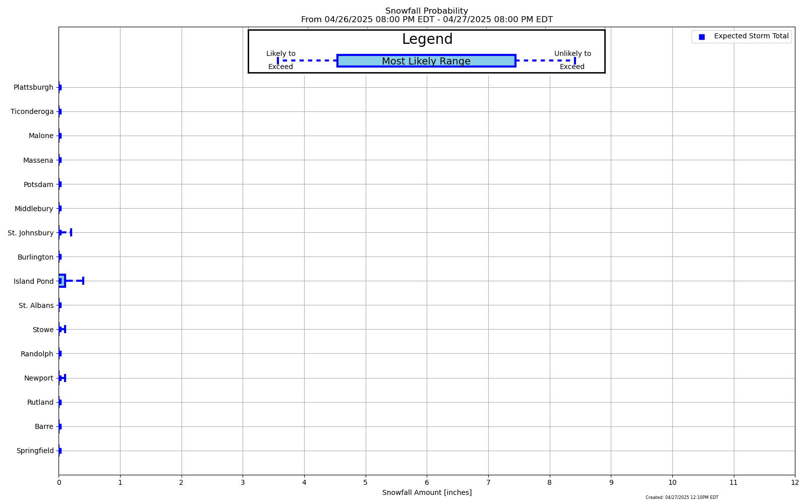
|
Expected
Snowfall - Exceedance Bar Plot
|
US Dept of Commerce
National Oceanic and Atmospheric Administration
National Weather Service
Burlington, VT
1200 Airport Drive
South Burlington, VT
(802) 862-2475
Comments? Questions? Please Contact Us.

