| Core Fire Weather Products |
| Additional Fire Weather Products |
 Day 1 SPC Fire Outlook |
 Day 2 SPC Fire Outlook |
 Day 3-8 SPC Fire Outlook |
| NWS National Fire Weather Page |
| Fire Danger |
 New York Fire Danger Map |
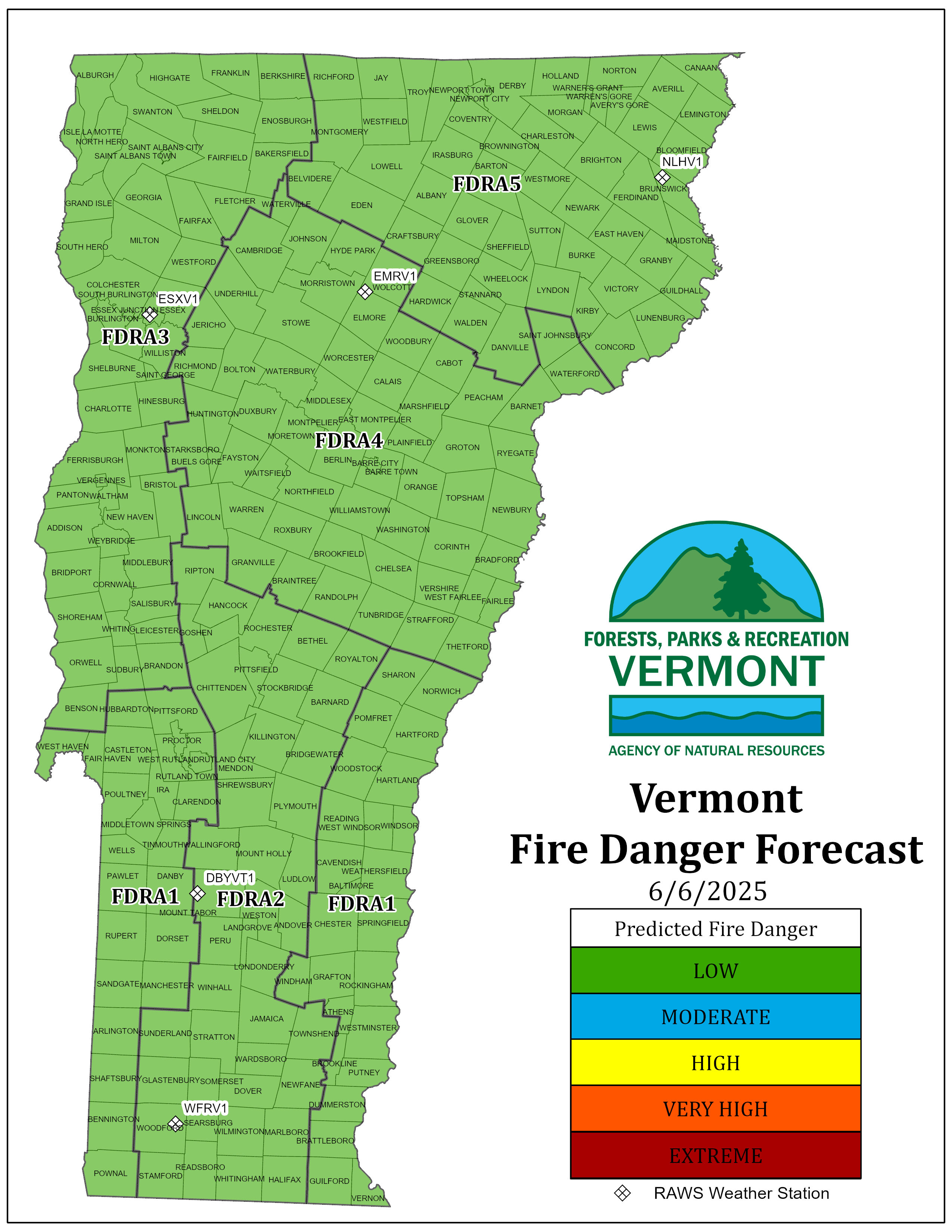 Vermont Fire Danger Map |
| Extended Forecasts/Outlooks |
 6-10 Day Temp Outlook |
 6-10 Day Precip Outlook |
 8-14 Day Temp Outlook |
 8-14 Day Precip Outlook |
 3-4 Week Temp Outlook |
 3-4 Week Pcpn Outlook |
 30 Day Temp Outlook |
 30 Day Precip Outlook |
 3 Month Temp Outlook |
 3 Month Pcpn Outlook |
| Climate Prediction Center (CPC) Interactive Map |
| Predictive Services |
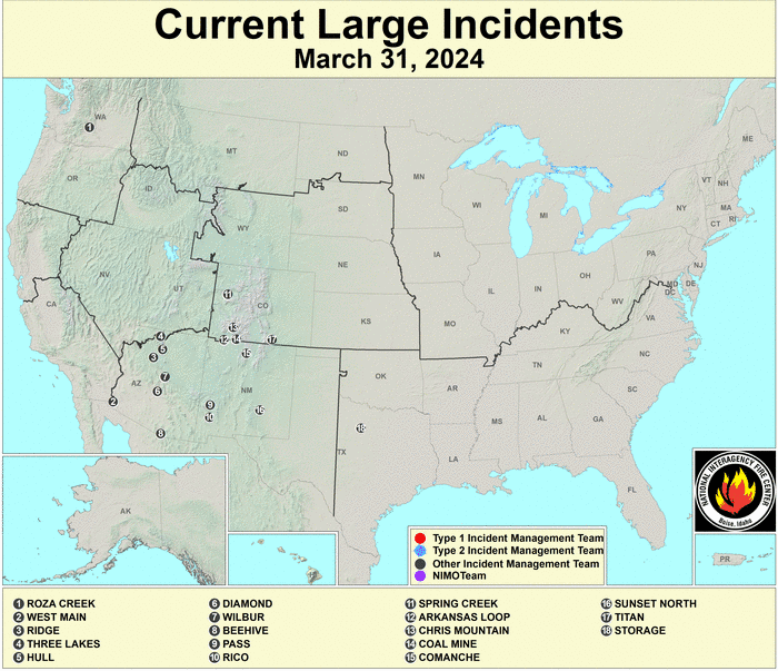
| Fire Situation |
|
| Current Observations |
| Weather & Hazards Data Viewer (Interactive Surface Analysis) |
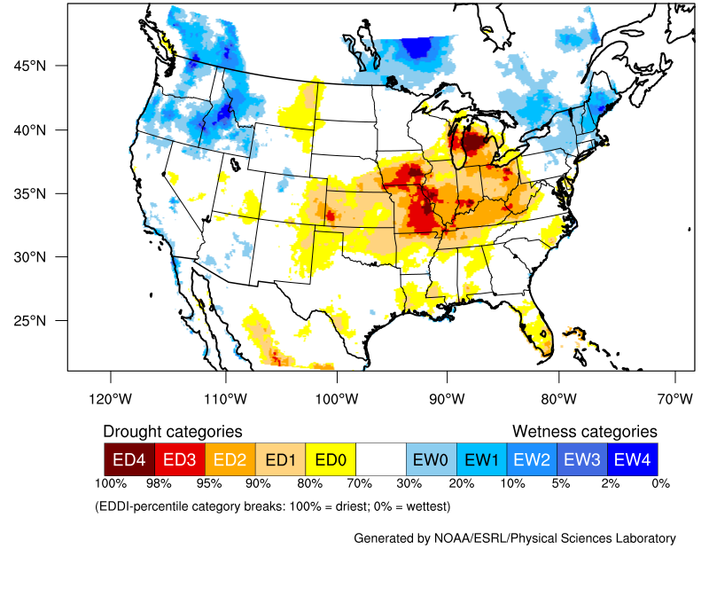
| Evaporative Demand Drought Index (EDDI) |
|
| Evaporative Demand Drought Index (EDDI) Website |
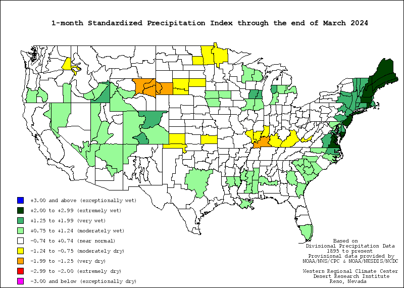
| Drought/Precipitation |
| Daily/Monthly/Seasonal PCPN Data | Fantastic TEMP/PCPN Maps (HPRCC) |
| Fire Indices |
| Administrative |
| Agencies |


